The Noose

Coastal Marsh, Saltings in Gloucestershire Forest of Dean

England

The Noose

Shed on the bank of the River Severn at Awre Photographed on a wet and windy November. Much relieved by an excellent pub at the end of the walk.
Shed on the bank of the River Severn at Awre Credit: Jerry Fryman

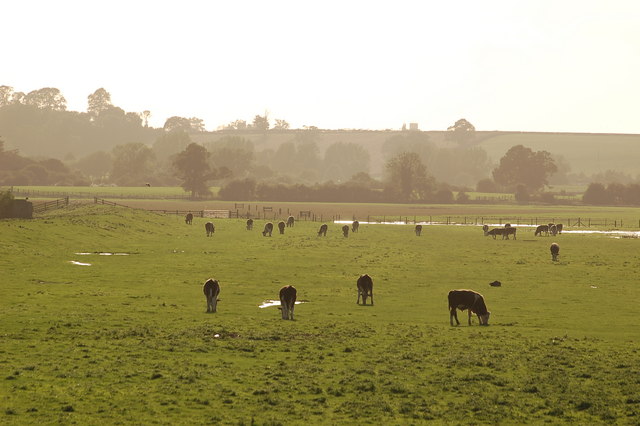
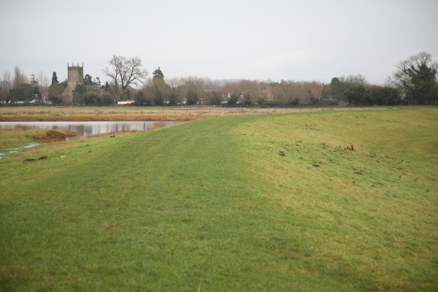
The Noose is a unique and captivating area located in Gloucestershire, England. Situated along the county's coastline, it is renowned for its stunning coastal marsh and saltings. Spanning over a significant stretch of land, The Noose offers a diverse ecosystem that attracts both nature enthusiasts and researchers alike.

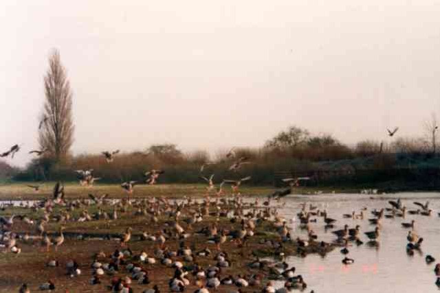
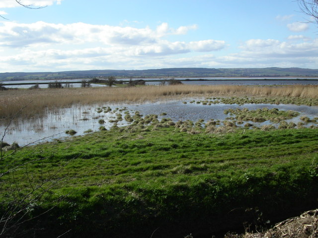
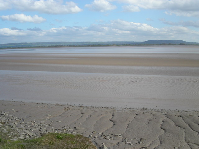
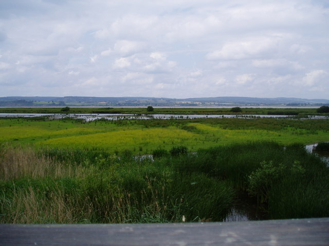
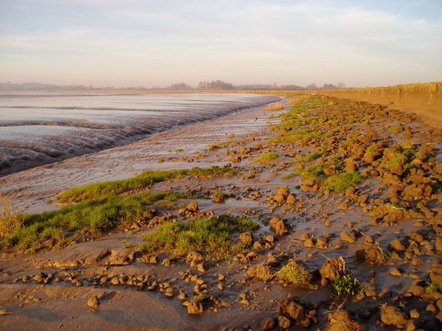
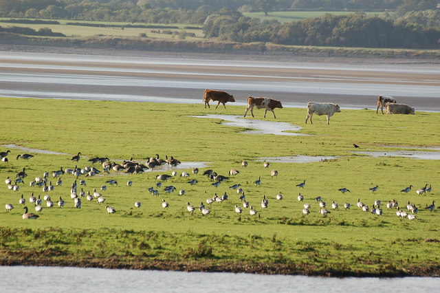
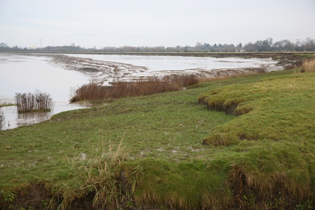
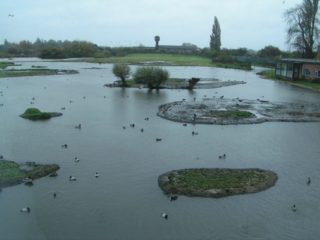
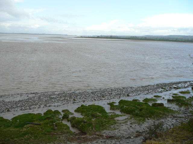
The coastal marsh at The Noose is a significant highlight of the area. It features a wide expanse of grassy wetlands, interspersed with shallow pools of water. These marshes provide a vital habitat for a variety of plant and animal species. Rare and endangered species such as the Natterjack Toad and the Marsh Harrier have been spotted here, making it a popular destination for birdwatchers and conservationists.

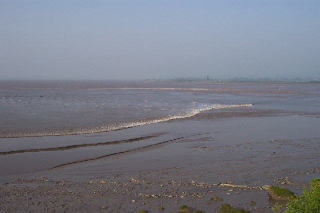
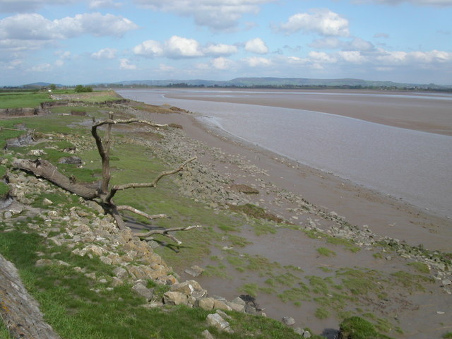
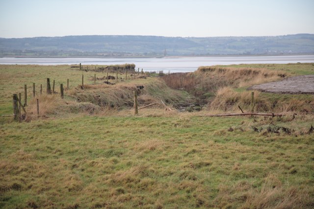
Adjacent to the marshes, the saltings at The Noose add another layer of intrigue. These are vast expanses of salt marshes, characterized by their high salinity due to the tidal influx of seawater. The unique conditions of the saltings create a distinct ecosystem that supports a range of specialized plant and animal species. Salt-tolerant plants like samphire and sea lavender can be found thriving here, along with various species of wading birds and invertebrates.

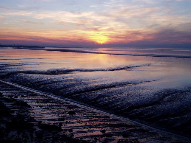
Aside from its ecological importance, The Noose also offers stunning views of the surrounding coastal landscape. Visitors can enjoy panoramic vistas of the sea, dunes, and rolling hills, creating a picturesque backdrop for leisurely walks or photography. The Noose is a designated Area of Outstanding Natural Beauty, ensuring its preservation and protection for generations to come.

If you have any feedback on the listing, please let us know in the comments section below.
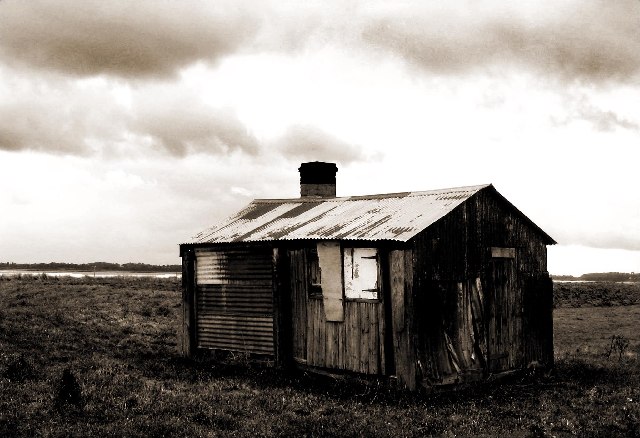
The Noose Images

Images are sourced within 2km of 51.759246/-2.4085873 or Grid Reference SO7106. Thanks to Geograph Open Source API. All images are credited.

Shed on the bank of the River Severn at Awre Photographed on a wet and windy November. Much relieved by an excellent pub at the end of the walk.
Shed on the bank of the River Severn at Awre
Photographed on a wet and windy November. Much relieved by an excellent pub at the end of the walk.
Wildfowl and Wetlands reserve, Slimbridge This lagoon is overlooked by the house which was built for Sir Peter Scott so birds are fed to make it more interesting.
Wildfowl and Wetlands reserve, Slimbridge
This lagoon is overlooked by the house which was built for Sir Peter Scott so birds are fed to make it more interesting.
Severn Bore This is the early stage of the Severn Bore where it is a broad whooshing wave travelling up the river that quickly covers the low tide mud and sand. Two fronts can be seen and these are travelling either side of a mudflat called "The Noose". This particular bore was early in the morning on Good Friday.
Severn Bore
This is the early stage of the Severn Bore where it is a broad whooshing wave travelling up the river that quickly covers the low tide mud and sand. Two fronts can be seen and these are travelling either side of a mudflat called "The Noose". This particular bore was early in the morning on Good Friday.
The Noose on the river Severn Looking from the Gloucester and Sharpness canal across the wetlands to the section of the Severn called the Noose. After completing the large oxbow at Newnham the river opens up to two kilometres across. On the horizon is the Forest of Dean.
The Noose on the river Severn
Looking from the Gloucester and Sharpness canal across the wetlands to the section of the Severn called the Noose. After completing the large oxbow at Newnham the river opens up to two kilometres across. On the horizon is the Forest of Dean.
The Noose The section of the river Severn that is known as the Noose sits entirely in the grid square SO7207. The tide is on its way out leaving massive sand banks. The distance to the opposite bank is 2Km. The church at Frampton on Severn is just left of centre.
The Noose
The section of the river Severn that is known as the Noose sits entirely in the grid square SO7207. The tide is on its way out leaving massive sand banks. The distance to the opposite bank is 2Km. The church at Frampton on Severn is just left of centre.
Bank of the river Severn Close to Awre this quiet section of the river Severn is a good area for wildlife spotting. The tide is on its way out revealing the massive sand banks. Large pieces of driftwood are deposited along the bank by the high tide.
Bank of the river Severn
Close to Awre this quiet section of the river Severn is a good area for wildlife spotting. The tide is on its way out revealing the massive sand banks. Large pieces of driftwood are deposited along the bank by the high tide.
The Dumbles Looking northwest from one of hides at the Wetland Centre
The Dumbles
Looking northwest from one of hides at the Wetland Centre
Vintage Car Run Vintage Car Run held by the Chipping Sodbury Rotary Club at Slimbridge.
Vintage Car Run
Vintage Car Run held by the Chipping Sodbury Rotary Club at Slimbridge.
Mudflats near Frampton-on-Severn The latest edition of the OS Landranger map marks mud on the left (i.e. east) side of the Severn channel and sand on the right side. This stretch of mud near Frampton extends along the estuary for a couple of kilometres, and the grassy foreshore (behind the mud cliffs on the right) is made up of several millennia of silt deposits.
Mudflats near Frampton-on-Severn
The latest edition of the OS Landranger map marks mud on the left (i.e. east) side of the Severn channel and sand on the right side. This stretch of mud near Frampton extends along the estuary for a couple of kilometres, and the grassy foreshore (behind the mud cliffs on the right) is made up of several millennia of silt deposits.
Channels in the mudflats This particular stretch of mudflats drains inland, with a rather straight channel carrying the water back to the river. I'm not sure of the explanation for this natural phenomenon, but I suspect it might be that when the river floods, it deposits the largest load of silt at the point closest to where it bursts its banks. (This is certainly the reason why levees form along rivers prone to flooding.) The sun can be seen setting behind the Forest of Dean.
Channels in the mudflats
This particular stretch of mudflats drains inland, with a rather straight channel carrying the water back to the river. I'm not sure of the explanation for this natural phenomenon, but I suspect it might be that when the river floods, it deposits the largest load of silt at the point closest to where it bursts its banks. (This is certainly the reason why levees form along rivers prone to flooding.) The sun can be seen setting behind the Forest of Dean.
View across the Dumbles near Slimbridge View across the Dumbles near Slimbridge.
View across the Dumbles near Slimbridge
View across the Dumbles near Slimbridge.
The Severn across the Dumbles View of the Severn across the Dumbles
The Severn across the Dumbles
View of the Severn across the Dumbles
The changing boundaries of the Severn Estuary The image shows the erosion that has taken place within the last thirty years on the banks of the Severn.  The inlet just before the area of erosion marks the point at which Frampton Pill joins the Severn.

It should be noted that there is no general public access to the land where this photograph was taken.  Historically, the residents of Frampton have had access to this area in order to launch boats from Frampton Pill.  As a result the residents of Frampton, and anyone accompanying them, retain some access to the area although it is somewhat contentious.

It should also be noted that public access to land alongside the Severn is a longstanding issue which has in the past ended up in the courts: the frequently changing course of the river - as shown in this image - has made it unlikely for permanent paths to form and as a result they cannot be mapped as rights of way.  As a result access to some areas have been lost in the last 60 years.  The residents thus make some effort to ensure that continued use is made of the land.  Meanwhile, the owners/managers of the land occasionally challenge those accessing the area in order to avoid setting up a precedent of permitted access.
The changing boundaries of the Severn Estuary
The image shows the erosion that has taken place within the last thirty years on the banks of the Severn. The inlet just before the area of erosion marks the point at which Frampton Pill joins the Severn. It should be noted that there is no general public access to the land where this photograph was taken. Historically, the residents of Frampton have had access to this area in order to launch boats from Frampton Pill. As a result the residents of Frampton, and anyone accompanying them, retain some access to the area although it is somewhat contentious. It should also be noted that public access to land alongside the Severn is a longstanding issue which has in the past ended up in the courts: the frequently changing course of the river - as shown in this image - has made it unlikely for permanent paths to form and as a result they cannot be mapped as rights of way. As a result access to some areas have been lost in the last 60 years. The residents thus make some effort to ensure that continued use is made of the land. Meanwhile, the owners/managers of the land occasionally challenge those accessing the area in order to avoid setting up a precedent of permitted access.
Frampton Pill Frampton Pill provided the point from which, historically, fishing boats would have been launched onto the Severn from Frampton.  These days it is somewhat silted up.

It should be noted that there is no public access to this land.  A discussion on the access and some of the history behind it can be found in <a href="https://www.geograph.org.uk/photo/653536">SO7306 : The changing boundaries of the Severn Estuary</a>
Frampton Pill
Frampton Pill provided the point from which, historically, fishing boats would have been launched onto the Severn from Frampton. These days it is somewhat silted up. It should be noted that there is no public access to this land. A discussion on the access and some of the history behind it can be found in SO7306 : The changing boundaries of the Severn Estuary
Flood defences beside the Severn Estuary The rasised bank of earth forms part of the flood defences in this area.  In the background is St Mary's Church, Frampton on Severn.

It should be noted that there is no public access to this land.  A discussion on the access and some of the history behind it can be found in <a href="https://www.geograph.org.uk/photo/653536">SO7306 : The changing boundaries of the Severn Estuary</a>
Flood defences beside the Severn Estuary
The rasised bank of earth forms part of the flood defences in this area. In the background is St Mary's Church, Frampton on Severn. It should be noted that there is no public access to this land. A discussion on the access and some of the history behind it can be found in SO7306 : The changing boundaries of the Severn Estuary
Wetlands Trust
Wetlands Trust
Awre Point from Hock Cliff View south-west across the gridsquare from the edge of the river cliff near Fretherne.
Awre Point from Hock Cliff
View south-west across the gridsquare from the edge of the river cliff near Fretherne.
Dying swan at Slimbridge A sad thing to have to report to those in charge on our visit to Slimbridge. The swan in the water is either dying or dead and the partner on the bank is just not sure what to do.
Dying swan at Slimbridge
A sad thing to have to report to those in charge on our visit to Slimbridge. The swan in the water is either dying or dead and the partner on the bank is just not sure what to do.
Show me another place!

The Noose is located at Grid Ref: SO7106 (Lat: 51.759246, Lng: -2.4085873)

Administrative County: Gloucestershire

District: Forest of Dean

Police Authority: Gloucestershire

What 3 Words

///profiled.other.emperor. Near Frampton on Severn, Gloucestershire

Nearby Locations

The Noose

Related Wikis

Awre

Awre () is a village, civil parish and electoral ward in the Forest of Dean District of Gloucestershire, England, near the River Severn. Both the parish...

WWT Slimbridge

WWT Slimbridge is a wetland wildlife reserve near Slimbridge in Gloucestershire, England. It is midway between Bristol and Gloucester on the eastern side...

River Cam, Gloucestershire

The River Cam is a small river in Gloucestershire, England. It flows for 12 miles (20 km) north-westwards from the Cotswold Edge, across the Vale of Berkeley...

Awre for Blakeney railway station

Awre for Blakeney railway station is a closed railway station in Gloucestershire, England, which served both the village of Awre and the town of Blakeney...

Have you been to The Noose?

Leave your review of The Noose below (or comments, questions and feedback).