Middle Point

Coastal Marsh, Saltings in Gloucestershire Stroud

England

Middle Point

The Wetlands at Slimbridge Looking south from one of the hides at the Wildfowl and Wetlands Trust. The River Severn is to the right of the picture.
The Wetlands at Slimbridge Credit: Bob Embleton

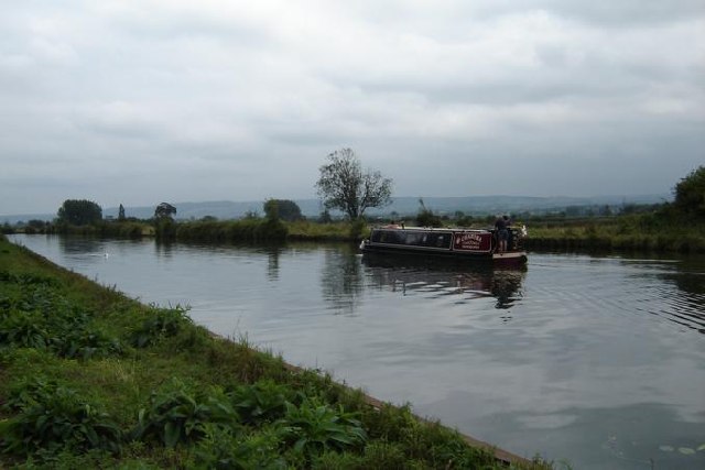
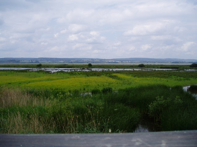
Middle Point is a coastal marsh and saltings located in Gloucestershire, England. Situated along the coast of the Severn Estuary, it is known for its unique ecosystem and diverse wildlife.

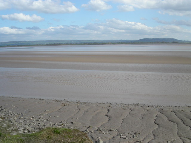
Covering an area of approximately 100 hectares, Middle Point is characterized by its marshy terrain, consisting of salt marshes, mudflats, and tidal channels. The area experiences regular tidal flooding, which contributes to the formation of salt pans and salt marshes. These marshes are crucial habitats for various plant species, including samphire and sea lavender, which have adapted to survive in saline environments.

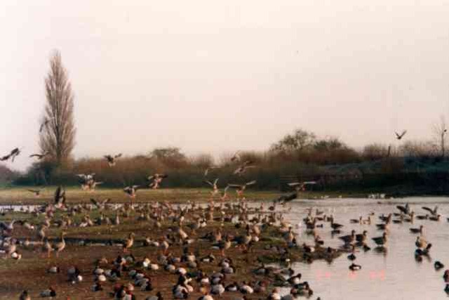
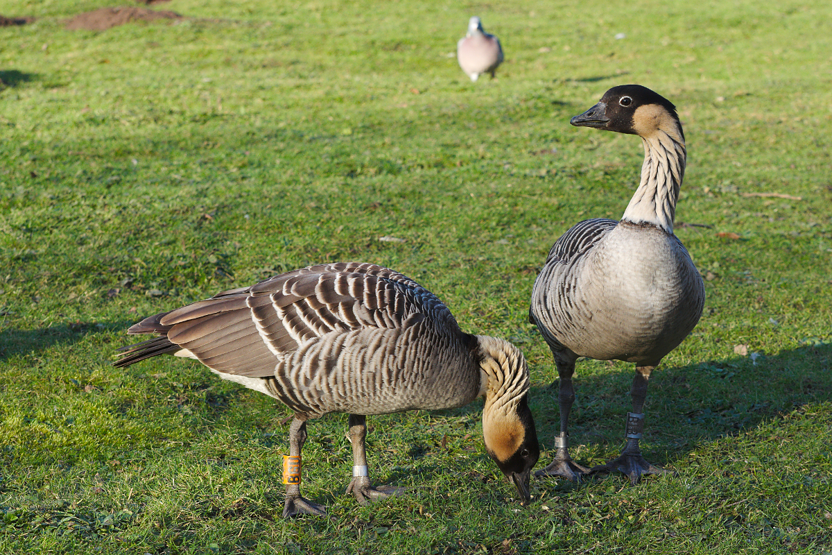
The saltings at Middle Point are home to a wide array of bird species, making it a popular destination for birdwatchers. The marshes provide an excellent feeding ground for migratory birds, such as waders and waterfowl. Some notable species that can be spotted in the area include dunlins, redshanks, and curlews.

In addition to its ecological significance, Middle Point also holds historical importance. The site has archaeological remains dating back to the Roman period, including a Roman villa and evidence of salt production. These remnants provide insights into the area's past and its connection to the salt industry.

Middle Point is a protected nature reserve, managed by local conservation organizations. Visitors can explore the marshes through designated footpaths and bird hides, allowing them to observe the diverse flora and fauna while minimizing disturbance to the delicate ecosystem.

Overall, Middle Point in Gloucestershire offers a unique coastal marsh and saltings environment, providing a habitat for various plant and bird species, as well as offering a glimpse into the area's rich history.

If you have any feedback on the listing, please let us know in the comments section below.

Middle Point Images

Images are sourced within 2km of 51.7492/-2.4094816 or Grid Reference SO7105. Thanks to Geograph Open Source API. All images are credited.

The Wetlands at Slimbridge Looking south from one of the hides at the Wildfowl and Wetlands Trust. The River Severn is to the right of the picture.
The Wetlands at Slimbridge
Looking south from one of the hides at the Wildfowl and Wetlands Trust. The River Severn is to the right of the picture.
Wildfowl and Wetlands reserve, Slimbridge This lagoon is overlooked by the house which was built for Sir Peter Scott so birds are fed to make it more interesting.
Wildfowl and Wetlands reserve, Slimbridge
This lagoon is overlooked by the house which was built for Sir Peter Scott so birds are fed to make it more interesting.
Swing bridge over  ship canal at Slimbridge The advisory signs at both ends of the bridge are somewhat unnecessary.
Swing bridge over ship canal at Slimbridge
The advisory signs at both ends of the bridge are somewhat unnecessary.
Milestone, Gloucester and Sharpness Canal 13 miles to Gloucester, the other side indicated 3 miles to Sharpness
Milestone, Gloucester and Sharpness Canal
13 miles to Gloucester, the other side indicated 3 miles to Sharpness
Gloucester and Sharpness Canal Plenty of water traffic, both human and avian. The swan was heading away from lunch at the pub, the narrowboat, and us, were heading towards it.
Gloucester and Sharpness Canal
Plenty of water traffic, both human and avian. The swan was heading away from lunch at the pub, the narrowboat, and us, were heading towards it.
Wooden sculpture, by the swing bridge A rather fine sculpture of human hands and birds, in wood. The shed beyond the bridge was built in 1911, but now is 'Slimbridge Boat Station' - a cafeteria that rents boats and bikes. See the '_Patch Bridge' in <span class="nowrap"><a title="http://www.gloucesterdocks.me.uk/canal/sharpsaul.htm" rel="nofollow ugc noopener" href="http://www.gloucesterdocks.me.uk/canal/sharpsaul.htm">Link</a><img style="margin-left:2px;" alt="External link" title="External link - shift click to open in new window" src="https://s1.geograph.org.uk/img/external.png" width="10" height="10"/></span> .
Wooden sculpture, by the swing bridge
A rather fine sculpture of human hands and birds, in wood. The shed beyond the bridge was built in 1911, but now is 'Slimbridge Boat Station' - a cafeteria that rents boats and bikes. See the '_Patch Bridge' in LinkExternal link .
Ship moored on Gloucester and Sharpness Canal Quite a feat of achievement to get a vessel this big up the canal, and pointing downstream.
Ship moored on Gloucester and Sharpness Canal
Quite a feat of achievement to get a vessel this big up the canal, and pointing downstream.
Wildfowl and Wetlands Trust
Bridge keepers cottage at Cambridge Arms bridge Bridge keepers cottage at Cambridge Arms bridge on the Gloucester and Sharpness canal.
Bridge keepers cottage at Cambridge Arms bridge
Bridge keepers cottage at Cambridge Arms bridge on the Gloucester and Sharpness canal.
The Noose The section of the river Severn that is known as the Noose sits entirely in the grid square SO7207. The tide is on its way out leaving massive sand banks. The distance to the opposite bank is 2Km. The church at Frampton on Severn is just left of centre.
The Noose
The section of the river Severn that is known as the Noose sits entirely in the grid square SO7207. The tide is on its way out leaving massive sand banks. The distance to the opposite bank is 2Km. The church at Frampton on Severn is just left of centre.
Patch Bridge This swing bridge is on the Gloucester & Sharpness Ship Canal near Slimbridge.
Patch Bridge
This swing bridge is on the Gloucester & Sharpness Ship Canal near Slimbridge.
The Dumbles Looking northwest from one of hides at the Wetland Centre
The Dumbles
Looking northwest from one of hides at the Wetland Centre
Vintage Car Run Vintage Car Run held by the Chipping Sodbury Rotary Club at Slimbridge.
Vintage Car Run
Vintage Car Run held by the Chipping Sodbury Rotary Club at Slimbridge.
Slimbridge Wildfowl and Wetland Trust Feeding time at 4pm. Rather him than me!
Slimbridge Wildfowl and Wetland Trust
Feeding time at 4pm. Rather him than me!
Slimbridge It's all a bit flamboyant for England!
Slimbridge
It's all a bit flamboyant for England!
Flamingoes A flamingo chick was born and reared at Slimbridge this year (2006).
Flamingoes
A flamingo chick was born and reared at Slimbridge this year (2006).
Shepherd's Patch Approaching Patch bridge over the Gloucester and Sharpness Canal.
Shepherd's Patch
Approaching Patch bridge over the Gloucester and Sharpness Canal.
Show me another place!

Middle Point is located at Grid Ref: SO7105 (Lat: 51.7492, Lng: -2.4094816)

Administrative County: Gloucestershire

District: Stroud

Police Authority: Gloucestershire

What 3 Words

///fended.jolt.potions. Near Frampton on Severn, Gloucestershire

Nearby Locations

Middle Point

Related Wikis

WWT Slimbridge

WWT Slimbridge is a wetland wildlife reserve near Slimbridge in Gloucestershire, England. It is midway between Bristol and Gloucester on the eastern side...

River Cam, Gloucestershire

The River Cam is a small river in Gloucestershire, England. It flows for 12 miles (20 km) north-westwards from the Cotswold Edge, across the Vale of Berkeley...

Awre

Awre () is a village, civil parish and electoral ward in the Forest of Dean District of Gloucestershire, England, near the River Severn. Both the parish...

Berkeley Arms, Purton

The Berkeley Arms is a public house at Purton, Gloucestershire GL13 9HU. It is on the Campaign for Real Ale's National Inventory of Historic Pub Interiors...

Awre for Blakeney railway station

Awre for Blakeney railway station is a closed railway station in Gloucestershire, England, which served both the village of Awre and the town of Blakeney...

Purton, Berkeley

Purton is a village on the east bank of the River Severn, 3 miles north of Berkeley, in Gloucestershire, England. The village is in the civil parish of...

Slimbridge

Slimbridge is a village and civil parish near Dursley in Gloucestershire, England. It is best known as the home of the Wildfowl and Wetlands Trust's Slimbridge...

Cambridge, Gloucestershire

Cambridge ( ) is a hamlet in the district of Stroud, in the county of Gloucestershire, England. It lies on the A38 road between Bristol and Gloucester...

Nearby Amenities

Located within 500m of 51.7492,-2.4094816
Middle Point
Natural: peninsula
Lat/Long: 51.7494293/-2.4095448
Board Type: history
Information: board
Tourism: information
Lat/Long: 51.7473409/-2.4073969
Direction: W
Tourism: viewpoint
Lat/Long: 51.7473975/-2.4074652
Board Type: nature
Information: board
Tourism: information
Lat/Long: 51.7474116/-2.4074588
Noexit: yes
Lat/Long: 51.7473932/-2.4074588
Bench
Backrest: no
Material: plastic
Seats: 3
Lat/Long: 51.7473968/-2.4074381
Bench
Backrest: yes
Material: wood
Seats: 5
Lat/Long: 51.747272/-2.4073748
Access: yes
Entrance: main
Lat/Long: 51.7473473/-2.4074057
Noexit: yes
Lat/Long: 51.748939/-2.4064828
Tourism: viewpoint
Lat/Long: 51.748804/-2.4088623
Noexit: yes
Lat/Long: 51.7487904/-2.4088895
Bench
Lat/Long: 51.7455638/-2.4081047
The data included in this document is from www.openstreetmap.org. The data is made available under ODbL.

Have you been to Middle Point?

Leave your review of Middle Point below (or comments, questions and feedback).