West Ayre

Coastal Marsh, Saltings in Orkney

Scotland

West Ayre

Track at Sellibister, Sanday
Track at Sellibister, Sanday Credit: Alpin Stewart

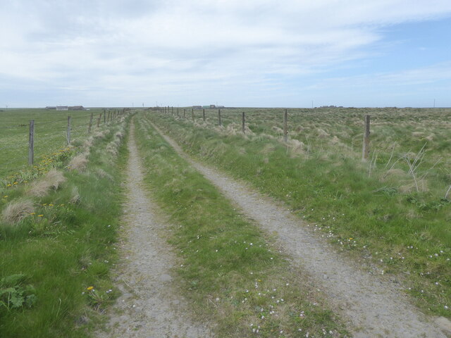
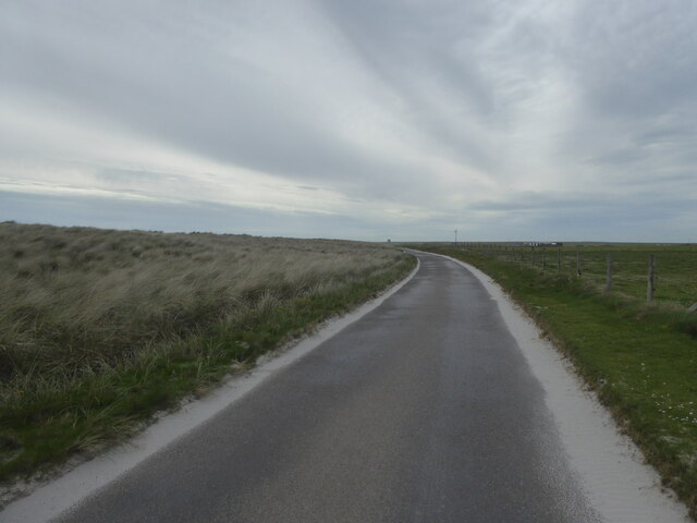
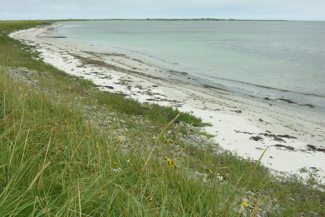
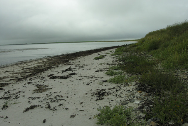
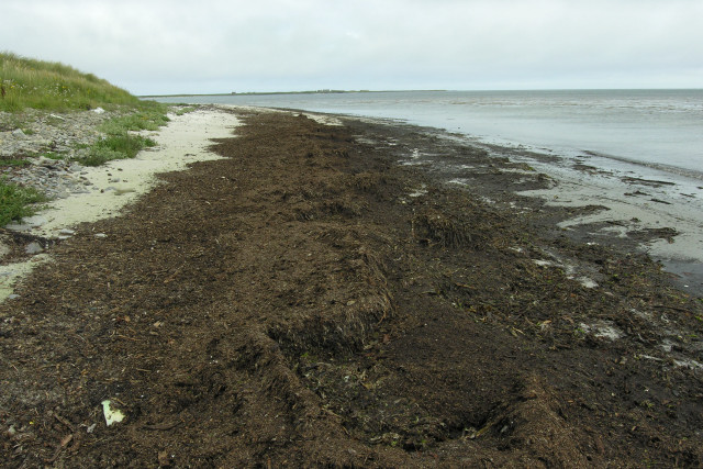
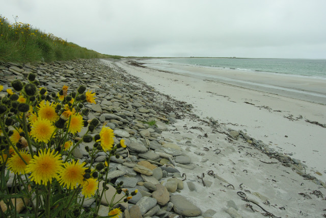
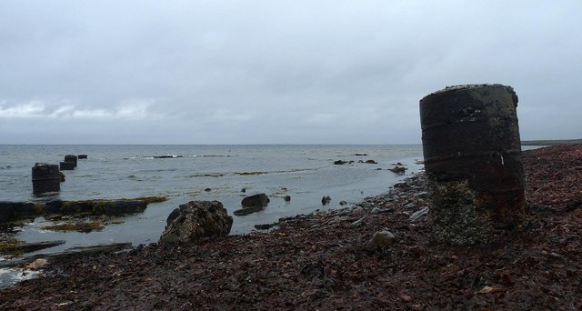
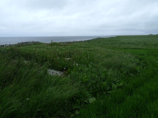
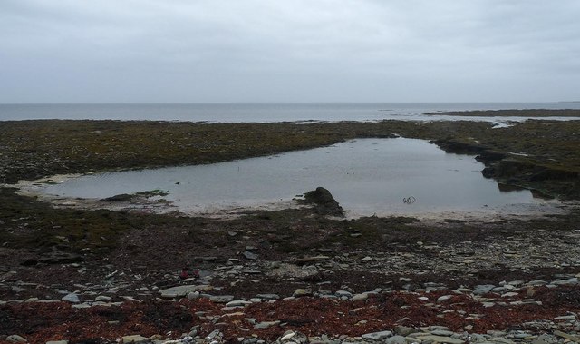
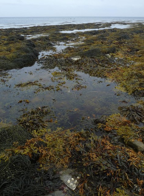
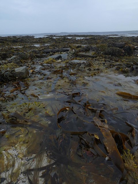
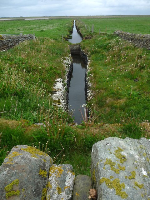
West Ayre is a coastal marshland located in Orkney, Scotland. It is situated on the western coast of the main island, overlooking the Atlantic Ocean. This unique geographical feature is characterized by its extensive saltings, which are areas of coastal land that are regularly flooded by the tides.

The marshland of West Ayre is a diverse ecological habitat, with a variety of plant and animal species that thrive in the brackish waters and muddy terrain. The saltings provide a crucial feeding ground for migratory birds, serving as a stopover point during their long journeys. Species such as waders, geese, and ducks can be spotted in abundance, making it a popular destination for birdwatchers.

The landscape of West Ayre is dominated by vast stretches of salt marshes, which are home to unique vegetation such as sea lavender, thrift, and saltmarsh grass. These plants have adapted to the challenging conditions of the marshland, with the ability to tolerate high salt concentrations and frequent inundation by seawater.

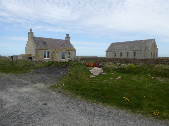
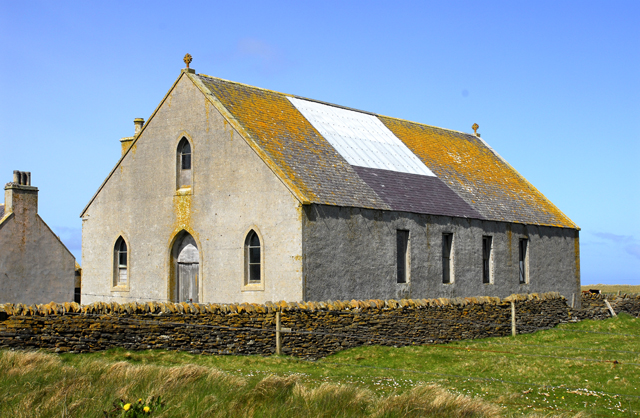
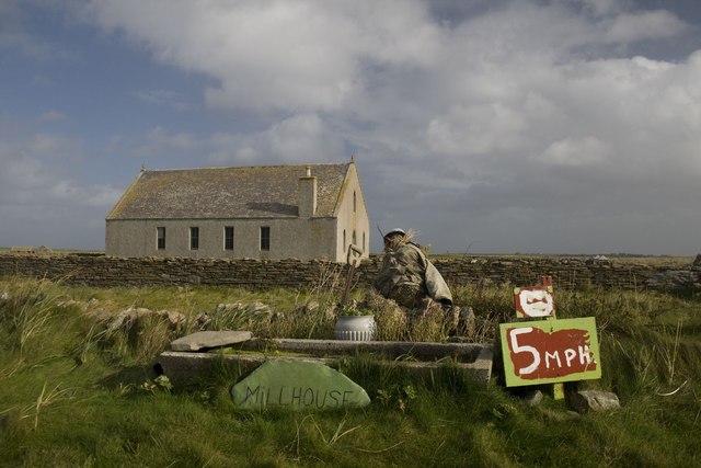
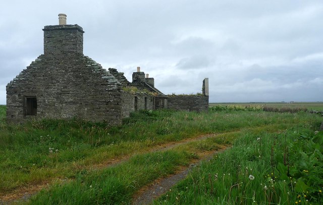
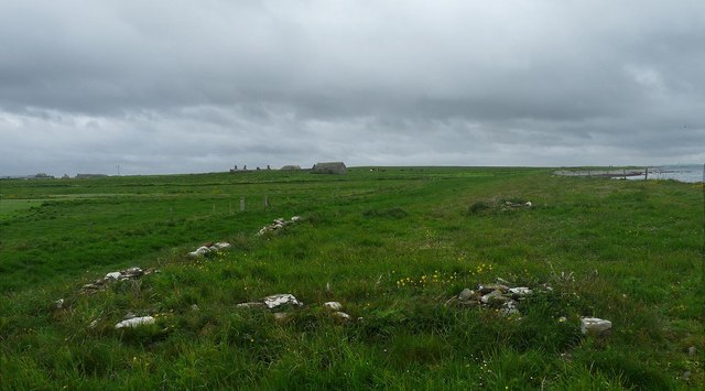
The area is also of historical significance, with traces of human activity dating back thousands of years. Archaeological sites, including ancient settlements and burial mounds, can be found in the vicinity, providing a glimpse into the rich cultural heritage of the region.

West Ayre is a tranquil and picturesque location, offering breathtaking views of the surrounding coastline and the expanse of the ocean beyond. It provides a natural haven for wildlife and a serene retreat for visitors seeking to immerse themselves in the beauty of Orkney's coastal landscape.

If you have any feedback on the listing, please let us know in the comments section below.

West Ayre Images

Images are sourced within 2km of 59.288924/-2.48129 or Grid Reference HY7244. Thanks to Geograph Open Source API. All images are credited.

Track at Sellibister, Sanday
B9069 by Bay of Lopness, Sanday
Disused house and church at Rusness, Sanday
Disused Sanday church There were three parishes on Sanday at one time. They are now combined, but this is one of the original churches.
Disused Sanday church
There were three parishes on Sanday at one time. They are now combined, but this is one of the original churches.
Bay of Lopness, Sanday Looking East across the shallow Bay of Lopness.
Bay of Lopness, Sanday
Looking East across the shallow Bay of Lopness.
Looking South West across the Bay of Lopness, Sanday Looking across the shallow Bay of Lopness with Long Taing of Newark in the distance.
Looking South West across the Bay of Lopness, Sanday
Looking across the shallow Bay of Lopness with Long Taing of Newark in the distance.
Looking East South East across the Bay of Lopness, Sanday Looking across the Bay of Lopness towards Lopness in the far distance.
Looking East South East across the Bay of Lopness, Sanday
Looking across the Bay of Lopness towards Lopness in the far distance.
Shore detail, Bay of Lopness, Sanday Shell sand gives way to flat sandstone cobbles along the shoreline of the Bay of Lopness.
Shore detail, Bay of Lopness, Sanday
Shell sand gives way to flat sandstone cobbles along the shoreline of the Bay of Lopness.
Scarecrow near Millhouse, Sanday, Orkney Disused Parish Church in background. See <a title="https://www.geograph.org.uk/photo/1898799" href="https://www.geograph.org.uk/photo/1898799">Link</a>
Scarecrow near Millhouse, Sanday, Orkney
Disused Parish Church in background. See Link
Coastline near Seater, Sanday, Orkney The seaweed is extensive here.  There are remains of kelp workings nearby.

I'm not sure what the pillars are, but I saw similar ones elsewhere on the island carrying sewage pipes into the sea.
Coastline near Seater, Sanday, Orkney
The seaweed is extensive here. There are remains of kelp workings nearby. I'm not sure what the pillars are, but I saw similar ones elsewhere on the island carrying sewage pipes into the sea.
Mound near Sellibister, Sanday, Orkney The derelict farm at Seater can be seen on the far right horizon.

This is the site of a chapel, Peterkirk, which was built on a prehistoric site, possibly a broch (ref <span class="nowrap"><a title="http://canmore.rcahms.gov.uk/en/site/3626/details/sanday+peterkirk/" rel="nofollow ugc noopener" href="http://canmore.rcahms.gov.uk/en/site/3626/details/sanday+peterkirk/">Link</a><img style="margin-left:2px;" alt="External link" title="External link - shift click to open in new window" src="https://s1.geograph.org.uk/img/external.png" width="10" height="10"/></span> ).
Mound near Sellibister, Sanday, Orkney
The derelict farm at Seater can be seen on the far right horizon. This is the site of a chapel, Peterkirk, which was built on a prehistoric site, possibly a broch (ref LinkExternal link ).
Tidal pool, Taing of Tor Sker, Sanday, Orkney The Tofts Ness peninsula can just be seen on the far right horizon.

The pool has possibly been used as a fish trap in the past (ref <span class="nowrap"><a title="http://canmore.rcahms.gov.uk/en/site/306735/details/sanday+taing+of+tor+sker/" rel="nofollow ugc noopener" href="http://canmore.rcahms.gov.uk/en/site/306735/details/sanday+taing+of+tor+sker/">Link</a><img style="margin-left:2px;" alt="External link" title="External link - shift click to open in new window" src="https://s1.geograph.org.uk/img/external.png" width="10" height="10"/></span> ).
Tidal pool, Taing of Tor Sker, Sanday, Orkney
The Tofts Ness peninsula can just be seen on the far right horizon. The pool has possibly been used as a fish trap in the past (ref LinkExternal link ).
Taing of Tor Sker, Sanday, Orkney The dots in the sea in the middle of the photo are hauled out seals.
Taing of Tor Sker, Sanday, Orkney
The dots in the sea in the middle of the photo are hauled out seals.
Taing of Tor Sker, Sanday, Orkney Tofts farm on the Tofts Ness peninsula can just be seen on the horizon.
Taing of Tor Sker, Sanday, Orkney
Tofts farm on the Tofts Ness peninsula can just be seen on the horizon.
Ruined cottage, Seater, Sanday, Orkney The cottage is part of a farmstead which was built on a mound which is probably the site of a previous farmstead or settlement (ref <span class="nowrap"><a title="http://canmore.rcahms.gov.uk/en/site/3613/details/sanday+seater/" rel="nofollow ugc noopener" href="http://canmore.rcahms.gov.uk/en/site/3613/details/sanday+seater/">Link</a><img style="margin-left:2px;" alt="External link" title="External link - shift click to open in new window" src="https://s1.geograph.org.uk/img/external.png" width="10" height="10"/></span> ).
Ruined cottage, Seater, Sanday, Orkney
The cottage is part of a farmstead which was built on a mound which is probably the site of a previous farmstead or settlement (ref LinkExternal link ).
Enclosure footings near Seater, Sanday, Orkney The enclosure is shown on the OS six inch map published in 1882.
Enclosure footings near Seater, Sanday, Orkney
The enclosure is shown on the OS six inch map published in 1882.
Water channel near Seater, Sanday, Orkney Looking towards Westayre Loch, from which the channel flows.
Water channel near Seater, Sanday, Orkney
Looking towards Westayre Loch, from which the channel flows.
Sanday: postbox № KW17 82, Sellibister A standard postbox that could do with a lick of paint, at the junction of the lane to Sellibister, where I believe Rusness Post Office was located prior to closure on 7 June 2006.
Sanday: postbox № KW17 82, Sellibister
A standard postbox that could do with a lick of paint, at the junction of the lane to Sellibister, where I believe Rusness Post Office was located prior to closure on 7 June 2006.
Show me another place!

West Ayre is located at Grid Ref: HY7244 (Lat: 59.288924, Lng: -2.48129)

Unitary Authority: Orkney Islands

Police Authority: Highlands and Islands

What 3 Words

///mixing.bitters.descended. Near Hollandstoun, Orkney Islands

Nearby Locations

Westayre Loch West Ayre

Related Wikis

East Sanday Coast

The East Sanday Coast is a protected wetland area on and around the island of Sanday, the third-largest of the Orkney islands off the north coast of Scotland...

Scar boat burial

The Scar boat burial is a Viking boat burial near the village of Scar, on Sanday, in Orkney, Scotland. The burial, which dates to between 875 and 950 AD...

Scar, Orkney

Scar is a village and farm complex on the island of Sanday in Orkney, Scotland. The B9068 road runs from Scar to Kettletoft. The Scar boat burial was found...

Sanday, Orkney

Sanday (, Scots: Sandee) is one of the inhabited islands of Orkney that lies off the north coast of mainland Scotland. With an area of 50.43 km2 (19.5...

Have you been to West Ayre?

Leave your review of West Ayre below (or comments, questions and feedback).