Salthouse Bank

Coastal Marsh, Saltings in Angus

Scotland

Salthouse Bank

Road works near Rossie Mills Road works on the A934, Montrose to Forfar Road.
Road works near Rossie Mills Credit: Maigheach-gheal

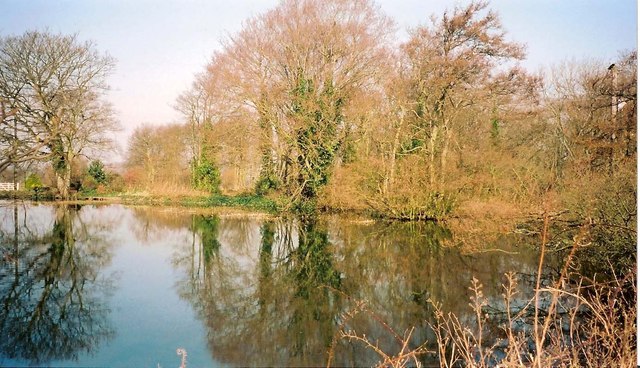
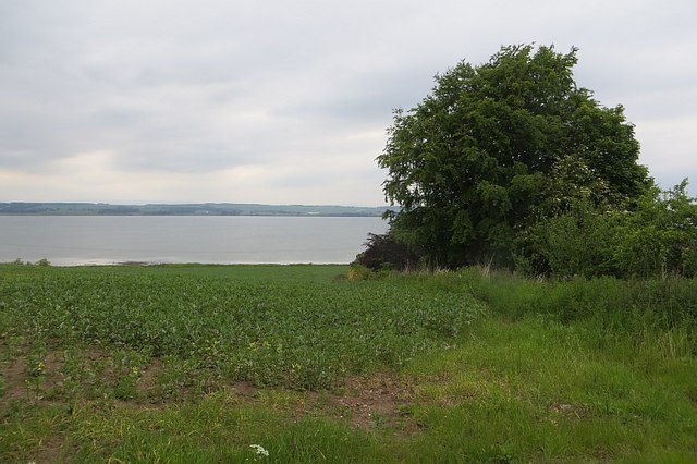
Salthouse Bank is a coastal marsh and saltings located in Angus, Scotland. Situated on the eastern coast of the country, it is a nature reserve of significant ecological importance. The site covers an area of approximately 100 hectares and is managed by local conservation organizations.

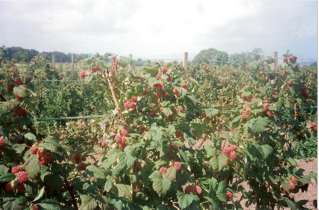
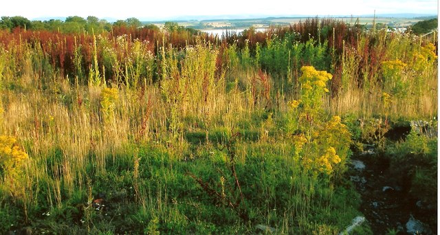
The bank is characterized by its unique habitat, which consists of a mixture of marshland, salt marsh, and saltings. These habitats are formed by the interaction of saltwater and freshwater, creating a diverse and dynamic ecosystem. The marshland is dominated by grasses and reeds, providing a breeding ground and foraging area for a variety of bird species.

Salthouse Bank is particularly renowned for its birdlife. It attracts a wide range of species, including migratory birds, due to its strategic location along the coast. Visitors can spot a plethora of bird species, such as wading birds, ducks, geese, and even rare species like the pink-footed goose.

Apart from its avian inhabitants, the bank also supports a diverse array of plant and animal life. It is home to numerous invertebrates, such as crabs and snails, which serve as a crucial food source for birds and other wildlife.

The site offers an excellent opportunity for birdwatching and nature enthusiasts. There are designated paths and viewing areas, allowing visitors to explore the area without disturbing the delicate ecosystem. Interpretive signs provide information about the various species and their habitats, enhancing the educational experience.

Overall, Salthouse Bank is a remarkable coastal marsh and saltings, offering a unique and vital habitat for a wide range of plant and animal species. It is a must-visit destination for nature lovers and those interested in observing diverse birdlife in a stunning coastal setting.

If you have any feedback on the listing, please let us know in the comments section below.

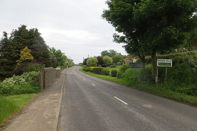
Salthouse Bank Images

Images are sourced within 2km of 56.702698/-2.4908429 or Grid Reference NO7056. Thanks to Geograph Open Source API. All images are credited.

Road works near Rossie Mills Road works on the A934, Montrose to Forfar Road.
Road works near Rossie Mills
Road works on the A934, Montrose to Forfar Road.
Sunset on Montrose Basin A spectacular sunset on Montrose Basin as viewed from Esk Road, Rossie Island on 07.08.2008.
Sunset on Montrose Basin
A spectacular sunset on Montrose Basin as viewed from Esk Road, Rossie Island on 07.08.2008.
Waterfall at Rossie wood Water flowing from Rossie Castle pond plunges over volcanic rocks as a waterfall in woods at Rossie. The stream then flows into the Basin. A rainbow can be seen in the photo. This is formed by sunlight being split in the spray from water falling on rocks in the plunge pool.
(Rossie Castle was designed by Richard Crichton and occupied by Hercules and Henrietta Ross in 1800. The castle, which had become ruined, was demolished by army sappers c1957.)
Waterfall at Rossie wood
Water flowing from Rossie Castle pond plunges over volcanic rocks as a waterfall in woods at Rossie. The stream then flows into the Basin. A rainbow can be seen in the photo. This is formed by sunlight being split in the spray from water falling on rocks in the plunge pool. (Rossie Castle was designed by Richard Crichton and occupied by Hercules and Henrietta Ross in 1800. The castle, which had become ruined, was demolished by army sappers c1957.)
Rossie Castle pond This view of Rossie Castle pond is taken from the east side closest to the site of the former Rossie Castle. Rossie Castle was demolished in the 1950's. The pond is smaller in size than it was originally as it was partly filled in with agricultural waste during the 1950' and 60's. The sluice gate for the pond is in the top, far corner of the photo as viewed. The Mill House and buildings known locally as 'the kennels', both of which were close to the sluice gate, have been demolished. Water flowing through the sluice goes into a lower pond locally known as 'the dam' before flowing over two waterfalls. The stream then flows to its mouth in the Montrose Basin.
Rossie Castle pond
This view of Rossie Castle pond is taken from the east side closest to the site of the former Rossie Castle. Rossie Castle was demolished in the 1950's. The pond is smaller in size than it was originally as it was partly filled in with agricultural waste during the 1950' and 60's. The sluice gate for the pond is in the top, far corner of the photo as viewed. The Mill House and buildings known locally as 'the kennels', both of which were close to the sluice gate, have been demolished. Water flowing through the sluice goes into a lower pond locally known as 'the dam' before flowing over two waterfalls. The stream then flows to its mouth in the Montrose Basin.
Montrose Basin south of Heathbank Sand and mudflats in the Montrose Basin, viewed two hours before low tide. The basin forms part of the estuary of the river South Esk, and is the habitat of many species of wildfowl and waders.
Montrose Basin south of Heathbank
Sand and mudflats in the Montrose Basin, viewed two hours before low tide. The basin forms part of the estuary of the river South Esk, and is the habitat of many species of wildfowl and waders.
View across the Montrose Basin A view across the tidal Montrose Basin, with sand and mudflats exposed as low tide approaches. The steeple in the town of Montrose can be seen across the basin, 2km distant.
View across the Montrose Basin
A view across the tidal Montrose Basin, with sand and mudflats exposed as low tide approaches. The steeple in the town of Montrose can be seen across the basin, 2km distant.
Raspberry field near the site of Rossie Castle, Montrose This photo shows detail of raspberry bushes growing in a field near the site of Rossie Castle. During the 1950's and 60's, the region was renowned for the quantity and quality of its raspberry production and in the late 1950's a steam train known as the "Raspberry Special" took fruit to Covent Garden in London. Much of the fruit from the Montrose area was taken by tractor load to the Chivers jam factory in Montrose. The fruit was mostly picked by local people including many women and children. The pickers were paid by the weight of fruit they produced. Rev W. M. Diack, M.A., the minister of Craig and Maryton parishes during the 1950's and 60's, often worked with his parishioners to harvest the fruit at that time. After the main commercial crop had been picked, gleaning was permitted. Although the main land use in Craig and Maryton at the present time is still agricultural, changes in the choice of crop or type of livestock to be farmed have resulted in greatly reduced quantities of raspberries and other soft fruits being grown.
Raspberry field near the site of Rossie Castle, Montrose
This photo shows detail of raspberry bushes growing in a field near the site of Rossie Castle. During the 1950's and 60's, the region was renowned for the quantity and quality of its raspberry production and in the late 1950's a steam train known as the "Raspberry Special" took fruit to Covent Garden in London. Much of the fruit from the Montrose area was taken by tractor load to the Chivers jam factory in Montrose. The fruit was mostly picked by local people including many women and children. The pickers were paid by the weight of fruit they produced. Rev W. M. Diack, M.A., the minister of Craig and Maryton parishes during the 1950's and 60's, often worked with his parishioners to harvest the fruit at that time. After the main commercial crop had been picked, gleaning was permitted. Although the main land use in Craig and Maryton at the present time is still agricultural, changes in the choice of crop or type of livestock to be farmed have resulted in greatly reduced quantities of raspberries and other soft fruits being grown.
Site of Rossie Castle, parish of Craig, Montrose The foreground of this photo shows the site of the former Rossie Castle near Montrose in Angus. The castle was built for Hercules and Henrietta Ross ; they took possession in 1800. The surrounding grounds had an American garden, ornamental trees, rhododendron bushes, a trout lake and a dovecot dating back to 1695.
The last day of the castle came when George Ogilvie, the landowning farmer, set off a detonation at 3.00 pm on Sunday 29th September 1957. The blast reduced the once magnificent three storey, 150 foot long building to 20,000 tons of stone and rubble.
With the consent of Mr Oglivie, who was an elder of Craig Parish Church, Rev William M Diack, M.A., used a little of the stone for paving at the nearby Manse of Craig. Most of the stone was used for widening the road between Montrose and Arbroath.
Site of Rossie Castle, parish of Craig, Montrose
The foreground of this photo shows the site of the former Rossie Castle near Montrose in Angus. The castle was built for Hercules and Henrietta Ross ; they took possession in 1800. The surrounding grounds had an American garden, ornamental trees, rhododendron bushes, a trout lake and a dovecot dating back to 1695. The last day of the castle came when George Ogilvie, the landowning farmer, set off a detonation at 3.00 pm on Sunday 29th September 1957. The blast reduced the once magnificent three storey, 150 foot long building to 20,000 tons of stone and rubble. With the consent of Mr Oglivie, who was an elder of Craig Parish Church, Rev William M Diack, M.A., used a little of the stone for paving at the nearby Manse of Craig. Most of the stone was used for widening the road between Montrose and Arbroath.
Potato field, Dysart The crop has been defoliated prior to lifting.
Potato field, Dysart
The crop has been defoliated prior to lifting.
Rossie Braes crop field Up to the late 1960's the fields along the Rossie Braes, such as the one in the photo, were typically used for growing raspberries. Since that time, the crops grown here have been more varied.
Rossie Braes crop field
Up to the late 1960's the fields along the Rossie Braes, such as the one in the photo, were typically used for growing raspberries. Since that time, the crops grown here have been more varied.
Potatoes growing in a field at Rossie This photo shows potatoes growing in a field at Rossie. The farmland surrounding Montrose has long been famous for growing potatoes.
Potatoes growing in a field at Rossie
This photo shows potatoes growing in a field at Rossie. The farmland surrounding Montrose has long been famous for growing potatoes.
Arable land, Maryton
A934. Rossie Mills Approaching Montrose.
A934. Rossie Mills
Approaching Montrose.
Field, Rossie Mills Shores of Montrose Basin.
Field, Rossie Mills
Shores of Montrose Basin.
Montrose Basin Looking across the Basin to the town of Montrose, which lies between the Basin and the North Sea.
Montrose Basin
Looking across the Basin to the town of Montrose, which lies between the Basin and the North Sea.
Maryton Parish Kirk No longer in ecclesiastical use, and although it is (or perhaps was) Category B Listed it has been radically altered by the addition of modern windows in the north wall which must have made it much more suitable for use as a house. It was built in 1791.
Maryton Parish Kirk
No longer in ecclesiastical use, and although it is (or perhaps was) Category B Listed it has been radically altered by the addition of modern windows in the north wall which must have made it much more suitable for use as a house. It was built in 1791.
Ordnance Survey Flush Bracket G875 This bracket can be found on the wall of a private dwelling in Bridge Street, Montrose.
The recorded details give a height of 6.6457 metres above sea level.
For more detail see : <span class="nowrap"><a title="https://www.bench-marks.org.uk/bm519" rel="nofollow ugc noopener" href="https://www.bench-marks.org.uk/bm519">Link</a><img style="margin-left:2px;" alt="External link" title="External link - shift click to open in new window" src="https://s1.geograph.org.uk/img/external.png" width="10" height="10"/></span>
Ordnance Survey Flush Bracket G875
This bracket can be found on the wall of a private dwelling in Bridge Street, Montrose. The recorded details give a height of 6.6457 metres above sea level. For more detail see : LinkExternal link
Ordnance Survey Flush Bracket G4073 This bracket can be found on the wall of the Town House, High Street, Montrose.
The recorded details give a height of 11.3268 metres above sea level.
For more details see : <span class="nowrap"><a title="https://www.bench-marks.org.uk/bm535" rel="nofollow ugc noopener" href="https://www.bench-marks.org.uk/bm535">Link</a><img style="margin-left:2px;" alt="External link" title="External link - shift click to open in new window" src="https://s1.geograph.org.uk/img/external.png" width="10" height="10"/></span>
Ordnance Survey Flush Bracket G4073
This bracket can be found on the wall of the Town House, High Street, Montrose. The recorded details give a height of 11.3268 metres above sea level. For more details see : LinkExternal link
Show me another place!

Salthouse Bank is located at Grid Ref: NO7056 (Lat: 56.702698, Lng: -2.4908429)

Unitary Authority: Angus

Police Authority: Tayside

What 3 Words

///decorator.missions.shameless. Near Montrose, Angus

Related Wikis

Montrose Basin

Montrose Basin is a nearly circular tidal basin which makes up part of the estuary of the River South Esk and which sits just inland of the town of Montrose...

Montrose Royal Infirmary

Montrose Royal Infirmary was a health facility in Bridge Street, Montrose, Angus, Scotland. It was managed by NHS Tayside. It is a Category A listed building...

Montrose Castle

Montrose Castle was a 12th-century castle built in Montrose, Angus, Scotland. Montrose was created a royal burgh by King David I of Scotland in the 12th...

Montrose Library

The Montrose Library is situated in an A-listed Carnegie funded building in the north Angus coastal town of Montrose. It was first opened in 1905 and in...

Nearby Amenities

Located within 500m of 56.702698,-2.4908429
Source: PGS
Lat/Long: 56.6996189/-2.4907407
Source: PGS
Lat/Long: 56.6994792/-2.4909371
Source: PGS
Lat/Long: 56.6991857/-2.4928628
Source: PGS
Lat/Long: 56.6991058/-2.4936207
Source: PGS
Lat/Long: 56.6990547/-2.4941977
Bus Stop
Montrose Basin Nature Reserve
Bench: no
Bin: no
Bus: yes
Lit: yes
Naptan AtcoCode: 6490IM992
Naptan Bearing: E
Naptan BusStopType: CUS
Naptan CommonName: Montrose Basin Nature Reserve
Naptan Indicator: at Main Gate
Naptan Landmark: Montrose Basin Nature Reserve
Naptan NaptanCode: 26425396
Naptan Street: A92
Naptan Verified: no
Public Transport: platform
Shelter: no
Source: naptan_import
Tactile Paving: no
Lat/Long: 56.698455/-2.4910012
Bus Stop
Montrose Basin Nature Reserve
Bus: yes
Naptan AtcoCode: 6490IM993
Naptan Bearing: W
Naptan BusStopType: CUS
Naptan CommonName: Montrose Basin Nature Reserve
Naptan Indicator: opp Main Gate
Naptan Landmark: Montrose Basin Nature Reserve
Naptan NaptanCode: 26425397
Naptan Street: A92
Naptan Verified: no
Public Transport: platform
Source: naptan_import
Lat/Long: 56.6983579/-2.4905591
Tourism: viewpoint
Lat/Long: 56.6990474/-2.4905665
Entrance: main
Lat/Long: 56.6988898/-2.4904779
Toilets
Access: customers
Changing Table: yes
Check Date: 2022-04-09
Fee: no
Operator: Scottish Wildlife Trust
Wheelchair: limited
Wheelchair Description: No Emergency Pull Cord
Lat/Long: 56.6989226/-2.4905686
The Bank of Scotland Hide
Leisure: bird_hide
Operator: Scottish Wildlife Trust
Operator Wikidata: Q1828470
Source: GPS
Wheelchair: no
Lat/Long: 56.6992939/-2.4889981
Cafe
Name Signed: no
Noname: yes
Opening Hours: Feb 14-Oct 31 10:30-17:00; Nov 1-Feb 13 10:30-16:00; Nov 1-Feb 13 Tu-Th off
Lat/Long: 56.6990188/-2.4904456
Generator Method: wind_turbine
Generator Source: wind
Power: generator
Lat/Long: 56.6984404/-2.4926711
Generator Method: photovoltaic
Generator Output Electricity: yes
Generator Source: solar
Generator Type: solar_photovoltaic_panel
Power: generator
Lat/Long: 56.6986315/-2.4896472
Power: pole
Lat/Long: 56.6989812/-2.4946994
Power: pole
Lat/Long: 56.6991108/-2.4927938
Power: pole
Lat/Long: 56.6992475/-2.4907127
Power: pole
Lat/Long: 56.699364/-2.4889348
Power: pole
Lat/Long: 56.6994948/-2.4871093
Power: pole
Lat/Long: 56.6996149/-2.4853466
Rossie Braes
Alt Name: Craig Braes
Place: hamlet
Lat/Long: 56.6986026/-2.4882231
Rossie Spit
Place: locality
Lat/Long: 56.701221/-2.4840586
The data included in this document is from www.openstreetmap.org. The data is made available under ODbL.

Have you been to Salthouse Bank?

Leave your review of Salthouse Bank below (or comments, questions and feedback).