Inchbraoch

Settlement in Angus

Scotland

Inchbraoch

Road works near Rossie Mills Road works on the A934, Montrose to Forfar Road.
Road works near Rossie Mills Credit: Maigheach-gheal

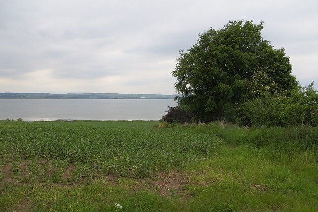
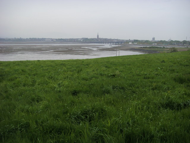
Inchbraoch is a small island located off the east coast of Angus, Scotland. It is situated in the North Sea, approximately 2 miles east of the town of Arbroath. The island is known for its stunning natural beauty and its historical significance.

Covering an area of around 16 acres, Inchbraoch is primarily made up of rocky cliffs and grassy slopes. The island is home to a variety of bird species, including puffins, guillemots, and razorbills, making it a popular spot for birdwatching enthusiasts. The surrounding waters are also rich in marine life, with seals often spotted in the area.

Inchbraoch has a deep-rooted history, dating back to the early medieval period. The island was once home to a monastery, which was established by Saint Drostan in the 8th century. The ruins of the monastery, including a chapel and a graveyard, can still be seen today. The island also served as a retreat for the monks of Arbroath Abbey.

Access to Inchbraoch is limited due to its status as a nature reserve. Visitors can only reach the island by boat or during low tide, when a causeway is exposed. The island offers a peaceful and tranquil environment, perfect for those seeking solitude amidst nature.

Overall, Inchbraoch is a hidden gem in Angus, providing both natural beauty and historical significance. Its remote location and rich wildlife make it a must-visit destination for nature lovers and history enthusiasts alike.

If you have any feedback on the listing, please let us know in the comments section below.

Inchbraoch Images

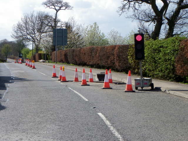
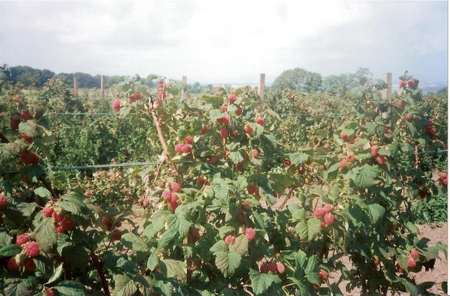
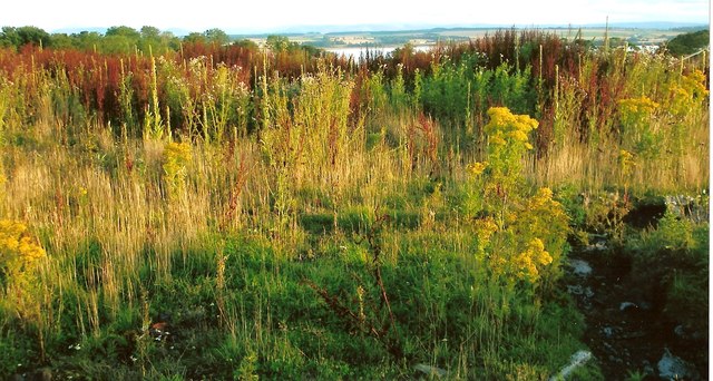
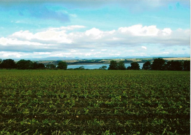
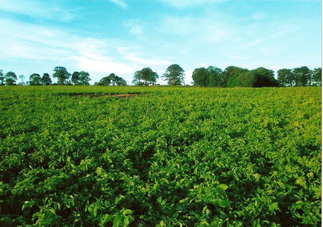
Images are sourced within 2km of 56.703535/-2.475676 or Grid Reference NO7056. Thanks to Geograph Open Source API. All images are credited.

Road works near Rossie Mills Road works on the A934, Montrose to Forfar Road.
Road works near Rossie Mills
Road works on the A934, Montrose to Forfar Road.
Sunset on Montrose Basin A spectacular sunset on Montrose Basin as viewed from Esk Road, Rossie Island on 07.08.2008.
Sunset on Montrose Basin
A spectacular sunset on Montrose Basin as viewed from Esk Road, Rossie Island on 07.08.2008.
Waterfall at Rossie wood Water flowing from Rossie Castle pond plunges over volcanic rocks as a waterfall in woods at Rossie. The stream then flows into the Basin. A rainbow can be seen in the photo. This is formed by sunlight being split in the spray from water falling on rocks in the plunge pool.
(Rossie Castle was designed by Richard Crichton and occupied by Hercules and Henrietta Ross in 1800. The castle, which had become ruined, was demolished by army sappers c1957.)
Waterfall at Rossie wood
Water flowing from Rossie Castle pond plunges over volcanic rocks as a waterfall in woods at Rossie. The stream then flows into the Basin. A rainbow can be seen in the photo. This is formed by sunlight being split in the spray from water falling on rocks in the plunge pool. (Rossie Castle was designed by Richard Crichton and occupied by Hercules and Henrietta Ross in 1800. The castle, which had become ruined, was demolished by army sappers c1957.)
Rossie Castle pond This view of Rossie Castle pond is taken from the east side closest to the site of the former Rossie Castle. Rossie Castle was demolished in the 1950's. The pond is smaller in size than it was originally as it was partly filled in with agricultural waste during the 1950' and 60's. The sluice gate for the pond is in the top, far corner of the photo as viewed. The Mill House and buildings known locally as 'the kennels', both of which were close to the sluice gate, have been demolished. Water flowing through the sluice goes into a lower pond locally known as 'the dam' before flowing over two waterfalls. The stream then flows to its mouth in the Montrose Basin.
Rossie Castle pond
This view of Rossie Castle pond is taken from the east side closest to the site of the former Rossie Castle. Rossie Castle was demolished in the 1950's. The pond is smaller in size than it was originally as it was partly filled in with agricultural waste during the 1950' and 60's. The sluice gate for the pond is in the top, far corner of the photo as viewed. The Mill House and buildings known locally as 'the kennels', both of which were close to the sluice gate, have been demolished. Water flowing through the sluice goes into a lower pond locally known as 'the dam' before flowing over two waterfalls. The stream then flows to its mouth in the Montrose Basin.
Raspberry field near the site of Rossie Castle, Montrose This photo shows detail of raspberry bushes growing in a field near the site of Rossie Castle. During the 1950's and 60's, the region was renowned for the quantity and quality of its raspberry production and in the late 1950's a steam train known as the "Raspberry Special" took fruit to Covent Garden in London. Much of the fruit from the Montrose area was taken by tractor load to the Chivers jam factory in Montrose. The fruit was mostly picked by local people including many women and children. The pickers were paid by the weight of fruit they produced. Rev W. M. Diack, M.A., the minister of Craig and Maryton parishes during the 1950's and 60's, often worked with his parishioners to harvest the fruit at that time. After the main commercial crop had been picked, gleaning was permitted. Although the main land use in Craig and Maryton at the present time is still agricultural, changes in the choice of crop or type of livestock to be farmed have resulted in greatly reduced quantities of raspberries and other soft fruits being grown.
Raspberry field near the site of Rossie Castle, Montrose
This photo shows detail of raspberry bushes growing in a field near the site of Rossie Castle. During the 1950's and 60's, the region was renowned for the quantity and quality of its raspberry production and in the late 1950's a steam train known as the "Raspberry Special" took fruit to Covent Garden in London. Much of the fruit from the Montrose area was taken by tractor load to the Chivers jam factory in Montrose. The fruit was mostly picked by local people including many women and children. The pickers were paid by the weight of fruit they produced. Rev W. M. Diack, M.A., the minister of Craig and Maryton parishes during the 1950's and 60's, often worked with his parishioners to harvest the fruit at that time. After the main commercial crop had been picked, gleaning was permitted. Although the main land use in Craig and Maryton at the present time is still agricultural, changes in the choice of crop or type of livestock to be farmed have resulted in greatly reduced quantities of raspberries and other soft fruits being grown.
Site of Rossie Castle, parish of Craig, Montrose The foreground of this photo shows the site of the former Rossie Castle near Montrose in Angus. The castle was built for Hercules and Henrietta Ross ; they took possession in 1800. The surrounding grounds had an American garden, ornamental trees, rhododendron bushes, a trout lake and a dovecot dating back to 1695.
The last day of the castle came when George Ogilvie, the landowning farmer, set off a detonation at 3.00 pm on Sunday 29th September 1957. The blast reduced the once magnificent three storey, 150 foot long building to 20,000 tons of stone and rubble.
With the consent of Mr Oglivie, who was an elder of Craig Parish Church, Rev William M Diack, M.A., used a little of the stone for paving at the nearby Manse of Craig. Most of the stone was used for widening the road between Montrose and Arbroath.
Site of Rossie Castle, parish of Craig, Montrose
The foreground of this photo shows the site of the former Rossie Castle near Montrose in Angus. The castle was built for Hercules and Henrietta Ross ; they took possession in 1800. The surrounding grounds had an American garden, ornamental trees, rhododendron bushes, a trout lake and a dovecot dating back to 1695. The last day of the castle came when George Ogilvie, the landowning farmer, set off a detonation at 3.00 pm on Sunday 29th September 1957. The blast reduced the once magnificent three storey, 150 foot long building to 20,000 tons of stone and rubble. With the consent of Mr Oglivie, who was an elder of Craig Parish Church, Rev William M Diack, M.A., used a little of the stone for paving at the nearby Manse of Craig. Most of the stone was used for widening the road between Montrose and Arbroath.
Rossie Braes crop field Up to the late 1960's the fields along the Rossie Braes, such as the one in the photo, were typically used for growing raspberries. Since that time, the crops grown here have been more varied.
Rossie Braes crop field
Up to the late 1960's the fields along the Rossie Braes, such as the one in the photo, were typically used for growing raspberries. Since that time, the crops grown here have been more varied.
Potatoes growing in a field at Rossie This photo shows potatoes growing in a field at Rossie. The farmland surrounding Montrose has long been famous for growing potatoes.
Potatoes growing in a field at Rossie
This photo shows potatoes growing in a field at Rossie. The farmland surrounding Montrose has long been famous for growing potatoes.
A934. Rossie Mills Approaching Montrose.
A934. Rossie Mills
Approaching Montrose.
Field, Rossie Mills Shores of Montrose Basin.
Field, Rossie Mills
Shores of Montrose Basin.
Montrose Basin There is no way to get into this square unless you have a boat. This is best photo I have managed to get so far.
Montrose Basin
There is no way to get into this square unless you have a boat. This is best photo I have managed to get so far.
Rossie Mills Village, Montrose Photo taken from the Forfar/Montrose Road, approaching the village.
Rossie Mills Village, Montrose
Photo taken from the Forfar/Montrose Road, approaching the village.
Montrose Basin Near Rossie Mills looking across the field to the Montrose Basin, with in the far distance the railway bridge and the church spire
Montrose Basin
Near Rossie Mills looking across the field to the Montrose Basin, with in the far distance the railway bridge and the church spire
West Terrace, Ferryden
Diamond Lil's, Ferryden On Brownlow Place.
Diamond Lil's, Ferryden
On Brownlow Place.
River South Esk, Ferryden
North shore, River South Esk
Fishermen's Huts at Ferryden
Show me another place!

Inchbraoch is located at Grid Ref: NO7056 (Lat: 56.703535, Lng: -2.475676)

Unitary Authority: Angus

Police Authority: Tayside

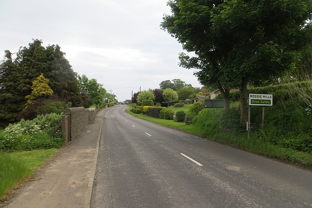
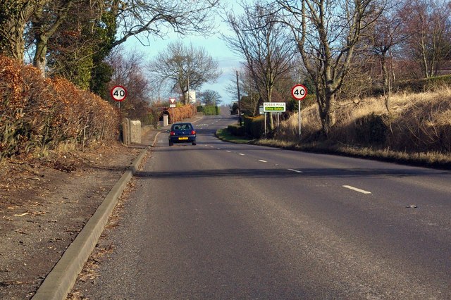
Also known as: Rossie Island

What 3 Words

///boxing.burying.clarifies. Near Montrose, Angus

Related Wikis

Montrose Royal Infirmary

Montrose Royal Infirmary was a health facility in Bridge Street, Montrose, Angus, Scotland. It was managed by NHS Tayside. It is a Category A listed building...

Montrose Castle

Montrose Castle was a 12th-century castle built in Montrose, Angus, Scotland. Montrose was created a royal burgh by King David I of Scotland in the 12th...
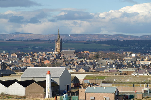
Montrose, Angus

Montrose ( mon-TROHZ; Scottish Gaelic: Mon Rois [mɔn ˈrˠɔʃ]) is a town and former royal burgh in Angus, Scotland. Situated 28 miles (45 kilometres) north...

Montrose Library

The Montrose Library is situated in an A-listed Carnegie funded building in the north Angus coastal town of Montrose. It was first opened in 1905 and in...

Nearby Amenities

Located within 500m of 56.703535,-2.475676
Source: PGS
Lat/Long: 56.7077689/-2.4759253
Source: PGS
Lat/Long: 56.7071284/-2.4759965
Source: PGS
Lat/Long: 56.7070712/-2.4758924
Source: PGS
Lat/Long: 56.7070421/-2.4757193
Source: PGS
Lat/Long: 56.7070411/-2.4755299
Source: PGS
Lat/Long: 56.7066957/-2.4749894
Source: PGS
Lat/Long: 56.7066273/-2.4744018
Source: PGS
Lat/Long: 56.7065909/-2.4742232
Source: PGS
Lat/Long: 56.7065597/-2.4738648
Source: PGS
Lat/Long: 56.7066939/-2.4714789
Source: PGS
Lat/Long: 56.7066261/-2.4710115
Source: PGS
Lat/Long: 56.7023653/-2.468892
Source: PGS
Lat/Long: 56.7034055/-2.4710879
Source: PGS
Lat/Long: 56.7038783/-2.4720784
Source: PGS
Lat/Long: 56.7041986/-2.4726881
Source: PGS
Lat/Long: 56.7043577/-2.4730994
Source: PGS
Lat/Long: 56.7048451/-2.4755502
Source: PGS
Lat/Long: 56.7049384/-2.475868
Source: PGS
Lat/Long: 56.7049503/-2.4763345
Source: PGS
Lat/Long: 56.7049136/-2.4763868
Source: PGS
Lat/Long: 56.7047751/-2.4766999
Mini Roundabout
Direction: clockwise
Lat/Long: 56.7067755/-2.474678
Good Food 2 Go
Shop: convenience
Lat/Long: 56.7024725/-2.4778788
Bus Stop
Burnside Place
Naptan AtcoCode: 6490IM1209
Naptan Bearing: E
Naptan CommonName: Burnside Place
Naptan Indicator: towards Pier
Naptan Landmark: Burnside Place
Naptan NaptanCode: 26423839
Naptan Street: Burnside Place
Naptan Verified: no
Source: naptan_import
Lat/Long: 56.7000708/-2.4774679
Bus Stop
Burnside Place
Naptan AtcoCode: 6490IM1210
Naptan Bearing: E
Naptan CommonName: Burnside Place
Naptan Indicator: opp Craig Road
Naptan Landmark: Craig Road
Naptan NaptanCode: 26423842
Naptan Street: Burnside Place
Naptan Verified: no
Source: naptan_import
Lat/Long: 56.7005464/-2.4729177
Bus Stop
Burnside Place
Naptan AtcoCode: 6490IM1211
Naptan Bearing: W
Naptan CommonName: Burnside Place
Naptan Indicator: at Craig Road
Naptan Landmark: Craig Road
Naptan NaptanCode: 26423843
Naptan Street: Burnside Place
Naptan Verified: no
Shelter: no
Source: naptan_import
Lat/Long: 56.7003132/-2.4728004
Bus Stop
Inch Terrace
Bench: yes
Bin: yes
Lit: yes
Naptan AtcoCode: 6490IM1212
Naptan Bearing: SW
Naptan CommonName: Inch Terrace
Naptan Indicator: opp Inch Terrace
Naptan Landmark: Inch Terrace
Naptan NaptanCode: 26425452
Naptan Street: Rossie Island Road
Naptan Verified: no
Shelter: yes
Source: naptan_import
Tactile Paving: no
Lat/Long: 56.7012365/-2.4790394
Bus Stop
Rossie Island Rd at Inch Terrace
Bench: no
Bin: no
Lit: yes
Naptan AtcoCode: 6490IM1213
Naptan Bearing: NE
Naptan CommonName: Rossie Island Rd at Inch Terrace
Naptan Indicator: at Inch Terrace
Naptan Landmark: Inch Terrace
Naptan NaptanCode: 26425439
Naptan Street: Rossie Island Road
Naptan Verified: no
Shelter: no
Source: naptan_import
Tactile Paving: no
Lat/Long: 56.7014572/-2.4790859
Bus Stop
West Terrace
Bench: no
Bin: no
Lit: yes
Naptan AtcoCode: 6490IM1254
Naptan Bearing: E
Naptan CommonName: West Terrace
Naptan Indicator: opp Inchbrayock Church
Naptan Landmark: Inchbrayock Church
Naptan NaptanCode: 26424272
Naptan Street: West Terrace
Naptan Verified: no
Shelter: no
Source: naptan_import
Tactile Paving: no
Lat/Long: 56.7008562/-2.4693777
Bus Stop
Bus Depot
Bench: yes
Bin: no
Lit: yes
Naptan AtcoCode: 6490IM126
Naptan Bearing: NE
Naptan CommonName: Bus Depot
Naptan Indicator: opp
Naptan Landmark: Rossie Island Bus Depot
Naptan NaptanCode: 26425456
Naptan Street: Rossie Island Road
Naptan Verified: no
Shelter: yes
Source: naptan_import
Tactile Paving: no
Lat/Long: 56.7030752/-2.4778025
Wharf Street
Naptan AtcoCode: 6490IM1265
Naptan Bearing: W
Naptan BusStopType: CUS
Naptan CommonName: Wharf Street
Naptan Indicator: near New Bridge
Naptan Landmark: New Bridge
Naptan NaptanCode: 26425467
Naptan Street: Wharf Street
Naptan Verified: no
Source: naptan_import
Lat/Long: 56.7067259/-2.4733055
Bus Stop
Burnside Place
Naptan AtcoCode: 6490IM465
Naptan Bearing: W
Naptan CommonName: Burnside Place
Naptan Indicator: at Roundabout
Naptan Landmark: Roundabout
Naptan NaptanCode: 26424263
Naptan Street: Burnside Place
Naptan Verified: no
Source: naptan_import
Lat/Long: 56.6998069/-2.4783627
Bus Stop
Montrose Infirmary
Bench: no
Bin: no
Lit: yes
Naptan AtcoCode: 6490IM715
Naptan Bearing: SW
Naptan CommonName: Montrose Infirmary
Naptan Indicator: at Infirmary
Naptan Landmark: Montrose Infirmary
Naptan NaptanCode: 26425357
Naptan Street: Bridge Street
Naptan Verified: no
Shelter: no
Source: naptan_import
Tactile Paving: no
Lat/Long: 56.7072485/-2.4743605
Bus Stop
Montrose Infirmary
Naptan AtcoCode: 6490IM716
Naptan Bearing: SW
Naptan CommonName: Montrose Infirmary
Naptan Indicator: opp Infirmary
Naptan Landmark: Montrose Infirmary
Naptan NaptanCode: 26425359
Naptan Street: Bridge Street
Naptan Verified: no
Source: naptan_import
Lat/Long: 56.7071991/-2.4740955
Bus Stop
Riverside Road
Bench: no
Bin: no
Naptan AtcoCode: 6490IM717
Naptan Bearing: SW
Naptan CommonName: Riverside Road
Naptan Indicator: at Riverside Road
Naptan Landmark: Riverside Road
Naptan NaptanCode: 26425453
Naptan Street: Rossie Island Road
Naptan Verified: no
Shelter: no
Source: naptan_import
Tactile Paving: no
Lat/Long: 56.704027/-2.4766361
Bus Stop
Croft Road
Bench: no
Bin: no
Lit: yes
Naptan AtcoCode: 6490IM718
Naptan Bearing: NE
Naptan CommonName: Croft Road
Naptan Indicator: opp Croft Road
Naptan Landmark: Montrose Bridge
Naptan NaptanCode: 26425454
Naptan Street: Rossie Island Road
Naptan Verified: no
Shelter: no
Source: naptan_import
Tactile Paving: no
Lat/Long: 56.7045392/-2.4766099
Turning Circle
Lat/Long: 56.7030777/-2.4786301
Seamark Light Category: upper
Seamark Light Character: F
Seamark Light Colour: green
Seamark Light Height: 33
Seamark Light Range: 5
Seamark Light Reference: A 3223.1
Seamark Type: light_minor
Source: US NGA Pub. 114. 2011-05-26.
Lat/Long: 56.7019167/-2.4725333
Seamark Light Category: lower
Seamark Light Character: F
Seamark Light Colour: green
Seamark Light Height: 21
Seamark Light Range: 5
Seamark Light Reference: A 3223
Seamark Type: light_minor
Source: US NGA Pub. 114. 2011-05-26.
Lat/Long: 56.7020667/-2.46955
Rossie Island
Alt Name: Inchbraoch
Alt Name 1: Inchbrayock
Name La: Insula Sancti Bricchi
Place: suburb
Wikidata: Q24638276
Lat/Long: 56.7026433/-2.4770701
Fuel
Shell
Addr City: Montrose
Addr Postcode: DD10 8AJ
Addr Street: Bridge Street
Brand: Shell
Brand Wikidata: Q110716465
Fuel Diesel: yes
Fuel Octane 95: yes
Opening Hours: Mo-Su 07:00-22:45
Phone: +44 1674 671525
Ref Navads: NVDS353_10019470
Website: https://find.shell.com/gb/fuel/10019470-montrose-service-station
Lat/Long: 56.7071299/-2.4747394
Historic: monument
Lat/Long: 56.7066458/-2.4737858
Historic: monument
Lat/Long: 56.7067061/-2.4728068
Booth: KX100
Covered: booth
Mapillary: 312466573811300
Removed Amenity: telephone
Survey Date: 2019-08-21
Lat/Long: 56.7027401/-2.4780343
Crossing
Crossing: traffic_signals
Lat/Long: 56.7027798/-2.4778887
Post Box
Mapillary: 2461121147391340
Operator: Royal Mail
Operator Wikidata: Q638098
Post Box Mounting: pier
Post Box Type: lamp
Lat/Long: 56.7034507/-2.4774268
Crossing
Crossing: uncontrolled
Crossing Island: yes
Lat/Long: 56.7035905/-2.4772304
Crossing
Crossing: uncontrolled
Crossing Island: yes
Lat/Long: 56.7041726/-2.4767418
Spar
Brand: Spar
Brand Wikidata: Q610492
Brand Wikipedia: en:Spar (retailer)
Shop: convenience
Lat/Long: 56.7072634/-2.4746731
Addr City: Montrose
Addr Housenumber: 32
Addr Postcode: DD10 9NW
Addr Street: Rossie Island Road
Lat/Long: 56.7021019/-2.4788898
Ian Grant Smith
Water Rescue
Emergency: water_rescue
Operator: Royal National Lifeboat Institution
Operator Short: RNLI
Ref: 13-10
Seamark Name: Ian Grant Smith
Seamark Radio Station Category: ais
Seamark Radio Station Mmsi: 235005113
Seamark Rescue Station Category: lifeboat_on_mooring
Seamark Source: Bing; https://rnli.org/find-my-nearest
Seamark Type: rescue_station
Website: https://rnli.org/find-my-nearest/lifeboat-stations/montrose-lifeboat-station/montrose-lifeboats
Lat/Long: 56.7063049/-2.4719989
Generator Method: photovoltaic
Generator Output Electricity: yes
Generator Source: solar
Generator Type: solar_photovoltaic_panel
Power: generator
Lat/Long: 56.6994156/-2.4761631
Power: pole
Lat/Long: 56.701271/-2.4810459
Power: pole
Lat/Long: 56.7021068/-2.4811087
Power: pole
Lat/Long: 56.7027107/-2.481152
Power: pole
Lat/Long: 56.7034157/-2.4805998
Power: pole
Lat/Long: 56.7040636/-2.4800865
Kinnes Shipping Ltd
Addr City: Montrose
Addr Housename: Montrose Harbour Buildings
Addr Postcode: DD10 9SL
Addr Street: West Terrace
Description: Ship's Agent, Freight forwarder and customs broker.
Email: montrose@kinnes-shipping.co.uk
Office: company
Opening Hours: 24/7
Phone: +441674 675328
Website: https://kinnes-shipping.co.uk
Lat/Long: 56.7010183/-2.4692185
The data included in this document is from www.openstreetmap.org. The data is made available under ODbL.

Have you been to Inchbraoch?

Leave your review of Inchbraoch below (or comments, questions and feedback).