Mops Pool

Coastal Marsh, Saltings in Angus
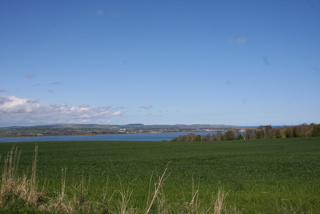
Scotland

Mops Pool

Road works near Rossie Mills Road works on the A934, Montrose to Forfar Road.
Road works near Rossie Mills Credit: Maigheach-gheal

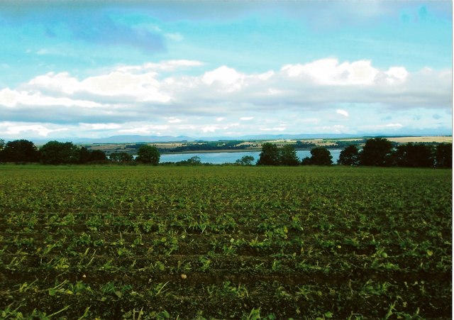
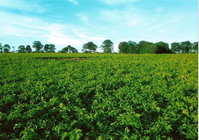
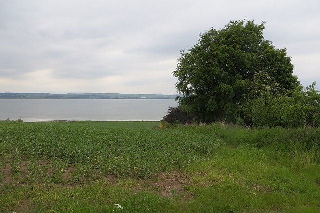
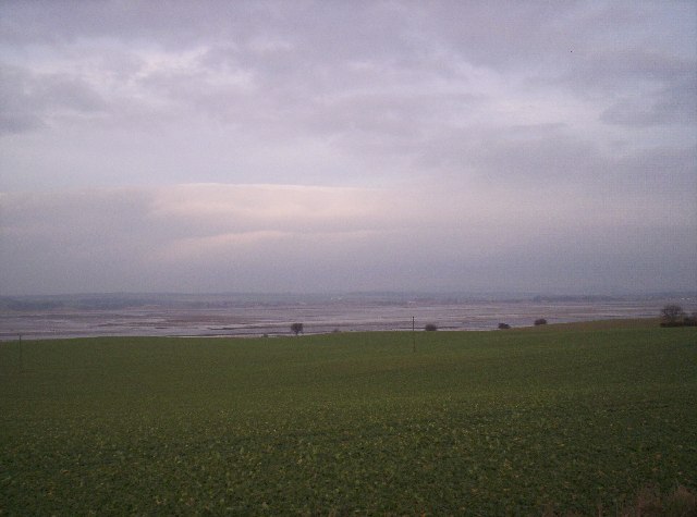
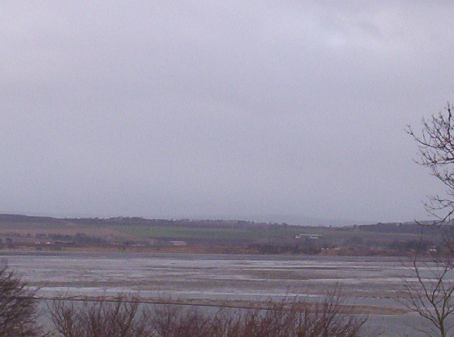
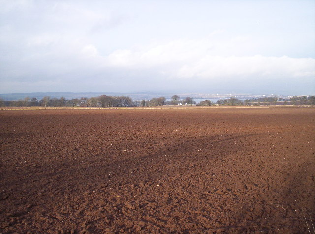
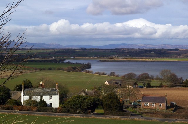
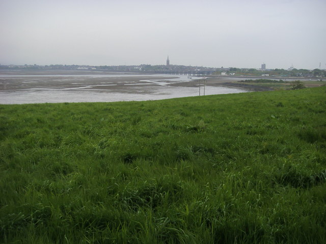
Mops Pool, located in Angus, Scotland, is a coastal marsh and saltings area that spans across a significant stretch of land. Covering approximately 200 acres, it is a rich and diverse ecosystem known for its unique and abundant plant and animal life.

The pool itself is a large, shallow body of water, fed by both freshwater streams and tidal flows from the nearby North Sea. This dynamic mix of water sources creates ideal conditions for a variety of aquatic plants and animals to thrive. The water depth fluctuates with the tides, providing a diverse range of habitats for both saltwater and freshwater species.

The surrounding marshland is characterized by its low-lying, muddy terrain and is home to an array of salt-tolerant plant species. These include sea lavender, sea rush, and saltmarsh grasses, which play a crucial role in stabilizing the marshland and providing shelter and food for a range of animals.

Birdwatchers flock to Mops Pool throughout the year, as it serves as an important breeding and feeding ground for numerous bird species. These include wintering waders such as curlews, dunlins, and redshanks, as well as resident species like lapwings and oystercatchers. Additionally, the pool attracts migratory birds during the spring and autumn, offering a temporary haven for species such as sandpipers and terns.

Mops Pool, with its interconnected network of marshes, saltings, and waterways, is not only a haven for wildlife but also plays a vital role in coastal protection and erosion control. Its value as a natural habitat and its ecological importance make it a significant site for conservation efforts and a popular destination for nature enthusiasts.

If you have any feedback on the listing, please let us know in the comments section below.
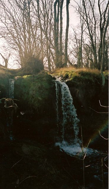
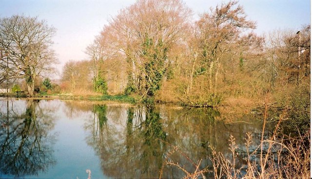
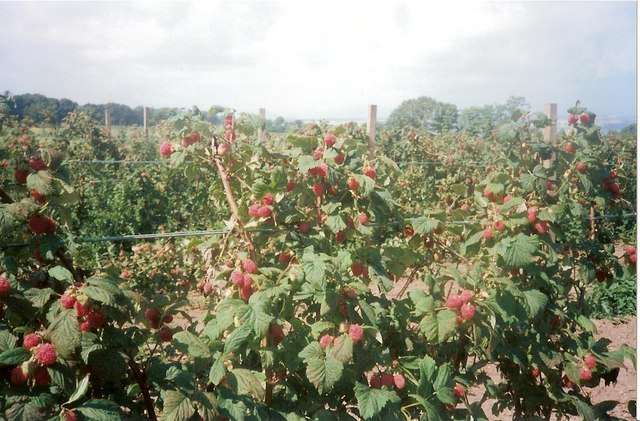
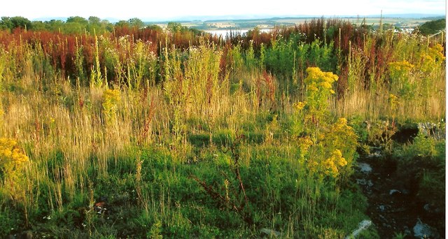
Mops Pool Images

Images are sourced within 2km of 56.700376/-2.4829415 or Grid Reference NO7056. Thanks to Geograph Open Source API. All images are credited.

Road works near Rossie Mills Road works on the A934, Montrose to Forfar Road.
Road works near Rossie Mills
Road works on the A934, Montrose to Forfar Road.
Sunset on Montrose Basin A spectacular sunset on Montrose Basin as viewed from Esk Road, Rossie Island on 07.08.2008.
Sunset on Montrose Basin
A spectacular sunset on Montrose Basin as viewed from Esk Road, Rossie Island on 07.08.2008.
Waterfall at Rossie wood Water flowing from Rossie Castle pond plunges over volcanic rocks as a waterfall in woods at Rossie. The stream then flows into the Basin. A rainbow can be seen in the photo. This is formed by sunlight being split in the spray from water falling on rocks in the plunge pool.
(Rossie Castle was designed by Richard Crichton and occupied by Hercules and Henrietta Ross in 1800. The castle, which had become ruined, was demolished by army sappers c1957.)
Waterfall at Rossie wood
Water flowing from Rossie Castle pond plunges over volcanic rocks as a waterfall in woods at Rossie. The stream then flows into the Basin. A rainbow can be seen in the photo. This is formed by sunlight being split in the spray from water falling on rocks in the plunge pool. (Rossie Castle was designed by Richard Crichton and occupied by Hercules and Henrietta Ross in 1800. The castle, which had become ruined, was demolished by army sappers c1957.)
Rossie Castle pond This view of Rossie Castle pond is taken from the east side closest to the site of the former Rossie Castle. Rossie Castle was demolished in the 1950's. The pond is smaller in size than it was originally as it was partly filled in with agricultural waste during the 1950' and 60's. The sluice gate for the pond is in the top, far corner of the photo as viewed. The Mill House and buildings known locally as 'the kennels', both of which were close to the sluice gate, have been demolished. Water flowing through the sluice goes into a lower pond locally known as 'the dam' before flowing over two waterfalls. The stream then flows to its mouth in the Montrose Basin.
Rossie Castle pond
This view of Rossie Castle pond is taken from the east side closest to the site of the former Rossie Castle. Rossie Castle was demolished in the 1950's. The pond is smaller in size than it was originally as it was partly filled in with agricultural waste during the 1950' and 60's. The sluice gate for the pond is in the top, far corner of the photo as viewed. The Mill House and buildings known locally as 'the kennels', both of which were close to the sluice gate, have been demolished. Water flowing through the sluice goes into a lower pond locally known as 'the dam' before flowing over two waterfalls. The stream then flows to its mouth in the Montrose Basin.
Raspberry field near the site of Rossie Castle, Montrose This photo shows detail of raspberry bushes growing in a field near the site of Rossie Castle. During the 1950's and 60's, the region was renowned for the quantity and quality of its raspberry production and in the late 1950's a steam train known as the "Raspberry Special" took fruit to Covent Garden in London. Much of the fruit from the Montrose area was taken by tractor load to the Chivers jam factory in Montrose. The fruit was mostly picked by local people including many women and children. The pickers were paid by the weight of fruit they produced. Rev W. M. Diack, M.A., the minister of Craig and Maryton parishes during the 1950's and 60's, often worked with his parishioners to harvest the fruit at that time. After the main commercial crop had been picked, gleaning was permitted. Although the main land use in Craig and Maryton at the present time is still agricultural, changes in the choice of crop or type of livestock to be farmed have resulted in greatly reduced quantities of raspberries and other soft fruits being grown.
Raspberry field near the site of Rossie Castle, Montrose
This photo shows detail of raspberry bushes growing in a field near the site of Rossie Castle. During the 1950's and 60's, the region was renowned for the quantity and quality of its raspberry production and in the late 1950's a steam train known as the "Raspberry Special" took fruit to Covent Garden in London. Much of the fruit from the Montrose area was taken by tractor load to the Chivers jam factory in Montrose. The fruit was mostly picked by local people including many women and children. The pickers were paid by the weight of fruit they produced. Rev W. M. Diack, M.A., the minister of Craig and Maryton parishes during the 1950's and 60's, often worked with his parishioners to harvest the fruit at that time. After the main commercial crop had been picked, gleaning was permitted. Although the main land use in Craig and Maryton at the present time is still agricultural, changes in the choice of crop or type of livestock to be farmed have resulted in greatly reduced quantities of raspberries and other soft fruits being grown.
Site of Rossie Castle, parish of Craig, Montrose The foreground of this photo shows the site of the former Rossie Castle near Montrose in Angus. The castle was built for Hercules and Henrietta Ross ; they took possession in 1800. The surrounding grounds had an American garden, ornamental trees, rhododendron bushes, a trout lake and a dovecot dating back to 1695.
The last day of the castle came when George Ogilvie, the landowning farmer, set off a detonation at 3.00 pm on Sunday 29th September 1957. The blast reduced the once magnificent three storey, 150 foot long building to 20,000 tons of stone and rubble.
With the consent of Mr Oglivie, who was an elder of Craig Parish Church, Rev William M Diack, M.A., used a little of the stone for paving at the nearby Manse of Craig. Most of the stone was used for widening the road between Montrose and Arbroath.
Site of Rossie Castle, parish of Craig, Montrose
The foreground of this photo shows the site of the former Rossie Castle near Montrose in Angus. The castle was built for Hercules and Henrietta Ross ; they took possession in 1800. The surrounding grounds had an American garden, ornamental trees, rhododendron bushes, a trout lake and a dovecot dating back to 1695. The last day of the castle came when George Ogilvie, the landowning farmer, set off a detonation at 3.00 pm on Sunday 29th September 1957. The blast reduced the once magnificent three storey, 150 foot long building to 20,000 tons of stone and rubble. With the consent of Mr Oglivie, who was an elder of Craig Parish Church, Rev William M Diack, M.A., used a little of the stone for paving at the nearby Manse of Craig. Most of the stone was used for widening the road between Montrose and Arbroath.
Potato field, Dysart The crop has been defoliated prior to lifting.
Potato field, Dysart
The crop has been defoliated prior to lifting.
Rossie Braes crop field Up to the late 1960's the fields along the Rossie Braes, such as the one in the photo, were typically used for growing raspberries. Since that time, the crops grown here have been more varied.
Rossie Braes crop field
Up to the late 1960's the fields along the Rossie Braes, such as the one in the photo, were typically used for growing raspberries. Since that time, the crops grown here have been more varied.
Potatoes growing in a field at Rossie This photo shows potatoes growing in a field at Rossie. The farmland surrounding Montrose has long been famous for growing potatoes.
Potatoes growing in a field at Rossie
This photo shows potatoes growing in a field at Rossie. The farmland surrounding Montrose has long been famous for growing potatoes.
A934. Rossie Mills Approaching Montrose.
A934. Rossie Mills
Approaching Montrose.
Field, Rossie Mills Shores of Montrose Basin.
Field, Rossie Mills
Shores of Montrose Basin.
Montrose Basin and Fields
Montrose Basin There is no way to get into this square unless you have a boat. This is best photo I have managed to get so far.
Montrose Basin
There is no way to get into this square unless you have a boat. This is best photo I have managed to get so far.
Ploughed field Montrose Basin in the distance.
Ploughed field
Montrose Basin in the distance.
Maryton, Montrose Looking north towards Maryton Farm, Montrose Basin and into the distant Grampian Mountains
Maryton, Montrose
Looking north towards Maryton Farm, Montrose Basin and into the distant Grampian Mountains
Rossie Mills Village, Montrose Photo taken from the Forfar/Montrose Road, approaching the village.
Rossie Mills Village, Montrose
Photo taken from the Forfar/Montrose Road, approaching the village.
Denhead Grassland Grassland on a relatively high spot above Montrose with a view of Montrose Basin in the distance.
Denhead Grassland
Grassland on a relatively high spot above Montrose with a view of Montrose Basin in the distance.
Montrose Basin Near Rossie Mills looking across the field to the Montrose Basin, with in the far distance the railway bridge and the church spire
Montrose Basin
Near Rossie Mills looking across the field to the Montrose Basin, with in the far distance the railway bridge and the church spire
Show me another place!

Mops Pool is located at Grid Ref: NO7056 (Lat: 56.700376, Lng: -2.4829415)

Unitary Authority: Angus

Police Authority: Tayside

What 3 Words

///hillsides.angel.investors. Near Montrose, Angus

Related Wikis

Montrose Royal Infirmary

Montrose Royal Infirmary was a health facility in Bridge Street, Montrose, Angus, Scotland. It was managed by NHS Tayside. It is a Category A listed building...

Montrose Castle

Montrose Castle was a 12th-century castle built in Montrose, Angus, Scotland. Montrose was created a royal burgh by King David I of Scotland in the 12th...
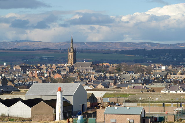
Montrose, Angus

Montrose ( mon-TROHZ; Scottish Gaelic: Mon Rois [mɔn ˈrˠɔʃ]) is a town and former royal burgh in Angus, Scotland. Situated 28 miles (45 kilometres) north...

Montrose Library

The Montrose Library is situated in an A-listed Carnegie funded building in the north Angus coastal town of Montrose. It was first opened in 1905 and in...

Nearby Amenities

Located within 500m of 56.700376,-2.4829415
Source: PGS
Lat/Long: 56.6996189/-2.4907407
Source: PGS
Lat/Long: 56.6994792/-2.4909371
Crossing
Crossing: uncontrolled
Crossing Island: no
Lat/Long: 56.6993425/-2.4815598
Good Food 2 Go
Shop: convenience
Lat/Long: 56.7024725/-2.4778788
Bus Stop
Ferryden Roundabout
Bench: yes
Naptan AtcoCode: 6490IM1175
Naptan Bearing: W
Naptan CommonName: Ferryden Roundabout
Naptan Indicator: towards Arbroath
Naptan Landmark: Ferryden Roundabout
Naptan NaptanCode: 26424267
Naptan Street: A92
Naptan Verified: no
Shelter: yes
Source: naptan_import
Lat/Long: 56.6994461/-2.4802882
Bus Stop
Ferryden Roundabout
Bench: no
Bin: no
Lit: yes
Naptan AtcoCode: 6490IM1176
Naptan Bearing: E
Naptan CommonName: Ferryden Roundabout
Naptan Indicator: towards Montrose
Naptan Landmark: Ferryden Roundabout
Naptan NaptanCode: 26424268
Naptan Street: A92
Naptan Verified: no
Shelter: no
Source: naptan_import
Tactile Paving: no
Lat/Long: 56.6994624/-2.4814938
Bus Stop
Burnside Place
Naptan AtcoCode: 6490IM1209
Naptan Bearing: E
Naptan CommonName: Burnside Place
Naptan Indicator: towards Pier
Naptan Landmark: Burnside Place
Naptan NaptanCode: 26423839
Naptan Street: Burnside Place
Naptan Verified: no
Source: naptan_import
Lat/Long: 56.7000708/-2.4774679
Bus Stop
Inch Terrace
Bench: yes
Bin: yes
Lit: yes
Naptan AtcoCode: 6490IM1212
Naptan Bearing: SW
Naptan CommonName: Inch Terrace
Naptan Indicator: opp Inch Terrace
Naptan Landmark: Inch Terrace
Naptan NaptanCode: 26425452
Naptan Street: Rossie Island Road
Naptan Verified: no
Shelter: yes
Source: naptan_import
Tactile Paving: no
Lat/Long: 56.7012365/-2.4790394
Bus Stop
Rossie Island Rd at Inch Terrace
Bench: no
Bin: no
Lit: yes
Naptan AtcoCode: 6490IM1213
Naptan Bearing: NE
Naptan CommonName: Rossie Island Rd at Inch Terrace
Naptan Indicator: at Inch Terrace
Naptan Landmark: Inch Terrace
Naptan NaptanCode: 26425439
Naptan Street: Rossie Island Road
Naptan Verified: no
Shelter: no
Source: naptan_import
Tactile Paving: no
Lat/Long: 56.7014572/-2.4790859
Bus Stop
Bus Depot
Bench: yes
Bin: no
Lit: yes
Naptan AtcoCode: 6490IM126
Naptan Bearing: NE
Naptan CommonName: Bus Depot
Naptan Indicator: opp
Naptan Landmark: Rossie Island Bus Depot
Naptan NaptanCode: 26425456
Naptan Street: Rossie Island Road
Naptan Verified: no
Shelter: yes
Source: naptan_import
Tactile Paving: no
Lat/Long: 56.7030752/-2.4778025
Bus Stop
Burnside Place
Naptan AtcoCode: 6490IM465
Naptan Bearing: W
Naptan CommonName: Burnside Place
Naptan Indicator: at Roundabout
Naptan Landmark: Roundabout
Naptan NaptanCode: 26424263
Naptan Street: Burnside Place
Naptan Verified: no
Source: naptan_import
Lat/Long: 56.6998069/-2.4783627
Turning Circle
Lat/Long: 56.7030777/-2.4786301
Tourism: viewpoint
Lat/Long: 56.6990474/-2.4905665
Entrance: main
Lat/Long: 56.6988898/-2.4904779
Toilets
Access: customers
Changing Table: yes
Check Date: 2022-04-09
Fee: no
Operator: Scottish Wildlife Trust
Wheelchair: limited
Wheelchair Description: No Emergency Pull Cord
Lat/Long: 56.6989226/-2.4905686
The Bank of Scotland Hide
Leisure: bird_hide
Operator: Scottish Wildlife Trust
Operator Wikidata: Q1828470
Source: GPS
Wheelchair: no
Lat/Long: 56.6992939/-2.4889981
Cafe
Name Signed: no
Noname: yes
Opening Hours: Feb 14-Oct 31 10:30-17:00; Nov 1-Feb 13 10:30-16:00; Nov 1-Feb 13 Tu-Th off
Lat/Long: 56.6990188/-2.4904456
Rossie Island
Alt Name: Inchbraoch
Alt Name 1: Inchbrayock
Name La: Insula Sancti Bricchi
Place: suburb
Wikidata: Q24638276
Lat/Long: 56.7026433/-2.4770701
Booth: KX100
Covered: booth
Mapillary: 312466573811300
Removed Amenity: telephone
Survey Date: 2019-08-21
Lat/Long: 56.7027401/-2.4780343
Crossing
Crossing: traffic_signals
Lat/Long: 56.7027798/-2.4778887
Post Box
Mapillary: 2461121147391340
Operator: Royal Mail
Operator Wikidata: Q638098
Post Box Mounting: pier
Post Box Type: lamp
Lat/Long: 56.7034507/-2.4774268
Crossing
Crossing: uncontrolled
Crossing Island: yes
Lat/Long: 56.7035905/-2.4772304
Addr City: Montrose
Addr Housenumber: 32
Addr Postcode: DD10 9NW
Addr Street: Rossie Island Road
Lat/Long: 56.7021019/-2.4788898
Generator Method: photovoltaic
Generator Output Electricity: yes
Generator Source: solar
Generator Type: solar_photovoltaic_panel
Power: generator
Lat/Long: 56.6992991/-2.4789572
Generator Method: photovoltaic
Generator Output Electricity: yes
Generator Source: solar
Generator Type: solar_photovoltaic_panel
Power: generator
Lat/Long: 56.6994156/-2.4761631
Generator Method: photovoltaic
Generator Output Electricity: yes
Generator Source: solar
Generator Type: solar_photovoltaic_panel
Power: generator
Lat/Long: 56.6986315/-2.4896472
Power: pole
Lat/Long: 56.6959046/-2.4821221
Power: pole
Lat/Long: 56.6966026/-2.4816717
Power: pole
Lat/Long: 56.6973136/-2.4812191
Power: pole
Lat/Long: 56.6979676/-2.4807817
Power: pole
Lat/Long: 56.6986453/-2.4803702
Power: pole
Lat/Long: 56.6994062/-2.479883
Power: pole
Lat/Long: 56.6963672/-2.4827046
Power: pole
Lat/Long: 56.6968713/-2.4833543
Power: pole
Lat/Long: 56.6974742/-2.4839606
Power: pole
Lat/Long: 56.6980472/-2.484476
Power: pole
Lat/Long: 56.6960545/-2.4809571
Power: pole
Lat/Long: 56.6992475/-2.4907127
Power: pole
Lat/Long: 56.699364/-2.4889348
Power: pole
Lat/Long: 56.6994948/-2.4871093
Power: pole
Lat/Long: 56.6996149/-2.4853466
Power: pole
Lat/Long: 56.6994841/-2.4827566
Power: pole
Lat/Long: 56.701271/-2.4810459
Power: pole
Lat/Long: 56.7021068/-2.4811087
Power: pole
Lat/Long: 56.7027107/-2.481152
Power: pole
Lat/Long: 56.7034157/-2.4805998
Power: pole
Lat/Long: 56.7040636/-2.4800865
Rossie Braes
Alt Name: Craig Braes
Place: hamlet
Lat/Long: 56.6986026/-2.4882231
Rossie Spit
Place: locality
Lat/Long: 56.701221/-2.4840586
The data included in this document is from www.openstreetmap.org. The data is made available under ODbL.

Have you been to Mops Pool?

Leave your review of Mops Pool below (or comments, questions and feedback).