Larick Scalp

Coastal Marsh, Saltings in Fife

Scotland

Larick Scalp

Broughty Ferry Beach Broughty Ferry beach on the mouth of the Firth of Tay, with Tayport in the distance.
Broughty Ferry Beach Credit: Scott Cormie

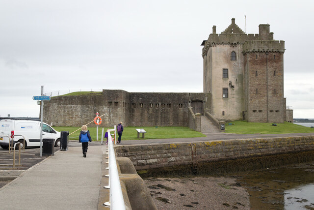
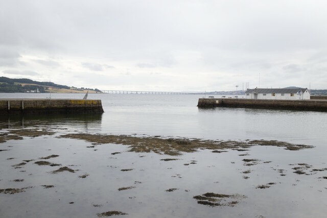
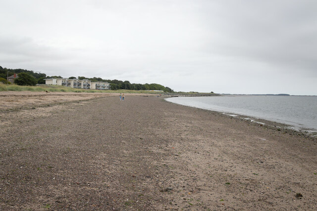
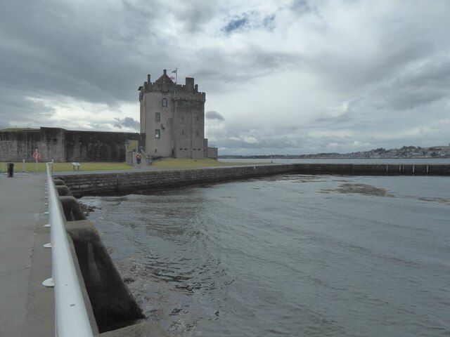
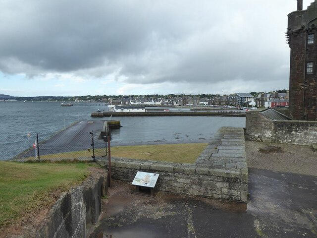
Larick Scalp is a coastal marsh located in Fife, Scotland. It is situated along the northern shore of the Firth of Tay, near the town of Wormit. The area is characterized by its unique blend of marshland and saltings, making it an important habitat for various bird species and other wildlife.

The marshland of Larick Scalp is a tidal area that is regularly flooded by the sea. This creates a dynamic ecosystem with a mix of saltwater and freshwater environments. The saltings, on the other hand, are areas of salt marshes that are covered in salt-tolerant plants. Together, these habitats support a diverse range of plant and animal life.

The coastal marsh is particularly renowned for its bird population. It serves as a crucial feeding and nesting ground for numerous species, including waders, waterfowl, and seabirds. Visitors to Larick Scalp may have the opportunity to see birds such as curlews, redshanks, oystercatchers, and teal.

Aside from its avian inhabitants, the marshland also supports a variety of other wildlife. Mammals such as otters and seals can occasionally be spotted along the shoreline. Additionally, the area is home to numerous invertebrates, amphibians, and reptiles.

Larick Scalp offers stunning views of the Firth of Tay and the surrounding coastline. It is a popular spot for nature enthusiasts, birdwatchers, and hikers who can explore the area via designated paths and trails. The coastal marsh provides a peaceful and scenic environment for visitors to observe and appreciate the diverse range of flora and fauna that call it home.

If you have any feedback on the listing, please let us know in the comments section below.

Larick Scalp Images

Images are sourced within 2km of 56.451118/-2.8723948 or Grid Reference NO4629. Thanks to Geograph Open Source API. All images are credited.

Broughty Ferry Beach Broughty Ferry beach on the mouth of the Firth of Tay, with Tayport in the distance.
Broughty Ferry Beach
Broughty Ferry beach on the mouth of the Firth of Tay, with Tayport in the distance.
Former Queen Street Church Church and steeple of the former Queen Street United Presbyterian Church in Broughty Ferry, now a restaurant.
Former Queen Street Church
Church and steeple of the former Queen Street United Presbyterian Church in Broughty Ferry, now a restaurant.
Broughty Ferry Library The public library in Broughty Ferry viewed across Queen Street.
Broughty Ferry Library
The public library in Broughty Ferry viewed across Queen Street.
1E11 Aberdeen to London Kings Cross passing through Broughty Ferry Station Unit 800102
1E11 Aberdeen to London Kings Cross passing through Broughty Ferry Station
Unit 800102
Construction of flood defences, Broughty Ferry
Broughty Castle
Broughty Castle
Harbour, Broughty Ferry
Broughty Ferry Beach
Promenade at James Place, Broughty Ferry
Firth of Tay Seen from the promenade at James Place, Broughty Ferry. The Tay Road Bridge can be seen on the horizon.
Firth of Tay
Seen from the promenade at James Place, Broughty Ferry. The Tay Road Bridge can be seen on the horizon.
Broughty Castle 15th Century, now housing a local museum.
Broughty Castle
15th Century, now housing a local museum.
The Harbour at Broughty Ferry Seen from the Castle.
The Harbour at Broughty Ferry
Seen from the Castle.
The Keep at Broughty Castle 15th Century, now housing a local museum.
The Keep at Broughty Castle
15th Century, now housing a local museum.
Gateway to Broughty Castle 15th Century, now housing a local museum. Looking out to the Harbour.
Gateway to Broughty Castle
15th Century, now housing a local museum. Looking out to the Harbour.
Dundee hire bike Hire scheme operated by the Dundee Cycle Hub. Seen outside Broughty Castle.
Dundee hire bike
Hire scheme operated by the Dundee Cycle Hub. Seen outside Broughty Castle.
Tide's out: Broughty Ferry Looking along old groyne towards Tentsmuir
Tide's out: Broughty Ferry
Looking along old groyne towards Tentsmuir
Low dunes Between beach and esplanade; roadworks on esplanade
Low dunes
Between beach and esplanade; roadworks on esplanade
Show me another place!

Larick Scalp is located at Grid Ref: NO4629 (Lat: 56.451118, Lng: -2.8723948)

Unitary Authority: Fife

Police Authority: Fife

What 3 Words

///multiples.stressed.shrub. Near Tayport, Fife

Nearby Locations

Larick Scalp

Related Wikis

Tayport railway station

Tayport railway station served the town of Tayport, Fife, Scotland from 1848 to 1967 on the Newport Railway. == History == The station opened on 17 May...
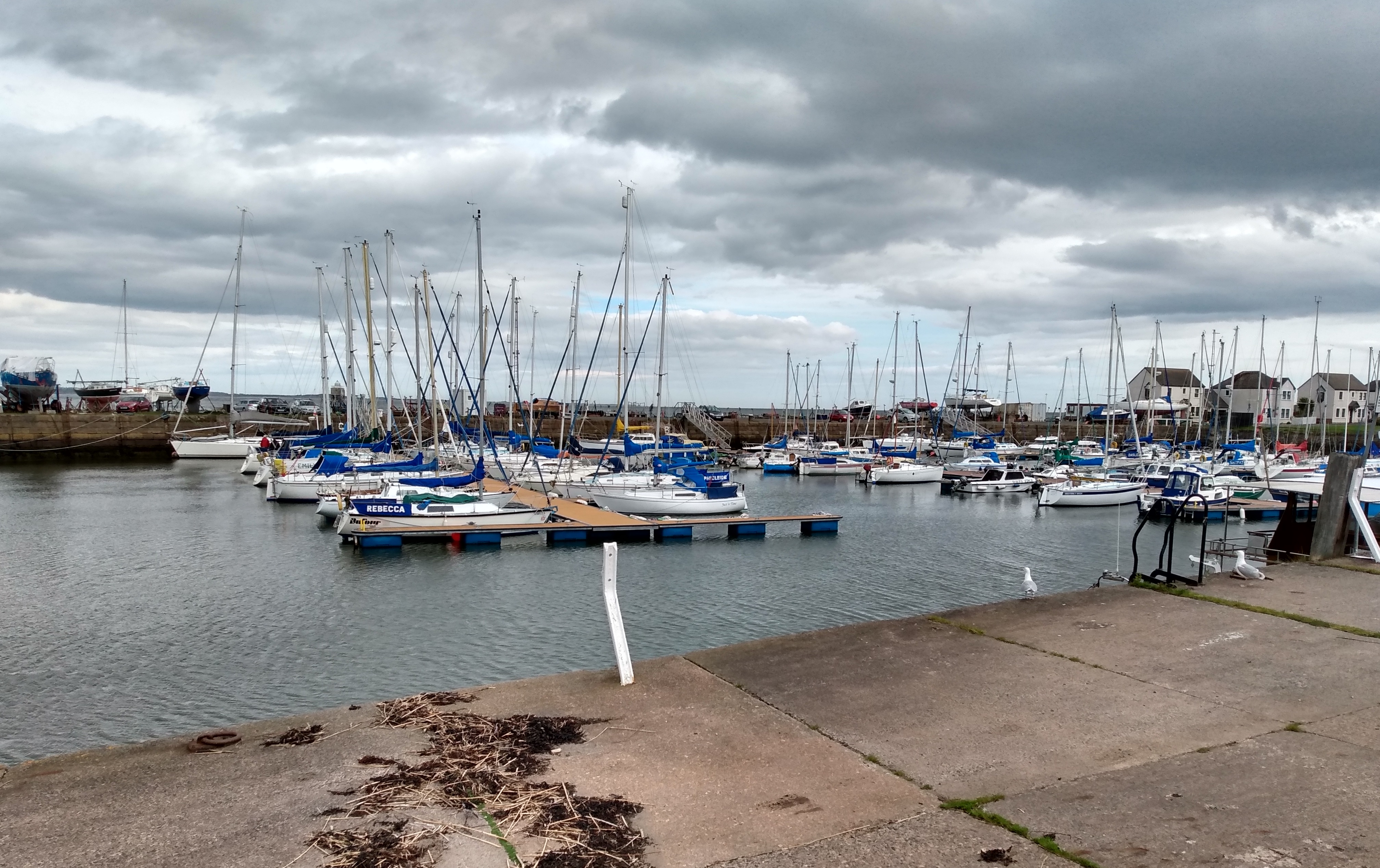
Tayport

Tayport, also known as Ferry-Port on Craig, is a town and burgh, and parish, in the county of Fife, Scotland, acting as a commuter town for Dundee. The...
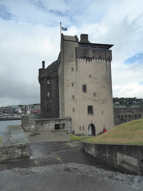
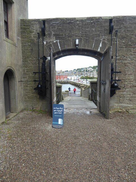
Tayport Castle

Tayport Castle, was a Z plan castle that was located near Tayport, Fife, Scotland. The castle was demolished in the 19th century and no remains above ground...

Tayport F.C.

Tayport Football Club are a Scottish football club from Tayport, Fife. Formed in 1947, they play their home games at The Canniepairt. Nicknamed the Port...

Nearby Amenities

Located within 500m of 56.451118,-2.8723948
Barrier: bollard
Bicycle: yes
Foot: yes
Lat/Long: 56.4508164/-2.8805065
Barrier: cycle_barrier
Bicycle: no
Foot: yes
Lat/Long: 56.4484116/-2.8780568
Tayport Pile Light
Man Made: lighthouse
Seamark Type: light_major
Source: yahoo
Wikidata: Q5856528
Lat/Long: 56.4529461/-2.8723519
Bench
Backrest: yes
Colour: black
Material: metal
Source: knowledge
Lat/Long: 56.4466775/-2.8726591
Bench
Backrest: yes
Colour: black
Material: metal
Source: knowledge
Lat/Long: 56.4469844/-2.8740767
Bench
Backrest: yes
Colour: black
Material: metal
Source: knowledge
Lat/Long: 56.4468117/-2.8733377
Bench
Backrest: no
Material: wood
Source: knowledge
Lat/Long: 56.4467353/-2.873506
Generator Method: photovoltaic
Generator Output Electricity: yes
Generator Source: solar
Generator Type: solar_photovoltaic_panel
Power: generator
Lat/Long: 56.4470986/-2.8749924
The data included in this document is from www.openstreetmap.org. The data is made available under ODbL.

Have you been to Larick Scalp?

Leave your review of Larick Scalp below (or comments, questions and feedback).