Abernethy Bank

Coastal Marsh, Saltings in Perthshire

Scotland

Abernethy Bank

Tay coble A rowing boat that would have been used by the net fishery on the Firth of Tay.
Tay coble Credit: Richard Webb

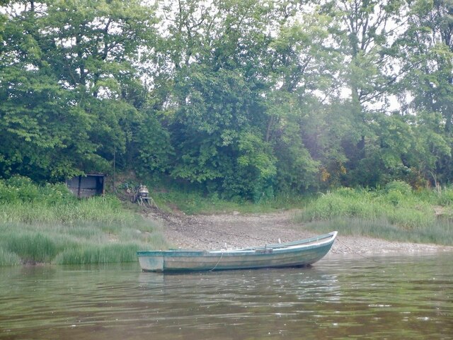
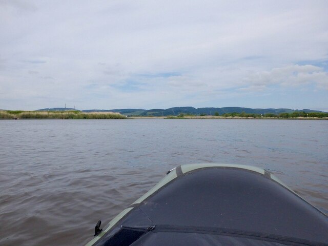
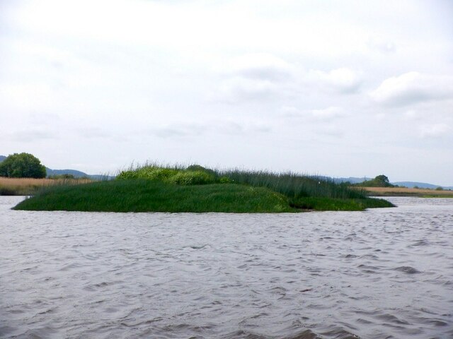
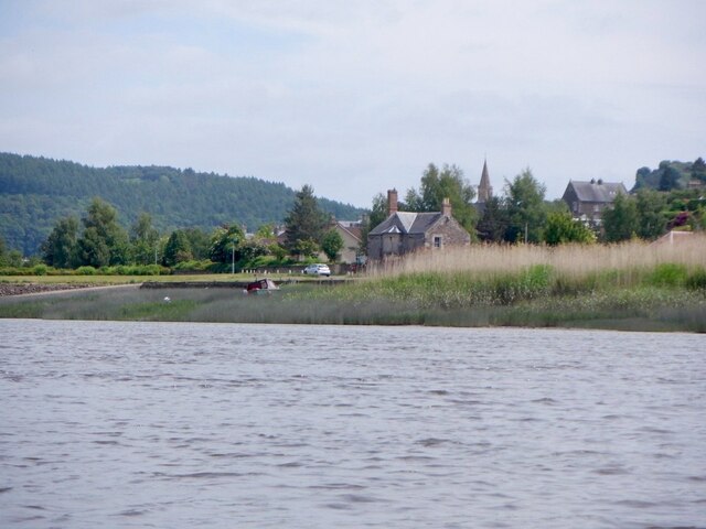
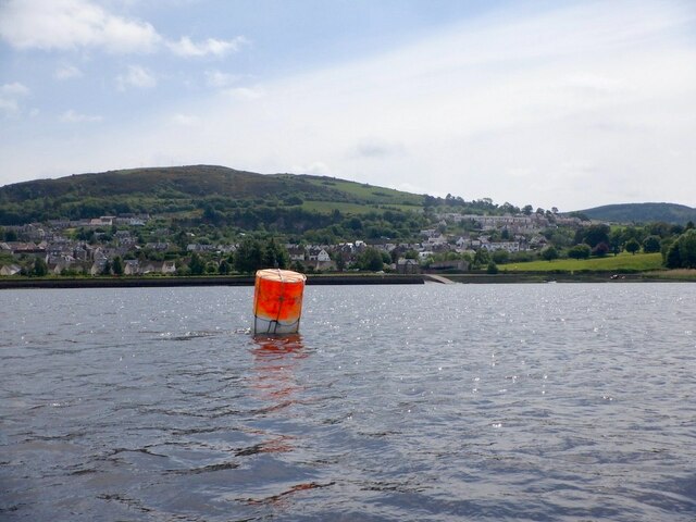
Abernethy Bank is a coastal marsh and saltings located in Perthshire, Scotland. Situated along the eastern coast of Scotland, this unique ecosystem covers an area of approximately 50 hectares. It is part of the larger Firth of Tay estuary, which spans across several counties in Scotland.

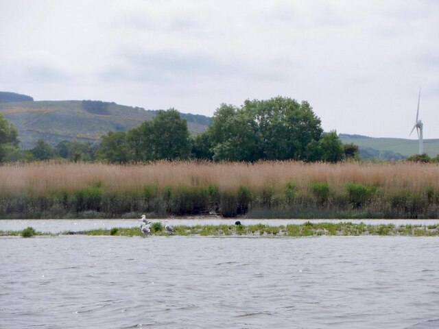
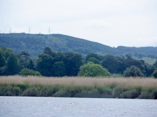
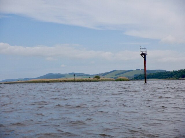
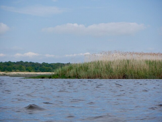
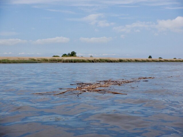
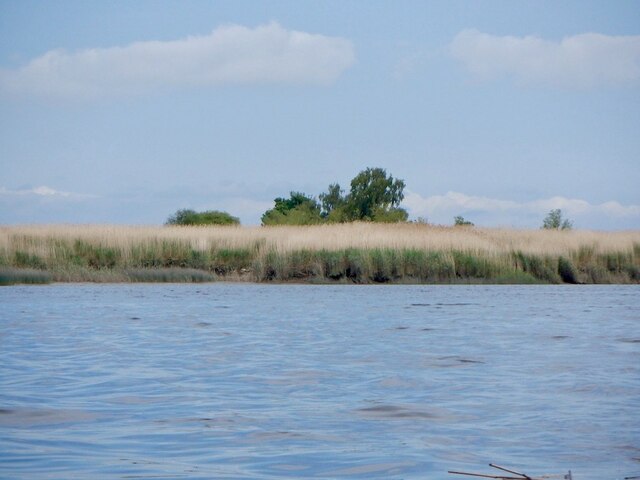
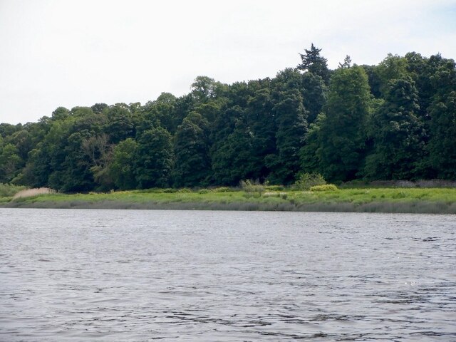
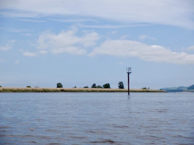
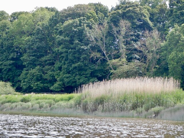
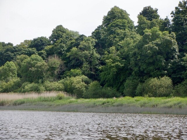
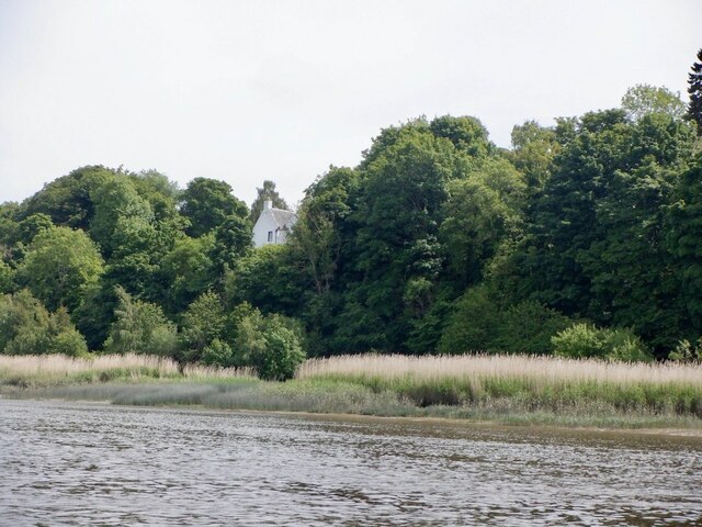
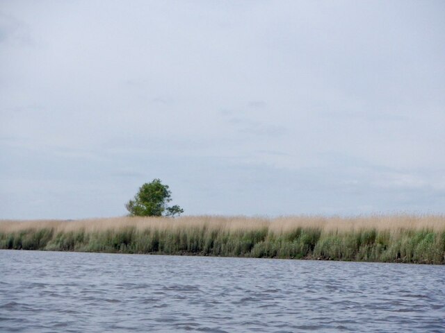
The bank is characterized by its extensive salt marshes and mudflats, which are influenced by the tidal movements of the North Sea. The area is rich in biodiversity and serves as an important habitat for a wide range of plant and animal species. The marshes are dominated by salt-tolerant plants such as sea lavender, sea aster, and saltmarsh grasses. These plants provide shelter and food for various invertebrates, birds, and mammals.

The saltings at Abernethy Bank are home to a variety of wading birds, including curlews, redshanks, and oystercatchers. These birds can be seen foraging for food in the mudflats during low tide. The area also attracts migratory birds, such as pink-footed geese and barnacle geese, during the winter months.

Abernethy Bank is not only important for its ecological value but also for its role in coastal protection. The salt marshes act as natural buffers, absorbing wave energy and reducing the risk of coastal erosion. They also help to improve water quality by filtering pollutants and excess nutrients from the surrounding land.

Due to its ecological significance, Abernethy Bank is designated as a Site of Special Scientific Interest (SSSI) and is managed by various conservation organizations. Access to the site is limited to protect the sensitive habitats, but there are designated viewing areas and walking trails for visitors to enjoy and appreciate the natural beauty of this coastal marsh.

If you have any feedback on the listing, please let us know in the comments section below.

Abernethy Bank Images

Images are sourced within 2km of 56.356521/-3.2746831 or Grid Reference NO2118. Thanks to Geograph Open Source API. All images are credited.

Tay coble A rowing boat that would have been used by the net fishery on the Firth of Tay.
Tay coble
A rowing boat that would have been used by the net fishery on the Firth of Tay.
Into the Tay Leaving the Earn for the wide open spaces of the Firth of Tay.
Into the Tay
Leaving the Earn for the wide open spaces of the Firth of Tay.
Carpow Bank Emerging mudbank in the Firth of Tay> The shelduck had departed but other birds stayed around.
Carpow Bank
Emerging mudbank in the Firth of Tay> The shelduck had departed but other birds stayed around.
Reed beds, Firth of Tay
Small island, Carpow Bank Vegetated muddy mound in the Firth of Tay.
Small island, Carpow Bank
Vegetated muddy mound in the Firth of Tay.
Navigation beacon, Firth of Tay One of a pair at the upstream end of the South Deep. Both have attracted nesting birds.
Navigation beacon, Firth of Tay
One of a pair at the upstream end of the South Deep. Both have attracted nesting birds.
Navigation beacon, Firth of Tay One of a pair at the upstream end of the South Deep. Both have attracted nesting birds.
Navigation beacon, Firth of Tay
One of a pair at the upstream end of the South Deep. Both have attracted nesting birds.
Reed Bed, Firth of Tay At the upstream entrance to the South Deep, the main shipping channel out of Perth.
Reed Bed, Firth of Tay
At the upstream entrance to the South Deep, the main shipping channel out of Perth.
Reeds floating down the South Deep Ebb tide on the shipping channel in the Firth of Tay with Mugdrum Island in the background.
Reeds floating down the South Deep
Ebb tide on the shipping channel in the Firth of Tay with Mugdrum Island in the background.
Mugdrum Island View from the South Deep.
Mugdrum Island
View from the South Deep.
Woodland beside the Firth of Tay
Navigation beacon, Firth of Tay Marking the South Deep shipping channel.
Navigation beacon, Firth of Tay
Marking the South Deep shipping channel.
South bank of the Firth of Tay Near Newburgh.
South bank of the Firth of Tay
Near Newburgh.
South bank of the Firth of Tay Near Newburgh.
South bank of the Firth of Tay
Near Newburgh.
Mugdrum House Near Newburgh
Mugdrum House
Near Newburgh
Newburgh seen from the South Deep Newburgh offers some escape routes off the water without too much interaction with the mud. Make sure you are on the right side of The Hard though. The ebb tide runs fast close to the shore here, unlike the slower flow by Mugdrum Island.
Newburgh seen from the South Deep
Newburgh offers some escape routes off the water without too much interaction with the mud. Make sure you are on the right side of The Hard though. The ebb tide runs fast close to the shore here, unlike the slower flow by Mugdrum Island.
Navigation marker off Newburgh One of a pair of bright orange marker barrels off Mugdrum Island.
Navigation marker off Newburgh
One of a pair of bright orange marker barrels off Mugdrum Island.
Mugdrum Island
Mugdrum Island
Show me another place!

Abernethy Bank is located at Grid Ref: NO2118 (Lat: 56.356521, Lng: -3.2746831)

Unitary Authority: Perth and Kinross

Police Authority: Tayside

What 3 Words

///relief.spinners.activism. Near Newburgh, Fife

Nearby Locations

Abernethy Bank

Related Wikis

Mugdrum Island

Mugdrum Island lies in the Firth of Tay, offshore from the town of Newburgh, Fife, in the east of Scotland. == Geography == Mugdrum is low-lying and reedy...

Carpow Roman Fort

The Roman Fort of Carpow was situated at the confluence of the rivers Tay and Earn in what is now Scotland.It was a large fortress with an area of thirty...

River Tay

The River Tay (Scottish Gaelic: Tatha, IPA: [ˈt̪ʰa.ə]; probably from the conjectured Brythonic Tausa, possibly meaning 'silent one' or 'strong one' or...

Newburgh railway station

See also Parbold railway station which was originally named "Newburgh railway station". There have been several railway stations serving the town of Newburgh...

Carpow

Carpow () is a diffuse hamlet in Perth and Kinross, Scotland. It is situated immediately to the east of the confluence of the River Tay and River Earn...

Cottown, Perth and Kinross

Cottown is a village in Perth and Kinross, Scotland, east of the village of St.Madoes and approximately 8 miles (13 kilometres) east of Perth. This area...

Newburgh, Fife

Newburgh is a royal burgh and parish in Fife, Scotland, at the south shore of the Firth of Tay. The town has a population of 2,171 (in 2011), which constitutes...

Pitfour Castle

Pitfour Castle is an 18th-century country house situated on the southeast edge of the village of St Madoes in the Carse of Gowrie, Perthshire, Scotland...

Nearby Amenities

Located within 500m of 56.356521,-3.2746831
Created By: almien_coastlines
Lat/Long: 56.353541/-3.269498
Created By: almien_coastlines
Lat/Long: 56.353535/-3.272265
Created By: almien_coastlines
Lat/Long: 56.353529/-3.275032
Created By: almien_coastlines
Lat/Long: 56.353527/-3.275954
Created By: almien_coastlines
Lat/Long: 56.354548/-3.277345
Created By: almien_coastlines
Lat/Long: 56.355064/-3.275504
Created By: almien_coastlines
Lat/Long: 56.355582/-3.273202
Created By: almien_coastlines
Lat/Long: 56.355582/-3.272741
Created By: almien_coastlines
Lat/Long: 56.355584/-3.272279
Created By: almien_coastlines
Lat/Long: 56.355841/-3.27182
Created By: almien_coastlines
Lat/Long: 56.3561/-3.270438
Created By: almien_coastlines
Lat/Long: 56.356873/-3.268138
Created By: almien_coastlines
Lat/Long: 56.357131/-3.267217
Created By: almien_coastlines
Lat/Long: 56.353539/-3.27042
Created By: almien_coastlines
Lat/Long: 56.353537/-3.271342
Created By: almien_coastlines
Lat/Long: 56.353533/-3.273187
Created By: almien_coastlines
Lat/Long: 56.353532/-3.273648
Created By: almien_coastlines
Lat/Long: 56.353528/-3.275493
Created By: almien_coastlines
Lat/Long: 56.353781/-3.276878
Created By: almien_coastlines
Lat/Long: 56.354034/-3.278264
Created By: almien_coastlines
Lat/Long: 56.354162/-3.278496
Created By: almien_coastlines
Lat/Long: 56.354417/-3.278728
Created By: almien_coastlines
Lat/Long: 56.354806/-3.276425
Created By: almien_coastlines
Lat/Long: 56.355324/-3.273661
Created By: almien_coastlines
Lat/Long: 56.356357/-3.269979
Created By: almien_coastlines
Lat/Long: 56.356614/-3.269519
Created By: almien_coastlines
Lat/Long: 56.35713/-3.267678
Created By: almien_coastlines
Lat/Long: 56.357353/-3.282439
Created By: almien_coastlines
Lat/Long: 56.35774/-3.28129
Created By: almien_coastlines
Lat/Long: 56.359671/-3.27646
Created By: almien_coastlines
Lat/Long: 56.360704/-3.272777
The data included in this document is from www.openstreetmap.org. The data is made available under ODbL.

Have you been to Abernethy Bank?

Leave your review of Abernethy Bank below (or comments, questions and feedback).