Airds Point

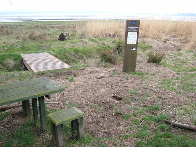
Coastal Marsh, Saltings in Kirkcudbrightshire

Scotland

Airds Point

Nith Estuary at Scar Point
Nith Estuary at Scar Point Credit: David Dixon

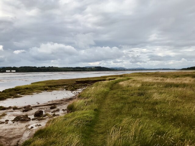
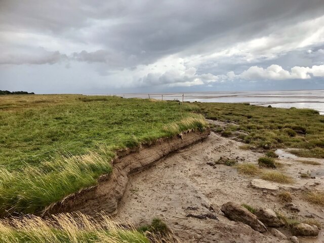
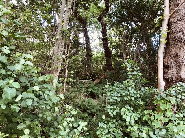
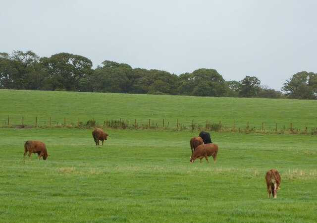
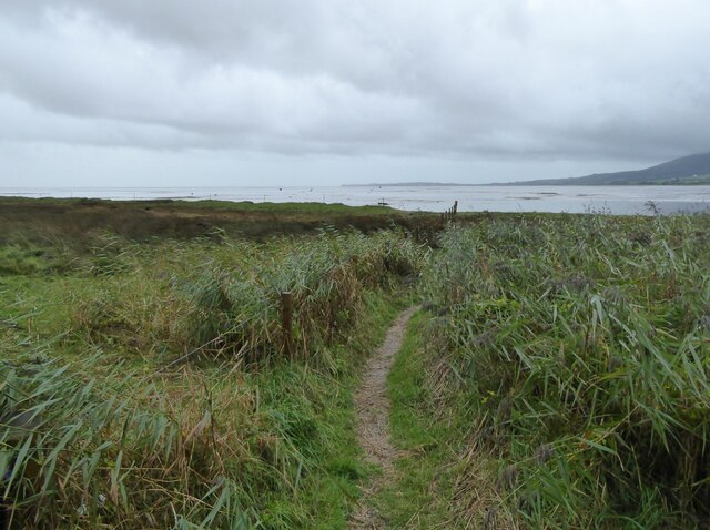
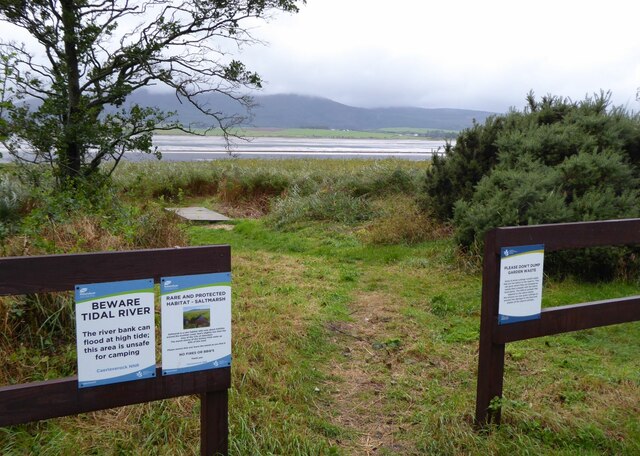
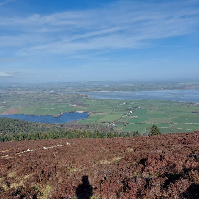
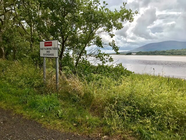
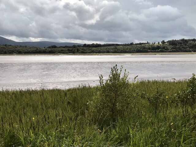
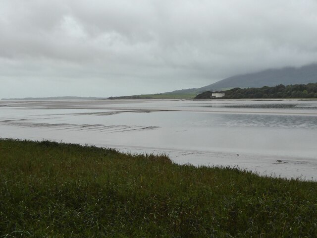
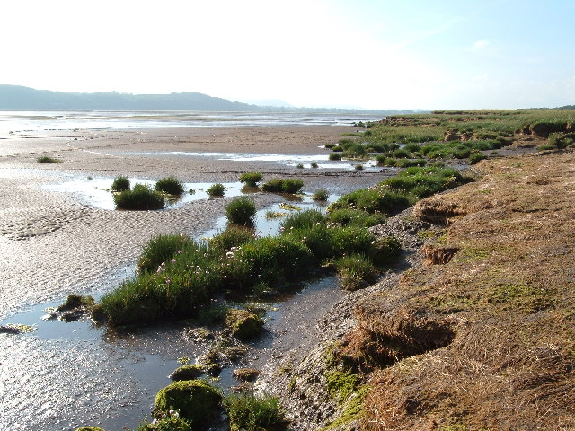
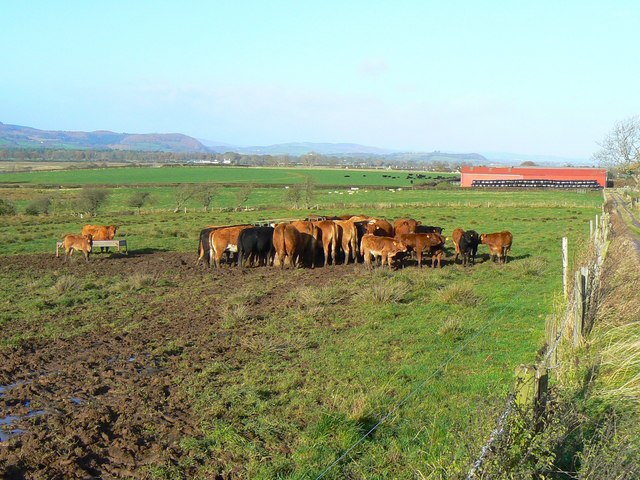
Airds Point is a scenic coastal marsh located in Kirkcudbrightshire, Scotland. Situated on the southern coast of the country, this area is known for its picturesque views and diverse ecosystem. The marshland is characterized by its vast expanse of saltmarshes and saltings, which are an integral part of the local environment.

The marshes at Airds Point are home to a wide variety of plant and animal species. The saltmarshes provide a unique habitat for various types of vegetation, including salt-tolerant grasses and herbs. These plants play a crucial role in stabilizing the marshland and preventing erosion.

The area is also a haven for birdwatchers and nature enthusiasts, as it serves as a vital stopover point for migratory birds. During the spring and autumn seasons, numerous species of waterfowl, waders, and seabirds can be observed in the marshes. Some of the common bird species found here include curlews, oystercatchers, and redshanks.

Airds Point is not only known for its natural beauty but also for its historical significance. The area has evidence of human occupation dating back to prehistoric times, with archaeological finds including ancient burial mounds and artifacts. The nearby town of Kirkcudbright offers visitors the opportunity to explore the region's rich history and culture.

Overall, Airds Point is a captivating destination for those seeking to immerse themselves in the stunning natural landscapes of coastal Scotland. With its diverse wildlife, breathtaking views, and historical significance, it offers a unique and memorable experience for all who visit.

If you have any feedback on the listing, please let us know in the comments section below.

Airds Point Images

Images are sourced within 2km of 54.978694/-3.5766183 or Grid Reference NX9966. Thanks to Geograph Open Source API. All images are credited.

Nith Estuary at Scar Point
Nith Estuary Salt Marshes, Caerlaverock Nature Reserve
Langyards Wood
Langyards Wood
Banks farm On the slopes rising from the River Nith.
Banks farm
On the slopes rising from the River Nith.
Cattle in pasture Near Lantonside.
Viewed from the Shore Road.
Cattle in pasture
Near Lantonside. Viewed from the Shore Road.
Path to the shore Near Scar Point.
Overlooking the Nith estuary.
Path to the shore
Near Scar Point. Overlooking the Nith estuary.
Information and warning signs The path leads down to the saltmarsh.
Saltmarsh is a rare habitat with only about 5400ha around the Scottish coast; that's slightly less than the area of the City of Aberdeen.  The marsh shores of the Solway Firth make up 40% of this total.
Information and warning signs
The path leads down to the saltmarsh. Saltmarsh is a rare habitat with only about 5400ha around the Scottish coast; that's slightly less than the area of the City of Aberdeen. The marsh shores of the Solway Firth make up 40% of this total.
House at Kenneth Bank Looking out across the Nith estuary.
House at Kenneth Bank
Looking out across the Nith estuary.
River Nith Estuary from Summit of Criffell March 2022 The Nith estuary is a tributary of the Solway Firth, overlooked by the prominent distinctive hill, Criffell.  The estuary dries at low tide, leaving a narrow river channel, and exposing the extensive Blackshaw Bank - a favoured feeding ground for waders and waterfowl. In the middle ground, just at the foot of Criffell, lies Loch Kindar.  The ruined Kirk Kindar stands on a small islet.
River Nith Estuary from Summit of Criffell March 2022
The Nith estuary is a tributary of the Solway Firth, overlooked by the prominent distinctive hill, Criffell. The estuary dries at low tide, leaving a narrow river channel, and exposing the extensive Blackshaw Bank - a favoured feeding ground for waders and waterfowl. In the middle ground, just at the foot of Criffell, lies Loch Kindar. The ruined Kirk Kindar stands on a small islet.
Nith Estuary,  Beware Fast Flowing Tides and Quicksands Warning notice between Shore Road and the estuary.
Nith Estuary, Beware Fast Flowing Tides and Quicksands
Warning notice between Shore Road and the estuary.
River Nith, south of Glencaple
Mudflats at the mouth of the River Nith With Airds Point on the far bank with two large tanks at the sewage works there.
Mudflats at the mouth of the River Nith
With Airds Point on the far bank with two large tanks at the sewage works there.
Wind blown trees in hedge Beside the B725 Shore Road.
Wind blown trees in hedge
Beside the B725 Shore Road.
Carse downstream from New Abbey To the end of the wall and across the New Abbey Pow.
Carse downstream from New Abbey
To the end of the wall and across the New Abbey Pow.
Scottish National Heritage nr Caerlaverock View across the Nith Estuary, Dumfries & Galloway.
Scottish National Heritage nr Caerlaverock
View across the Nith Estuary, Dumfries & Galloway.
House at Kenneth Bank
Caerlaverock National Nature Reserve At the very northern end of the reserve. Nith estuary beyond.
Caerlaverock National Nature Reserve
At the very northern end of the reserve. Nith estuary beyond.
Cattle feeding in the mud Much of Banks farm here is low-lying wet land, close to the river Nith.
Cattle feeding in the mud
Much of Banks farm here is low-lying wet land, close to the river Nith.
Show me another place!

Airds Point is located at Grid Ref: NX9966 (Lat: 54.978694, Lng: -3.5766183)

Unitary Authority: Dumfries and Galloway

Police Authority: Dumfries and Galloway

What 3 Words

///subject.sweeter.brew. Near Dumfries, Dumfries & Galloway

Nearby Locations

Airds Point

Related Wikis

Abbey Vale F.C.

Abbey Vale Football Club are a football club based in the village of New Abbey in the historical county of Kirkcudbright shire in the Dumfries and Galloway...

Sweetheart Abbey

The Abbey of Dulce Cor, better known as Sweetheart Abbey (Gaelic: An Abaid Ur), was a Cistercian monastery founded in 1275 in what is now the village of...

Glencaple

Glencaple is a small settlement in the Dumfries and Galloway area of Scotland. Situated on the banks of the River Nith, it once served as a port for nearby...

New Abbey

New Abbey (Scottish Gaelic: An Abaid Ùr) is a village in the historical county of Kirkcudbrightshire in Dumfries and Galloway, Scotland. It is 6 miles...

River Nith

The River Nith (Scottish Gaelic: Abhainn Nid; Common Brittonic: Nowios) is a river in south-west Scotland. The Nith rises in the Carsphairn hills of East...

National Museum of Costume

The National Museum of Costume was located at Shambellie House, in New Abbey, Dumfries and Galloway, Scotland and it formed part of the National Museums...
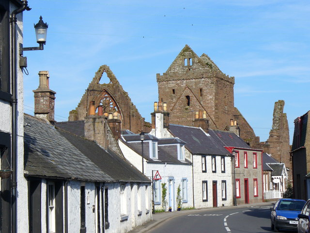
Caerlaverock Castle

Caerlaverock Castle is a moated triangular castle first built in the 13th century. It is located on the southern coast of Scotland, eleven kilometres...

Bankend, Dumfries and Galloway

Bankend is a village in Dumfries and Galloway, Scotland. It is located near Lochar Water, the civil parish Caerlaverock and the villages of Blackshaw,...

Nearby Amenities

Located within 500m of 54.978694,-3.5766183
Source: PGS
Lat/Long: 54.9764959/-3.5821729
Source: PGS
Lat/Long: 54.9766669/-3.5819723
Source: PGS
Lat/Long: 54.9770157/-3.580915
Source: PGS
Lat/Long: 54.9771358/-3.5806304
Source: PGS
Lat/Long: 54.9777023/-3.5797251
Source: PGS
Lat/Long: 54.9781131/-3.5791589
Source: PGS
Lat/Long: 54.978284/-3.5786303
Source: PGS
Lat/Long: 54.9785567/-3.5777119
Source: PGS
Lat/Long: 54.9788695/-3.5766535
Source: PGS
Lat/Long: 54.9789862/-3.5764292
Source: PGS
Lat/Long: 54.9796967/-3.5761181
Source: PGS
Lat/Long: 54.9800279/-3.5759891
Created By: almien_coastlines
Source: PGS
Lat/Long: 54.9803342/-3.5761178
Source: PGS
Lat/Long: 54.9806863/-3.5760191
Source: PGS
Lat/Long: 54.9808365/-3.5759458
Source: PGS
Lat/Long: 54.9821328/-3.5757637
Airds Point Tanks
Man Made: yes
Lat/Long: 54.9805314/-3.5767863
Seamark Beacon Special Purpose Category: outfall
Seamark Beacon Special Purpose Colour: red
Seamark Name: Airds tanks outfall
Seamark Topmark Colour: red
Seamark Topmark Shape: cylinder
Seamark Type: beacon_special_purpose
Lat/Long: 54.9805306/-3.5760144
Airds point
Place: locality
Source: PGS
Lat/Long: 54.9792252/-3.5785256
Power: pole
Lat/Long: 54.9798148/-3.5829394
Power: pole
Lat/Long: 54.9798741/-3.5817821
Power: pole
Lat/Long: 54.9799374/-3.5805449
Power: pole
Lat/Long: 54.9799913/-3.5792725
Power: pole
Lat/Long: 54.98006/-3.5780376
Power: pole
Lat/Long: 54.9801193/-3.5768615
The data included in this document is from www.openstreetmap.org. The data is made available under ODbL.

Have you been to Airds Point?

Leave your review of Airds Point below (or comments, questions and feedback).