Devil's Point

Coastal Marsh, Saltings in Devon

England

Devil's Point

Scaffolded house, Ilsham Valley Work taking place on a house on Ilsham Road.
Scaffolded house, Ilsham Valley Credit: Derek Harper

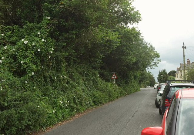
Devil's Point, located in Devon, England, is a picturesque coastal marsh known for its unique ecosystem and stunning natural beauty. Situated on the southern edge of Plymouth Sound, this area is renowned for its expansive saltings, which are marshy, saltwater flooded areas that are influenced by the tides.

The marshland of Devil's Point is characterized by its diverse plant and animal life. The salt tolerant vegetation found here includes sea lavender, samphire, and sea aster, which create a vibrant and colorful landscape during the summer months. These plants provide a vital habitat for a variety of bird species, such as curlews, oystercatchers, and dunlins, making it a popular spot for birdwatchers.

The tides play a significant role in shaping the landscape of Devil's Point. As the waters recede during low tide, vast mudflats are exposed, attracting wading birds and other marine creatures that thrive in this rich feeding ground. At high tide, the area transforms into a tranquil haven, with the marshes submerged under the water, reflecting the sky and creating a breathtaking sight.

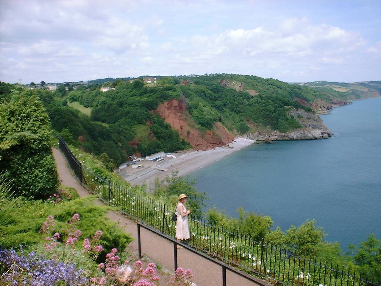
Devil's Point is also well-known for its panoramic views, offering glimpses of the iconic Plymouth Hoe, Mount Edgcumbe, and the bustling Plymouth Sound. Visitors can take leisurely walks along the coastal path, enjoying the fresh sea breeze and the beautiful vistas that stretch out before them.

With its diverse ecosystem, stunning scenery, and abundant wildlife, Devil's Point is a haven for nature enthusiasts and a popular destination for those seeking a tranquil escape by the sea.

If you have any feedback on the listing, please let us know in the comments section below.

Devil's Point Images

Images are sourced within 2km of 50.472559/-3.5009751 or Grid Reference SX9364. Thanks to Geograph Open Source API. All images are credited.

Scaffolded house, Ilsham Valley Work taking place on a house on Ilsham Road.
Scaffolded house, Ilsham Valley
Work taking place on a house on Ilsham Road.
Postbox near Babbacombe George VI postbox TQ1 80 is towards the lower end of Quinta Road.
Postbox near Babbacombe
George VI postbox TQ1 80 is towards the lower end of Quinta Road.
Postbox near Babbacombe A close-up of the plate on George VI postbox TQ1 80, shown in <a href="https://www.geograph.org.uk/photo/6899710">SX9264 : Postbox near Babbacombe</a>.
Postbox near Babbacombe
A close-up of the plate on George VI postbox TQ1 80, shown in SX9264 : Postbox near Babbacombe.
Steps on path from Lyme View Road The path drops to meet Perinville Road.
Steps on path from Lyme View Road
The path drops to meet Perinville Road.
Steps on path from Lyme View Road A different angle from <a href="https://www.geograph.org.uk/photo/6918505">SX9265 : Steps on path from Lyme View Road</a>, and the backdrop changes from the sea to All Saints' Church.
Steps on path from Lyme View Road
A different angle from SX9265 : Steps on path from Lyme View Road, and the backdrop changes from the sea to All Saints' Church.
Lyme View Close, Babbacombe A short cul-de-sac with good views.
Lyme View Close, Babbacombe
A short cul-de-sac with good views.
Lyme View Road, Babbacombe It's the houses that get the view, rather than the road, though there are glimpses in between. At the bend is a right turn into Seaton Close.
Lyme View Road, Babbacombe
It's the houses that get the view, rather than the road, though there are glimpses in between. At the bend is a right turn into Seaton Close.
House on Lyme View Road Beside a path that drops past Locks Close to Perinville Road.
House on Lyme View Road
Beside a path that drops past Locks Close to Perinville Road.
View from Lyme View Road A service road drops to run behind the terrace shown on the left of <a href="https://www.geograph.org.uk/photo/6918614">SX9265 : Lyme View Road, Babbacombe</a>. Meanwhile, a path runs beside it and continues downhill behind houses on Locks Close to reach Perinville Road. Beyond are buildings on Walls Hill Road.
View from Lyme View Road
A service road drops to run behind the terrace shown on the left of SX9265 : Lyme View Road, Babbacombe. Meanwhile, a path runs beside it and continues downhill behind houses on Locks Close to reach Perinville Road. Beyond are buildings on Walls Hill Road.
Lyme View Road, Babbacombe In the dip are two left turns: Locks Hill and Charmouth Close.
Lyme View Road, Babbacombe
In the dip are two left turns: Locks Hill and Charmouth Close.
Houses at Babbacombe A view between houses on Lyme View Road. The next houses are on Perinville Road, and then buildings around the junction of St Anne's Road, Babbacombe Road and Babbacombe Downs Road, with the theatre behind the tree in the centre.
Houses at Babbacombe
A view between houses on Lyme View Road. The next houses are on Perinville Road, and then buildings around the junction of St Anne's Road, Babbacombe Road and Babbacombe Downs Road, with the theatre behind the tree in the centre.
Lyme View Road The road leaves Reddenhill Road, curving up into a large housing estate.
Lyme View Road
The road leaves Reddenhill Road, curving up into a large housing estate.
Trees alongside Reddenhill Road, Babbacombe Houses on the west side of the road face a wooded hillside.
Trees alongside Reddenhill Road, Babbacombe
Houses on the west side of the road face a wooded hillside.
Houses on Reddenhill Road, Babbacombe The houses facing the trees shown in <a href="https://www.geograph.org.uk/photo/6918922">SX9265 : Trees alongside Reddenhill Road, Babbacombe</a>.
Houses on Reddenhill Road, Babbacombe
The houses facing the trees shown in SX9265 : Trees alongside Reddenhill Road, Babbacombe.
Trees alongside Reddenhill Road, Babbacombe A reverse view of <a href="https://www.geograph.org.uk/photo/6918922">SX9265 : Trees alongside Reddenhill Road, Babbacombe</a>. Great bindweed flowers are prominent.
Trees alongside Reddenhill Road, Babbacombe
A reverse view of SX9265 : Trees alongside Reddenhill Road, Babbacombe. Great bindweed flowers are prominent.
Crossroads, Reddenhill Road, Babbacombe Reddenhill Road is the main road here; on the left is Cary Avenue, and on the right, Perinville Road.
Crossroads, Reddenhill Road, Babbacombe
Reddenhill Road is the main road here; on the left is Cary Avenue, and on the right, Perinville Road.
Trecarn Hotel On Palermo Road.
Trecarn Hotel
On Palermo Road.
Palermo Road, Babbacombe Flats along the southern side of the road.
Palermo Road, Babbacombe
Flats along the southern side of the road.
Show me another place!

Devil's Point is located at Grid Ref: SX9364 (Lat: 50.472559, Lng: -3.5009751)

Unitary Authority: Torbay

Police Authority: Devon and Cornwall

What 3 Words

///focal.solo.random. Near Torquay, Devon

Related Wikis

RAF Hospital Torquay

The RAF Hospital Torquay (also known as the RAF Officer's Convalescent Hospital), was a medical facility run by the Royal Air Force (RAF) in the Torquay...

Gleneagles Hotel, Torquay

The Gleneagles Hotel was a hotel in Torquay, Devon, England. The 41-bed establishment, which opened in the 1960s, was the inspiration for Fawlty Towers...

Long Quarry Point

Long Quarry Point is a coastal promontory below Wall's Hill in Torquay, Devon, England. The site is part of the Hope's Nose to Wall's Hill Site of Special...

Kents Cavern

Kents Cavern is a cave system in Torquay, Devon, England. It is notable both for its archaeological and geological features (as a karst feature in the...

Ellacombe, Devon

Ellacombe is a district of Torquay, Devon. Ellacombe is home to Ellacombe Primary school, which is known to be the only place in Torquay that still has...

Babbacombe Theatre

The Babbacombe Theatre is a theatre in Babbacombe in Torquay, South Devon, England. Refurbished in 2009, the venue has been part of the Bay’s tourism industry...

Oddicombe Beach

Oddicombe Beach is a popular beach, noted for its interesting breccia cliffs, below the Babbacombe district of Torbay, Devon in England. The beach includes...

Babbacombe

Babbacombe is a district of Torquay, Devon, England. It is notable for Babbacombe Model Village, the Babbacombe Theatre and its clifftop green, Babbacombe...

Related Videos

Hiking to Thatcher's Point Along the South West Coast Path - Nature Diaries

Hi Conservation Crew! Thank you for joining us once again for an episode of Nature Diaries. In this video we share part of our 11 ...

TORQUAY DEVON | Full tour of the seaside holiday town of Torquay

TORQUAY DEVON | Full tour of the seaside holiday town of Torquay We love a visit to Torquay. It's one of our favourite travel and ...

HIKING THE ENGLISH RIVIERA | TORQUAY TO HOPE'S NOSE

City bugs turned into adventurous hikers - that's us! We had a great time hiking the English Riviera, despite not wearing the most ...

TORQUAY | The Perfect Summer Holiday seaside town of Torquay, Devon

Torquay is a beautiful seaside holiday town located in the English Riviera, on the south coast of Devon and close to Brixham and ...

Nearby Amenities

Located within 500m of 50.472559,-3.5009751
Source: PGS
Lat/Long: 50.4703072/-3.4948698
Source: PGS
Lat/Long: 50.47049/-3.4952769
Source: PGS
Lat/Long: 50.4707452/-3.4955577
Source: PGS
Lat/Long: 50.471173/-3.4963786
Source: PGS
Lat/Long: 50.471102/-3.4975357
Source: PGS
Lat/Long: 50.4712426/-3.4987166
Source: PGS
Lat/Long: 50.4714003/-3.4998463
Source: PGS
Lat/Long: 50.4717601/-3.5003967
Source: PGS
Lat/Long: 50.471887/-3.5011185
Source: PGS
Lat/Long: 50.4727163/-3.5010168
Source: PGS
Lat/Long: 50.4728068/-3.5019081
Source: PGS
Lat/Long: 50.4737956/-3.5019068
Source: PGS
Lat/Long: 50.4747364/-3.5008797
Source: PGS
Lat/Long: 50.475393/-3.4987849
Source: PGS
Lat/Long: 50.4756345/-3.4979896
Source: PGS
Lat/Long: 50.4756165/-3.4978202
Source: PGS
Lat/Long: 50.4757732/-3.4976793
Source: PGS
Lat/Long: 50.4761022/-3.4978275
Source: PGS
Lat/Long: 50.4764019/-3.499329
Source: PGS
Lat/Long: 50.4765141/-3.4996178
Source: PGS
Lat/Long: 50.4769253/-3.500289
Speed Camera
Lat/Long: 50.4717889/-3.5066693
Anstey's Cove
Natural: bay
Wikidata: Q50817241
Lat/Long: 50.4721309/-3.5006787
Bicycle Parking
Bicycle Parking: stands
Capacity: 8
Covered: no
Lat/Long: 50.4704328/-3.5020069
Long Quarry Point
Is In: Devon, England, UK
Natural: headland
Place: locality
Source: NPE
Wikidata: Q60763065
Wikipedia: en:Long Quarry Point
Lat/Long: 50.4758562/-3.4978218
Bus Stop
Palace Hotel
Bench: yes
Bin: no
Bus: yes
Lit: yes
Naptan AtcoCode: 1190TOA10467
Naptan Bearing: S
Naptan CommonName: Palace Hotel
Naptan NaptanCode: tbygmgt
Naptan Street: Babbacombe Road
Naptan Verified: no
Public Transport: platform
Shelter: yes
Source: naptan_import
Tactile Paving: no
Lat/Long: 50.4711377/-3.5067609
Bus Stop
Palace Hotel
Bus: yes
Naptan AtcoCode: 1190TOA10468
Naptan Bearing: N
Naptan CommonName: Palace Hotel
Naptan Indicator: Opp
Naptan NaptanCode: tbygmgp
Naptan Street: Babbacombe Road
Naptan Verified: no
Public Transport: platform
Source: naptan_import
Lat/Long: 50.4716318/-3.5068048
Bus Stop
Ansteys Cove
Bench: no
Bin: no
Bus: yes
Lit: yes
Naptan AtcoCode: 1190TOA10470
Naptan Bearing: N
Naptan CommonName: Ansteys Cove
Naptan Indicator: Opp
Naptan NaptanCode: tbygmjd
Naptan Street: Babbacombe Road
Naptan Verified: no
Public Transport: platform
Shelter: no
Source: naptan_import
Tactile Paving: no
Lat/Long: 50.4727665/-3.5066858
Bus Stop
Ansteys Cove
Bench: yes
Bin: no
Bus: yes
Lit: yes
Naptan AtcoCode: 1190TOA10472
Naptan Bearing: S
Naptan CommonName: Ansteys Cove
Naptan Crossing: Babbacombe Road
Naptan NaptanCode: tbygmjm
Naptan Street: Acre Lane
Naptan Verified: no
Public Transport: platform
Shelter: yes
Source: naptan_import
Tactile Paving: no
Lat/Long: 50.4737204/-3.5066457
Bus Stop
Ansteys Close
Bench: no
Bus: yes
Naptan AtcoCode: 1190TOA10492
Naptan Bearing: SE
Naptan CommonName: Ansteys Close
Naptan Crossing: Ansteys Close
Naptan NaptanCode: tbygmpm
Naptan Street: Asheldon Road
Naptan Verified: no
Public Transport: platform
Shelter: no
Source: naptan_import
Lat/Long: 50.4696607/-3.5041351
Bus Stop
Kents Cavern
Bus: yes
Naptan AtcoCode: 1190TOA10495
Naptan Bearing: SE
Naptan CommonName: Kents Cavern
Naptan Indicator: Opp
Naptan NaptanCode: tbygmta
Naptan Street: Ilsham Road
Naptan Verified: no
Public Transport: platform
Source: naptan_import
Lat/Long: 50.4684349/-3.5029406
Bench
Backrest: yes
Lat/Long: 50.4750316/-3.5023964
Bench
Backrest: yes
Lat/Long: 50.4762122/-3.5014537
Devil's Point
Natural: headland
Lat/Long: 50.4724283/-3.500912
Long Quarry
Place: locality
Source: OS OpenData StreetView
Lat/Long: 50.4760018/-3.5000917
Ele: 82
Natural: peak
Source: OS1
Lat/Long: 50.4702308/-3.5000165
FIXME: incomplete
Lat/Long: 50.4708817/-3.4995454
Access: yes
Leisure: playground
Lat/Long: 50.4684802/-3.5012043
Generator Method: photovoltaic
Generator Output Electricity: yes
Generator Source: solar
Generator Type: solar_photovoltaic_panel
Location: roof
Power: generator
Lat/Long: 50.4687056/-3.4992568
Generator Method: photovoltaic
Generator Output Electricity: yes
Generator Source: solar
Generator Type: solar_photovoltaic_panel
Location: roof
Power: generator
Lat/Long: 50.4724136/-3.5079024
Source: PGS
Lat/Long: 50.4727239/-3.5018218
Bench
Backrest: yes
Lat/Long: 50.4749892/-3.5034906
Bench
Backrest: no
Survey Date: 2022-09-17
Lat/Long: 50.4696706/-3.5014445
Bench
Backrest: no
Survey Date: 2022-09-17
Lat/Long: 50.4694644/-3.5012981
Waste Basket
Survey Date: 2022-09-17
Waste: dog_excrement
Lat/Long: 50.468675/-3.5015667
Leisure: picnic_table
Survey Date: 2022-09-17
Lat/Long: 50.4684748/-3.501334
Bench
Survey Date: 2022-09-17
Lat/Long: 50.4710301/-3.5009415
Waste Basket
Survey Date: 2022-09-17
Lat/Long: 50.471451/-3.5019104
Bench
Backrest: no
Survey Date: 2022-09-17
Lat/Long: 50.4698793/-3.5015706
Bench
Backrest: no
Survey Date: 2022-09-17
Lat/Long: 50.4691246/-3.5010848
Bench
Backrest: no
Survey Date: 2022-09-17
Lat/Long: 50.4688207/-3.500907
Waste Basket
Survey Date: 2022-09-17
Lat/Long: 50.4686424/-3.5016098
Life Ring
Emergency: life_ring
Survey Date: 2022-09-17
Lat/Long: 50.4723762/-3.5011976
Bench
Backrest: no
Survey Date: 2022-09-17
Lat/Long: 50.4700745/-3.5016979
Waste Basket
Survey Date: 2022-09-17
Waste: dog_excrement
Lat/Long: 50.4684683/-3.500803
Leisure: picnic_table
Survey Date: 2022-09-17
Lat/Long: 50.468548/-3.5011328
Leisure: picnic_table
Survey Date: 2022-09-17
Lat/Long: 50.468465/-3.5014141
Bench
Backrest: no
Survey Date: 2022-09-17
Lat/Long: 50.4695141/-3.5013274
Bench
Backrest: yes
Survey Date: 2022-10-15
Lat/Long: 50.4753355/-3.5021342
Bench
Backrest: yes
Survey Date: 2022-10-15
Lat/Long: 50.4754292/-3.5019097
Fire Hydrant
Emergency: fire_hydrant
Fire Hydrant Type: underground
Survey Date: 2022-10-15
Lat/Long: 50.4731288/-3.506496
Crossing
Crossing: marked
Crossing Island: no
Lat/Long: 50.4724173/-3.5066041
The data included in this document is from www.openstreetmap.org. The data is made available under ODbL.

Have you been to Devil's Point?

Leave your review of Devil's Point below (or comments, questions and feedback).