Abbey Head

Coastal Marsh, Saltings in Kirkcudbrightshire

Scotland

Abbey Head

Old Target An old target on Kirkcudbright Ranges.
Old Target Credit: Rab McMurdo

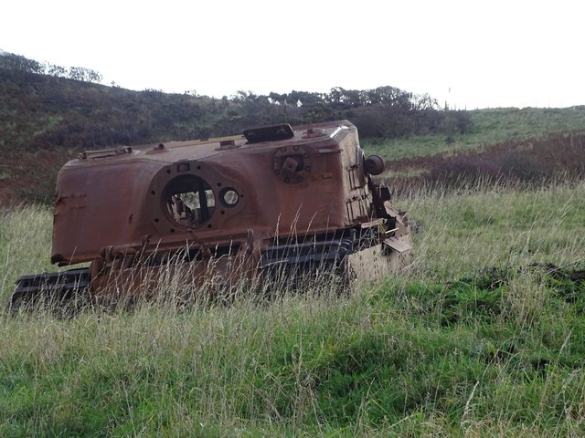
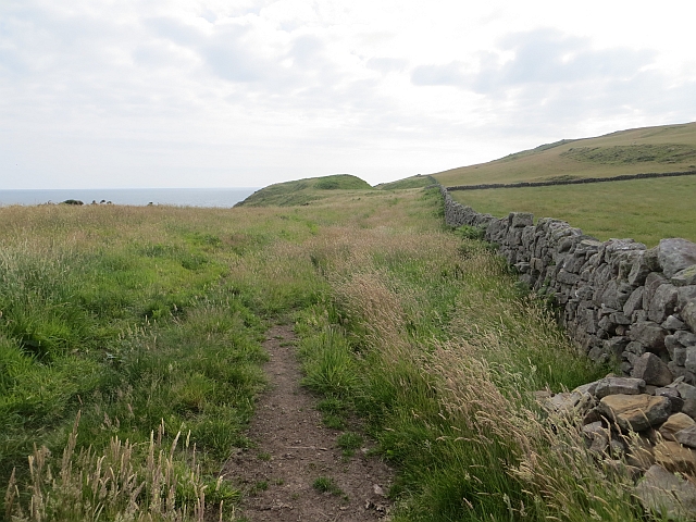
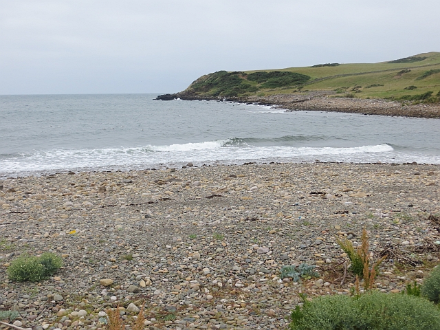
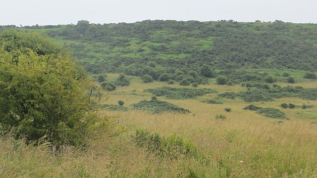
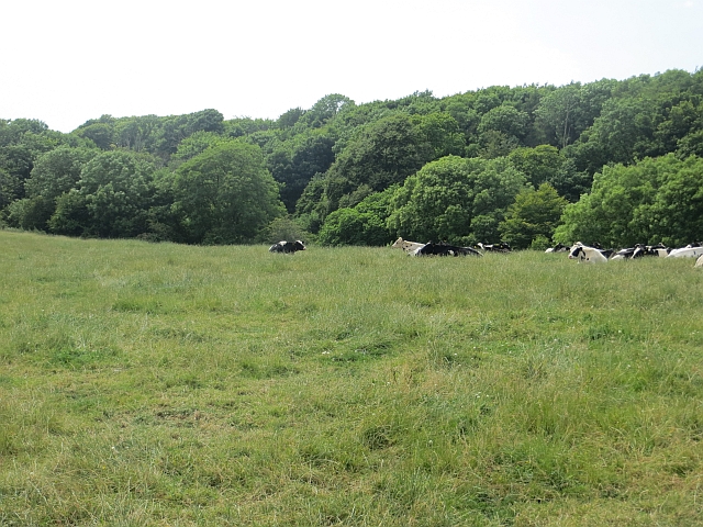
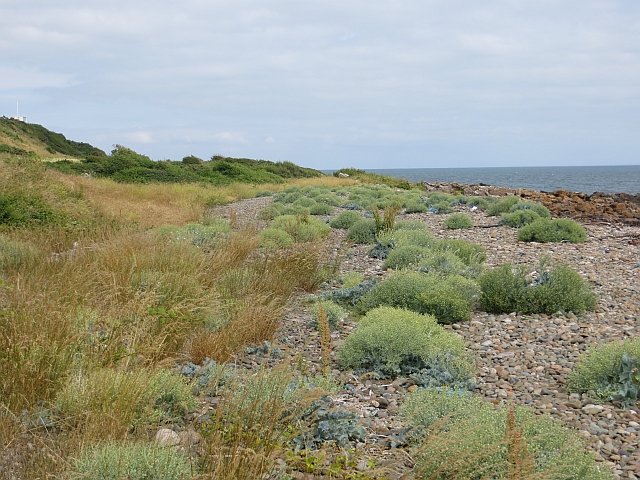
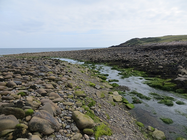
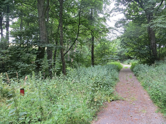
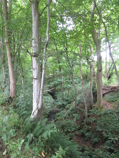
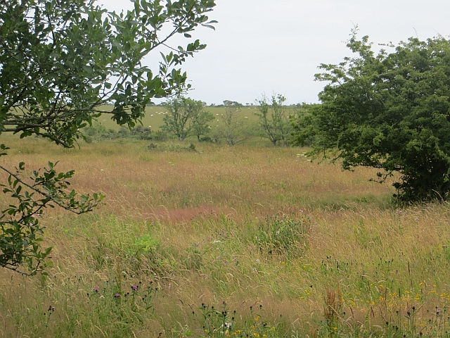
Abbey Head, located in Kirkcudbrightshire, is a coastal marsh area known for its unique saltings. Situated along the shores of the Solway Firth in southwest Scotland, this natural landscape offers a diverse range of habitats and stunning views.

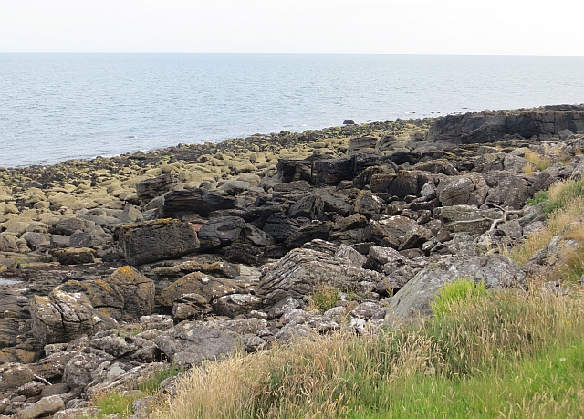
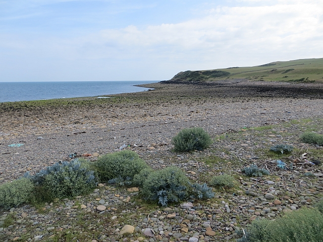
The marshes at Abbey Head are characterized by their saltwater environment, where the incoming tide from the Solway Firth brings in a mix of brackish water. This creates a unique ecosystem that supports a variety of plant and animal species. The saltings, or salt marshes, are home to salt-tolerant vegetation such as samphire, sea lavender, and cordgrass. These plants provide important food and shelter for a range of wildlife, including wading birds, ducks, and geese.

The area is also known for its tidal flats, which are exposed during low tide. These muddy areas attract a wealth of birdlife, including curlews, oystercatchers, and redshanks. Many migratory birds also make a stop at Abbey Head during their journeys, making it a prime spot for birdwatching enthusiasts.

In addition to its natural beauty, Abbey Head has historical significance as well. The ruins of Sweetheart Abbey, a 13th-century Cistercian monastery, are located nearby. This adds an extra layer of charm and interest to the area, making it a popular destination for both nature lovers and history buffs.

Overall, Abbey Head in Kirkcudbrightshire offers a unique and diverse coastal marsh environment, providing a haven for wildlife and a picturesque setting for visitors to enjoy.

If you have any feedback on the listing, please let us know in the comments section below.

Abbey Head Images

Images are sourced within 2km of 54.77373/-3.959713 or Grid Reference NX7443. Thanks to Geograph Open Source API. All images are credited.

Old Target An old target on Kirkcudbright Ranges.
Old Target
An old target on Kirkcudbright Ranges.
Kirkcudbright Ranges An old tank used as a target on the Kirkcudbright Ranges.
Kirkcudbright Ranges
An old tank used as a target on the Kirkcudbright Ranges.
Abbey Head Bouldery beach and headland. The boulders are mostly sandstone but there are a few lumps of granite in there as well.
Abbey Head
Bouldery beach and headland. The boulders are mostly sandstone but there are a few lumps of granite in there as well.
Abbey Head A dyke between the cattle (this bit of the range is still farmed) and the cliffs.
Abbey Head
A dyke between the cattle (this bit of the range is still farmed) and the cliffs.
Burnfoot Beach A helpful notice by the road end, west of Dundrennan tells you if the road through the range to the beach is open. <a href="https://www.geograph.org.uk/photo/3564913">NX7447 : Burnfoot Beach sign</a> View towards Abbey Head on the bouldery beach which was used painstakingly to get at the undocumented squares there.

At a higher state of the tide: <a href="https://www.geograph.org.uk/photo/3564964">NX7444 : Burnfoot Beach</a>
Burnfoot Beach
A helpful notice by the road end, west of Dundrennan tells you if the road through the range to the beach is open. NX7447 : Burnfoot Beach sign View towards Abbey Head on the bouldery beach which was used painstakingly to get at the undocumented squares there. At a higher state of the tide: NX7444 : Burnfoot Beach
Burnfoot Beach Near high water. Comparison: <a href="https://www.geograph.org.uk/photo/3564897">NX7444 : Burnfoot Beach</a>
Burnfoot Beach
Near high water. Comparison: NX7444 : Burnfoot Beach
Road, Netherlaw Burn A former public road to Abbey Burnfoot (which no longer exists). Now part of the Kirkcudbright Infantry Training Range. The road is part of a waymarked traverse of the range which is open when the flags are down.
Road, Netherlaw Burn
A former public road to Abbey Burnfoot (which no longer exists). Now part of the Kirkcudbright Infantry Training Range. The road is part of a waymarked traverse of the range which is open when the flags are down.
Controlled Impact Area South of the waymarked route along the Netherlaw Burn, a large expanse of now wild land which appears to be the recipient of a lot of ordnance, hence the sign.
Some signs have been covered in sacking, my guess is that they are reflecting light at the gunners.

This is one of the few keep out signs that I am happy to photograph from the front.
Controlled Impact Area
South of the waymarked route along the Netherlaw Burn, a large expanse of now wild land which appears to be the recipient of a lot of ordnance, hence the sign. Some signs have been covered in sacking, my guess is that they are reflecting light at the gunners. This is one of the few keep out signs that I am happy to photograph from the front.
Tanks, Kirkcudbright Infantry Training Range On former farmland, now flowery grassland, of Barcheskie.
Tanks, Kirkcudbright Infantry Training Range
On former farmland, now flowery grassland, of Barcheskie.
Range road, Netherlaw Wood A former public road, now part of the Kirkcudbright Infantry Training Range. The waymarked path crossing the range rather conveniently turns left here, giving easy access to a surprising number of (at the time unvisited) gridsquares.
Range road, Netherlaw Wood
A former public road, now part of the Kirkcudbright Infantry Training Range. The waymarked path crossing the range rather conveniently turns left here, giving easy access to a surprising number of (at the time unvisited) gridsquares.
Controlled Impact Area The heart of the Kirkcudbright Range, no longer farmed and a vast area of wild land on the slopes of Wall Hill.

The range was not operational today, hence the photos from a road open to public use at such times. Unfortunately Corporal Cleg was on still on manoeuvres.
Controlled Impact Area
The heart of the Kirkcudbright Range, no longer farmed and a vast area of wild land on the slopes of Wall Hill. The range was not operational today, hence the photos from a road open to public use at such times. Unfortunately Corporal Cleg was on still on manoeuvres.
Road near Craigraploch The road runs beside the Controlled Impact Area of the Kirkcudbright Infantry Training Area. It is a waymarked route across the range when the flags are down.
Road near Craigraploch
The road runs beside the Controlled Impact Area of the Kirkcudbright Infantry Training Area. It is a waymarked route across the range when the flags are down.
Cattle, Netherlaw A farmed bit of the Dundrennan Ranges.
Cattle, Netherlaw
A farmed bit of the Dundrennan Ranges.
Burnfoot Beach Plant life just above the high water mark.
Burnfoot Beach
Plant life just above the high water mark.
Abbey Burn, Burnfoot Beach Burn crossing the intertidal area.
Abbey Burn, Burnfoot Beach
Burn crossing the intertidal area.
Road, Netherlaw This length of road appears to get little use. No doubt it is closed within the range for much of the time and the military appear not to use it. There was a village here once, before the ranges.
Road, Netherlaw
This length of road appears to get little use. No doubt it is closed within the range for much of the time and the military appear not to use it. There was a village here once, before the ranges.
Netherlaw Burn Wooded burn below the road. Most of the land here is open, either farmed or part of the impact area of the Kirkcudbright Training Range.
Netherlaw Burn
Wooded burn below the road. Most of the land here is open, either farmed or part of the impact area of the Kirkcudbright Training Range.
Barcheskie Barcheskie was a farm before the Kirkcudbright Infantry Training Range was established.
Barcheskie
Barcheskie was a farm before the Kirkcudbright Infantry Training Range was established.
Show me another place!

Abbey Head is located at Grid Ref: NX7443 (Lat: 54.77373, Lng: -3.959713)

Unitary Authority: Dumfries and Galloway

Police Authority: Dumfries and Galloway

What 3 Words

///lodge.manhole.reinstate. Near Kirkcudbright, Dumfries & Galloway

Nearby Locations

Abbey Head

Related Wikis

Abbey Head

Abbey Head is a headland on the Solway Firth coast of Dumfries and Galloway. == References ==

Dundrennan Abbey

Dundrennan Abbey, in Dundrennan, Scotland, near to Kirkcudbright, was a Cistercian monastery in the Romanesque architectural style, established in 1142...

Dundrennan

Dundrennan (Gaelic: Dun Droighnein) is a village Dumfries and Galloway, Scotland, about 5 miles (8 km) east of Kirkcudbright. Its population is around...

Dundrennan Range

Dundrennan Range is a weapons testing range on the Solway Firth, near Kirkcudbright in Dumfries and Galloway, in south west Scotland, it is part of the...

Wickerman Festival

The Wickerman Festival was an annual music festival held near Auchencairn in Dumfries and Galloway, Scotland. Dubbed "Scotland's Alternative Music festival...

High Banks cup and ring markings

The High Banks cup and ring markings are a series of Neolithic or Bronze Age carvings on an outcrop of rock near High Banks farm, 3 km SE of Kirkcudbright...

Kirkcudbright Bay

Kirkcudbright Bay is an inlet of the Irish Sea on the coast of Galloway in southwest Scotland. Its coastline falls entirely within the modern administrative...

River Dee, Galloway

The River Dee (Scottish Gaelic: Dè / Uisge Dhè), in south-west Scotland, flows from its source in Loch Dee amongst the Galloway Hills, firstly to Clatteringshaws...

Nearby Amenities

Located within 500m of 54.77373,-3.959713
Source: PGS
Lat/Long: 54.7712608/-3.9660448
Source: PGS
Lat/Long: 54.771294/-3.9657742
Source: PGS
Lat/Long: 54.7714586/-3.9654287
Source: PGS
Lat/Long: 54.7714991/-3.9651285
Source: PGS
Lat/Long: 54.7715891/-3.9644069
Source: PGS
Lat/Long: 54.7715961/-3.9639315
Source: PGS
Lat/Long: 54.7717612/-3.9636664
Source: PGS
Lat/Long: 54.7718956/-3.9631206
Source: PGS
Lat/Long: 54.7719544/-3.9627225
Source: PGS
Lat/Long: 54.7720432/-3.9624329
Source: PGS
Lat/Long: 54.7721732/-3.9621742
Source: PGS
Lat/Long: 54.7723193/-3.961982
Source: PGS
Lat/Long: 54.7724091/-3.9618346
Source: PGS
Lat/Long: 54.7725783/-3.9616574
Source: PGS
Lat/Long: 54.7727083/-3.961509
Source: PGS
Lat/Long: 54.7728704/-3.9614432
Source: PGS
Lat/Long: 54.7730084/-3.961267
Source: PGS
Lat/Long: 54.7731936/-3.9608391
Source: PGS
Lat/Long: 54.7734421/-3.9604992
Source: PGS
Lat/Long: 54.7737633/-3.9599838
Source: PGS
Lat/Long: 54.7739329/-3.9596513
Source: PGS
Lat/Long: 54.7740629/-3.9599047
Source: PGS
Lat/Long: 54.7743054/-3.959451
Source: PGS
Lat/Long: 54.7750774/-3.9585526
Source: PGS
Lat/Long: 54.7757822/-3.9582304
Source: PGS
Lat/Long: 54.7762058/-3.9578107
Source: PGS
Lat/Long: 54.7765351/-3.9581576
Source: PGS
Lat/Long: 54.7770019/-3.9588466
The data included in this document is from www.openstreetmap.org. The data is made available under ODbL.

Have you been to Abbey Head?

Leave your review of Abbey Head below (or comments, questions and feedback).