Bog of Allen

Coastal Marsh, Saltings in Kirkcudbrightshire

Scotland

Bog of Allen

At Auchenvey Plantation A winter view showing hardwood planting near the Crogo Burn.
At Auchenvey Plantation Credit: Mary and Angus Hogg

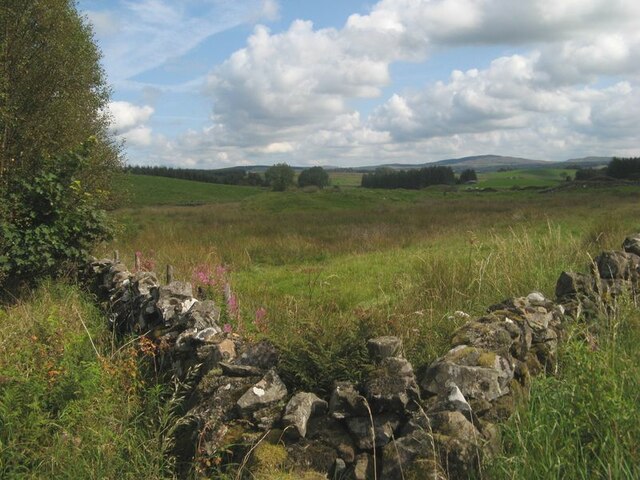
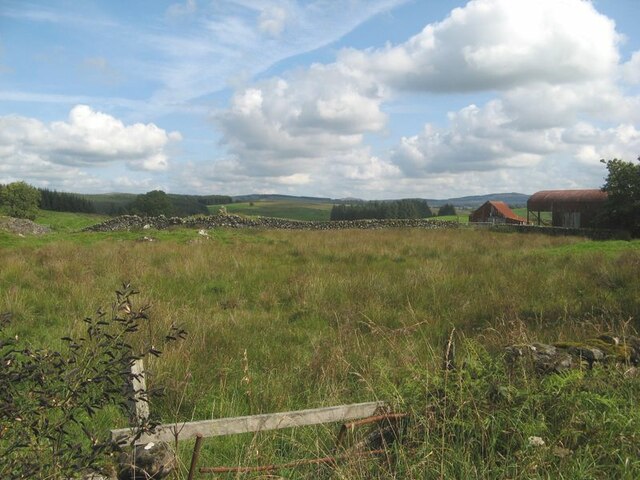
The Bog of Allen, located in Kirkcudbrightshire, Scotland, is a coastal marshland characterized by its vast expanse of salt marshes and saltings. Covering an area of approximately 1,200 hectares, the Bog of Allen is home to a diverse range of plant and animal species that have adapted to the unique brackish environment.

The marshland is fed by a combination of freshwater and saltwater sources, creating a dynamic ecosystem that supports a variety of habitats. The salt marshes are dominated by salt-tolerant plants such as samphire, sea lavender, and sea purslane, while the surrounding areas are home to a diverse array of bird species including waders, waterfowl, and migratory birds.

The Bog of Allen plays a crucial role in supporting local biodiversity and provides important habitat for many species of plants and animals. It also serves as a valuable resource for scientific research and education, allowing researchers to study the complex interactions between land, water, and wildlife in a coastal marsh environment.

Overall, the Bog of Allen is a unique and ecologically significant area that provides a glimpse into the rich diversity of coastal ecosystems in Kirkcudbrightshire.

If you have any feedback on the listing, please let us know in the comments section below.

Bog of Allen Images

Images are sourced within 2km of 55.078558/-3.971476 or Grid Reference NX7477. Thanks to Geograph Open Source API. All images are credited.

At Auchenvey Plantation A winter view showing hardwood planting near the Crogo Burn.
At Auchenvey Plantation
A winter view showing hardwood planting near the Crogo Burn.
Corner of walls Pasture land by forestry at Auchenvey.
Corner of walls
Pasture land by forestry at Auchenvey.
Field and farm Damp pasture and outbuildings at Auchenvey.
Field and farm
Damp pasture and outbuildings at Auchenvey.
A712 at Langtoo Bank
The A712 to Crocketford
Road to Balmaclellan
Shepherds' Cairn on Caldow Moor A Shepherds' cairn on Caldow Moor now hidden by the forestry.
Shepherds' Cairn on Caldow Moor
A Shepherds' cairn on Caldow Moor now hidden by the forestry.
Small Shepherds' Cairn on Caldow Moor Small Shepherds' cairn on Caldow Moor now covered by woodland.
Small Shepherds' Cairn on Caldow Moor
Small Shepherds' cairn on Caldow Moor now covered by woodland.
Rough grazing near Crogo Mill An area of rough grazing near Crogo Mill.
Rough grazing near Crogo Mill
An area of rough grazing near Crogo Mill.
Rough grazing for Belted Galloway cows A small area of rough grazing for a herd of Belted Galloway cows.
Rough grazing for Belted Galloway cows
A small area of rough grazing for a herd of Belted Galloway cows.
A forestry road in Garcrogo Plantation Sitka trees on Caldow Moor.
A forestry road in Garcrogo Plantation
Sitka trees on Caldow Moor.
Forest road, Garcrogo
Track leading to Barmark, Corsock
Barmark Farm, Corsock
Forest track near Barmark Hill A pleasant mossy green track. Ideal for cycling along.
Forest track near Barmark Hill
A pleasant mossy green track. Ideal for cycling along.
Forest track west of Barmark Hill Not shown on the OS map this track leads towards Auchenvey
Forest track west of Barmark Hill
Not shown on the OS map this track leads towards Auchenvey
Entrance to Crogo Mill, Corsock
Looking downstream from Crogo Bridge, Corsock
Show me another place!

Bog of Allen is located at Grid Ref: NX7477 (Lat: 55.078558, Lng: -3.971476)

Unitary Authority: Dumfries and Galloway

Police Authority: Dumfries and Galloway

What 3 Words

///chatters.shirtless.alarming. Near Castle Douglas, Dumfries & Galloway

Related Wikis

Corsock

Corsock (Scottish Gaelic: Corsag) is a village in the historical county of Kirkcudbrightshire, Dumfries and Galloway, south-west Scotland. It is located...

Dumfries and Galloway

Dumfries and Galloway (Scots: Dumfries an Gallowa; Scottish Gaelic: Dùn Phrìs is Gall-Ghaidhealaibh) is one of the 32 unitary council areas of Scotland...

Craigenputtock

Craigenputtock (usually spelled by the Carlyles as Craigenputtoch) is an estate in Scotland where Thomas Carlyle lived from 1828 to 1834. He wrote several...

Glenlair House

Glenlair, near the village of Corsock in the historical county of Kirkcudbrightshire, in Dumfries and Galloway, was the home of the physicist James Clerk...

Nearby Amenities

Located within 500m of 55.078558,-3.971476
Power: pole
Lat/Long: 55.0747056/-3.9674765
Power: pole
Lat/Long: 55.0749768/-3.9687172
Power: pole
Lat/Long: 55.0752663/-3.9699749
Power: pole
Lat/Long: 55.0751781/-3.9713143
Power: pole
Lat/Long: 55.0750832/-3.9726634
Power: pole
Lat/Long: 55.0750175/-3.9736257
Power: pole
Lat/Long: 55.0749215/-3.9750406
Power: pole
Lat/Long: 55.0755886/-3.9708926
Ford: yes
Lat/Long: 55.0763722/-3.966921
Ford: yes
Lat/Long: 55.0766021/-3.9741955
The data included in this document is from www.openstreetmap.org. The data is made available under ODbL.

Have you been to Bog of Allen?

Leave your review of Bog of Allen below (or comments, questions and feedback).