Ynys Bach

Coastal Marsh, Saltings in Anglesey

Wales

Ynys Bach

Hydrant sign on Glanrafon Hill, Bangor
Hydrant sign on Glanrafon Hill, Bangor Credit: Meirion

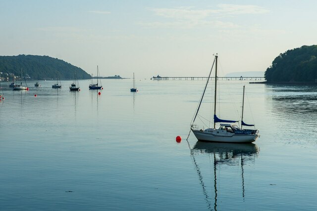
Ynys Bach, located on the island of Anglesey in North Wales, is a coastal marsh and saltings area known for its unique ecological features. Covering an area of approximately 300 hectares, this nature reserve is a haven for a diverse range of flora and fauna.

The reserve is characterized by its extensive salt marshes, which are flooded by the tidal waters of the Irish Sea twice daily. This constant ebb and flow of seawater has created a rich and fertile habitat for various species of plants and animals. Ynys Bach is particularly renowned for its rare saltmarsh plants, such as sea lavender, sea aster, and sea purslane, which thrive in the saline conditions.

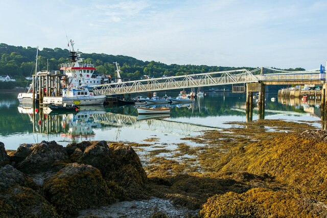
The reserve also serves as an important breeding ground for numerous bird species. During the summer months, the marshes become a nesting site for birds like redshanks, lapwings, and oystercatchers. These wading birds can often be seen probing the mudflats for invertebrates and small fish.

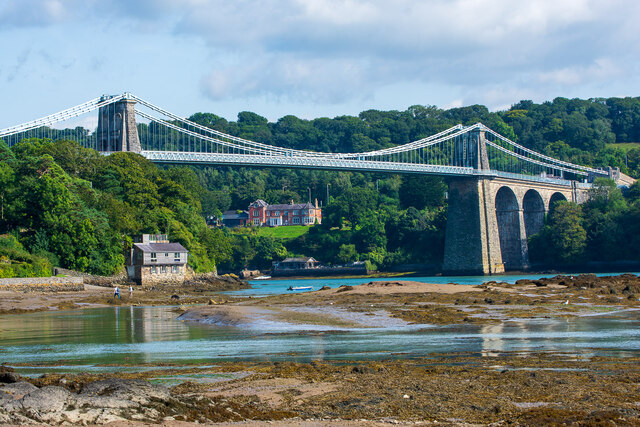
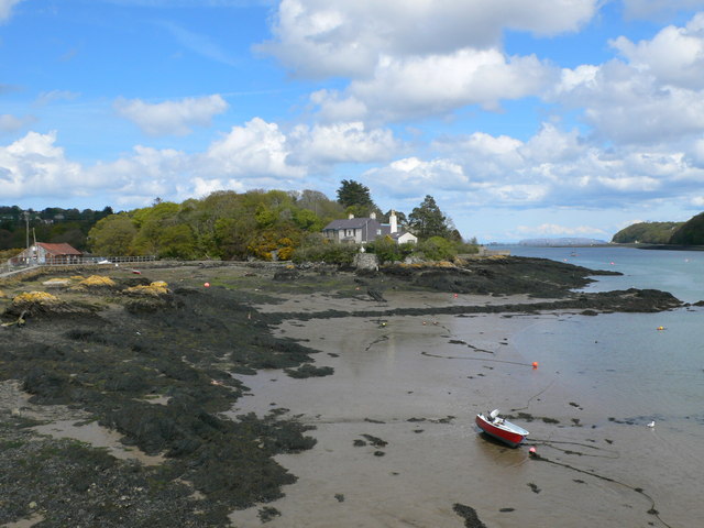
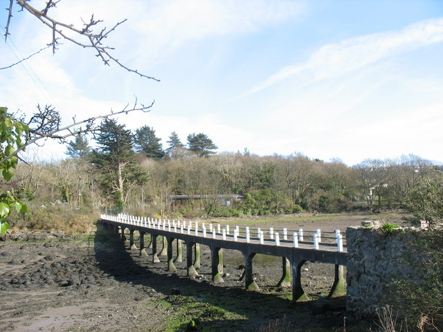
Ynys Bach is not only a sanctuary for wildlife but also offers breathtaking views of the surrounding landscape. Visitors can explore the reserve by following the network of footpaths and boardwalks that wind through the salt marshes. The reserve is managed by the Royal Society for the Protection of Birds (RSPB), which provides information boards and bird hides for observation purposes.

Overall, Ynys Bach is a remarkable coastal marsh and saltings area that offers a glimpse into the unique ecosystems found along the Welsh coastline. With its diverse wildlife and stunning scenery, it is a must-visit destination for nature enthusiasts and birdwatchers alike.

If you have any feedback on the listing, please let us know in the comments section below.

Ynys Bach Images

Images are sourced within 2km of 53.227455/-4.1590752 or Grid Reference SH5572. Thanks to Geograph Open Source API. All images are credited.

Hydrant sign on Glanrafon Hill, Bangor
Hydrant sticker on Glanrafon Hill, Bangor
Hydrant marker on Hill Street, Bangor
Menai Suspension Bridge The world's first major suspension bridge, it was designed by Thomas Telford and completed in 1826. A Grade I structure, it spans the Menai Strait between Anglesey and the Welsh mainland. Viewed from the Welsh mainland side of the Menai Strait.
Menai Suspension Bridge
The world's first major suspension bridge, it was designed by Thomas Telford and completed in 1826. A Grade I structure, it spans the Menai Strait between Anglesey and the Welsh mainland. Viewed from the Welsh mainland side of the Menai Strait.
Menai Suspension Bridge Viewed at low tide, from Church Island.
Menai Suspension Bridge
Viewed at low tide, from Church Island.
Water Street and St George's Road, Menai Bridge St George's Road and the Promenade are located further to the right, past the Liverpool Arms.
Water Street and St George's Road, Menai Bridge
St George's Road and the Promenade are located further to the right, past the Liverpool Arms.
Commemoration plaques at St George's Pier, Menai Bridge Top to bottom: Original opening in 1904; opening following reconstruction in 1979; centenary in 2004. On the opposite stone pier are two further plaques: opening following an earlier reconstruction in 1969, and a Welsh translation of the 1979 plaque.
Commemoration plaques at St George's Pier, Menai Bridge
Top to bottom: Original opening in 1904; opening following reconstruction in 1979; centenary in 2004. On the opposite stone pier are two further plaques: opening following an earlier reconstruction in 1969, and a Welsh translation of the 1979 plaque.
Entrance to the Promenade, Menai Bridge The building and gates probably formed a toll complex for the St George's Pier of 1904. The building is now an ice cream kiosk.
Entrance to the Promenade, Menai Bridge
The building and gates probably formed a toll complex for the St George's Pier of 1904. The building is now an ice cream kiosk.
Hydrant sign on telephone pole on Penrallt Road, Bangor
Hydrant sign on College Road, Bangor
Hydrant sign on Menai Avenue, Bangor
Hydrant sticker on Victoria Park, Bangor
Hydrant marker on Farrar Road, Bangor
Royal Mail pouch box on Ffriddoedd Road, Bangor
The scene of a Marathon, Menai Bridge Spectators, stewards and road closures in place for the Anglesey Half Marathon 2021. This Marathon evidently spanned from the mainland side of the Menai Suspension Bridge, through Menai Bridge and beyond Beaumaris.
The scene of a Marathon, Menai Bridge
Spectators, stewards and road closures in place for the Anglesey Half Marathon 2021. This Marathon evidently spanned from the mainland side of the Menai Suspension Bridge, through Menai Bridge and beyond Beaumaris.
Moreia Welsh Baptist Church, Menai Bridge An entirely ruinous Chapel on Dale Street; recently used as a makeshift market hall of sorts, but now clearly of an unsustainable condition.
Moreia Welsh Baptist Church, Menai Bridge
An entirely ruinous Chapel on Dale Street; recently used as a makeshift market hall of sorts, but now clearly of an unsustainable condition.
The Menai Strait from the Bowling Green Taken from near the Bowling Green shelter in Menai Bridge, displaying the landmasses of Anglesey (left) and the Wales Mainland (right). Their respective extremities in this view are Gallows Point and Bangor Pier.
The Menai Strait from the Bowling Green
Taken from near the Bowling Green shelter in Menai Bridge, displaying the landmasses of Anglesey (left) and the Wales Mainland (right). Their respective extremities in this view are Gallows Point and Bangor Pier.
St George's Pier, Menai Bridge Taken in the early morning from the masses of mud near Ynys Faelog.
St George's Pier, Menai Bridge
Taken in the early morning from the masses of mud near Ynys Faelog.
Show me another place!

Ynys Bach is located at Grid Ref: SH5572 (Lat: 53.227455, Lng: -4.1590752)

Unitary Authority: Isle of Anglesey

Police Authority: North Wales

What 3 Words

///partly.herbs.crumb. Near Menai Bridge, Isle of Anglesey

Related Wikis

Ynys Faelog

Ynys Faelog is a small tidal island in the Menai Strait between Gwynedd and the Isle of Anglesey, Wales, near the town of Menai Bridge. On average it measures...

Glannau Porthaethwy

Glannau Porthaethwy is a designated Site of Special Scientific Interest (SSSI) along the northern shore of the Menai Strait in North Wales. It is a linear...

Hawthorn House, Menai Bridge

Hawthorn House is a Grade II listed building located on the main street in the town of Menai Bridge, on the Isle of Anglesey. == References ==

Menai Bridge

Menai Bridge (Welsh: Porthaethwy; usually referred to colloquially as Y Borth) is a town and community on the Isle of Anglesey in north-west Wales. It...

Ynys Gaint

Ynys Gaint is a small island in the Menai Strait connected to the town of Menai Bridge on Anglesey by a causeway (which still exists today) and also a...

Victoria Hotel, Menai Bridge

The Victoria Hotel is a Grade II listed building in Menai Bridge, Anglesey. == References ==

Battle of Moel-y-don

The Battle of Moel-y-don was fought in 1282 as part of the conquest of Wales by Edward I. Also known as the Battle of the Bridge of Boats, it is now considered...

St Mary's Church, Menai Bridge

St Mary's Church is a Grade II listed church in Menai Bridge, Anglesey serving the parish of Bro Tysilio, in the Diocese of St Davids of the Church in...

Nearby Amenities

Located within 500m of 53.227455,-4.1590752
Source: PGS
Lat/Long: 53.229697/-4.1558356
Source: PGS
Lat/Long: 53.2276155/-4.1573292
Source: PGS
Lat/Long: 53.2240026/-4.1543864
Source: PGS
Lat/Long: 53.2239227/-4.154682
Source: PGS
Lat/Long: 53.2245362/-4.1609003
Source: PGS
Lat/Long: 53.2251548/-4.1607635
Source: PGS
Lat/Long: 53.2256013/-4.1605996
Source: PGS
Lat/Long: 53.2272724/-4.1598406
Uxbridge Square
Name Cy: Y Sgwar
Name En: Uxbridge Square
Lat/Long: 53.2259658/-4.1629077
Porthaethwy / Menai Bridge
Name Cy: Porthaethwy
Name En: Menai Bridge
Place: town
Wikidata: Q2655856
Lat/Long: 53.2259347/-4.1631064
Post Box
Collection Times: Mo-Fr 11:30; Sa 10:00
Operator: Royal Mail
Operator Wikidata: Q638098
Post Box Type: lamp
Ref: LL59 45
Royal Cypher: EIIR
Royal Cypher Wikidata: Q33102113
Lat/Long: 53.2292008/-4.1599776
Bus Stop
Ffordd Cadnant
Bus: yes
Departures Board: no
Network: Arriva
Network Wikidata: Q680991
Network Wikipedia: en:Arriva
Operator: Arriva
Public Transport: platform
Shelter: no
Lat/Long: 53.2286045/-4.1609661
Bus Stop
Oriel Tegfryn
Bench: no
Bus: yes
Departures Board: no
Network: Arriva
Network Wikidata: Q680991
Network Wikipedia: en:Arriva
Operator: Arriva
Public Transport: platform
Shelter: no
Lat/Long: 53.228045/-4.1615447
Barrier: kissing_gate
Foot: yes
Lat/Long: 53.2250375/-4.164716
Post Office
Menai Bridge Post Office
Addr Postcode: LL59 5EE
Branch: Menai Bridge
Brand: Post Office
Brand Wikidata: Q1783168
Check Date: 2020-02-20
Contact Website: https://www.postoffice.co.uk/branch-finder/2606046/menai-bridge
Name Cy: Swyddfa'r Post Porthaethwy
Ref Pol Id: 10338
Lat/Long: 53.226274/-4.1628808
Post Box
Note: Inside post office
Ref: LL59 43
Lat/Long: 53.2263232/-4.1628623
Pub
Auckland Arms
Internet Access: wlan
Wikidata: Q80857889
Lat/Long: 53.2255014/-4.1621969
Crossing
Crossing: traffic_signals
Lat/Long: 53.226236/-4.1627974
Barrier: bollard
Lat/Long: 53.2273568/-4.1628413
Barrier: bollard
Lat/Long: 53.2272975/-4.1628774
Bus Stop
Ffordd y Ffair
Bus: yes
Departures Board: realtime
Public Transport: platform
Lat/Long: 53.225363/-4.1642219
Bus Stop
Ffordd y Ffair
Bus: yes
Departures Board: realtime
Naptan AtcoCode: 5410AWD70026
Naptan NaptanCode: ynydajm
Public Transport: platform
Lat/Long: 53.2254332/-4.1641364
Princes Pier
Leisure: garden
Lat/Long: 53.2239472/-4.1613678
Link
Atm: yes
Operator: Link
Lat/Long: 53.2260005/-4.1631401
Post Box
Collection Times: Mo-Fr 09:00; Sa 07:00
Operator: Royal Mail
Operator Wikidata: Q638098
Post Box Type: wall
Ref: LL59 112D
Royal Cypher: EIIR
Royal Cypher Wikidata: Q33102113
Lat/Long: 53.2273743/-4.1665131
Awen Menai
Addr Housenumber: 17
Addr Postcode: LL59 5EE
Addr Street: High Street
Shop: books
Source: Survey
Website: www.awenmenai.co.uk
Lat/Long: 53.226598/-4.1628003
Seamark Light Character: Fl
Seamark Light Colour: green
Seamark Light Period: 10
Seamark Light Reference: A 5155
Seamark Light Sequence: 1+(9)
Seamark Type: light_minor
Source: US NGA Pub. 114. 2011-05-26.
Lat/Long: 53.2253748/-4.1592158
Bicycle Parking
Bicycle Parking: stands
Capacity: 8
Lat/Long: 53.2253855/-4.1643832
Entrance: yes
Lat/Long: 53.2257573/-4.1649
Fast Food
Menai Deli
Addr Housenumber: 20
Addr Postcode: LL59 5EE
Addr Street: High Street
Cuisine: sandwich
Fhrs Id: 208924
Opening Hours: Mo-Sa 07:00-15:00; Su 08:30-13:30
Source Addr: FHRS Open Data
Takeaway: yes
Lat/Long: 53.2265864/-4.1625428
Entrance: main
Lat/Long: 53.2267682/-4.1612124
Bicycle Parking
Bicycle Parking: stands
Capacity: 12
Covered: no
Lat/Long: 53.2268317/-4.1611418
Fixme: position very approximate
Lat/Long: 53.2269328/-4.1579768
Recycling
Recycling Clothes: yes
Recycling Type: container
Lat/Long: 53.2278337/-4.162582
Elsa
Addr City: Menai Bridge
Addr Street: 1 Nant Terrace, Cadnant Road
Shop: clothes
Wheelchair: yes
Lat/Long: 53.227801/-4.1619311
Man Made: surveillance
Surveillance: public
Surveillance Zone: town
Lat/Long: 53.2259839/-4.1628048
Bench
Lat/Long: 53.2250183/-4.1609559
Meirionfa
Building: yes
Note: middle bdg in terrace of three.
Lat/Long: 53.2253013/-4.1619061
Bowling Green
Tourism: viewpoint
Lat/Long: 53.2235212/-4.1611803
Power: substation
Lat/Long: 53.226168/-4.160567
Power: substation
Lat/Long: 53.226759/-4.161834
Power: substation
Lat/Long: 53.224895/-4.164539
Cafe
Plus39
Addr Postcode: LL59 5DG
Addr Street: Y Sgwar
Fhrs Id: 1051099
Old Amenity: bank
Old Name: HSBC
Source Addr: FHRS Open Data
Lat/Long: 53.2260086/-4.1630916
Lifestyle Express
Addr City: Menai Bridge
Addr Country: GB
Addr Postcode: LL59 5DN
Addr Street: Bridge Street
Brand: Lifestyle Express
Brand Wikidata: Q61994869
Check Date: 2024-03-03
Fhrs Id: 554624
Old Name: Menai Bridge Post Office
Shop: convenience
Lat/Long: 53.2256608/-4.1628472
Post Box
Collection Times: Mo-Fr 17:30; Sa 12:15
Post Box Apertures: 2
Post Box Design: type_c
Post Box Type: pillar
Ref: LL59 42;LL59 942
Royal Cypher: EIIR
Royal Cypher Wikidata: Q33102113
Lat/Long: 53.2257041/-4.162815
Direction: 100
Generator Method: photovoltaic
Generator Output Electricity: yes
Generator Solar Modules: 14
Generator Source: solar
Generator Type: solar_photovoltaic_panel
Location: roof
Power: generator
Lat/Long: 53.2307348/-4.1628153
Direction: 100
Generator Method: photovoltaic
Generator Output Electricity: yes
Generator Solar Modules: 5
Generator Source: solar
Generator Type: solar_photovoltaic_panel
Location: roof
Power: generator
Lat/Long: 53.2309371/-4.1617176
Direction: 280
Generator Method: photovoltaic
Generator Output Electricity: yes
Generator Solar Modules: 5
Generator Source: solar
Generator Type: solar_photovoltaic_panel
Location: roof
Power: generator
Lat/Long: 53.2309102/-4.1617612
Direction: 80
Generator Method: photovoltaic
Generator Output Electricity: yes
Generator Solar Modules: 16
Generator Source: solar
Generator Type: solar_photovoltaic_panel
Location: roof
Power: generator
Lat/Long: 53.2263193/-4.1602611
Direction: SSE
Generator Method: photovoltaic
Generator Output Electricity: yes
Generator Solar Modules: 11
Generator Source: solar
Generator Type: solar_photovoltaic_panel
Location: roof
Power: generator
Lat/Long: 53.2265456/-4.1659668
Direction: 125
Generator Method: photovoltaic
Generator Output Electricity: yes
Generator Solar Modules: 10
Generator Source: solar
Generator Type: solar_photovoltaic_panel
Location: roof
Power: generator
Lat/Long: 53.2285708/-4.1640306
Direction: 130
Generator Method: photovoltaic
Generator Output Electricity: yes
Generator Solar Modules: 17
Generator Source: solar
Generator Type: solar_photovoltaic_panel
Location: roof
Power: generator
Lat/Long: 53.2298123/-4.1612113
Direction: SSW
Generator Method: photovoltaic
Generator Output Electricity: yes
Generator Solar Modules: 16
Generator Source: solar
Generator Type: solar_photovoltaic_panel
Location: roof
Power: generator
Lat/Long: 53.2313994/-4.1603744
Bench
Lat/Long: 53.2253934/-4.1642281
Waste Basket
Lat/Long: 53.2253993/-4.1642394
Charging Station
Wood Street Car Park
Access: yes
Capacity: 2
Fee: yes
Operator: Swarco e-Connect
Payment Contactless: yes
Socket Chademo: 1
Socket Type2: 1
Socket Type2 Combo Output: 1
Lat/Long: 53.2252365/-4.1644673
Entrance: yes
Lat/Long: 53.2246858/-4.1629902
Traffic Signals
Traffic Signals: pedestrian_crossing
Traffic Signals Direction: backward
Lat/Long: 53.2262088/-4.1628084
Traffic Signals
Traffic Signals: pedestrian_crossing
Traffic Signals Direction: forward
Lat/Long: 53.226265/-4.1627857
Restaurant
SteakFritesMoules @ Prohibition
Cuisine: american;french
Smoking: no
Takeaway: no
Lat/Long: 53.2260061/-4.1634858
The data included in this document is from www.openstreetmap.org. The data is made available under ODbL.

Have you been to Ynys Bach?

Leave your review of Ynys Bach below (or comments, questions and feedback).