South Bank

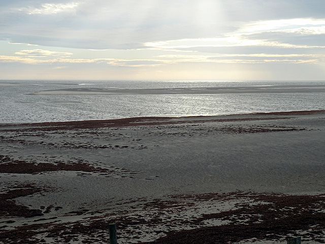
Coastal Marsh, Saltings in Merionethshire

Wales

South Bank

Morfa Bychan, Gwynedd Early evening at the beach at Morfa Bychan.
Morfa Bychan, Gwynedd Credit: Rebecca A Wills

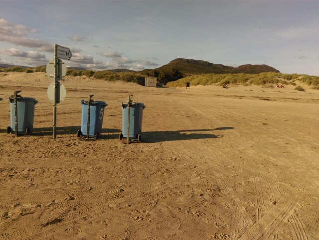
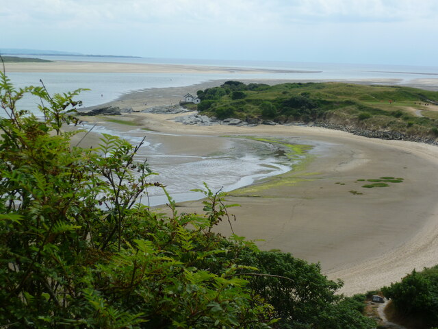
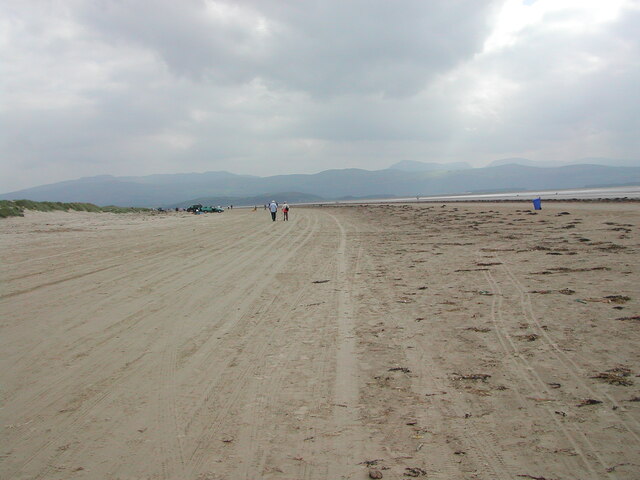
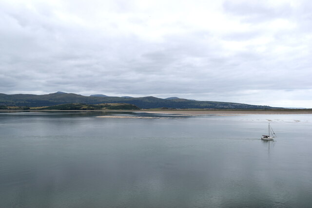
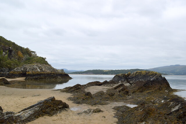
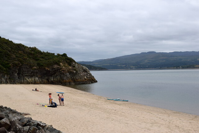
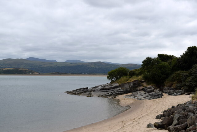
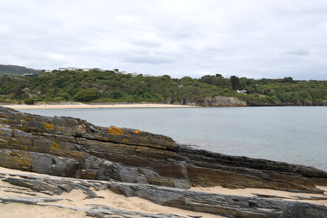
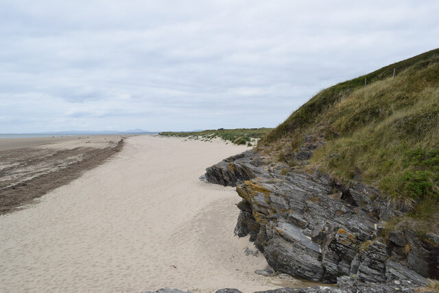
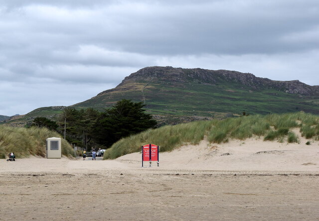
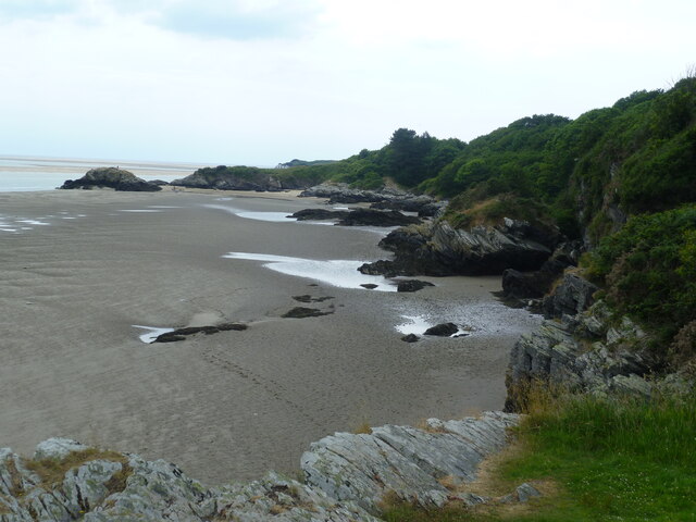
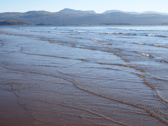
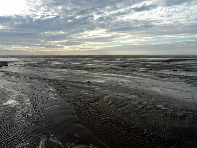
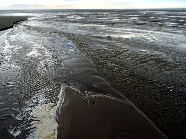
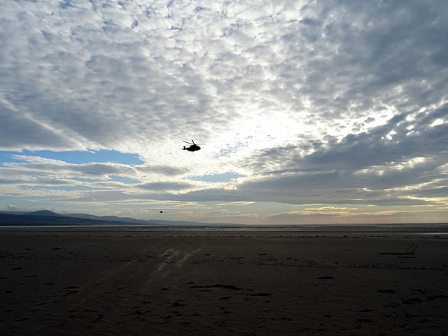
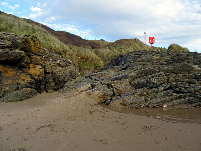
South Bank, located in Merionethshire, is a picturesque coastal marshland known for its stunning saltings. This scenic area is situated on the western coast of Wales, offering visitors a unique and diverse natural environment.

The coastal marsh of South Bank is characterized by its vast expanses of salt-tolerant grasses, reeds, and other wetland vegetation. It serves as a significant habitat for various bird species, including waders like curlew, redshank, and lapwing. The marshland is also home to a range of other wildlife, such as otters, water voles, and several species of fish.

The saltings, which are an integral part of South Bank's ecosystem, are areas of coastal land that are regularly flooded by tidal waters. These tidal marshes provide an ideal environment for salt-tolerant plants, such as samphire and sea lavender, to thrive. They also attract a diverse array of birdlife, including herons, egrets, and avocets.

The unique combination of the coastal marsh and saltings at South Bank creates an ecologically rich and visually stunning landscape. It offers visitors the opportunity to explore and appreciate the natural beauty of this coastal region. There are several walking trails and birdwatching points in the area, allowing nature enthusiasts to immerse themselves in the diverse flora and fauna.

South Bank, Merionethshire, is a must-visit destination for those seeking to experience the tranquility and beauty of a coastal marshland. Its rich biodiversity, stunning saltings, and scenic views make it a haven for both wildlife and visitors alike.

If you have any feedback on the listing, please let us know in the comments section below.

South Bank Images

Images are sourced within 2km of 52.895816/-4.1448523 or Grid Reference SH5535. Thanks to Geograph Open Source API. All images are credited.

Morfa Bychan, Gwynedd Early evening at the beach at Morfa Bychan.
Morfa Bychan, Gwynedd
Early evening at the beach at Morfa Bychan.
Bins on the beach Cars can drive onto this beach and the council has provided litter bins to help users keep it clean
Bins on the beach
Cars can drive onto this beach and the council has provided litter bins to help users keep it clean
View to Ynys Cyngar Across a sandy beach from a coastal path
View to Ynys Cyngar
Across a sandy beach from a coastal path
Black Rock Sands looking south-east The Sands (beach) are named after Graig Ddu (Black Rock) at the north-west end of the beach. The beach is about 3 kilometres in length and lies between Criccieth and Porthmadog. Vehicles are permitted on the beach. Sand dunes extend along the landward side of the beach and are designated a Site of Special Scientific Interest. The Llŷn coastal path, part of the Wales Coast Path, follows the beach. The mountains in the distance form the southern part of the Snowdonia National park.
Black Rock Sands looking south-east
The Sands (beach) are named after Graig Ddu (Black Rock) at the north-west end of the beach. The beach is about 3 kilometres in length and lies between Criccieth and Porthmadog. Vehicles are permitted on the beach. Sand dunes extend along the landward side of the beach and are designated a Site of Special Scientific Interest. The Llŷn coastal path, part of the Wales Coast Path, follows the beach. The mountains in the distance form the southern part of the Snowdonia National park.
Sailing out to sea
Sailing out to sea
Coastal rocks near Borth-y-Gest According to the British Geological Society interactive map, these are outcrops of the Ffestiniog flags formation being mudstone, siltstone and sandstone formed between 499 and 485.4 million years ago during the Cambrian period.
Coastal rocks near Borth-y-Gest
According to the British Geological Society interactive map, these are outcrops of the Ffestiniog flags formation being mudstone, siltstone and sandstone formed between 499 and 485.4 million years ago during the Cambrian period.
On the beach at Morfa Bychan
Coastal rocks, Morfa Brychan beach The BGS interactive map identifies them as part of the Maentwrog formation of mudstone, siltstone and sandstone formed between 508 and 485.4 million years ago during the Cambrian period.
Coastal rocks, Morfa Brychan beach
The BGS interactive map identifies them as part of the Maentwrog formation of mudstone, siltstone and sandstone formed between 508 and 485.4 million years ago during the Cambrian period.
Mudstone formation, Morfa Brychan beach
Looking onto Black rock Sands at Ynys Cyngar
Beach access, Morfa Brychan... ...with Moel-y-Gest hill in the background.  Moel-y-Gest is an unnamed igneous intrusion of micro-gabbro formed between 485.4 and 443.8 million years ago during the Ordovician period with the site of a hillfort at the top.
Beach access, Morfa Brychan...
...with Moel-y-Gest hill in the background. Moel-y-Gest is an unnamed igneous intrusion of micro-gabbro formed between 485.4 and 443.8 million years ago during the Ordovician period with the site of a hillfort at the top.
Rocky beach towards Garreg-goch View from the coastal path
Rocky beach towards Garreg-goch
View from the coastal path
Morfa Bychan
Morfa Bychan
Crossing a 'stream' across Black Rock Sands No doubt in normal times one could just step over it, but filled with storm run-off, the stream has become a river. My GPS suggests that it has changed course to the west since mapped by the OS. With no constraints, I'm sure that it continually wanders over the beach as it sees fit.
Crossing a 'stream' across Black Rock Sands
No doubt in normal times one could just step over it, but filled with storm run-off, the stream has become a river. My GPS suggests that it has changed course to the west since mapped by the OS. With no constraints, I'm sure that it continually wanders over the beach as it sees fit.
A very full stream running across Black Rock Sands
Black ops over Black Rock? - 1 A pair of helicopters swept in from the sea over Black Rock Sands (the second is seen as a small blob lower to the left). Almost certainly military but I could see no identification. (See also <a href="https://www.geograph.org.uk/photo/4761123">SH5436 : Black ops over Black Rock? - 2</a>)
Black ops over Black Rock? - 1
A pair of helicopters swept in from the sea over Black Rock Sands (the second is seen as a small blob lower to the left). Almost certainly military but I could see no identification. (See also SH5436 : Black ops over Black Rock? - 2)
The Wales Coast Path leaves the sand by Ynys Cyngar After following the shoreline for about a mile and a half, the coast path makes a short climb over the rocks here.
The Wales Coast Path leaves the sand by Ynys Cyngar
After following the shoreline for about a mile and a half, the coast path makes a short climb over the rocks here.
A final look over Black Rock Sands Viewed from the Wales Coast Path as it rounds the headland by Ynys Cyngar.
A final look over Black Rock Sands
Viewed from the Wales Coast Path as it rounds the headland by Ynys Cyngar.
Show me another place!

South Bank is located at Grid Ref: SH5535 (Lat: 52.895816, Lng: -4.1448523)

Unitary Authority: Gwynedd

Police Authority: North Wales

What 3 Words

///dote.soups.doormat. Near Porthmadog, Gwynedd

Nearby Locations

South Bank

Related Wikis

Morfa Harlech National Nature Reserve

Morfa Harlech National Nature Reserve (grid reference SH571337) is a nature reserve in Wales, located north of Harlech. The reserve reaches across expanses...

Morfa Bychan

Morfa Bychan is a village located in Gwynedd, North Wales, with a population of over 500, with an almost equal number of people born in England or Wales...

Harlech Military Railway

The Harlech Military Railway was a military branch line in Merioneth, Wales. It ran roughly west-northwest from a junction with the Cambrian Coast Line...

Afon Glaslyn

The Afon Glaslyn (English, River Glaslyn) is a river in Gwynedd, north-west Wales. While not of great significance in terms of its length (about 16 miles...

Porthmadog Harbour railway station

Porthmadog Harbour railway station (formerly known as Portmadoc Harbour railway station) in Porthmadog (formerly Portmadoc), Gwynedd (formerly Merioneth...

Ffestiniog Railway

The Ffestiniog Railway (Welsh: Rheilffordd Ffestiniog) is a heritage railway based on 1 ft 11+1⁄2 in (597 mm) narrow-gauge, located in Gwynedd, Wales....

Porthmadog cross town link

The Porthmadog cross town link is a section of the 1 ft 11+1⁄2 in (597 mm) narrow gauge Welsh Highland Railway, specifically built to link with the Ffestiniog...

The Hotel Portmeirion

The Hotel Portmeirion or sometimes Portmeirion Hotel (Welsh: Gwesty Portmeirion) is a hotel and restaurant in the village of Portmeirion, in Gwynedd, northwest...

Nearby Amenities

Located within 500m of 52.895816,-4.1448523
Source: PGS
Lat/Long: 52.8966948/-4.1389147
Source: PGS
Lat/Long: 52.8965606/-4.1397263
Source: PGS
Lat/Long: 52.8963354/-4.1404935
Source: PGS
Lat/Long: 52.896007/-4.1412211
Source: PGS
Lat/Long: 52.895319/-4.1424631
Source: PGS
Lat/Long: 52.8947767/-4.143228
Source: PGS
Lat/Long: 52.8943556/-4.1439412
Source: PGS
Lat/Long: 52.8939529/-4.1446728
Source: PGS
Lat/Long: 52.8929417/-4.1458995
Source: PGS
Lat/Long: 52.8917122/-4.1466347
The data included in this document is from www.openstreetmap.org. The data is made available under ODbL.

Have you been to South Bank?

Leave your review of South Bank below (or comments, questions and feedback).