Clach Bhadach

Coastal Marsh, Saltings in Argyllshire

Scotland

Clach Bhadach

Forest road, Lettermay A useful road leading into several hills. The view ahead is of the very steep Beinn Lochain.
Forest road, Lettermay Credit: Richard Webb

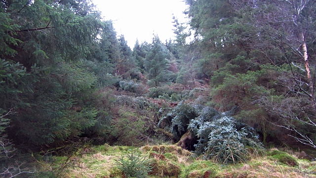
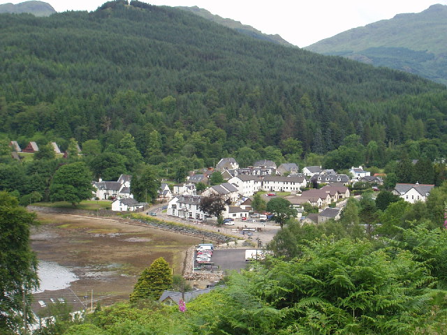
Clach Bhadach, located in Argyllshire, is a coastal marsh and saltings area that stretches along the western coast of Scotland. This unique ecosystem is renowned for its biodiversity and captivating natural beauty.

The marsh is primarily composed of saltwater and mud, creating an ideal habitat for a wide variety of plant and animal species. The area is characterized by its extensive salt marshes, which are covered by tidal waters during high tides and exposed during low tides. This constant ebb and flow of water creates a dynamic environment, supporting a rich array of marine life.

The vegetation in Clach Bhadach is adapted to the saline conditions, with species such as saltmarsh grass, sea lavender, and thrift dominating the landscape. These plants not only provide food and shelter for numerous bird species but also help stabilize the soil and prevent erosion.

The marshes of Clach Bhadach are home to a diverse range of birdlife, including wading birds, ducks, and geese. During the breeding season, it is common to spot species such as redshanks, curlews, and oystercatchers nesting in the marshes. Additionally, the area serves as an important stopover point for migratory birds, making it a popular destination for birdwatchers.

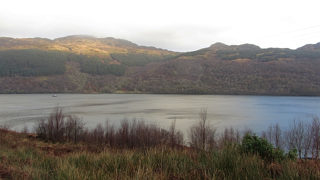
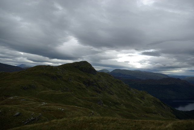
The natural beauty of Clach Bhadach is enhanced by the stunning views of the surrounding landscape, with rugged cliffs, sandy beaches, and rolling hills creating a picturesque backdrop. Visitors to the area can explore the marshes and enjoy scenic walks along the coast, immersing themselves in the tranquility and splendor of this coastal marsh and saltings ecosystem.

If you have any feedback on the listing, please let us know in the comments section below.

Clach Bhadach Images

Images are sourced within 2km of 56.147805/-4.901056 or Grid Reference NS1998. Thanks to Geograph Open Source API. All images are credited.

Forest road, Lettermay A useful road leading into several hills. The view ahead is of the very steep Beinn Lochain.
Forest road, Lettermay
A useful road leading into several hills. The view ahead is of the very steep Beinn Lochain.
South ridge of Cruach nam Miseag Taken from just below the summit. It was too windy to hold the camera there. Cruach nam Miseag is a very fine viewpoint.
South ridge of Cruach nam Miseag
Taken from just below the summit. It was too windy to hold the camera there. Cruach nam Miseag is a very fine viewpoint.
Substation above Douglas Pier Douglas Pier, over the road on the left is a War Office research station for marine noise suppression and detection and torpedo design. I presume the torpedo work moved over from Loch Long.
Substation above Douglas Pier
Douglas Pier, over the road on the left is a War Office research station for marine noise suppression and detection and torpedo design. I presume the torpedo work moved over from Loch Long.
Aird Rubha Mhadaidh A rhododendron choked headland on the west side of Loch Goil. The peninsula in the background, Ardgoil, is also badly infested with rhododendrons.
Aird Rubha Mhadaidh
A rhododendron choked headland on the west side of Loch Goil. The peninsula in the background, Ardgoil, is also badly infested with rhododendrons.
Cormonachan Wood There is some surviving broadleaf woodland here from before the time the conifers were planted.
Cormonachan Wood
There is some surviving broadleaf woodland here from before the time the conifers were planted.
Windthrow, Lettermay The forestry plantations here have taken a battering from recent gales, especially on 3rd January 2012. This mess is costly and dangerous to clear up.
Windthrow, Lettermay
The forestry plantations here have taken a battering from recent gales, especially on 3rd January 2012. This mess is costly and dangerous to clear up.
Loch Goil seen from Cruach nam Miseag Fjord scenery with Loch Goil and a glimpse of Loch Long past its entrance. View from just below the summit of Cruach nam Miseag.
Loch Goil seen from Cruach nam Miseag
Fjord scenery with Loch Goil and a glimpse of Loch Long past its entrance. View from just below the summit of Cruach nam Miseag.
Cruach nam Miseag A glimpse of the summit (dark mass in the notch, left) from knolly ground on a plateau.  The hill is surrounded by steep ground which was hazardous in the exceptionally wet conditions.
Cruach nam Miseag
A glimpse of the summit (dark mass in the notch, left) from knolly ground on a plateau. The hill is surrounded by steep ground which was hazardous in the exceptionally wet conditions.
Loch Goil and Ardgoil Birch woods are making a return to the shores of Loch Goil here. Beyond the loch there are oak woods on the rugged Ardgoil peninsula. Sadly both shorelines are heavily infested in Rhododendron ponticum.
Loch Goil and Ardgoil
Birch woods are making a return to the shores of Loch Goil here. Beyond the loch there are oak woods on the rugged Ardgoil peninsula. Sadly both shorelines are heavily infested in Rhododendron ponticum.
Cruach nam Miseag The peak looks very sharp from Carrick Castle.
Cruach nam Miseag
The peak looks very sharp from Carrick Castle.
More vegetation ...and a new bilingual sign. See: <a title="https://www.geograph.org.uk/photo/763070" href="https://www.geograph.org.uk/photo/763070">Link</a>
More vegetation
...and a new bilingual sign. See: Link
Looking towards Lettermay
Woodland Beside Loch Goil Woodland and scrub north of Cormonachan.
Woodland Beside Loch Goil
Woodland and scrub north of Cormonachan.
Forest track above Lettermay A track through the heavily forested hillside above Loch Goil.
Forest track above Lettermay
A track through the heavily forested hillside above Loch Goil.
Tree harvester by the Lettermay forest track A brutal but impressively efficient machine for cutting and stripping softwood trees, here at rest by the access track.
Tree harvester by the Lettermay forest track
A brutal but impressively efficient machine for cutting and stripping softwood trees, here at rest by the access track.
View from Gob a Chalmain Looking south east down Loch Goil.
View from Gob a Chalmain
Looking south east down Loch Goil.
Woodland road to The Lodge
Private road at The Lodge on Loch Goil
Show me another place!

Clach Bhadach is located at Grid Ref: NS1998 (Lat: 56.147805, Lng: -4.901056)

Unitary Authority: Argyll and Bute

Police Authority: Argyll and West Dunbartonshire

What 3 Words

///acid.stockpile.gathers. Near Garelochhead, Argyll & Bute

Related Wikis

Cruach nam Miseag

Cruach nam Miseag is a mountain near Lochgoilhead within the Arrochar Alps, Scotland. It reaches a height of 606 m (1989 ft). It is located at NS182981...

Loch Goil

Loch Goil; (Scottish Gaelic: Loch Goil) is a small sea loch forming part of the coast of the Cowal peninsula in Argyll and Bute, Scotland. The sea loch...

The Steeple (Lochgoilhead)

The Steeple is a small Mountain in the Ardgoil Peninsula and Arrochar Alps behind the village of Lochgoilhead within Loch Lomond and the Trossachs National...

Tom nan Gamhna

Tom nan Gamhna is a mountain within the Ardgoil Peninsula and Arrochar Alps near Lochgoilhead in Argyll, Scottish Highlands. The mountain reaches a height...

Lochgoilhead

Lochgoilhead (Scottish Gaelic: Ceann Loch Goibhle, IPA:[ˈkʰʲaun̴̪ˈɫ̪ɔxˈkɤilə]) is a village on the Cowal peninsula, in Argyll and Bute, Scottish Highlands...

Tom Molach

Tom Molach is a peak within the Ardgoil Peninsula and Arrochar Alps near Lochgoilhead in Argyll, Scotland. The peak reaches a height of 370 metres (1,210...

The Saddle (Lochgoilhead)

The Saddle is a mountain near Lochgoilhead in The Ardgoil Peninsula in Argyll. It reaches a height of 521m and is in the Arrochar Alps.

Beinn Reithe

Beinn Reithe is a mountain in Argyll in the Scottish Highlands and forms part of the Ardgoil Peninsula and Arrochar Alps. Beinn Reithe is located between...

Nearby Amenities

Located within 500m of 56.147805,-4.901056
Created By: almien_coastlines
Lat/Long: 56.145001/-4.900401
Created By: almien_coastlines
Lat/Long: 56.146287/-4.900005
Created By: almien_coastlines
Lat/Long: 56.147307/-4.900284
Created By: almien_coastlines
Lat/Long: 56.148057/-4.901469
Created By: almien_coastlines
Lat/Long: 56.148562/-4.901953
Created By: almien_coastlines
Lat/Long: 56.148818/-4.901966
The data included in this document is from www.openstreetmap.org. The data is made available under ODbL.

Have you been to Clach Bhadach?

Leave your review of Clach Bhadach below (or comments, questions and feedback).