Marazion Marsh

Coastal Marsh, Saltings in Cornwall

England

Marazion Marsh

St Michael's Mount Morning visitors gather at the west entrance to the castle on the last warm day of summer 2021.
St Michael's Mount Credit: Jonathan Billinger

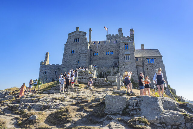
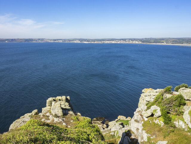
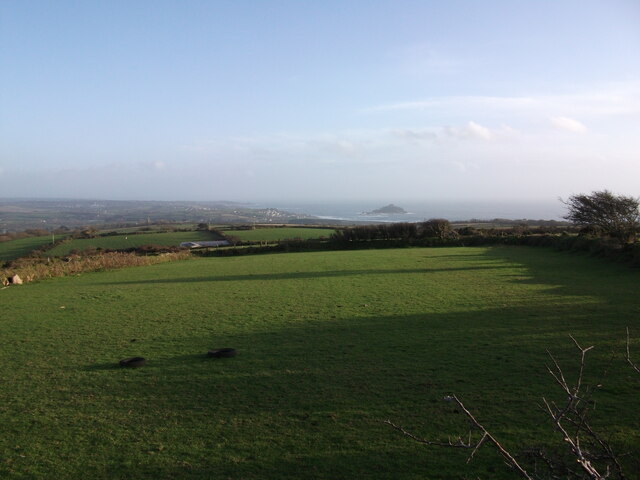
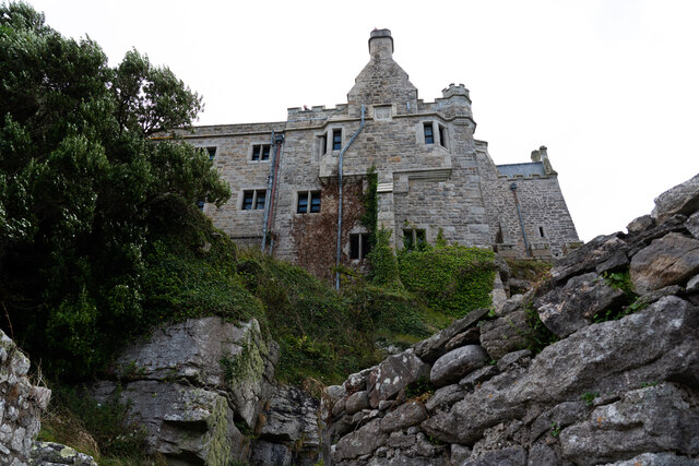
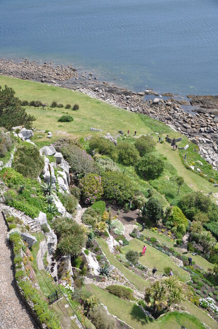
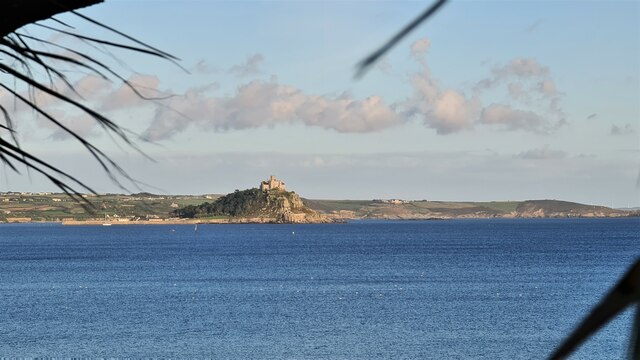
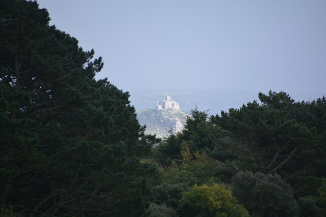
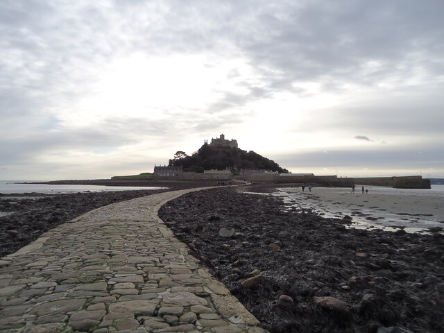
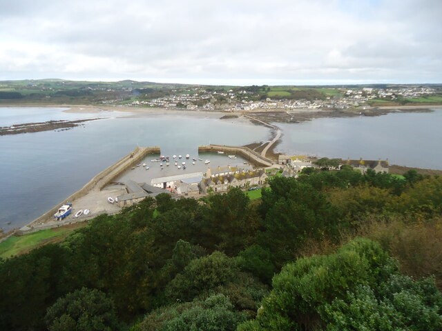
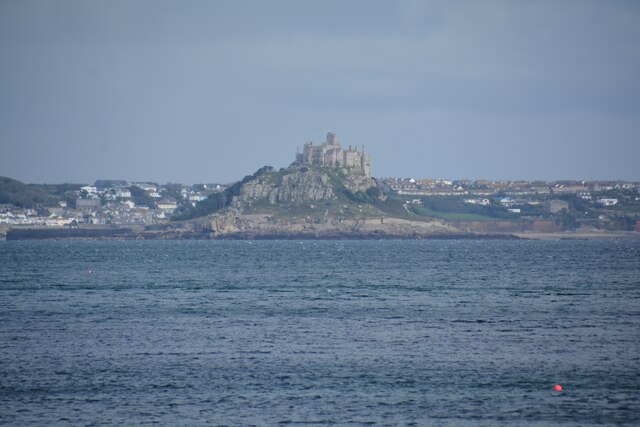
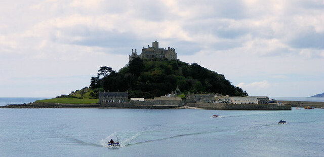
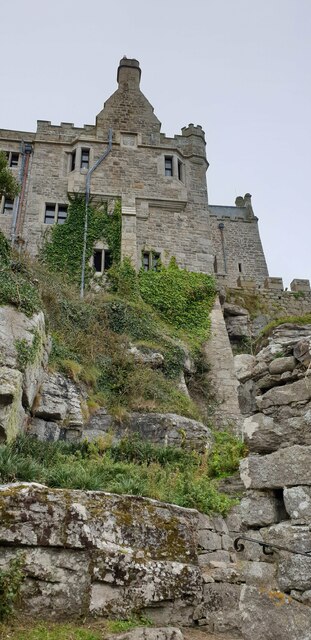
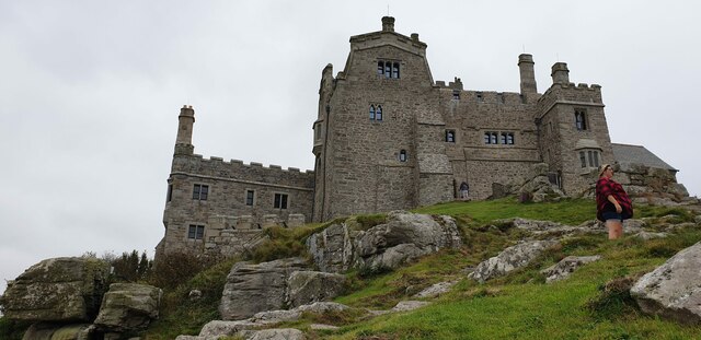
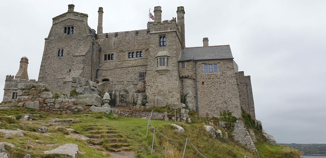
Marazion Marsh is a coastal marsh and saltings located in Marazion, Cornwall, England. It is a designated Site of Special Scientific Interest (SSSI) due to its rich biodiversity and unique ecosystem. The marsh covers an area of approximately 140 acres and is situated adjacent to the famous St Michael's Mount.

The marsh is characterized by a variety of habitats, including wetlands, reed beds, and salt marshes, making it a haven for numerous plant and animal species. It is particularly known for its diverse birdlife, attracting a wide range of resident and migratory species. Some of the bird species that can be spotted in the marsh include reed warblers, sedge warblers, little egrets, and kingfishers.

The vegetation in Marazion Marsh is equally impressive, with a mixture of grasses, rushes, and flowering plants. The marsh is home to several rare and protected plant species, such as sea aster and sea lavender, which thrive in the brackish water and saline conditions.

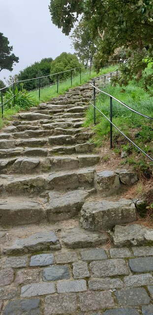
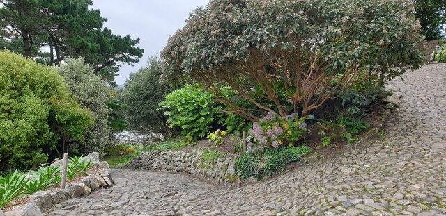
Visitors to Marazion Marsh can explore the area via a network of footpaths and boardwalks, offering picturesque views of the marsh and its surroundings. The marsh is also a popular spot for birdwatching enthusiasts and nature lovers, who can observe the diverse range of wildlife in its natural habitat.

Marazion Marsh is not only an important conservation area but also a place of tranquility and natural beauty, providing a unique opportunity to experience the rich biodiversity of Cornwall's coastal ecosystems.

If you have any feedback on the listing, please let us know in the comments section below.

Marazion Marsh Images

Images are sourced within 2km of 50.132803/-5.4819354 or Grid Reference SW5131. Thanks to Geograph Open Source API. All images are credited.

St Michael's Mount Morning visitors gather at the west entrance to the castle on the last warm day of summer 2021.
St Michael's Mount
Morning visitors gather at the west entrance to the castle on the last warm day of summer 2021.
Rocky cliff top View west from below the castle entrance.
Penzance in the distance.
Rocky cliff top
View west from below the castle entrance. Penzance in the distance.
Terrace garden, St Michael's Mount The garden which was designed in 1878 for Sir John St Aubyn.
Terrace garden, St Michael's Mount
The garden which was designed in 1878 for Sir John St Aubyn.
Rocky foreshore, St Michael's Mount
View to St. Michael's Mount from Quarry Hill A view over Mounts Bay to St. Michaels Mount from the junction of Quarry Hill and the B3311 above Penzance.
View to St. Michael's Mount from Quarry Hill
A view over Mounts Bay to St. Michaels Mount from the junction of Quarry Hill and the B3311 above Penzance.
Castle of St Michael's Mount viewed from footpath below
The gardens at St. Michael's Mount
St Michael's Mount From Penzance
St Michael's Mount
From Penzance
Madron : St Michael's Mount From Trengwaiton Estate looking across to St Michael's Mount.
Madron : St Michael's Mount
From Trengwaiton Estate looking across to St Michael's Mount.
St Michael's Mount Seen across the causeway which is available when the tide is low.
St Michael's Mount
Seen across the causeway which is available when the tide is low.
St Michael's Mount Looking back across the causeway which is walkable when the tide is out.
St Michael's Mount
Looking back across the causeway which is walkable when the tide is out.
Penzance : Mousehole - Coastal Scenery Looking across the bay towards St Michael's Mount.
Penzance : Mousehole - Coastal Scenery
Looking across the bay towards St Michael's Mount.
St Michael's Mount
St Michael's Mount
Steps up St Michael's Mount Steep, uneven steps up to St Michael's Mount.
Steps up St Michael's Mount
Steep, uneven steps up to St Michael's Mount.
Winding path on St Michael's Mount A winding cobble path up St Michael's Mount with planted gardens surrounding.
Winding path on St Michael's Mount
A winding cobble path up St Michael's Mount with planted gardens surrounding.
The castle, St Michael's Mount Viewed from the winding path below.
The castle, St Michael's Mount
Viewed from the winding path below.
St Michael's Mount castle The castle's west face from down the mount.
St Michael's Mount castle
The castle's west face from down the mount.
St Michael's Mount castle A view of the castle from the west.
St Michael's Mount castle
A view of the castle from the west.
Show me another place!

Marazion Marsh is located at Grid Ref: SW5131 (Lat: 50.132803, Lng: -5.4819354)

Unitary Authority: Cornwall

Police Authority: Devon and Cornwall

What 3 Words

///catch.tastings.corn. Near Marazion, Cornwall

Related Wikis

Red River (Amal)

The Red River (Cornish: Dowr Amal, meaning boundary river) which discharges into the sea to the west of Marazion is one of two watercourses in Cornwall...

Marazion Marsh

Marazion Marsh is a Royal Society for the Protection of Birds (RSPB) reserve situated in a shallow river valley, half a kilometre to the west of Marazion...

Marazion

Marazion (; Cornish: Marhasyow) is a civil parish and town, on the shore of Mount's Bay in Cornwall, England, United Kingdom. It is 2 miles (3.2 km) east...

Varfell

Varfell is a hamlet within the parish of Ludgvan, Cornwall, UK. Varfell Farm is the world's largest producers of daffodil bulbs. == History == In 1882...

Nearby Amenities

Located within 500m of 50.132803,-5.4819354
Barrier: stile
Lat/Long: 50.1348521/-5.4827637
Railway: crossing
Lat/Long: 50.132568/-5.4817166
Barrier: stile
Lat/Long: 50.1347532/-5.4826248
Barrier: stile
Lat/Long: 50.1326107/-5.4817529
Bench
Lat/Long: 50.1318551/-5.4814905
Barrier: stile
Lat/Long: 50.1325121/-5.481637
Bench
Lat/Long: 50.1319135/-5.4815603
Railway: crossing
Lat/Long: 50.1325449/-5.4816836
Post Box
Collection Times: Mo-Fr 16:30; Sa 11:45
Operator: Royal Mail
Operator Wikidata: Q638098
Post Box Type: lamp
Ref: TR17 37
Royal Cypher: EIIR
Royal Cypher Wikidata: Q33102113
Source: survey
Survey Date: 2015-09-30
Lat/Long: 50.1308717/-5.4794102
Power: pole
Transformer: distribution
Lat/Long: 50.1339921/-5.4831943
Power: pole
Lat/Long: 50.1337273/-5.4841277
Location Transition: yes
Power: pole
Lat/Long: 50.133552/-5.4843289
Power: pole
Lat/Long: 50.1336138/-5.4854232
Power: pole
Transformer: distribution
Lat/Long: 50.1332958/-5.4880866
Marazion Bridge
Power: substation
Voltage: 11000
Lat/Long: 50.1290635/-5.4800796
Location Transition: yes
Power: pole
Transformer: distribution
Lat/Long: 50.1312102/-5.4777387
Power: pole
Transformer: distribution
Lat/Long: 50.1322539/-5.4769313
Power: pole
Lat/Long: 50.1317587/-5.4772881
Power: pole
Lat/Long: 50.13191/-5.4784226
Power: pole
Lat/Long: 50.132333/-5.4798871
Power: pole
Lat/Long: 50.132412/-5.4814991
Power: pole
Lat/Long: 50.1314681/-5.4753059
The data included in this document is from www.openstreetmap.org. The data is made available under ODbL.

Have you been to Marazion Marsh?

Leave your review of Marazion Marsh below (or comments, questions and feedback).