Rubha na Cloiche Bige

Coastal Marsh, Saltings in Ross-shire

Scotland

Rubha na Cloiche Bige

Fossil river bed by Stornoway This layer of conglomerate rock, eroding at the seaward edge, represents a 250 million year old river bed or delta. It looks as if it would be easy to pick up one of the rounded fist-sized stones but they are impossibly cemented together.  It's quite a feeling walking on the surface of this deposit, knowing that you're on an ancient river bed.
Fossil river bed by Stornoway Credit: AlastairG

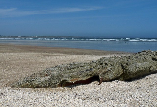
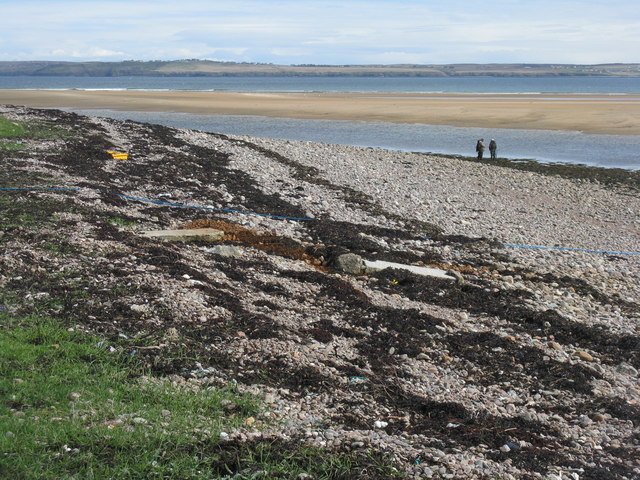
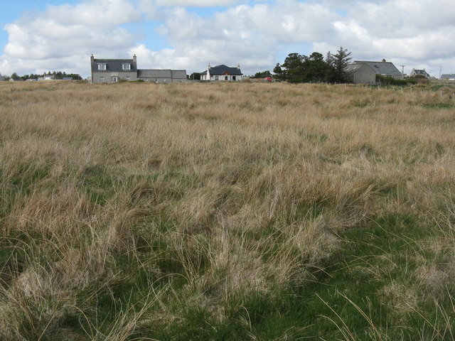
Rubha na Cloiche Bige, located in Ross-shire, Scotland, is a coastal marshland known for its remarkable natural beauty and diverse wildlife. Situated on the eastern coast of Scotland, this area encompasses an expansive stretch of saltings, providing a unique habitat for numerous species.

The marshland of Rubha na Cloiche Bige is characterized by its vast expanse of marsh grasses, reeds, and sedges, which create a lush and vibrant landscape. The area is dominated by tidal influence, as the marshes are regularly flooded by the rising tides of the North Sea. This constant ebb and flow of the tides creates a dynamic and ever-changing environment.

The marshland serves as an important feeding and nesting ground for a wide variety of bird species. Migratory birds, such as sandpipers, curlews, and lapwings, can be spotted here during their annual journeys. The marshes are also home to resident bird species, including ducks, geese, and herons.

In addition to its avian inhabitants, Rubha na Cloiche Bige is also home to a diverse range of plant species. Tall sea lavender, sea aster, and sea purslane are just a few examples of the plants that thrive in this unique coastal environment. The marshes also support a variety of marine life, including small fish, crustaceans, and mollusks.

Rubha na Cloiche Bige offers visitors a chance to experience the beauty and tranquility of a coastal marshland. Its stunning vistas, rich biodiversity, and unique ecosystem make it a must-visit destination for nature enthusiasts and birdwatchers alike.

If you have any feedback on the listing, please let us know in the comments section below.

Rubha na Cloiche Bige Images

Images are sourced within 2km of 58.238386/-6.3327313 or Grid Reference NB4535. Thanks to Geograph Open Source API. All images are credited.
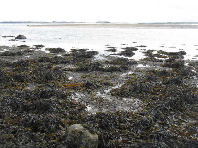
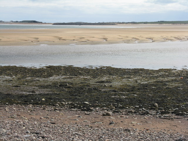
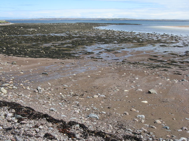
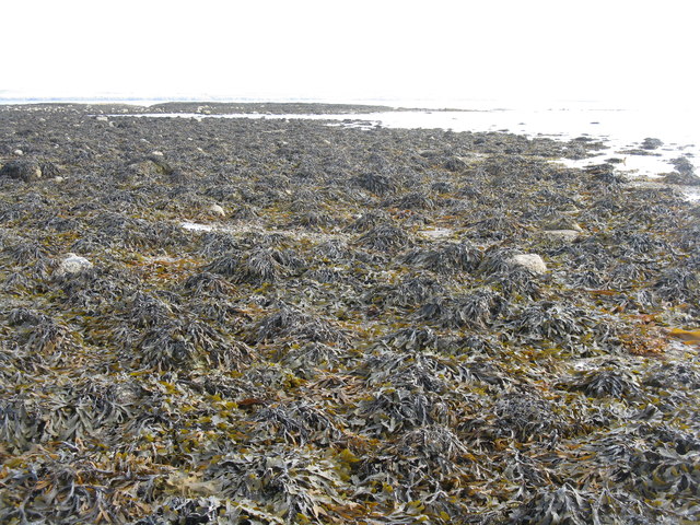
Fossil river bed by Stornoway This layer of conglomerate rock, eroding at the seaward edge, represents a 250 million year old river bed or delta. It looks as if it would be easy to pick up one of the rounded fist-sized stones but they are impossibly cemented together.  It's quite a feeling walking on the surface of this deposit, knowing that you're on an ancient river bed.
Fossil river bed by Stornoway
This layer of conglomerate rock, eroding at the seaward edge, represents a 250 million year old river bed or delta. It looks as if it would be easy to pick up one of the rounded fist-sized stones but they are impossibly cemented together. It's quite a feeling walking on the surface of this deposit, knowing that you're on an ancient river bed.
Remains of a drainage pipe, Tràigh Mhealaboist, Stornoway, Isle of Lewis This section of the beach lies below Stornoway Airport.  The pipe is likely to be a remnant from the wartime RAF station which occupied the airport from 1941 to 1946.
Remains of a drainage pipe, Tràigh Mhealaboist, Stornoway, Isle of Lewis
This section of the beach lies below Stornoway Airport. The pipe is likely to be a remnant from the wartime RAF station which occupied the airport from 1941 to 1946.
Sron Ruadh at low tide Looking across the outflow of the Abhainn Locasdail towards the airport. Algae in abundance.
Sron Ruadh at low tide
Looking across the outflow of the Abhainn Locasdail towards the airport. Algae in abundance.
Water tower at Tunga Disused and recently changed hands - local residents wonder what might happen to it.
Water tower at Tunga
Disused and recently changed hands - local residents wonder what might happen to it.
Car park at Tunga Recycling, parked roller and playing field.
Car park at Tunga
Recycling, parked roller and playing field.
Primary school at Tunga On the B895 from Newmarket to Tolsta.
Primary school at Tunga
On the B895 from Newmarket to Tolsta.
Farm building at Tunga Little changed since Richard Webb was there in 2009 <a href="https://www.geograph.org.uk/photo/1250397">NB4437 : Moorland road above Tunga</a>.
Farm building at Tunga
Little changed since Richard Webb was there in 2009 NB4437 : Moorland road above Tunga.
Boat on the shore At Àird Thunga on Broad Bay/Loch a Tuath.
Boat on the shore
At Àird Thunga on Broad Bay/Loch a Tuath.
Looking south across the head of Broad Bay Across Abhainn Lacasdail to Tràigh Mhealaboist and the airport at Stornoway.
Looking south across the head of Broad Bay
Across Abhainn Lacasdail to Tràigh Mhealaboist and the airport at Stornoway.
Fishing at Rubha na Cloiche Bige At the entrance of the Abhainn Lacasdail to Broad Bay/Loch a Tuath.
Fishing at Rubha na Cloiche Bige
At the entrance of the Abhainn Lacasdail to Broad Bay/Loch a Tuath.
Boats ashore at Rubha na Cloiche Bige On the edge of Broad Bay/Loch a Tuath.
Boats ashore at Rubha na Cloiche Bige
On the edge of Broad Bay/Loch a Tuath.
Coastal protection at Tunga Gabions protect the shore at Geòdha na Cloiche Bige.
Coastal protection at Tunga
Gabions protect the shore at Geòdha na Cloiche Bige.
Geòdha na Cloiche Bige The shore near Tunga from the sea wall of gabions - low tide exposed an unvisited 1km square.
Geòdha na Cloiche Bige
The shore near Tunga from the sea wall of gabions - low tide exposed an unvisited 1km square.
Houses at Tunga Rough grassland in a crofting community by the shore.
Houses at Tunga
Rough grassland in a crofting community by the shore.
Geòdha na Cloiche Bige Algae exposed at low tide.
Geòdha na Cloiche Bige
Algae exposed at low tide.
Brown algae at low tide Mostly serrated wrack [Fucus serratus], with Broad Bay/Loch a Tuath and the Eye Peninsula/An Rubha beyond.
Brown algae at low tide
Mostly serrated wrack [Fucus serratus], with Broad Bay/Loch a Tuath and the Eye Peninsula/An Rubha beyond.
Rocks, barnacles and brown algae At low tide at Geòdha na Cloiche Bige, looking out to Broad Bay.
Rocks, barnacles and brown algae
At low tide at Geòdha na Cloiche Bige, looking out to Broad Bay.
Coastal erosion at Sròn Ruadh From the shore at Geòdha na Cloiche Bige.
Coastal erosion at Sròn Ruadh
From the shore at Geòdha na Cloiche Bige.
Show me another place!

Rubha na Cloiche Bige is located at Grid Ref: NB4535 (Lat: 58.238386, Lng: -6.3327313)

Unitary Authority: Na h-Eileanan an Iar

Police Authority: Highlands and Islands

What 3 Words

///recliner.remotest.resting. Near Stornoway, Na h-Eileanan Siar

Related Wikis

Tong, Lewis

Tong (Scottish Gaelic: Tunga from Old Norse: Tunga) is a village on the Isle of Lewis, Scotland, 4 miles (6 kilometres) northeast of the main town of Stornoway...

RAF Stornoway

Royal Air Force Stornoway or more simply RAF Stornoway is a former Royal Air Force station near the burgh of Stornoway, on the Isle of Lewis, in the Western...

Steinish

Steinish (Scottish Gaelic: Steinnis, IPA:[ˈʃtʰʲeɲɪʃ]) is a village in the Scottish Outer Hebrides, on the Isle of Lewis, near Plasterfield and Stornoway...
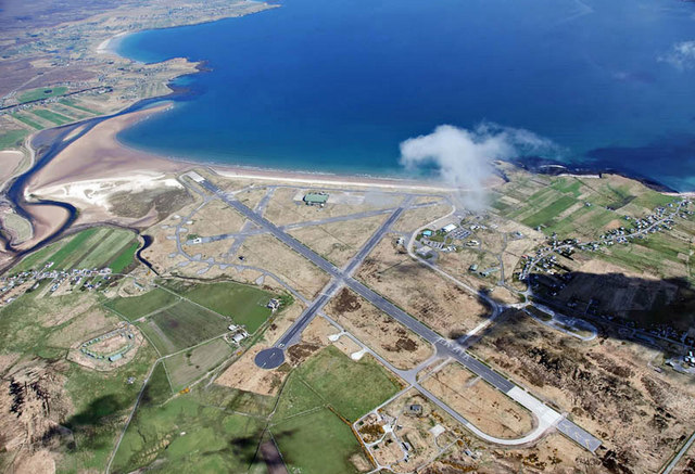
Stornoway Airport

Stornoway Airport (IATA: SYY, ICAO: EGPO) (Scottish Gaelic: Port-adhair Steòrnabhaigh) is an airfield located 2 NM (3.7 km; 2.3 mi) east of the town of...

Nearby Amenities

Located within 500m of 58.238386,-6.3327313
Turning Circle
Lat/Long: 58.2411097/-6.3324119
Barrier: cattle_grid
Bicycle: yes
Foot: yes
Lat/Long: 58.2405156/-6.3301484
Barrier: entrance
Lat/Long: 58.2404733/-6.3306109
Power: pole
Lat/Long: 58.2419856/-6.3314597
Aeroway: navigationaid
Navigationaid: als
Lat/Long: 58.2385225/-6.335448
The data included in this document is from www.openstreetmap.org. The data is made available under ODbL.

Have you been to Rubha na Cloiche Bige?

Leave your review of Rubha na Cloiche Bige below (or comments, questions and feedback).