Fillet Tail

Coastal Feature, Headland, Point in Yorkshire Scarborough

England

Fillet Tail

Near Kettleness Looking towards the old quarries.
Near Kettleness Credit: T Eyre

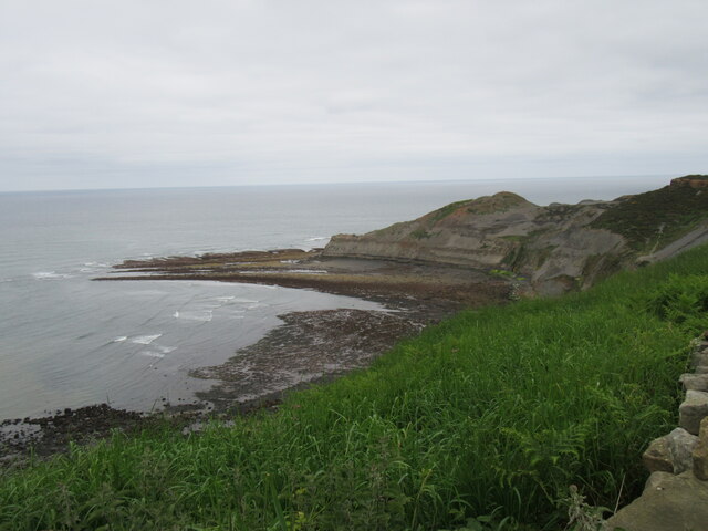
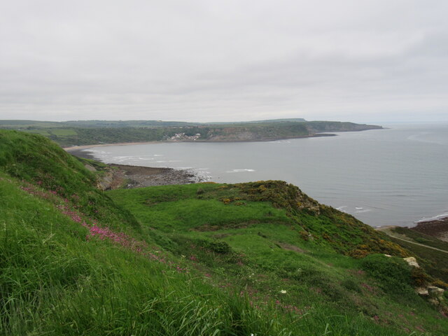
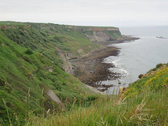
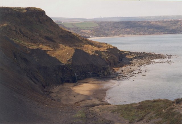
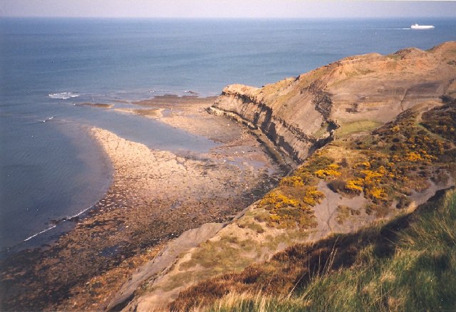
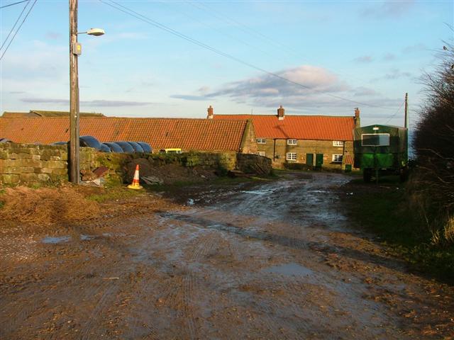
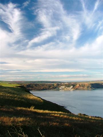
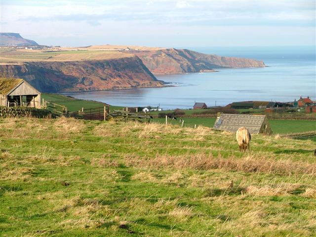
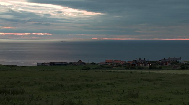
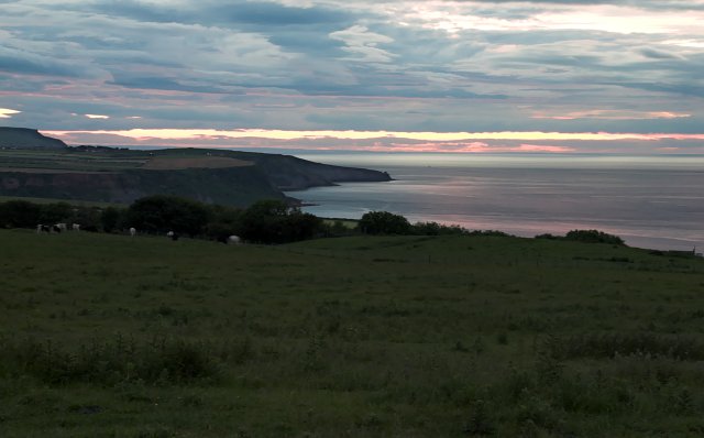
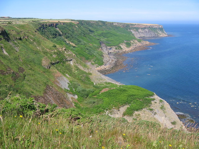
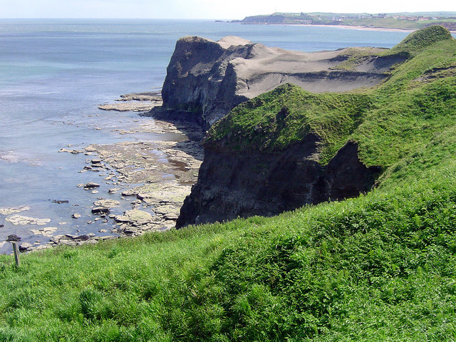
Fillet Tail is a prominent headland located on the Yorkshire coast in England. Situated between the towns of Scarborough and Filey, it juts out into the North Sea, forming a distinct point along the coastline.

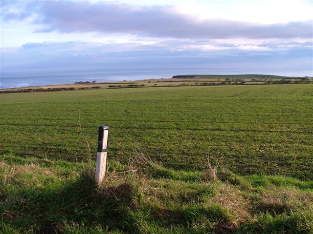
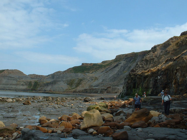
The headland is characterized by its rugged cliffs, which rise to an impressive height, offering stunning views of the surrounding area. The cliffs are composed of layers of sedimentary rocks, including sandstone and shale, which have been shaped by the relentless force of the sea over millions of years. At the base of the cliffs, there are often rock pools that are home to a variety of marine life, providing a fascinating and diverse ecosystem.

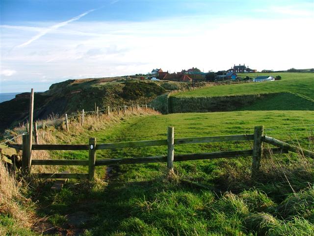
Fillet Tail is a popular destination for outdoor enthusiasts and nature lovers. Its dramatic landscape attracts hikers and walkers who enjoy exploring the numerous trails that wind along the headland. The area is also a haven for birdwatchers, as it provides an ideal habitat for a wide range of seabirds, including puffins, gulls, and cormorants.

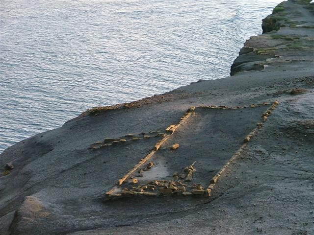
In addition to its natural beauty, Fillet Tail is steeped in history. The headland was once the site of a Roman signal station, which played a crucial role in the Roman Empire's communication system along the coast. Today, visitors can still see the remains of the fortifications, adding an extra layer of intrigue to their exploration of the area.

Overall, Fillet Tail is a captivating coastal feature that offers a unique blend of natural beauty and historical significance. It is a must-visit destination for anyone seeking to immerse themselves in the stunning landscapes and rich heritage of the Yorkshire coast.

If you have any feedback on the listing, please let us know in the comments section below.

Fillet Tail Images

Images are sourced within 2km of 54.532806/-0.70518597 or Grid Reference NZ8316. Thanks to Geograph Open Source API. All images are credited.

Near Kettleness Looking towards the old quarries.
Near Kettleness
Looking towards the old quarries.
Kettleness view Looking towards Runswick Bay.
Kettleness view
Looking towards Runswick Bay.
Loop Wyke Viewed from the Cleveland Way.
Loop Wyke
Viewed from the Cleveland Way.
Kettleness
Kettleness
Hill Stones, Kettleness, Barnby This is a view from the western slopes of Kettle Ness, looking east over Kettleness Sand and past the waterfall to Hill Stones, with Runswick Bay in the distance.
Hill Stones, Kettleness, Barnby
This is a view from the western slopes of Kettle Ness, looking east over Kettleness Sand and past the waterfall to Hill Stones, with Runswick Bay in the distance.
Kettle Ness, Barnby The promontory is the 'ness' of Kettleness, seen here from the west.  To the right of it are the scars of alum mining.
Kettle Ness, Barnby
The promontory is the 'ness' of Kettleness, seen here from the west. To the right of it are the scars of alum mining.
Wade's Stone To quote from English Heritage's website: "A Bronze Age standing stone, originally one of two, the other no longer survives. It is roughly cut into rectangular shape which tapers slightly towards the top and leans a little to the north west. It is 1.5 metres high and 0.7 by 0.5 metres in section. On the south face the letters JS and ES have been inscribed. The monument is scheduled. There is another possible "Wades Stone" at NZ 81 SW 2." I believe this latter reference means NZ830130.
Wade's Stone
To quote from English Heritage's website: "A Bronze Age standing stone, originally one of two, the other no longer survives. It is roughly cut into rectangular shape which tapers slightly towards the top and leans a little to the north west. It is 1.5 metres high and 0.7 by 0.5 metres in section. On the south face the letters JS and ES have been inscribed. The monument is scheduled. There is another possible "Wades Stone" at NZ 81 SW 2." I believe this latter reference means NZ830130.
Cleveland Way, Kettleness View east along the Cleveland Way towards Kettleness Farm with Kettleness village behind.
Cleveland Way, Kettleness
View east along the Cleveland Way towards Kettleness Farm with Kettleness village behind.
Goldsborough
Goldsborough
View from the Cliffs North of Kettleness Looking west towards Runswick Bay.
View from the Cliffs North of Kettleness
Looking west towards Runswick Bay.
Alum Works Remains This piece of our industrial heritage hangs precariously close to the cliff. It only a matter of time before the sea claims it.
Alum Works Remains
This piece of our industrial heritage hangs precariously close to the cliff. It only a matter of time before the sea claims it.
Fields East of Goldsborough View east from the road bend towards the cliffs along which runs the Cleveland Way footpath.
Fields East of Goldsborough
View east from the road bend towards the cliffs along which runs the Cleveland Way footpath.
Goldsborough Roman Signal Station Taken looking north west from the site of the Goldsborough Roman Signal Station. This was one of a series of stations built along the coast to provide early warning of Scottish or Saxon invaders. It is supposed that the next signal station would have been on the Boultby cliffs (far left) but it is supposed that any remains have been destroyed by the alum workings.
Goldsborough Roman Signal Station
Taken looking north west from the site of the Goldsborough Roman Signal Station. This was one of a series of stations built along the coast to provide early warning of Scottish or Saxon invaders. It is supposed that the next signal station would have been on the Boultby cliffs (far left) but it is supposed that any remains have been destroyed by the alum workings.
Former Kettleness Railway Station Now used by East Cleveland Scouts. The building suggests Kettleness once had a more substantial community than at present. Unless of course the railway had to build such an elaborate station on condition of laying the track through the village. I wouldn't have thought the nearby alum mines would have warranted it alone. The railway was opened in December 1883.
Former Kettleness Railway Station
Now used by East Cleveland Scouts. The building suggests Kettleness once had a more substantial community than at present. Unless of course the railway had to build such an elaborate station on condition of laying the track through the village. I wouldn't have thought the nearby alum mines would have warranted it alone. The railway was opened in December 1883.
On the beach at Hill Stones A happy hunting ground for fossil collectors
On the beach at Hill Stones
A happy hunting ground for fossil collectors
Late Evening at Kettleness In high Summer the Northern sky glows throughout the night as the Sun is barely below the horizon.
Late Evening at Kettleness
In high Summer the Northern sky glows throughout the night as the Sun is barely below the horizon.
Coastline between Kettleness and Runswick Bay Late evening with lingering afterglow post Sunset
Coastline between Kettleness and Runswick Bay
Late evening with lingering afterglow post Sunset
Loop Wyke Looking NW from the east edge of the grid square.
Loop Wyke
Looking NW from the east edge of the grid square.
Show me another place!

Fillet Tail is located at Grid Ref: NZ8316 (Lat: 54.532806, Lng: -0.70518597)

Division: North Riding

Administrative County: North Yorkshire

District: Scarborough

Police Authority: North Yorkshire

What 3 Words

///station.fluffed.cutlets. Near Whitby, North Yorkshire

Related Wikis

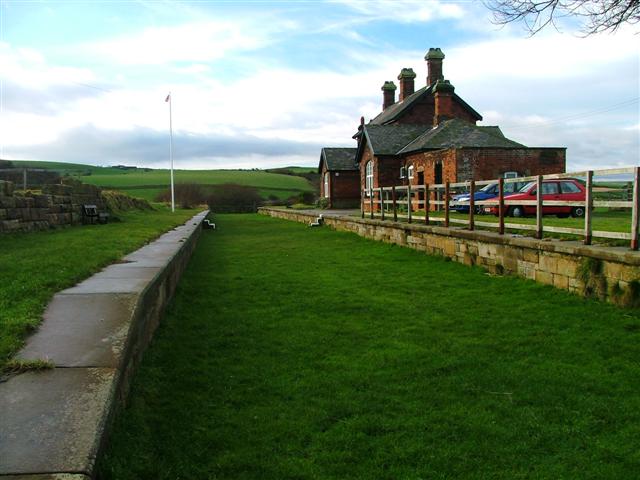
Kettleness railway station

Kettleness was a railway station on the Whitby, Redcar and Middlesbrough Union Railway from 1883 to 1958 serving the remote village of Kettleness. The...

Kettleness

Kettleness, is a hamlet in the Scarborough District of North Yorkshire, England. The settlement only consists of half-a-dozen houses, but up until the...

Sandsend Tunnel

Sandsend Tunnel is a tunnel on the former Whitby, Redcar and Middlesbrough Union Railway that was opened in 1883 and closed in 1958. The rail line that...

Goldsborough, Scarborough

Goldsborough is a small hamlet in the civil parish of Lythe, North Yorkshire, England within the North York Moors National Park. It is situated a few miles...

RAF Goldsborough

Royal Air Force Goldsborough or more simply RAF Goldsborough is a former Royal Air Force station located in North Yorkshire, England. == History == It...

Hob Holes

The Hob Holes are caves in the cliffs of Runswick Bay, Scarborough, England which resulted from mining for jet – fossilised wood which is valuable as a...

Sandsend Ness

Sandsend Ness is an old alum quarrying site close to Whitby in North Yorkshire, England. Beneath extensive deposits of grey pyritic shale a thin band of...

Runswick Bay Lifeboat Station

Runswick Bay Lifeboat Station was a Royal National Lifeboat Institution (RNLI) lifeboat station located in Runswick Bay in North Yorkshire, England. The...

Nearby Amenities

Located within 500m of 54.532806,-0.70518597
Source: PGS
Lat/Long: 54.5285264/-0.7049737
Source: PGS
Lat/Long: 54.5300385/-0.7056818
Source: PGS
Lat/Long: 54.5303871/-0.7058534
Source: PGS
Lat/Long: 54.5307856/-0.7061109
Source: PGS
Lat/Long: 54.5312338/-0.7069692
Source: PGS
Lat/Long: 54.5318813/-0.7086
Source: PGS
Lat/Long: 54.5319809/-0.7097158
Source: PGS
Lat/Long: 54.5321303/-0.7104883
Source: PGS
Lat/Long: 54.5330765/-0.7125482
Source: PGS
Lat/Long: 54.5335745/-0.7127199
The data included in this document is from www.openstreetmap.org. The data is made available under ODbL.

Have you been to Fillet Tail?

Leave your review of Fillet Tail below (or comments, questions and feedback).