Wind Hole

Coastal Feature, Headland, Point in Yorkshire Scarborough

England

Wind Hole

Runswick Bay Beach The water in the foreground comes from the Calais Beck which empties into Runswick Bay here. To the right of that a small horse and a very large dog enjoy themselves on the sand.
Runswick Bay Beach Credit: Stephen McKay

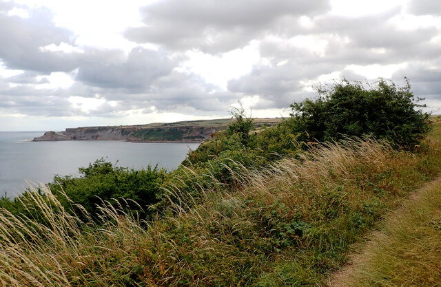
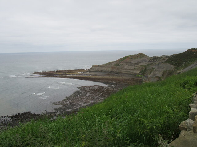
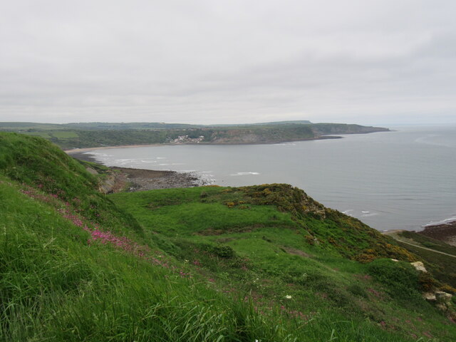
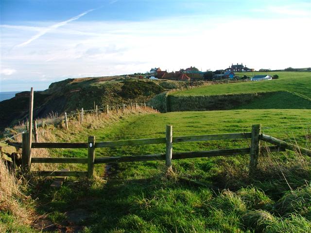
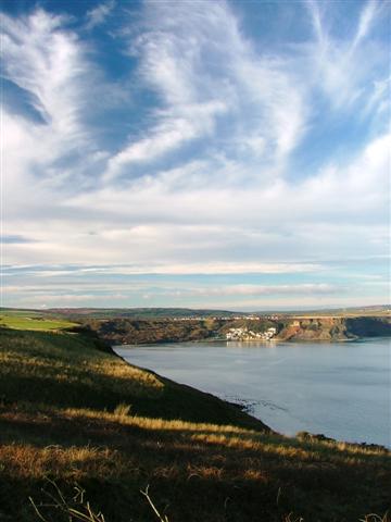
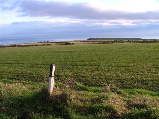
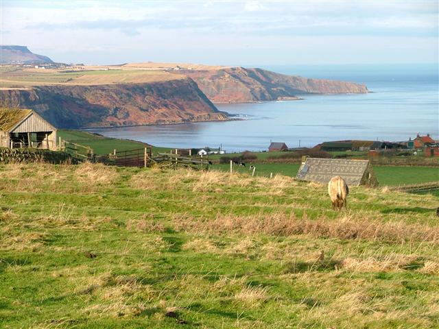
Wind Hole is a prominent coastal feature located in Yorkshire, England. Situated on the eastern coast, it is specifically found on the southern side of the village of Flamborough, near the Flamborough Headland. This headland juts out into the North Sea, forming a distinctive point that is known for its stunning natural beauty and geological significance.

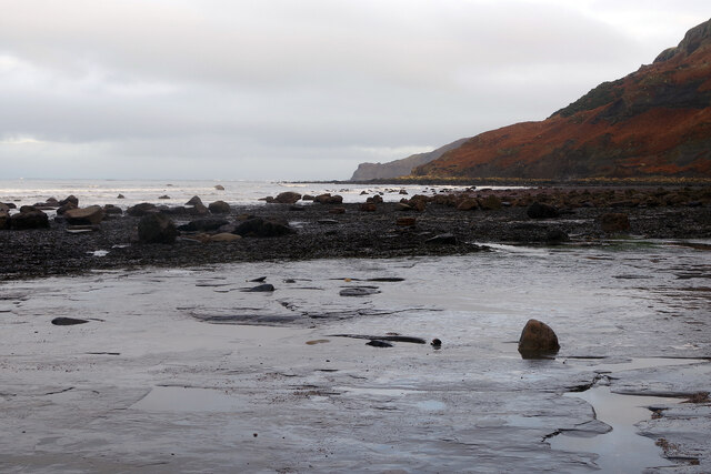
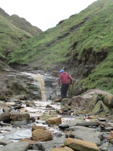
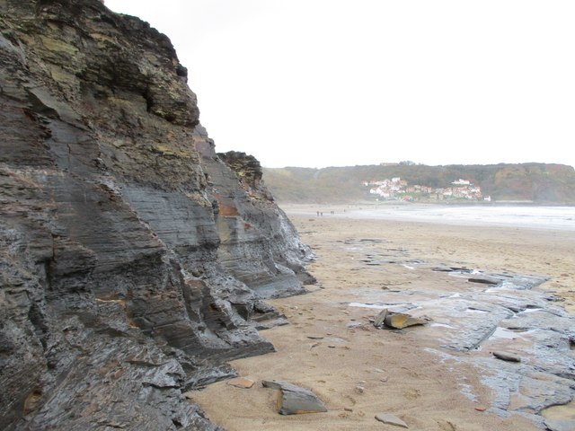
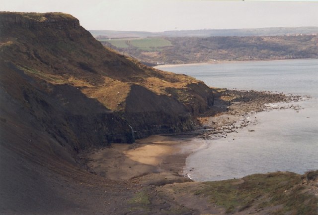
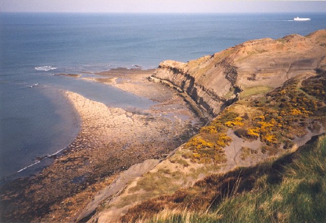
Wind Hole is characterized by its rugged cliffs, which reach heights of up to 100 meters (328 feet) above sea level. The cliffs are predominantly composed of chalk, a sedimentary rock that gives them an awe-inspiring white appearance. Over millions of years, the erosive power of the sea has carved out a deep, narrow inlet within the headland, forming the Wind Hole.

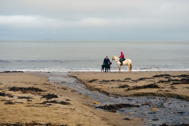
The Wind Hole is a popular spot for both locals and tourists due to its dramatic scenery and its importance as a haven for various bird species. It serves as a nesting site for thousands of seabirds, including puffins, gannets, and kittiwakes. Birdwatchers flock to Wind Hole to witness the impressive sight of these birds in their natural habitat.

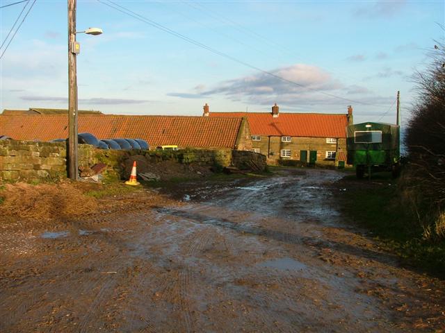
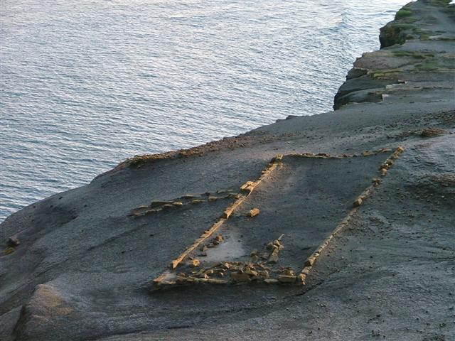
In addition to its ecological significance, Wind Hole also holds historical importance. The remains of a World War II gun battery can be found nearby, serving as a reminder of the area's role in defending the British coastline during the war.

Overall, Wind Hole is a remarkable coastal feature that offers a unique blend of natural beauty, wildlife diversity, and historical interest. It provides visitors with an opportunity to immerse themselves in the stunning landscapes and rich heritage of Yorkshire's coastline.

If you have any feedback on the listing, please let us know in the comments section below.

Wind Hole Images

Images are sourced within 2km of 54.533834/-0.7147818 or Grid Reference NZ8316. Thanks to Geograph Open Source API. All images are credited.

Runswick Bay Beach The water in the foreground comes from the Calais Beck which empties into Runswick Bay here. To the right of that a small horse and a very large dog enjoy themselves on the sand.
Runswick Bay Beach
The water in the foreground comes from the Calais Beck which empties into Runswick Bay here. To the right of that a small horse and a very large dog enjoy themselves on the sand.
Runswick Bay Beach The sand runs out towards the south-eastern end of the beach, giving way to flat rocks as the coastline heads round towards Kettle Ness.
Runswick Bay Beach
The sand runs out towards the south-eastern end of the beach, giving way to flat rocks as the coastline heads round towards Kettle Ness.
Runswick Bay seen from The Cleveland Way The Cleveland Way runs 110 miles (177 km) between Helmsley and the Brigg at Filey, skirting the North York Moors National Park. Its highest point is at Urra Moor, 1,489 ft (454 m).
Runswick Bay seen from The Cleveland Way
The Cleveland Way runs 110 miles (177 km) between Helmsley and the Brigg at Filey, skirting the North York Moors National Park. Its highest point is at Urra Moor, 1,489 ft (454 m).
Near Kettleness Looking towards the old quarries.
Near Kettleness
Looking towards the old quarries.
Kettleness view Looking towards Runswick Bay.
Kettleness view
Looking towards Runswick Bay.
Claymore  Beck  emptying  onto  Runswick  Sands This is also the point where the Cleveland Way and English Coast Path leaves the beach and goes up the side of the beck then takes a cliff path to the left over to Kettleness
Claymore Beck emptying onto Runswick Sands
This is also the point where the Cleveland Way and English Coast Path leaves the beach and goes up the side of the beck then takes a cliff path to the left over to Kettleness
Cliff  face  and  Runswick  Sands Looking along the bay to the village of Runswick Bay
Cliff face and Runswick Sands
Looking along the bay to the village of Runswick Bay
Runswick Bay Looking North
Runswick Bay
Looking North
Kettleness
Kettleness
Hill Stones, Kettleness, Barnby This is a view from the western slopes of Kettle Ness, looking east over Kettleness Sand and past the waterfall to Hill Stones, with Runswick Bay in the distance.
Hill Stones, Kettleness, Barnby
This is a view from the western slopes of Kettle Ness, looking east over Kettleness Sand and past the waterfall to Hill Stones, with Runswick Bay in the distance.
Kettle Ness, Barnby The promontory is the 'ness' of Kettleness, seen here from the west.  To the right of it are the scars of alum mining.
Kettle Ness, Barnby
The promontory is the 'ness' of Kettleness, seen here from the west. To the right of it are the scars of alum mining.
Wade's Stone To quote from English Heritage's website: "A Bronze Age standing stone, originally one of two, the other no longer survives. It is roughly cut into rectangular shape which tapers slightly towards the top and leans a little to the north west. It is 1.5 metres high and 0.7 by 0.5 metres in section. On the south face the letters JS and ES have been inscribed. The monument is scheduled. There is another possible "Wades Stone" at NZ 81 SW 2." I believe this latter reference means NZ830130.
Wade's Stone
To quote from English Heritage's website: "A Bronze Age standing stone, originally one of two, the other no longer survives. It is roughly cut into rectangular shape which tapers slightly towards the top and leans a little to the north west. It is 1.5 metres high and 0.7 by 0.5 metres in section. On the south face the letters JS and ES have been inscribed. The monument is scheduled. There is another possible "Wades Stone" at NZ 81 SW 2." I believe this latter reference means NZ830130.
Cleveland Way, Kettleness View east along the Cleveland Way towards Kettleness Farm with Kettleness village behind.
Cleveland Way, Kettleness
View east along the Cleveland Way towards Kettleness Farm with Kettleness village behind.
Goldsborough
Goldsborough
View from the Cliffs North of Kettleness Looking west towards Runswick Bay.
View from the Cliffs North of Kettleness
Looking west towards Runswick Bay.
Alum Works Remains This piece of our industrial heritage hangs precariously close to the cliff. It only a matter of time before the sea claims it.
Alum Works Remains
This piece of our industrial heritage hangs precariously close to the cliff. It only a matter of time before the sea claims it.
Fields East of Goldsborough View east from the road bend towards the cliffs along which runs the Cleveland Way footpath.
Fields East of Goldsborough
View east from the road bend towards the cliffs along which runs the Cleveland Way footpath.
Goldsborough Roman Signal Station Taken looking north west from the site of the Goldsborough Roman Signal Station. This was one of a series of stations built along the coast to provide early warning of Scottish or Saxon invaders. It is supposed that the next signal station would have been on the Boultby cliffs (far left) but it is supposed that any remains have been destroyed by the alum workings.
Goldsborough Roman Signal Station
Taken looking north west from the site of the Goldsborough Roman Signal Station. This was one of a series of stations built along the coast to provide early warning of Scottish or Saxon invaders. It is supposed that the next signal station would have been on the Boultby cliffs (far left) but it is supposed that any remains have been destroyed by the alum workings.
Show me another place!

Wind Hole is located at Grid Ref: NZ8316 (Lat: 54.533834, Lng: -0.7147818)

Division: North Riding

Administrative County: North Yorkshire

District: Scarborough

Police Authority: North Yorkshire

What 3 Words

///flick.enlighten.snored. Near Whitby, North Yorkshire

Related Wikis

Kettleness

Kettleness, is a hamlet in the Scarborough District of North Yorkshire, England. The settlement only consists of half-a-dozen houses, but up until the...

Kettleness railway station

Kettleness was a railway station on the Whitby, Redcar and Middlesbrough Union Railway from 1883 to 1958 serving the remote village of Kettleness. The...
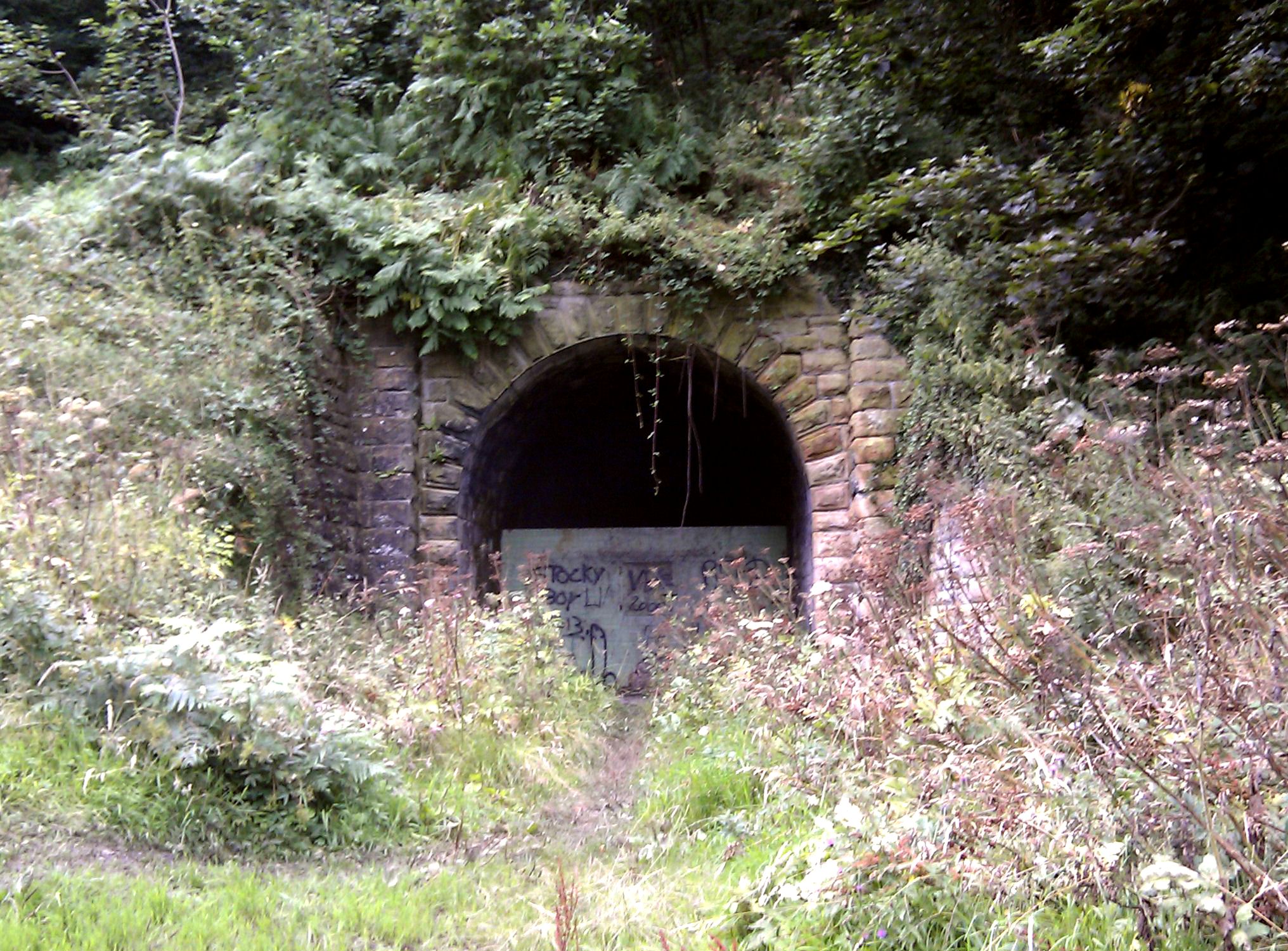
Sandsend Tunnel

Sandsend Tunnel is a tunnel on the former Whitby, Redcar and Middlesbrough Union Railway that was opened in 1883 and closed in 1958. The rail line that...

Goldsborough, Scarborough

Goldsborough is a small hamlet in the civil parish of Lythe, North Yorkshire, England within the North York Moors National Park. It is situated a few miles...

Hob Holes

The Hob Holes are caves in the cliffs of Runswick Bay, Scarborough, England which resulted from mining for jet – fossilised wood which is valuable as a...

Runswick Bay Lifeboat Station

Runswick Bay Lifeboat Station was a Royal National Lifeboat Institution (RNLI) lifeboat station located in Runswick Bay in North Yorkshire, England. The...

RAF Goldsborough

Royal Air Force Goldsborough or more simply RAF Goldsborough is a former Royal Air Force station located in North Yorkshire, England. == History == It...

Runswick Bay

Runswick Bay is a bay in the Scarborough Borough of North Yorkshire, England. It is also the name of a village located on the western edge of the bay...

Nearby Amenities

Located within 500m of 54.533834,-0.7147818
Source: PGS
Lat/Long: 54.5318813/-0.7086
Source: PGS
Lat/Long: 54.5319809/-0.7097158
Source: PGS
Lat/Long: 54.5321303/-0.7104883
Source: PGS
Lat/Long: 54.5330765/-0.7125482
Source: PGS
Lat/Long: 54.5335745/-0.7127199
Source: PGS
Lat/Long: 54.5337737/-0.7133207
Source: PGS
Lat/Long: 54.5338235/-0.7140073
Source: PGS
Lat/Long: 54.5337737/-0.7147798
Source: PGS
Lat/Long: 54.5344211/-0.7157239
Source: PGS
Lat/Long: 54.5343063/-0.7164299
Source: PGS
Lat/Long: 54.5330974/-0.7163049
Source: PGS
Lat/Long: 54.5325785/-0.7163248
Source: PGS
Lat/Long: 54.5322266/-0.7162765
Source: PGS
Lat/Long: 54.5319604/-0.7173166
Source: PGS
Lat/Long: 54.5309543/-0.7185472
The data included in this document is from www.openstreetmap.org. The data is made available under ODbL.

Have you been to Wind Hole?

Leave your review of Wind Hole below (or comments, questions and feedback).