Ethel Point

Coastal Feature, Headland, Point in Hampshire

England

Ethel Point

Bembridge Lifeboat Launch Station
Bembridge Lifeboat Launch Station Credit: Glen Diamond

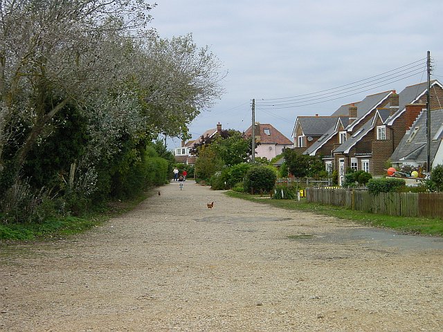
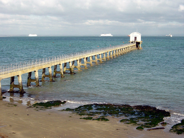
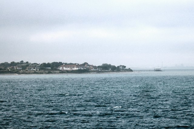
Ethel Point is a prominent coastal feature situated on the southern coast of Hampshire, England. It is classified as a headland and is often referred to as Ethel Head or simply The Point by locals. The point is located on the eastern edge of the picturesque village of Ethel, overlooking the English Channel.

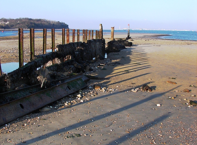
Characterized by its steep cliffs and rugged terrains, Ethel Point offers breathtaking panoramic views of the surrounding coastal landscape. Its sheer height and strategic location make it a popular destination for hikers, nature enthusiasts, and photographers. The cliffs, composed mainly of chalk and limestone, are dotted with vibrant green vegetation and colorful wildflowers during the summer months, adding to the area's natural charm.

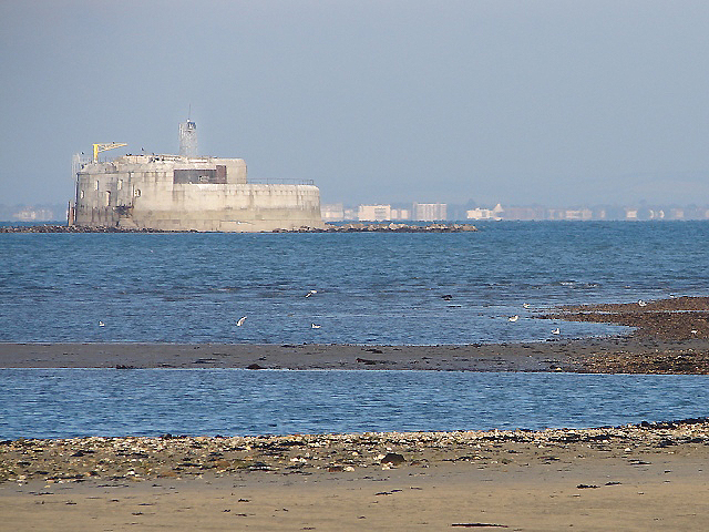
Ethel Point is known for its rich biodiversity and is home to a variety of bird species, including gulls, cormorants, and fulmars. The nearby waters are also teeming with marine life, making it a haven for fishing and birdwatching activities. Visitors can often spot seals and dolphins frolicking in the waves, adding to the area's allure.

The rugged coastline surrounding Ethel Point is also a popular spot for adrenaline-seekers, who enjoy activities such as rock climbing and cliff diving. However, it is important to note that these activities should only be undertaken by experienced individuals due to the challenging nature of the terrain.

Overall, Ethel Point is a stunning coastal feature that offers a unique blend of natural beauty, biodiversity, and recreational opportunities. It is a must-visit destination for those seeking a true coastal experience in Hampshire.

If you have any feedback on the listing, please let us know in the comments section below.
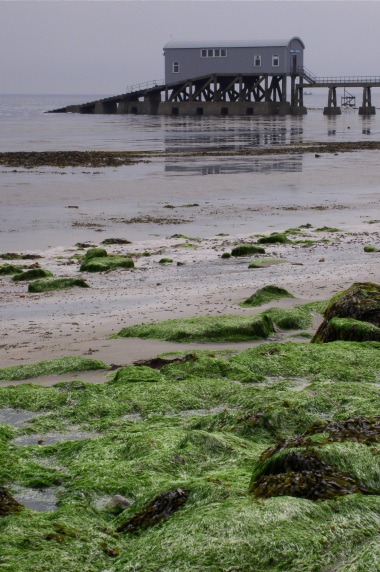
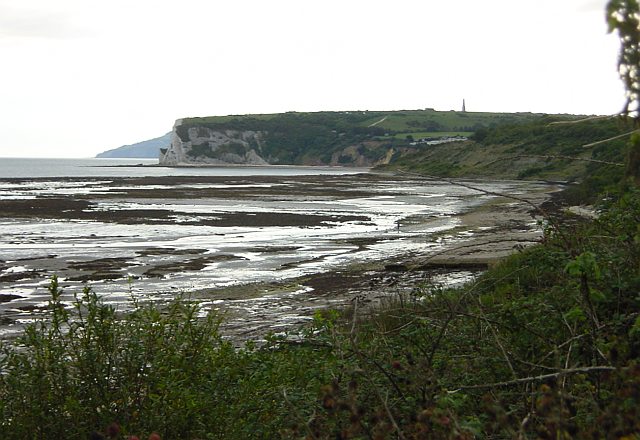
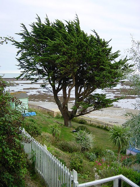
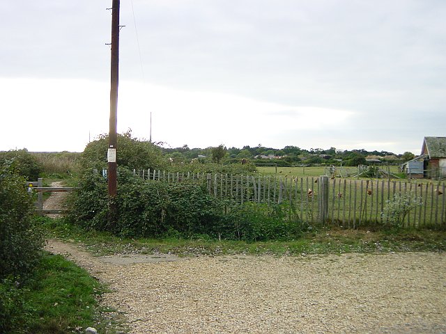
Ethel Point Images

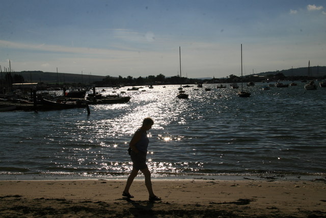
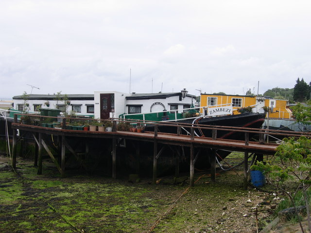
Images are sourced within 2km of 50.689556/-1.0694888 or Grid Reference SZ6588. Thanks to Geograph Open Source API. All images are credited.

Bembridge Lifeboat Launch Station
Foreland Beach The weed covered rock pools visible at low tide are in the subject square, the nearer ones marked on the map as Black Rock Ledge while the further line is Long Ledge. Beyond them, across Whitecliff Bay is Culver Down with its monument <a href="https://www.geograph.org.uk/photo/13226">SZ6385 : Culver Down Monument</a>.
Foreland Beach
The weed covered rock pools visible at low tide are in the subject square, the nearer ones marked on the map as Black Rock Ledge while the further line is Long Ledge. Beyond them, across Whitecliff Bay is Culver Down with its monument SZ6385 : Culver Down Monument.
Beach Hut Garden Some of the beach huts between the coastal path and the foreshore have very elaborate gardens. Looking SE from the coastal path near the Crab & Lobster pub.
Beach Hut Garden
Some of the beach huts between the coastal path and the foreshore have very elaborate gardens. Looking SE from the coastal path near the Crab & Lobster pub.
Chicken Farm at Foreland Fields The Coastal Path heading SW for Sandown from Bembridge skirts a poultry farm at this point.
Chicken Farm at Foreland Fields
The Coastal Path heading SW for Sandown from Bembridge skirts a poultry farm at this point.
Forelands Field Road A couple of stray hens from the poultry farm <a href="https://www.geograph.org.uk/photo/61589">SZ6587 : Chicken Farm at Foreland Fields</a> wander around on this unadopted road which runs down to the coastal path.
Forelands Field Road
A couple of stray hens from the poultry farm SZ6587 : Chicken Farm at Foreland Fields wander around on this unadopted road which runs down to the coastal path.
Another view of the Lifeboat station, Bembridge
Breakwater at Bembridge Point The eastern side to the entrance to Bembridge Harbour which is on the left. Portsmouth on the horizon with the Spinnaker Tower visible between the last two posts.
Breakwater at Bembridge Point
The eastern side to the entrance to Bembridge Harbour which is on the left. Portsmouth on the horizon with the Spinnaker Tower visible between the last two posts.
St Helen's Fort The fort is accessible on foot by a causeway on only one or two extra low tides a year - an annual walk out and around the fort is arranged each summer. It was recently advertised for sale and a condition of occupation is that you do not call on the fire service or expect to have your rubbish collected!  More info here: <span class="nowrap"><a title="http://www.bembridge.com/article.asp?ID1=9&ID2=21&ID3=261" rel="nofollow ugc noopener" href="http://www.bembridge.com/article.asp?ID1=9&ID2=21&ID3=261">Link</a><img style="margin-left:2px;" alt="External link" title="External link - shift click to open in new window" src="https://s1.geograph.org.uk/img/external.png" width="10" height="10"/></span>
St Helen's Fort
The fort is accessible on foot by a causeway on only one or two extra low tides a year - an annual walk out and around the fort is arranged each summer. It was recently advertised for sale and a condition of occupation is that you do not call on the fire service or expect to have your rubbish collected! More info here: LinkExternal link
Coast near Ryde Foreland and Bembridge Lifeboat seen from the sea.  You can just make out a faint tower on the horizon, which marks the <a href="https://www.geograph.org.uk/photo/222931">SZ6299 : Spinnaker Tower</a> and the Portsmouth shoreline.
Coast near Ryde
Foreland and Bembridge Lifeboat seen from the sea. You can just make out a faint tower on the horizon, which marks the SZ6299 : Spinnaker Tower and the Portsmouth shoreline.
Bembridge Harbour The 1940s map lists this as Brading Harbour.
Bembridge Harbour
The 1940s map lists this as Brading Harbour.
Houseboats at Bembridge Harbour
Beach House On left of the shot one of many Beach Houses in this area.
Beach House
On left of the shot one of many Beach Houses in this area.
Steyne Cross This crossroads is now a mini roundabout although the difference is immaterial given the way the traffic behaves.  This is looking south west towards the wall and stable block of Steyne House (left).  This is effectively the western extremity of Bembridge.
Steyne Cross
This crossroads is now a mini roundabout although the difference is immaterial given the way the traffic behaves. This is looking south west towards the wall and stable block of Steyne House (left). This is effectively the western extremity of Bembridge.
Bembridge Ledge The extreme eastern end of the Isle Of Wight.  Although taken 10 minutes after low tide, the sand between the two final sections of rock was not uncovered and would have made for a risky paddle.  The last bit of land, Bembridge Ledge, extends from the left hand side to the centre horizon of the photo.  As you would expect, lots of rock pools and slippery seaweed.
Bembridge Ledge
The extreme eastern end of the Isle Of Wight. Although taken 10 minutes after low tide, the sand between the two final sections of rock was not uncovered and would have made for a risky paddle. The last bit of land, Bembridge Ledge, extends from the left hand side to the centre horizon of the photo. As you would expect, lots of rock pools and slippery seaweed.
Coastal path at Bembridge The warmer climate on this shaded side of the island has benefited many creative gardeners.  But here, little has changed in 18 months since the first geograph for this square.  Even the tide is still out!
Coastal path at Bembridge
The warmer climate on this shaded side of the island has benefited many creative gardeners. But here, little has changed in 18 months since the first geograph for this square. Even the tide is still out!
Bembridge lifeboat station Taken from Bembridge Ledge (the most easterly point on the Isle of Wight) about 15 minutes after low tide.  You can see why the lifeboat station has needed a long pier, so that the boat can be launched at any state of the tide.
Bembridge lifeboat station
Taken from Bembridge Ledge (the most easterly point on the Isle of Wight) about 15 minutes after low tide. You can see why the lifeboat station has needed a long pier, so that the boat can be launched at any state of the tide.
Bembridge Windmill From the footpath to the west near Mill Farm.  This path is part of the Bembridge and River Yar Trail.
Bembridge Windmill
From the footpath to the west near Mill Farm. This path is part of the Bembridge and River Yar Trail.
Entrance to Bembridge Windmill From the road junction, where there is parking, it is about 200 yard walk down this track to the windmill.  Although prices and opening times are displayed here the ticket office is nearer the windmill.
Entrance to Bembridge Windmill
From the road junction, where there is parking, it is about 200 yard walk down this track to the windmill. Although prices and opening times are displayed here the ticket office is nearer the windmill.
Show me another place!

Ethel Point is located at Grid Ref: SZ6588 (Lat: 50.689556, Lng: -1.0694888)

Unitary Authority: Isle of Wight

Police Authority: Hampshire

What 3 Words

///rooks.lectures.escorting. Near Bembridge, Isle of Wight

Related Wikis

Bembridge Lifeboat Station

Bembridge Lifeboat Station is an RNLI station located in the village of Bembridge on the Isle of Wight in the United Kingdom. == Location == The station...

Foreland, Isle of Wight

Foreland or Forelands, and the adjacent Foreland Fields (50°40′57″N 1°04′36″W), is the easternmost point of the Isle of Wight, part of the village of Bembridge...

Bembridge School

Bembridge School was a British independent school in Bembridge on the Isle of Wight, founded in 1919 by social reformer and Liberal MP John Howard Whitehouse...

Bembridge

Bembridge is a village and civil parish located on the easternmost point of the Isle of Wight. It had a population of 3,848 according to the 2001 census...

Nearby Amenities

Located within 500m of 50.689556,-1.0694888
Leisure: slipway
Seamark Small Craft Facility Category: slipway
Seamark Type: small_craft_facility
Lat/Long: 50.688823/-1.0721198
Source: PGS
Lat/Long: 50.690921/-1.075454
Source: PGS
Lat/Long: 50.690913/-1.0753693
Source: PGS
Lat/Long: 50.690395/-1.074669
Source: PGS
Lat/Long: 50.6901373/-1.0740977
Source: Bing
Lat/Long: 50.6892829/-1.0729404
Source: PGS
Lat/Long: 50.6882672/-1.0713923
Source: Bing
Lat/Long: 50.6880358/-1.0710381
Source: PGS
Lat/Long: 50.6875625/-1.0705452
Source: PGS
Lat/Long: 50.6871026/-1.0701596
Source: PGS
Lat/Long: 50.6865618/-1.0699173
Source: Bing
Lat/Long: 50.6877997/-1.0707848
Source: Bing
Lat/Long: 50.690606/-1.0753466
Toilets
Source: Bing
Lat/Long: 50.6886586/-1.0720347
Source: Bing
Lat/Long: 50.6855936/-1.0699252
Post Box
Check Date: 2022-07-08
Check Date Collection Times: 2022-07-08
Check Date Ref: 2022-07-08
Collection Times: Mo-Fr 09:00; Sa 07:00
Operator: Royal Mail
Operator Wikidata: Q638098
Post Box Type: lamp
Ref: PO35 51D
Ref GB Uprn: 10015435812
Royal Cypher: EIIR
Royal Cypher Wikidata: Q33102113
Website: https://www.royalmail.com/services-near-you/postbox/lane-end-po35-5aa/0000PO3551
Lat/Long: 50.6873526/-1.0751594
Source: Bing
Lat/Long: 50.6901784/-1.0742486
Steps
Lat/Long: 50.6907906/-1.0756905
Steps
Lat/Long: 50.6909631/-1.0760282
Bench
Backrest: yes
Lat/Long: 50.6882848/-1.0716793
Bench
Backrest: yes
Lat/Long: 50.688193/-1.0715559
Bench
Backrest: yes
Lat/Long: 50.6882253/-1.0715935
Bench
Backrest: yes
Lat/Long: 50.6882559/-1.0716364
Hiking: yes
Information: guidepost
Tourism: information
Lat/Long: 50.6877147/-1.0709216
Bench
Backrest: yes
Lat/Long: 50.6884386/-1.0719529
Bench
Backrest: yes
Lat/Long: 50.6884632/-1.0719851
Hiking: yes
Information: guidepost
Tourism: information
Lat/Long: 50.6886081/-1.0721178
Noexit: yes
Lat/Long: 50.6902249/-1.0704308
Noexit: yes
Lat/Long: 50.6902608/-1.070526
Access: private
Entrance: yes
Lat/Long: 50.6855922/-1.0713321
Entrance: yes
Lat/Long: 50.6855748/-1.0714225
Power: substation
Ref GB Uprn: 10025279652
Lat/Long: 50.6870757/-1.0748819
Lane End
Is In: Bembridge, Isle of Wight
Place: locality
Lat/Long: 50.6877308/-1.074965
Defibrillator
Access: yes
Contact Phone: +44 1298 872 186
Defibrillator Location: On outside wall of RNLI Bembridge Inshore Lifeboat Station by Lane End car park
Emergency: defibrillator
Indoor: no
Level: 0
Opening Hours: 24/7
Wheelchair: yes
Lat/Long: 50.6885304/-1.0724087
Power: substation
Ref GB Uprn: 10024896486
Lat/Long: 50.6884105/-1.072901
Seamark Rock Water Level: awash
Seamark Type: rock
Lat/Long: 50.6912517/-1.0643006
Seamark Rock Water Level: awash
Seamark Type: rock
Lat/Long: 50.6900146/-1.0627771
Fast Food
Archie's
Addr Street: Fishermans Walk
Check Date: 2022-07-08
Fast Food: van
Lat/Long: 50.6883771/-1.0719101
Waste Basket
Check Date: 2022-07-08
Level: 0
Waste: trash
Lat/Long: 50.6885181/-1.0723973
Toilets
Check Date: 2022-07-08
Level: 0
Wheelchair: only
Lat/Long: 50.6885096/-1.072493
Leisure: swimming_pool
Lat/Long: 50.6852628/-1.0714854
Parking Space
Parking Space: disabled
Lat/Long: 50.688597/-1.0722043
Parking Space
Parking Space: disabled
Lat/Long: 50.6885749/-1.0721722
The data included in this document is from www.openstreetmap.org. The data is made available under ODbL.

Have you been to Ethel Point?

Leave your review of Ethel Point below (or comments, questions and feedback).