Engirs Geo
Coastal Feature, Headland, Point in Shetland
Scotland
Engirs Geo

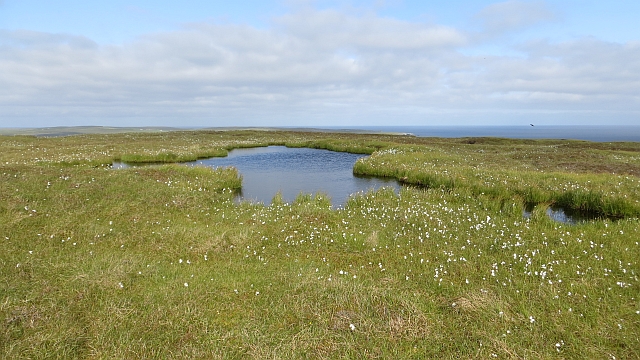
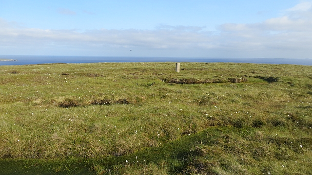
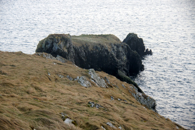
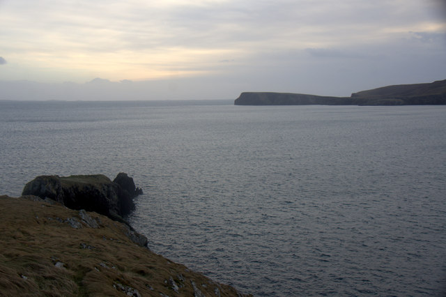
Engirs Geo is a prominent coastal feature located in Shetland, an archipelago off the northeast coast of Scotland. Specifically, it is situated on the eastern coast of the main island of Shetland, known as Mainland. Engirs Geo is classified as a headland, a term used to describe a narrow piece of land that juts out into the sea.
This impressive headland is characterized by its rugged cliffs, towering above the crashing waves of the North Sea. The cliffs are made of layered sedimentary rock, displaying a range of colors and textures that add to the area's visual appeal. The geological formation of Engirs Geo is believed to be the result of ancient volcanic activity, which shaped the landscape over millions of years.
The headland offers breathtaking views of the surrounding coastline, with its exposed cliffs providing an ideal vantage point for observing the dramatic seascape and wildlife. Visitors to Engirs Geo can witness a variety of seabirds nesting on the cliffs, such as puffins, razorbills, and fulmars, adding to the area's natural beauty and ecological significance.
Access to Engirs Geo is relatively easy, with a well-maintained coastal path leading to the headland. However, caution must be exercised when exploring the area, as the cliffs can be hazardous, especially during inclement weather. The site is a popular destination for hikers, nature enthusiasts, and photographers, who flock to Engirs Geo to capture its awe-inspiring scenery.
Overall, Engirs Geo is a remarkable coastal feature that showcases the natural beauty and geological diversity of Shetland. Its rugged cliffs, panoramic views, and abundant wildlife make it a must-visit destination for those seeking an authentic coastal experience in this remote and captivating part of Scotland.
If you have any feedback on the listing, please let us know in the comments section below.
Engirs Geo Images
Images are sourced within 2km of 60.590487/-0.88329749 or Grid Reference HU6190. Thanks to Geograph Open Source API. All images are credited.


Engirs Geo is located at Grid Ref: HU6190 (Lat: 60.590487, Lng: -0.88329749)
Unitary Authority: Shetland Islands
Police Authority: Highlands and Islands
What 3 Words
///speared.zinc.distanced. Near Houbie, Shetland Islands
Related Wikis

Fetlar
Fetlar (Scots: Fetlar) is one of the North Isles of Shetland, Scotland, with a usually resident population of 61 at the time of the 2011 census. Its main...

Haltadans
Haltadans, also known as Fairy Ring or Haltadans stone circle, is a stone circle on the island of Fetlar in Shetland, Scotland. This site is a ring of...

Funzie Girt
Funzie Girt (; Scots: Funyie Girt "Finns' dyke") is an ancient dividing wall that was erected from north to south across the island of Fetlar in Shetland...

Brough Lodge
Brough Lodge is a 19th-century Gothic mansion on Fetlar, one of the Shetland Islands, in northern Scotland. Built by the Nicolson family, who were responsible...

Urie Lingey
For other islands with similar names, see Linga (disambiguation) Urie Lingey is one of the Shetland Islands. It is between Fetlar and Unst, and Yell is...

Hamars Ness
Hamars Ness is a headland on the island of Fetlar in Shetland, Scotland. The name is from the Old Norse Hamarsnes meaning "craggy headland". A ro-ro ferry...

Hascosay
Hascosay (Scots: Hascosay; Old Norse "Hafskotsey") is a small island lying between Yell and Fetlar in the Shetland Islands, Scotland. == Geography and... ==

Sound Gruney
For other islands with similar names, see Gruney (disambiguation) Sound Gruney is one of the Shetland islands. It lies about 1.5 kilometres (0.93 mi)...
Nearby Amenities
Located within 500m of 60.590487,-0.88329749Have you been to Engirs Geo?
Leave your review of Engirs Geo below (or comments, questions and feedback).