Seli Geo
Coastal Feature, Headland, Point in Shetland
Scotland
Seli Geo

Seli Geo is a coastal feature located in the Shetland Islands, Scotland. It is classified as a headland or point, jutting out into the North Sea. The name "Seli Geo" is derived from the Old Norse language, where "Seli" means "seat" or "chair," and "Geo" refers to a narrow inlet or cove.
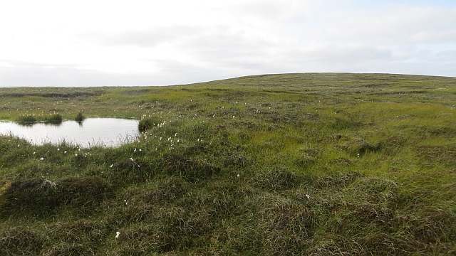
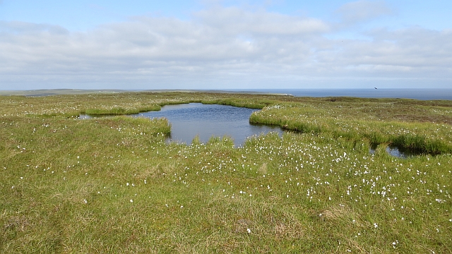
Seli Geo is characterized by its rugged and rocky coastline, with steep cliffs that rise dramatically from the sea. The headland is composed of layers of sedimentary rock, primarily sandstone and shale, which have been shaped and eroded over millions of years by the relentless action of wind and waves. The geology of the area is particularly fascinating, displaying a variety of formations and fossilized remains that provide valuable insights into the Earth's history.
The headland offers breathtaking views of the surrounding ocean and the nearby islands. It is a popular spot for wildlife enthusiasts, as Seli Geo is home to a diverse range of seabirds, including puffins, gannets, and fulmars. Additionally, seals and dolphins can often be spotted in the waters below.
Access to Seli Geo is relatively easy, with a well-maintained footpath leading visitors to the headland. However, caution is advised due to the steep and potentially treacherous cliffs. Visitors are advised to stay on marked paths and observe safety guidelines.
Overall, Seli Geo is a remarkable coastal feature that showcases the natural beauty and geological diversity of the Shetland Islands. Its impressive cliffs, stunning views, and abundant wildlife make it a must-visit destination for nature lovers and outdoor enthusiasts alike.
If you have any feedback on the listing, please let us know in the comments section below.
Seli Geo Images
Images are sourced within 2km of 60.590453/-0.87177922 or Grid Reference HU6190. Thanks to Geograph Open Source API. All images are credited.


Seli Geo is located at Grid Ref: HU6190 (Lat: 60.590453, Lng: -0.87177922)
Unitary Authority: Shetland Islands
Police Authority: Highlands and Islands
What 3 Words
///magically.lawful.lunching. Near Houbie, Shetland Islands
Nearby Locations
Related Wikis

Fetlar
Fetlar (Scots: Fetlar) is one of the North Isles of Shetland, Scotland, with a usually resident population of 61 at the time of the 2011 census. Its main...

Haltadans
Haltadans, also known as Fairy Ring or Haltadans stone circle, is a stone circle on the island of Fetlar in Shetland, Scotland. This site is a ring of...

Funzie Girt
Funzie Girt (; Scots: Funyie Girt "Finns' dyke") is an ancient dividing wall that was erected from north to south across the island of Fetlar in Shetland...

Brough Lodge
Brough Lodge is a 19th-century Gothic mansion on Fetlar, one of the Shetland Islands, in northern Scotland. Built by the Nicolson family, who were responsible...

Urie Lingey
For other islands with similar names, see Linga (disambiguation) Urie Lingey is one of the Shetland Islands. It is between Fetlar and Unst, and Yell is...

Hamars Ness
Hamars Ness is a headland on the island of Fetlar in Shetland, Scotland. The name is from the Old Norse Hamarsnes meaning "craggy headland". A ro-ro ferry...

Hascosay
Hascosay (Scots: Hascosay; Old Norse "Hafskotsey") is a small island lying between Yell and Fetlar in the Shetland Islands, Scotland. == Geography and... ==

Sound Gruney
For other islands with similar names, see Gruney (disambiguation) Sound Gruney is one of the Shetland islands. It lies about 1.5 kilometres (0.93 mi)...
Nearby Amenities
Located within 500m of 60.590453,-0.87177922Have you been to Seli Geo?
Leave your review of Seli Geo below (or comments, questions and feedback).