The Taing

Coastal Feature, Headland, Point in Shetland

Scotland

The Taing

Outer Dale, Lambhoga, Fetlar
Outer Dale, Lambhoga, Fetlar Credit: Mike Pennington

The Taing is a prominent coastal feature located in Shetland, an archipelago in Scotland. It is a headland, also known as a point, that extends out into the North Sea, offering breathtaking views of the surrounding landscape.

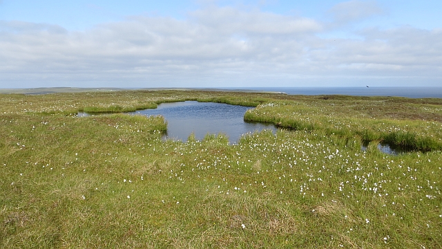
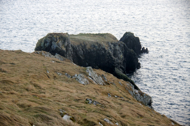
Situated on the western coast of mainland Shetland, The Taing is characterized by its rocky cliffs, which rise high above the crashing waves below. The headland is composed of ancient rock formations, displaying layers of sedimentary rock that have been shaped by millions of years of erosion.

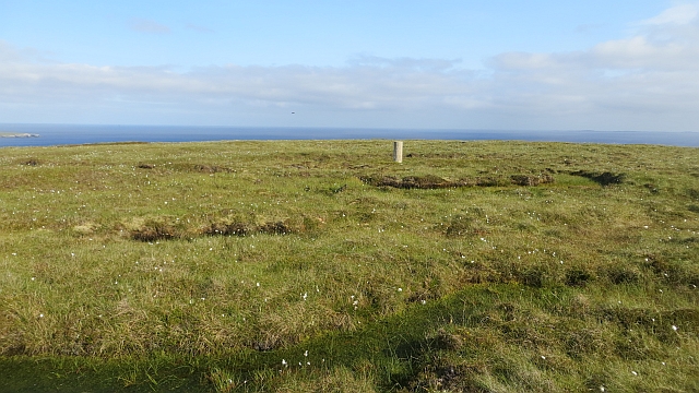
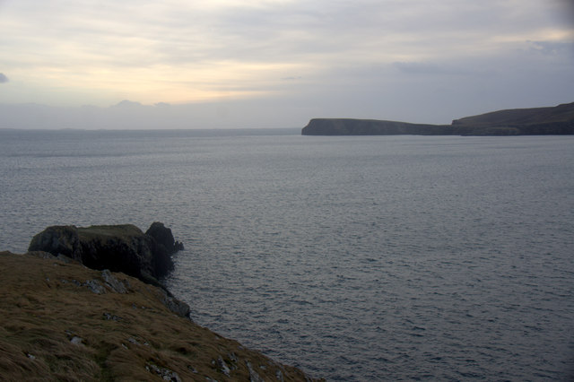
At the top of The Taing, there is a narrow strip of land that provides a vantage point for visitors to witness the raw power of the sea. The panoramic views from this spot are truly awe-inspiring, with the vast expanse of the North Sea stretching out before the eyes, and the distant horizon seemingly endless.

The area surrounding The Taing is rich in biodiversity, with various species of seabirds nesting along the cliffs. It is also a popular spot for wildlife enthusiasts, who come to observe seals, dolphins, and even occasional sightings of whales. The rugged beauty of the headland attracts hikers and photographers alike, who are drawn to the dramatic scenery and the opportunity to capture the essence of Shetland's coastline.

Overall, The Taing is a remarkable coastal feature in Shetland, offering visitors a chance to immerse themselves in the natural beauty and power of the North Sea.

If you have any feedback on the listing, please let us know in the comments section below.

The Taing Images

Images are sourced within 2km of 60.590335/-0.88344877 or Grid Reference HU6190. Thanks to Geograph Open Source API. All images are credited.

Outer Dale, Lambhoga, Fetlar
North of Hoganeap, Lambhoga, Fetlar
Three Geos, Hoganeap, Fetlar Although this area seems to be named Three Stacks on the OS 1:10000 map, I am informed by Andrew Leaper of Fetlar that the area in the photo is named Three Geos and that Three Stacks is further north along the coast.
Three Geos, Hoganeap, Fetlar
Although this area seems to be named Three Stacks on the OS 1:10000 map, I am informed by Andrew Leaper of Fetlar that the area in the photo is named Three Geos and that Three Stacks is further north along the coast.
South Geo of Heoganeap, Fetlar
Looking north from path up to Lamb Hoga There is a very good track from the car park beside Fetlar Kirk up onto Lamb Hoga with views to Out Skerries, Bressay and across the whole of Fetlar.  I had assumed that Lamb Hoga would be pronounced as written but oh no, it's pronounced as a single word "Lahmuga" with the stress on the first sylable "Lahm".
Looking north from path up to Lamb Hoga
There is a very good track from the car park beside Fetlar Kirk up onto Lamb Hoga with views to Out Skerries, Bressay and across the whole of Fetlar. I had assumed that Lamb Hoga would be pronounced as written but oh no, it's pronounced as a single word "Lahmuga" with the stress on the first sylable "Lahm".
Fields on Aith Ness
Fields on Aith Ness
The Peat Road The bogs of Lamb Hoga provided Fetlar with high quality fuel. Every year, islanders would move to the peninsula to cast and dry peats. The fuel was then taken off via this road or by boat across to Aith for the eastern side of the island.
 The beach at Tresta is in the background along with Vord Hill.
The Peat Road
The bogs of Lamb Hoga provided Fetlar with high quality fuel. Every year, islanders would move to the peninsula to cast and dry peats. The fuel was then taken off via this road or by boat across to Aith for the eastern side of the island. The beach at Tresta is in the background along with Vord Hill.
Peat Road, Lamb Hoga The route which was used to carry winter fuel off the bogs of Lamb Hoga up to the 1950s.
Peat Road, Lamb Hoga
The route which was used to carry winter fuel off the bogs of Lamb Hoga up to the 1950s.
Bog, Lamb Hoga The west side of Gillis Field which was the source of Fetlar's peat. The moorland is now home to many bonxies and they were pretty mean today.
Bog, Lamb Hoga
The west side of Gillis Field which was the source of Fetlar's peat. The moorland is now home to many bonxies and they were pretty mean today.
The Dale A shallow reentrant on the boggy Lamb Hoga plateau. There is a view over the Wick of Tresta towards Aithbank where peats cut here were once landed.
The Dale
A shallow reentrant on the boggy Lamb Hoga plateau. There is a view over the Wick of Tresta towards Aithbank where peats cut here were once landed.
Fields, Aith Ness A fertile peninsula on the south side of Fetlar.
Fields, Aith Ness
A fertile peninsula on the south side of Fetlar.
The Peat Road Lamb Hoga was the source of Fetlar's peat and this was one of the ways the peat was carried to the crofts. Much of the peat was taken out by boat and landed at Airthbank.
The Peat Road
Lamb Hoga was the source of Fetlar's peat and this was one of the ways the peat was carried to the crofts. Much of the peat was taken out by boat and landed at Airthbank.
Bog pool, Gillis Field Prime bonxie real estate on the boggy Lamb Hoga peninsula.
Bog pool, Gillis Field
Prime bonxie real estate on the boggy Lamb Hoga peninsula.
Gillis Field Triangulation pillar amongst the bogs.
Gillis Field
Triangulation pillar amongst the bogs.
Gillis Field Triangulation pillar on Lamb Hoga.
Gillis Field
Triangulation pillar on Lamb Hoga.
Gillis Field The higher parts of Lamb Hoga. The peninsula was the source of Fetlar's peat.
Gillis Field
The higher parts of Lamb Hoga. The peninsula was the source of Fetlar's peat.
The Heog, Houbie, Fetlar
The Heog, near Houbie, Fetlar And the view across the Wick of Tresta towards the Head of Lambhoga.
The Heog, near Houbie, Fetlar
And the view across the Wick of Tresta towards the Head of Lambhoga.
Show me another place!

The Taing is located at Grid Ref: HU6190 (Lat: 60.590335, Lng: -0.88344877)

Unitary Authority: Shetland Islands

Police Authority: Highlands and Islands

What 3 Words

///brotherly.numeral.elated. Near Houbie, Shetland Islands

Related Wikis

Fetlar

Fetlar (Scots: Fetlar) is one of the North Isles of Shetland, Scotland, with a usually resident population of 61 at the time of the 2011 census. Its main...

Haltadans

Haltadans, also known as Fairy Ring or Haltadans stone circle, is a stone circle on the island of Fetlar in Shetland, Scotland. This site is a ring of...

Funzie Girt

Funzie Girt (; Scots: Funyie Girt "Finns' dyke") is an ancient dividing wall that was erected from north to south across the island of Fetlar in Shetland...

Brough Lodge

Brough Lodge is a 19th-century Gothic mansion on Fetlar, one of the Shetland Islands, in northern Scotland. Built by the Nicolson family, who were responsible...

Urie Lingey

For other islands with similar names, see Linga (disambiguation) Urie Lingey is one of the Shetland Islands. It is between Fetlar and Unst, and Yell is...

Hamars Ness

Hamars Ness is a headland on the island of Fetlar in Shetland, Scotland. The name is from the Old Norse Hamarsnes meaning "craggy headland". A ro-ro ferry...

Hascosay

Hascosay (Scots: Hascosay; Old Norse "Hafskotsey") is a small island lying between Yell and Fetlar in the Shetland Islands, Scotland. == Geography and... ==

Sound Gruney

For other islands with similar names, see Gruney (disambiguation) Sound Gruney is one of the Shetland islands. It lies about 1.5 kilometres (0.93 mi)...

Nearby Amenities

Located within 500m of 60.590335,-0.88344877
Turning Circle
Lat/Long: 60.5932274/-0.8834626
Tresta
Place: hamlet
Lat/Long: 60.5932064/-0.8848476
Power: pole
Lat/Long: 60.5933492/-0.8850487
Power: pole
Lat/Long: 60.5938255/-0.8854648
Power: pole
Lat/Long: 60.5943363/-0.8859278
The data included in this document is from www.openstreetmap.org. The data is made available under ODbL.

Have you been to The Taing?

Leave your review of The Taing below (or comments, questions and feedback).