Ruggen

Coastal Feature, Headland, Point in Shetland

Scotland

Ruggen

South Bressay and the Ward of Bressay from the sea
South Bressay and the Ward of Bressay from the sea Credit: Mike Pennington

Ruggen is a prominent coastal feature located in the Shetland Islands, which are part of Scotland in the United Kingdom. Specifically, it is a headland or point that juts out into the North Sea. The name "Ruggen" is derived from the Old Norse word "ruggr," meaning a ridge or back, which accurately describes the physical characteristics of this coastal landmark.

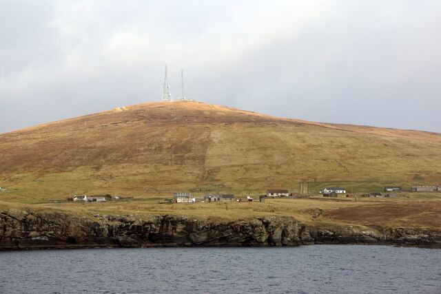
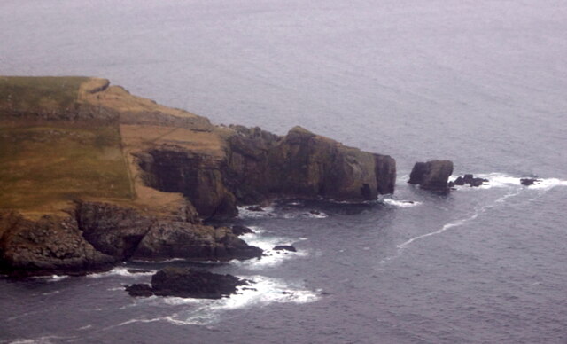
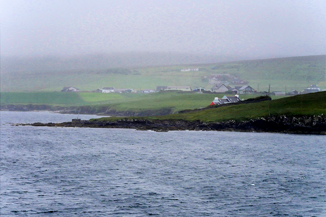
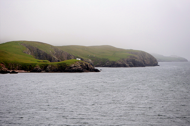
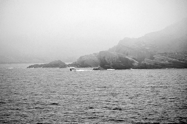
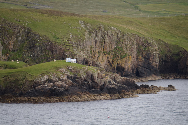
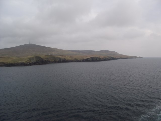
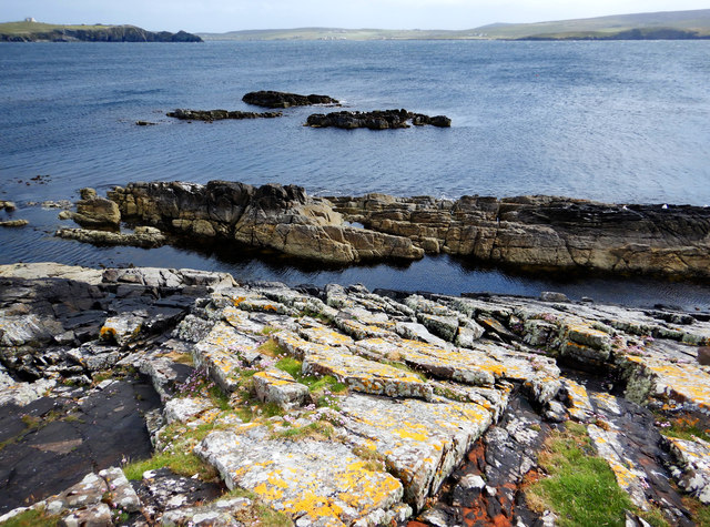
Ruggen is situated on the eastern coast of Shetland, near the settlement of Vatsetter. It is known for its rugged and rocky terrain, with steep cliffs that offer breathtaking views of the surrounding sea. The headland is composed of ancient igneous rocks, primarily basalt, which have been shaped by the relentless forces of wind and waves over millions of years.

The area surrounding Ruggen is rich in biodiversity, with numerous seabird colonies nesting on the cliffs. Visitors to the headland can often observe a variety of bird species, including puffins, guillemots, and fulmars. The coastal waters are also home to a diverse range of marine life, such as seals, dolphins, and various species of fish.

Due to its exposed location, Ruggen is subject to harsh weather conditions, particularly during the winter months when storms can batter the coast. As a result, the headland is a popular spot for coastal walks and birdwatching, attracting both locals and tourists alike.

In summary, Ruggen is a striking headland in the Shetland Islands, characterized by its rocky cliffs, diverse wildlife, and stunning coastal views. Its geological significance and natural beauty make it a noteworthy coastal feature in the region.

If you have any feedback on the listing, please let us know in the comments section below.
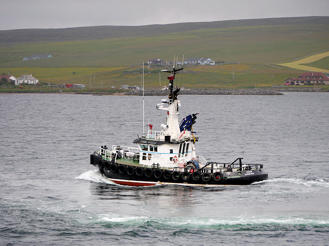
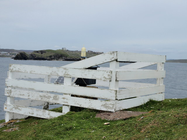
Ruggen Images

Images are sourced within 2km of 60.128975/-1.15515 or Grid Reference HU4738. Thanks to Geograph Open Source API. All images are credited.

South Bressay and the Ward of Bressay from the sea
Loch of Kirkabister
Loch of Kirkabister
MV Costa Fortuna at anchor in Bressay Sound The size of the MV Costa Fortuna (464 cabins, nine swimming pools and five restaurants) meant that it was obliged to anchor out in the Sound rather than at the quayside in Lerwick. A flotilla of barges were kept busy ferrying passengers to and from the Victoria Pier. The Costa Fortuna is a sister ship to the ill-starred Costa Concordia which sank off the Italian coast in 2012.
MV Costa Fortuna at anchor in Bressay Sound
The size of the MV Costa Fortuna (464 cabins, nine swimming pools and five restaurants) meant that it was obliged to anchor out in the Sound rather than at the quayside in Lerwick. A flotilla of barges were kept busy ferrying passengers to and from the Victoria Pier. The Costa Fortuna is a sister ship to the ill-starred Costa Concordia which sank off the Italian coast in 2012.
Pullar's Loch, Sound, from the air
Ness of Sound, Lerwick, from the air
Ness of Sound from the air
On MV Hrossey - the overnight ferry to Aberdeen A few passengers stayed on the outside upper deck of MV Hrossey as the darkness faded and the cool breeze penetrated.  The headland that marks the end of Bressay Sound is just visible to port.
On MV Hrossey - the overnight ferry to Aberdeen
A few passengers stayed on the outside upper deck of MV Hrossey as the darkness faded and the cool breeze penetrated. The headland that marks the end of Bressay Sound is just visible to port.
Small boat off Ness of Sound Taken from the Knab in Lerwick.
Small boat off Ness of Sound
Taken from the Knab in Lerwick.
MV Knab, Lerwick Pilot Boat The Lerwick pilot boat, MV Knab, in Bressay Sound.
MV Knab, Lerwick Pilot Boat
The Lerwick pilot boat, MV Knab, in Bressay Sound.
Cro of Ham
Cro of Ham
Bressay Coastline between Ham and Kirkabister
Cliffs South of Ham Part of the Bressay coastline between Ham and Kirkabister.
Cliffs South of Ham
Part of the Bressay coastline between Ham and Kirkabister.
Cuddie Sound Passing Ness of Sound as the mist falls.
Cuddie Sound
Passing Ness of Sound as the mist falls.
Light Beacon White construction, Cro of Ham on Bressay, containing a light beacon,
that anyone who has ever taken the Lerwick-Aberdeen Ferry, must have 
seen when entering/leaving Lerwick Harbour.
Across Bressay Sound you see South Ness Cemetery.
Light Beacon
White construction, Cro of Ham on Bressay, containing a light beacon, that anyone who has ever taken the Lerwick-Aberdeen Ferry, must have seen when entering/leaving Lerwick Harbour. Across Bressay Sound you see South Ness Cemetery.
Ruggen, Ness of Sound Taken from the Marco Polo cruise ship on the way out of Lerwick.
Ruggen, Ness of Sound
Taken from the Marco Polo cruise ship on the way out of Lerwick.
Cro of Ham
Cro of Ham
Cliffs near Green Head and Hevdi
Skerries on east side of Ness of Sound The gently dipping Middle Old Red Sandstone of east Mainland produces skerries with a steep side facing the shore of Ness of Sound, and a slope off into the waters of Brei Wick. This makes them easy for seals to haul out on the seaward side, and slide quickly away from the shore if disturbed, though the ones we saw had chosen a boulder beach a little way north where they seemed better camouflaged. Perhaps the less visible ones remained while ones here had already departed before we got to them ! There certainly seeme to be seal heads popping up all along the shore of Brei Wick, watching the people passing by.

In the distance in this view is Bressay Sound, overlooked by Lerwick on the left (with the prominent coastguard building on the hilltop) and Bressay on the right.
Skerries on east side of Ness of Sound
The gently dipping Middle Old Red Sandstone of east Mainland produces skerries with a steep side facing the shore of Ness of Sound, and a slope off into the waters of Brei Wick. This makes them easy for seals to haul out on the seaward side, and slide quickly away from the shore if disturbed, though the ones we saw had chosen a boulder beach a little way north where they seemed better camouflaged. Perhaps the less visible ones remained while ones here had already departed before we got to them ! There certainly seeme to be seal heads popping up all along the shore of Brei Wick, watching the people passing by. In the distance in this view is Bressay Sound, overlooked by Lerwick on the left (with the prominent coastguard building on the hilltop) and Bressay on the right.
Show me another place!

Ruggen is located at Grid Ref: HU4738 (Lat: 60.128975, Lng: -1.15515)

Unitary Authority: Shetland Islands

Police Authority: Highlands and Islands

What 3 Words

///soak.clutches.pelted. Near Lerwick, Shetland Islands

Related Wikis

Lerwick Observatory

Lerwick Observatory (also known as Lerwick Magnetic Observatory) is a British meteorological observatory located near the port at Lerwick, Shetland Islands...

Sound, Lerwick

Sound is an area situated to the south-west of central Lerwick, the capital of Shetland, Scotland.Sound is home to a primary school, public hall, and gospel...
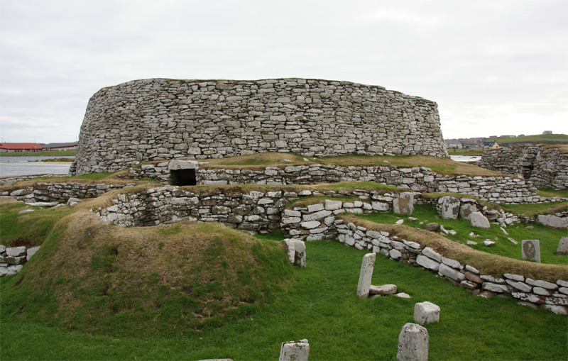
Broch of Clickimin

The Broch of Clickimin (also Clickimin or Clickhimin Broch) is a large, well-preserved but restored broch in Lerwick, Shetland, Scotland (grid reference...

Gilbert Bain Hospital

The Gilbert Bain Hospital is a rural general hospital in the burgh of Lerwick, Shetland, Scotland. It is managed by NHS Shetland. == History == The hospital...

Clickimin Loch

Clickimin Loch is a loch in Shetland, Scotland, west of Lerwick. A Pictish fort from the 6th century called Clickimin Broch is located on a small islet...

Montfield Hospital

The Montfield Hospital is a health facility in the burgh of Lerwick, Shetland, Scotland. It is managed by NHS Shetland. == History == The facility, which...

Lerwick and Bressay Parish Church

Lerwick and Bressay Parish Church is the largest Church of Scotland congregation in Shetland, serving the islands' capital Lerwick and the surrounding...

Shetland Library

Shetland Library is the public library service of Shetland, with its main branch based in Lerwick. Membership is open to both residents of and visitors...

Nearby Amenities

Located within 500m of 60.128975,-1.15515
Description: Ness of Sound WW2 Gun & Searchlight Battery
Historic: archaeological_site
Lat/Long: 60.1332216/-1.1532023
The data included in this document is from www.openstreetmap.org. The data is made available under ODbL.

Have you been to Ruggen?

Leave your review of Ruggen below (or comments, questions and feedback).