Geo of Coosa

Coastal Feature, Headland, Point in Shetland

Scotland

Geo of Coosa

Wick of Sandsyre Bay at Leebitten.
Wick of Sandsyre Credit: Oliver Dixon

Geo of Coosa is a prominent coastal feature located in the Shetland Islands, which lie off the northeastern coast of Scotland. It is specifically situated on the eastern coast of the main island of Shetland, known as Mainland. Geo of Coosa is classified as a headland, also referred to as a point, due to its distinct geographical characteristics.

The headland is characterized by its steep cliffs that rise dramatically from the surrounding sea level. These cliffs are composed of rugged rock formations, predominantly consisting of sandstone and shale. The height of the cliffs varies, with some sections reaching up to 100 meters (330 feet) above sea level. The rocky coastal landscape is interspersed with small caves, fissures, and crevices, adding to the geological interest of Geo of Coosa.

The headland is exposed to the full force of the North Sea, resulting in powerful waves crashing against the cliffs, particularly during stormy weather. This natural process has contributed to the formation of sea stacks, which are isolated pillars of rock that have separated from the mainland due to erosion. These sea stacks can be observed near the headland, adding to its unique beauty and appeal.

Geo of Coosa is not only a geological attraction but also provides a habitat for diverse marine and bird life. The surrounding waters are home to various species of fish, seals, and seabirds, including puffins, guillemots, and fulmars. Birdwatchers and nature enthusiasts are often drawn to the area to witness the diverse avian population that flocks to the cliffs and sea stacks.

Overall, Geo of Coosa is a visually striking coastal feature, characterized by its towering cliffs, sea stacks, and rich biodiversity. It offers visitors a unique opportunity to experience the rugged beauty and natural wonders of the Shetland Islands.

If you have any feedback on the listing, please let us know in the comments section below.
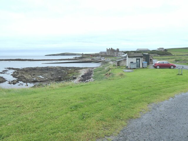
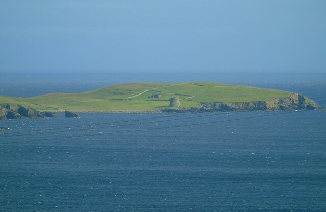
Geo of Coosa Images

Images are sourced within 2km of 59.992495/-1.2009863 or Grid Reference HU4423. Thanks to Geograph Open Source API. All images are credited.

Wick of Sandsyre Bay at Leebitten.
Wick of Sandsyre
Bay at Leebitten.
Solan IV This is the Solan IV moored at the pier at the Wick of Sandsayre, Leebitten, on the eastern mainland of Shetland. This boat would have taken us out to Mousa if it had not been so windy on this day. Solan is Shetland dialect for northern gannet.
Solan IV
This is the Solan IV moored at the pier at the Wick of Sandsayre, Leebitten, on the eastern mainland of Shetland. This boat would have taken us out to Mousa if it had not been so windy on this day. Solan is Shetland dialect for northern gannet.
Mousa and the Broch We are at the parking place above Crossie Geo just north of Leebitten, roughly half-way between Sumburgh Head and Lerwick on the mainland of Shetlant, and looking across Mousa Sound to the island of Mousa and the Broch of Mousa. The wind proved to be too strong on this particular day for us to make the crossing to view the broch close up.
Mousa and the Broch
We are at the parking place above Crossie Geo just north of Leebitten, roughly half-way between Sumburgh Head and Lerwick on the mainland of Shetlant, and looking across Mousa Sound to the island of Mousa and the Broch of Mousa. The wind proved to be too strong on this particular day for us to make the crossing to view the broch close up.
Loch of Noness from the air
Broch of Mousa from the air
West Ham and East Ham, Mousa, from the air
Sandsayre and Sand Lodge, Sandwick, from the air
Sand Lodge, Sandwick, from the air
Meadowbank, Sandwick, from the air
Sanick, Sandwick, from the air
Sand Wick, Sandwick, from the air
Mousa Sound and Mousa from the air
Noness, Sandwick, from the air
Broch of Mousa Taken from the viewing point on the South Road above Leebitten, Sandwick, on the main island of Shetland, I am looking south east towards the island of Mousa. The Broch of Mousa (centre of shot) is the best-preserved of Scotland's brochs or Iron Age roundhouses. The island can be accessed by boat from Sandwick (weather and wind permitting).
Broch of Mousa
Taken from the viewing point on the South Road above Leebitten, Sandwick, on the main island of Shetland, I am looking south east towards the island of Mousa. The Broch of Mousa (centre of shot) is the best-preserved of Scotland's brochs or Iron Age roundhouses. The island can be accessed by boat from Sandwick (weather and wind permitting).
The Broch of Mousa Looking north towards Burgi Ayre.
The Broch of Mousa
Looking north towards Burgi Ayre.
The Broch of Mousa The detail of the stonework is very clear in this photo. The entrance is on the left, and inside it is possible to climb to the top of the tower - hence the railings.
The Broch of Mousa
The detail of the stonework is very clear in this photo. The entrance is on the left, and inside it is possible to climb to the top of the tower - hence the railings.
The top of the broch The stairs descend to the left from the gate between the walls. Note the grid, bottom right, to prevent falls back into the broch.

Top right is the ruin of The Haa, the former residence of the laird of the island.
The top of the broch
The stairs descend to the left from the gate between the walls. Note the grid, bottom right, to prevent falls back into the broch. Top right is the ruin of The Haa, the former residence of the laird of the island.
Show me another place!

Geo of Coosa is located at Grid Ref: HU4423 (Lat: 59.992495, Lng: -1.2009863)

Unitary Authority: Shetland Islands

Police Authority: Highlands and Islands

What 3 Words

///unionists.followers.groom. Near Sandwick, Shetland Islands

Related Wikis

Broch of Mousa

Broch of Mousa (or Mousa Broch) is a preserved Iron Age broch or round tower. It is on the island of Mousa in Shetland, Scotland. It is the tallest broch...

Sandwick, Dunrossness

see also Sandwick, Whalsay and Sandwick, Orkney Sandwick (Old Norse: Sandvik "Sandy Bay") is a village and an ancient parish in the Shetland Islands,...

Mousa

Mousa (Old Norse: Mosey "moss island") is a small island in Shetland, Scotland, uninhabited since the nineteenth century. The island is known for the...

Peerie Bard

Perie Bard is one of the Shetland Islands. It is a small islet off the east coast of the island of Mousa. Although named 'Perie Bard' on OS Maps, the name...

Nearby Amenities

Located within 500m of 59.992495,-1.2009863
Broch of Burraland
Historic: archaeological_site
Lat/Long: 59.9913272/-1.2006694
The data included in this document is from www.openstreetmap.org. The data is made available under ODbL.

Have you been to Geo of Coosa?

Leave your review of Geo of Coosa below (or comments, questions and feedback).