The Houll
Coastal Feature, Headland, Point in Shetland
Scotland
The Houll
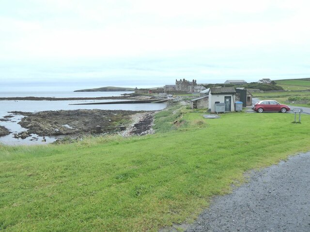
The Houll is a prominent coastal feature located in Shetland, Scotland. It is classified as a headland and point, jutting out into the North Sea. Situated on the eastern coast of the mainland, the Houll is known for its rugged and picturesque landscape, making it a popular destination for nature enthusiasts and photographers.
The headland is characterized by its steep cliffs, which rise dramatically from the sea, providing stunning panoramic views of the surrounding coastline. These cliffs are composed of sedimentary rock, showcasing layers of various colors and textures, adding to the visual appeal of the area.
The Houll also boasts an abundance of wildlife, with numerous species of seabirds nesting on its cliffs, including puffins, fulmars, and kittiwakes. Visitors may have the opportunity to observe these beautiful creatures in their natural habitat, particularly during the breeding season.
Access to the Houll is relatively easy, with a well-maintained footpath leading from the nearby village. The path offers a pleasant walk through the Shetland countryside, providing glimpses of wildflowers and heather along the way.
The Houll is not only a stunning natural feature but also holds historical significance. It is believed to have been a site of Viking settlements, with artifacts and remains discovered in the vicinity. As such, it attracts history enthusiasts and archeologists who are interested in exploring the area's past.
Overall, the Houll in Shetland is a captivating coastal feature, offering breathtaking views, diverse wildlife, and a glimpse into the region's rich history. It is a must-visit destination for those seeking to immerse themselves in the beauty of Scotland's rugged coastline.
If you have any feedback on the listing, please let us know in the comments section below.
The Houll Images
Images are sourced within 2km of 59.993415/-1.2016811 or Grid Reference HU4423. Thanks to Geograph Open Source API. All images are credited.


The Houll is located at Grid Ref: HU4423 (Lat: 59.993415, Lng: -1.2016811)
Unitary Authority: Shetland Islands
Police Authority: Highlands and Islands
What 3 Words
///payer.rewrites.point. Near Sandwick, Shetland Islands
Nearby Locations
Related Wikis

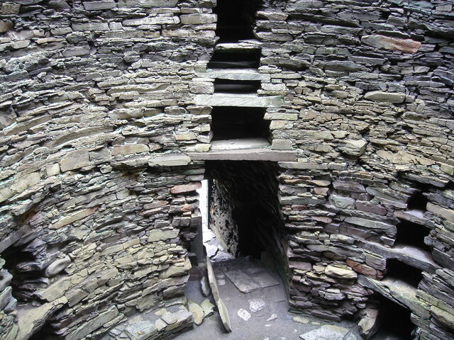
Broch of Mousa
Broch of Mousa (or Mousa Broch) is a preserved Iron Age broch or round tower. It is on the island of Mousa in Shetland, Scotland. It is the tallest broch...

Sandwick, Dunrossness
see also Sandwick, Whalsay and Sandwick, OrkneySandwick (Old Norse: Sandvik "Sandy Bay") is a village and an ancient parish in the Shetland Islands, Scotland...

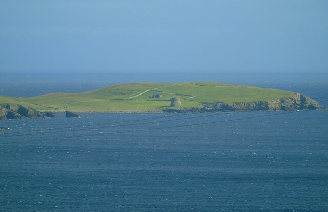
Mousa
Mousa (Old Norse: Mosey "moss island") is a small island in Shetland, Scotland, uninhabited since the nineteenth century. The island is known for the...

Peerie Bard
Perie Bard is one of the Shetland Islands. It is a small islet off the east coast of the island of Mousa.Although named 'Perie Bard' on OS Maps, the name...
Nearby Amenities
Located within 500m of 59.993415,-1.2016811Have you been to The Houll?
Leave your review of The Houll below (or comments, questions and feedback).