Rams Taing

Coastal Feature, Headland, Point in Shetland

Scotland

Rams Taing

Aith, Cunningsburgh, from the air
Aith, Cunningsburgh, from the air Credit: Mike Pennington

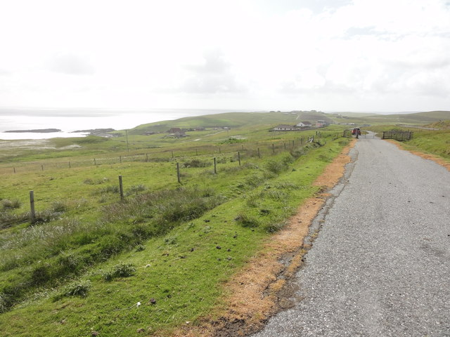
Rams Taing is a prominent coastal feature located in Shetland, an archipelago in Scotland. It is specifically situated on the mainland of Shetland, near the village of Sandwick. Rams Taing is categorized as a headland, also known as a point, due to its distinctive geographic formation.

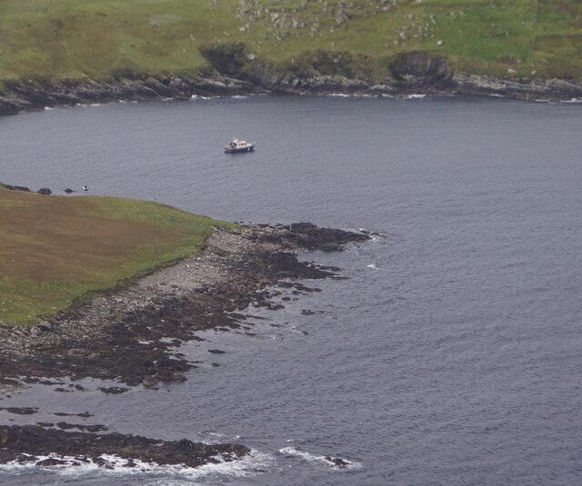
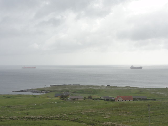
The headland stretches out into the North Sea, jutting out from the surrounding coastline. It is characterized by its rugged and rocky terrain, formed by the powerful forces of erosion from the crashing waves and turbulent tides. Rams Taing is composed of various types of rocks, including sandstone and granite, which contribute to its unique appearance and texture.

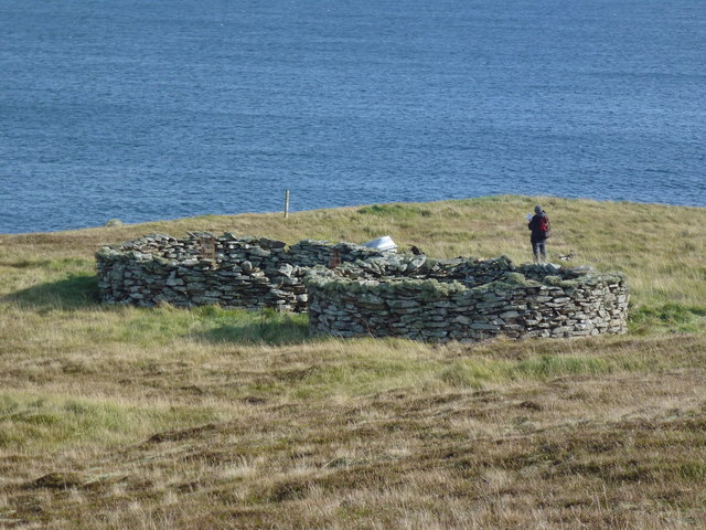
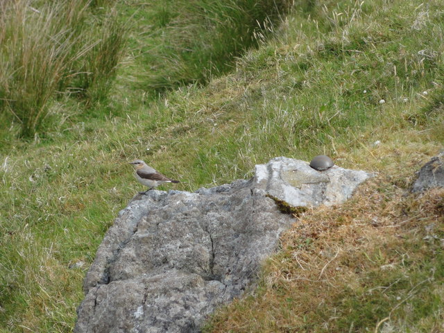
The headland offers breathtaking views of the surrounding sea and coastline, making it a popular destination for tourists and locals alike. Visitors can witness the dramatic clash of waves against the rocky shoreline, creating a mesmerizing display of natural power and beauty. The rugged cliffs of Rams Taing also provide a habitat for various marine and bird species, making it an important ecological site.

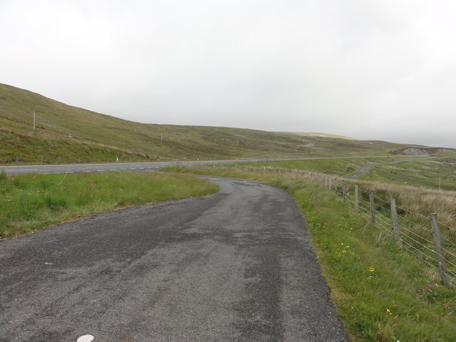
Access to Rams Taing is relatively easy, with a nearby road providing convenient access for visitors. However, caution must be exercised when exploring the headland, as the terrain can be treacherous and slippery, especially during inclement weather or high tides.

In summary, Rams Taing is a stunning headland located in Shetland, Scotland. Its rugged and rocky terrain, along with its breathtaking views, make it a popular destination for nature enthusiasts seeking a glimpse of the raw power of the North Sea.

If you have any feedback on the listing, please let us know in the comments section below.

Rams Taing Images

Images are sourced within 2km of 60.05971/-1.204697 or Grid Reference HU4430. Thanks to Geograph Open Source API. All images are credited.

Aith, Cunningsburgh, from the air
Aithsetter, Cunningsburgh, from the air
Ukinsetter, Fladdabister, from the air
Bay of Fladdabister from the air
A970 at Cunningsburgh Cunningsburgh, formerly also known as Coningsburgh (from the Old Norse: Konungsborgr meaning "King's castle"), is a hamlet on the coast of Mainland Shetland, nine miles south-west of Lerwick, about halfway between there and Sumburgh Head.
A970 at Cunningsburgh
Cunningsburgh, formerly also known as Coningsburgh (from the Old Norse: Konungsborgr meaning "King's castle"), is a hamlet on the coast of Mainland Shetland, nine miles south-west of Lerwick, about halfway between there and Sumburgh Head.
Burn Of Aith Broch This mound has been identified as the remains of a broch. <span class="nowrap"><a title="https://canmore.org.uk/site/939/burn-of-aith" rel="nofollow ugc noopener" href="https://canmore.org.uk/site/939/burn-of-aith">Link</a><img style="margin-left:2px;" alt="External link" title="External link - shift click to open in new window" src="https://s1.geograph.org.uk/img/external.png" width="10" height="10"/></span>
Burn Of Aith Broch
This mound has been identified as the remains of a broch. LinkExternal link
Planticrubs Turri Ness These, usually round, structures are to be found all over Shetland.
The near one, in this case, is still in use (few are).
Traditionally used for growing Kale or Cabbages in shelter and protected from rabbits and livestock.
In this case all but a few red cabbage seedlings had been recently removed.
Nice old pictures here - <span class="nowrap"><a title="http://shetlopedia.com/Planticrubs" rel="nofollow ugc noopener" href="http://shetlopedia.com/Planticrubs">Link</a><img style="margin-left:2px;" alt="External link" title="External link - shift click to open in new window" src="https://s1.geograph.org.uk/img/external.png" width="10" height="10"/></span>
Planticrubs Turri Ness
These, usually round, structures are to be found all over Shetland. The near one, in this case, is still in use (few are). Traditionally used for growing Kale or Cabbages in shelter and protected from rabbits and livestock. In this case all but a few red cabbage seedlings had been recently removed. Nice old pictures here - LinkExternal link
Shetland Crub The Planticrub <a href="https://www.geograph.org.uk/photo/2622576">HU4529 : Planticrubs Turri Ness</a> here is in use. It is totally closed off to protect the cabbage plants.
Dot stands on the step used for access.
The tanker Loch Rannoch sits way out, biding her time.
Shetland Crub
The Planticrub HU4529 : Planticrubs Turri Ness here is in use. It is totally closed off to protect the cabbage plants. Dot stands on the step used for access. The tanker Loch Rannoch sits way out, biding her time.
View across pasture towards Cunningsburgh marina and beyond The stretch of water is Aith Voe
View across pasture towards Cunningsburgh marina and beyond
The stretch of water is Aith Voe
Pasture, and the head of Aith Voe at high tide, Cunningsburgh
Building haystacks, Gord
Beach at the head of Aith Voe
Aith Voe Looking north from the marina.
Aith Voe
Looking north from the marina.
Bay of Fladdabister Bay of Fladdabister with cargo ships passing the coastline
Bay of Fladdabister
Bay of Fladdabister with cargo ships passing the coastline
A970 Road A970 road with a lay-by formed out of the old single lane road.
A970 Road
A970 road with a lay-by formed out of the old single lane road.
Abandoned road near Fladdabister Old road no longer used near Fladdabister
Abandoned road near Fladdabister
Old road no longer used near Fladdabister
New OSBM Bolt Ordnance Survey benchmark bolt, described as: NEW OSBM BOLT ROCK 12.3M NE SIDE RD 5.1M SE C STR (67.718m above Lerwick datum, 2nd order, new 1978).
New OSBM Bolt
Ordnance Survey benchmark bolt, described as: NEW OSBM BOLT ROCK 12.3M NE SIDE RD 5.1M SE C STR (67.718m above Lerwick datum, 2nd order, new 1978).
Show me another place!

Rams Taing is located at Grid Ref: HU4430 (Lat: 60.05971, Lng: -1.204697)

Unitary Authority: Shetland Islands

Police Authority: Highlands and Islands

What 3 Words

///struck.entitles.tonsils. Near Sandwick, Shetland Islands

Related Wikis

Aithsetter

Aithsetter (Old Norse: Eiðseti, meaning "the farm at the isthmus") is a village on the island of Mainland, in Shetland, Scotland. Aithsetter is in the...

Cunningsburgh

Cunningsburgh, formerly also known as Coningsburgh (Old Norse: Konungsborgr meaning "King's castle"), is a new hamlet and ancient parish in the south of...

Bremirehoull

Bremirehoull is a settlement on the island of Mainland, in Shetland, Scotland. Bremirehoull is situated on the A970 in the Cunningsburgh area. == References... ==

Mail, Shetland

Mail is a hamlet on the island of Mainland, in the Shetland Islands, Scotland. == Geography == Mail is located on the south-eastern side of the island...

South Mainland

The South Mainland of the Shetland Islands is the southern peninsula of Mainland island. It lies south of Hellister (60° 14′N). The greater southern part...

Catpund

Catpund is a quarry site in Shetland, Scotland, where steatite vessels were cut from the rock from prehistory onwards. The quarrying marks are still visible...

Quarff

Quarff is a small village on Mainland in the Shetland Islands in Scotland. It is located on the main A970 road, 5 miles (8.0 km) south of Shetland's only...

Brindister, South Mainland

Brindister is a village on South Mainland in Shetland, Scotland. Brindister is within the parish of Lerwick, and adjacent to the A970 south of Gulberwick...

Nearby Amenities

Located within 500m of 60.05971,-1.204697
Aithsetter
Old Name: Eioseti
Place: village
Wikidata: Q2816648
Wikipedia: en:Aithsetter
Lat/Long: 60.057043/-1.2095028
Power: pole
Lat/Long: 60.0555102/-1.2077391
Power: pole
Lat/Long: 60.0560695/-1.2085153
Power: pole
Lat/Long: 60.0569423/-1.209795
Power: pole
Lat/Long: 60.0571256/-1.210883
Power: pole
Lat/Long: 60.057189/-1.2118971
The data included in this document is from www.openstreetmap.org. The data is made available under ODbL.

Have you been to Rams Taing?

Leave your review of Rams Taing below (or comments, questions and feedback).