Geo of Bodista

Coastal Feature, Headland, Point in Shetland

Scotland

Geo of Bodista

Aith, Cunningsburgh, from the air
Aith, Cunningsburgh, from the air Credit: Mike Pennington

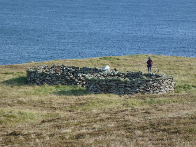
Geo of Bodista is a prominent coastal feature located on the western coast of Shetland, an archipelago in Scotland. It is specifically situated on the mainland of Shetland, near the village of Sandness. Geo of Bodista is primarily characterized as a headland or a point, jutting out into the North Atlantic Ocean.

The headland is known for its rugged and dramatic cliffs, which rise up to impressive heights, providing breathtaking views of the surrounding landscape. The cliffs are composed of layered sedimentary rocks, including sandstone and shale, which have been shaped and eroded by the relentless action of the sea over thousands of years.

At the base of the cliffs, there are several small, picturesque beaches, adorned with smooth pebbles and occasional stretches of golden sand. These beaches are popular with locals and visitors alike, offering opportunities for leisurely walks, sunbathing, and exploring the rich marine life in the rock pools.

The headland is also home to a variety of seabirds, including puffins, fulmars, and kittiwakes, which nest in the cliffs during the breeding season. Their presence adds to the area's natural beauty and makes it a haven for birdwatching enthusiasts.

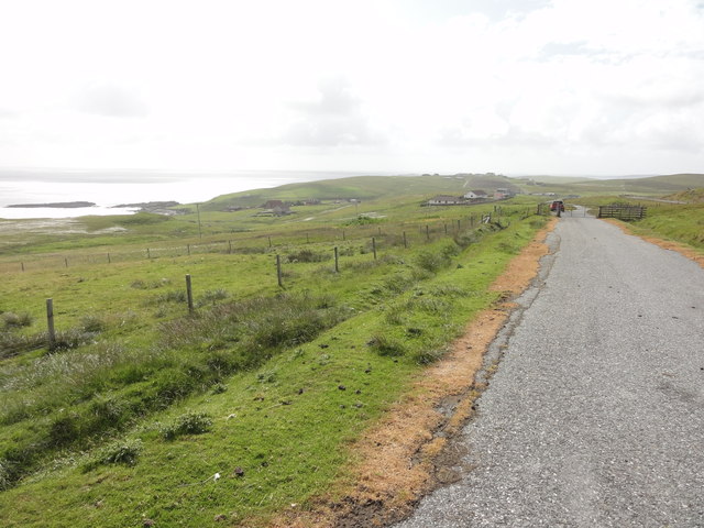
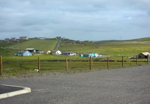
Geo of Bodista is easily accessible by road, with a car park nearby, providing convenient access to the headland. It is a popular destination for outdoor enthusiasts, hikers, and photographers, seeking to experience the raw beauty of Shetland's coastal landscape.

If you have any feedback on the listing, please let us know in the comments section below.

Geo of Bodista Images

Images are sourced within 2km of 60.055939/-1.2002441 or Grid Reference HU4430. Thanks to Geograph Open Source API. All images are credited.

Aith, Cunningsburgh, from the air
Greenmow and Helli Ness, Cunningsburgh, from the air
Aithsetter, Cunningsburgh, from the air
Ukinsetter, Fladdabister, from the air
A970 at Cunningsburgh Cunningsburgh, formerly also known as Coningsburgh (from the Old Norse: Konungsborgr meaning "King's castle"), is a hamlet on the coast of Mainland Shetland, nine miles south-west of Lerwick, about halfway between there and Sumburgh Head.
A970 at Cunningsburgh
Cunningsburgh, formerly also known as Coningsburgh (from the Old Norse: Konungsborgr meaning "King's castle"), is a hamlet on the coast of Mainland Shetland, nine miles south-west of Lerwick, about halfway between there and Sumburgh Head.
Bus Stop at Cunningsburgh Bus stop outside Cunningsburgh Primary School.
Bus Stop at Cunningsburgh
Bus stop outside Cunningsburgh Primary School.
Bus Stop on the A970 at Cunningsburgh Cunningsburgh, formerly also known as Coningsburgh (from the Old Norse: Konungsborgr meaning "King's castle"), is a hamlet on the coast of Mainland Shetland, nine miles south-west of Lerwick, about halfway between there and Sumburgh Head.
Bus Stop on the A970 at Cunningsburgh
Cunningsburgh, formerly also known as Coningsburgh (from the Old Norse: Konungsborgr meaning "King's castle"), is a hamlet on the coast of Mainland Shetland, nine miles south-west of Lerwick, about halfway between there and Sumburgh Head.
Burn Of Aith Broch This mound has been identified as the remains of a broch. <span class="nowrap"><a title="https://canmore.org.uk/site/939/burn-of-aith" rel="nofollow ugc noopener" href="https://canmore.org.uk/site/939/burn-of-aith">Link</a><img style="margin-left:2px;" alt="External link" title="External link - shift click to open in new window" src="https://s1.geograph.org.uk/img/external.png" width="10" height="10"/></span>
Burn Of Aith Broch
This mound has been identified as the remains of a broch. LinkExternal link
Aithsvoe Marina A very nice facility, built in 2004, still looking new.
The biggish boat off the water is the Mousa Ferry (Solan IV); both it <a href="https://www.geograph.org.uk/photo/1180671">HU4428 : Mousa ferry at winter home, Aithsvoe, Cunningsburgh</a> and the ferry business is up for sale (2011)
Aithsvoe Marina
A very nice facility, built in 2004, still looking new. The biggish boat off the water is the Mousa Ferry (Solan IV); both it HU4428 : Mousa ferry at winter home, Aithsvoe, Cunningsburgh and the ferry business is up for sale (2011)
Planticrubs Turri Ness These, usually round, structures are to be found all over Shetland.
The near one, in this case, is still in use (few are).
Traditionally used for growing Kale or Cabbages in shelter and protected from rabbits and livestock.
In this case all but a few red cabbage seedlings had been recently removed.
Nice old pictures here - <span class="nowrap"><a title="http://shetlopedia.com/Planticrubs" rel="nofollow ugc noopener" href="http://shetlopedia.com/Planticrubs">Link</a><img style="margin-left:2px;" alt="External link" title="External link - shift click to open in new window" src="https://s1.geograph.org.uk/img/external.png" width="10" height="10"/></span>
Planticrubs Turri Ness
These, usually round, structures are to be found all over Shetland. The near one, in this case, is still in use (few are). Traditionally used for growing Kale or Cabbages in shelter and protected from rabbits and livestock. In this case all but a few red cabbage seedlings had been recently removed. Nice old pictures here - LinkExternal link
Shetland Crub The Planticrub <a href="https://www.geograph.org.uk/photo/2622576">HU4529 : Planticrubs Turri Ness</a> here is in use. It is totally closed off to protect the cabbage plants.
Dot stands on the step used for access.
The tanker Loch Rannoch sits way out, biding her time.
Shetland Crub
The Planticrub HU4529 : Planticrubs Turri Ness here is in use. It is totally closed off to protect the cabbage plants. Dot stands on the step used for access. The tanker Loch Rannoch sits way out, biding her time.
View across pasture towards Cunningsburgh marina and beyond The stretch of water is Aith Voe
View across pasture towards Cunningsburgh marina and beyond
The stretch of water is Aith Voe
Pasture, and the head of Aith Voe at high tide, Cunningsburgh
Building haystacks, Gord
Beach at the head of Aith Voe
Aith Voe Looking north from the marina.
Aith Voe
Looking north from the marina.
Abandoned road near Fladdabister Old road no longer used near Fladdabister
Abandoned road near Fladdabister
Old road no longer used near Fladdabister
View towards Aithsetter View from the car park of a new farm and coffee shop which has recently opened beside the main road.
View towards Aithsetter
View from the car park of a new farm and coffee shop which has recently opened beside the main road.
Show me another place!

Geo of Bodista is located at Grid Ref: HU4430 (Lat: 60.055939, Lng: -1.2002441)

Unitary Authority: Shetland Islands

Police Authority: Highlands and Islands

What 3 Words

///skies.prawn.arching. Near Sandwick, Shetland Islands

Related Wikis

Aithsetter

Aithsetter (Old Norse: EiĆ°seti, meaning "the farm at the isthmus") is a village on the island of Mainland, in Shetland, Scotland. Aithsetter is in the...

Cunningsburgh

Cunningsburgh, formerly also known as Coningsburgh (Old Norse: Konungsborgr meaning "King's castle"), is a new hamlet and ancient parish in the south of...

Bremirehoull

Bremirehoull is a settlement on the island of Mainland, in Shetland, Scotland. Bremirehoull is situated on the A970 in the Cunningsburgh area. == References... ==

Mail, Shetland

Mail is a hamlet on the island of Mainland, in the Shetland Islands, Scotland. == Geography == Mail is located on the south-eastern side of the island...

Nearby Amenities

Located within 500m of 60.055939,-1.2002441
Power: pole
Lat/Long: 60.0547492/-1.2079355
Power: pole
Lat/Long: 60.0550479/-1.2069653
Power: pole
Lat/Long: 60.0545716/-1.2057225
Power: pole
Lat/Long: 60.0553096/-1.2074689
Power: pole
Lat/Long: 60.0555102/-1.2077391
Power: pole
Lat/Long: 60.0560695/-1.2085153
The data included in this document is from www.openstreetmap.org. The data is made available under ODbL.

Have you been to Geo of Bodista?

Leave your review of Geo of Bodista below (or comments, questions and feedback).