Birrier

Coastal Feature, Headland, Point in Shetland

Scotland

Birrier

Loch of Birriesgirt The north shore of this remote lake. In the distance you can see there is not much separating it from the cliff edge and the sea.
Loch of Birriesgirt Credit: Des Blenkinsopp

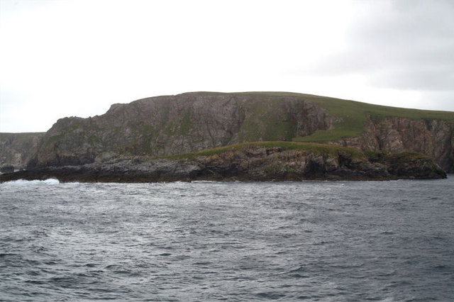
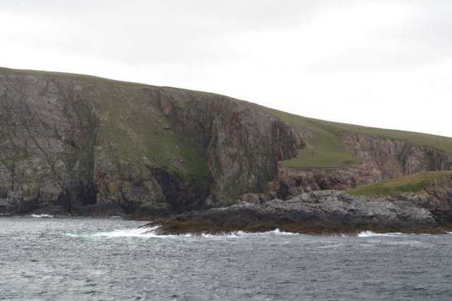
Birrier is a prominent coastal feature located in Shetland, an archipelago in Scotland. It is a headland or point that stretches out into the North Sea, situated on the western side of the main island, known as the Mainland.

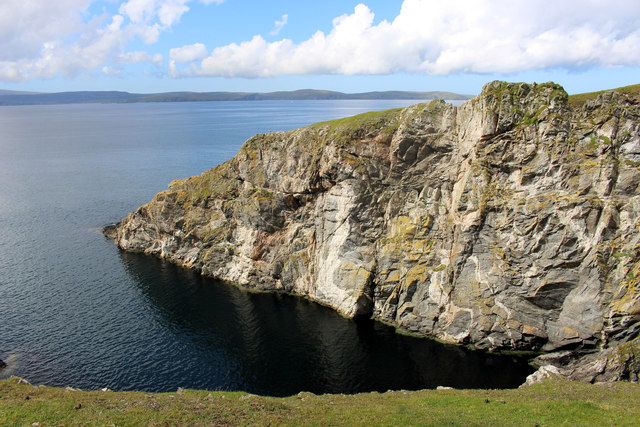
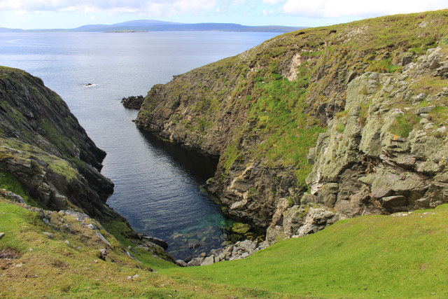
The geographical coordinates of Birrier are approximately 60.149°N latitude and 1.240°W longitude. It is situated on the western coast of the Mainland, close to the village of Walls. The headland is characterized by steep cliffs that rise from the sea, offering breathtaking views of the surrounding landscape.

Birrier is known for its rugged and wild beauty, with its rocky terrain and crashing waves making it a popular spot for nature lovers and photographers. The headland is home to a diverse range of seabirds, including puffins, guillemots, and razorbills, which nest on the cliffs during the breeding season. Visitors often come to Birrier to observe these fascinating creatures in their natural habitat.

The coastal area surrounding Birrier also boasts an abundance of marine life, making it a great spot for fishing and angling enthusiasts. The waters off the headland are teeming with various species of fish, including cod, haddock, and mackerel. Additionally, seals can often be spotted basking on the rocks or swimming nearby.

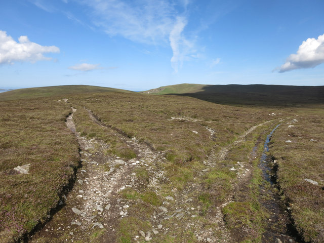
Birrier is easily accessible by road, with a nearby car park providing convenient parking for visitors. From the headland, one can enjoy panoramic views of the North Sea, as well as the surrounding cliffs and coastal landscape. Whether it's for birdwatching, fishing, or simply enjoying the raw beauty of the Shetland coastline, Birrier offers a captivating experience for all who visit.

If you have any feedback on the listing, please let us know in the comments section below.

Birrier Images

Images are sourced within 2km of 60.603401/-1.200951 or Grid Reference HU4391. Thanks to Geograph Open Source API. All images are credited.

Loch of Birriesgirt The north shore of this remote lake. In the distance you can see there is not much separating it from the cliff edge and the sea.
Loch of Birriesgirt
The north shore of this remote lake. In the distance you can see there is not much separating it from the cliff edge and the sea.
Towards Varnadil Not too bad walking around here. Mostly grassy, with scrubby heather in places, and a lot of sheep tracks to help visitors.
This was one of the wet bits.
Towards Varnadil
Not too bad walking around here. Mostly grassy, with scrubby heather in places, and a lot of sheep tracks to help visitors. This was one of the wet bits.
Barkie, of Birrier, Barkie and Slog There are three of these promontories side by side along here named Birrier, Barkie and Slog, like a firm of dodgy solicitors.
This is Barkie, the middle one.
Barkie, of Birrier, Barkie and Slog
There are three of these promontories side by side along here named Birrier, Barkie and Slog, like a firm of dodgy solicitors. This is Barkie, the middle one.
Birrier, of Birrier, Barkie and Slog There are three of these promontories side by side along here named Birrier, Barkie and Slog, like a firm of dodgy solicitors.
This is Birrier, the northern one.
Birrier, of Birrier, Barkie and Slog
There are three of these promontories side by side along here named Birrier, Barkie and Slog, like a firm of dodgy solicitors. This is Birrier, the northern one.
Slog, of Birrier, Barkie and Slog There are three of these promontories side by side along here named Birrier, Barkie and Slog, like a firm of dodgy solicitors.
This is Slog, the southern one.
Slog, of Birrier, Barkie and Slog
There are three of these promontories side by side along here named Birrier, Barkie and Slog, like a firm of dodgy solicitors. This is Slog, the southern one.
High Road or Low Road The high road looked the better option, although it wasn't shown on the map, but it petered out after about 1/4 mile.
High Road or Low Road
The high road looked the better option, although it wasn't shown on the map, but it petered out after about 1/4 mile.
A Small Loch Nameless on the 1:25000 sheet, but at maximum zoom on the input map the name Loch of Lungasta Quhamm appears.
A fine big name for quite a small loch.
A Small Loch
Nameless on the 1:25000 sheet, but at maximum zoom on the input map the name Loch of Lungasta Quhamm appears. A fine big name for quite a small loch.
Sky & Stones, Mill Loch
Cliffs at the Head Just north of West Sandwick. Taken from one of the Yell Sound ferries on a North Isles cruise.
Cliffs at the Head
Just north of West Sandwick. Taken from one of the Yell Sound ferries on a North Isles cruise.
Birrier There is apparently an ancient settlement on this promontory. Taken from one of the Yell Sound ferries on a North Isles cruise.
Birrier
There is apparently an ancient settlement on this promontory. Taken from one of the Yell Sound ferries on a North Isles cruise.
Sweinna Stack With the hill of Varnadil. Taken from one of the Yell Sound ferries on a North Isles cruise.
Sweinna Stack
With the hill of Varnadil. Taken from one of the Yell Sound ferries on a North Isles cruise.
Sweinna Stack The tongue of land behind the stack gives an idea of the topography of the land before erosion. Taken from one of the Yell Sound ferries on a North Isles cruise.
Sweinna Stack
The tongue of land behind the stack gives an idea of the topography of the land before erosion. Taken from one of the Yell Sound ferries on a North Isles cruise.
Point of Bugarth The two small stacks offshore which form the extreme of the headland are in the square. The Hill of Rulkie behind is in the next square. Taken from one of the Yell Sound ferries on a North Isles cruise.
Point of Bugarth
The two small stacks offshore which form the extreme of the headland are in the square. The Hill of Rulkie behind is in the next square. Taken from one of the Yell Sound ferries on a North Isles cruise.
Rulkies Hill, Graveland
Sweinna Stack
Sweinna Stack
Sweinna Stack
Sweinna Stack
Sweinna Stack from the south
Cliffs at The Head These cliffs are much more interesting from the landward side.  Walking is easy and the geology is fascinating.
Cliffs at The Head
These cliffs are much more interesting from the landward side. Walking is easy and the geology is fascinating.
Show me another place!

Birrier is located at Grid Ref: HU4391 (Lat: 60.603401, Lng: -1.200951)

Unitary Authority: Shetland Islands

Police Authority: Highlands and Islands

What 3 Words

///perfect.dynasties.dummy. Near Ulsta, Shetland Islands

Related Wikis

West Sandwick

West Sandwick is a settlement on the island of Yell, Shetland Islands, Scotland. It is one of the few settlements in the west of the island. West Sandwick...

Muckle Holm, Yell Sound

Muckle Holm is a small island in Shetland. It is in Yell Sound, near the Northmavine. It is 23 metres (75 ft) at its highest point. There is a lighthouse...

Yell Sound

Yell Sound is the strait running between Yell and Mainland, Shetland, Scotland. It is the boundary between the Mainland and the North Isles and it contains...

Ern Stack

Ern Stack is a sea stack off Yell, in Shetland, Scotland. The word "ern" means an eagle (it is a cognate of, for example, Swedish "örn"), and it is said...

Yell, Shetland

Yell (Scots: Yell) is one of the North Isles of Shetland, Scotland. In the 2011 census it had a usually resident population of 966. It is the second largest...

Little Holm, Yell Sound

Little Holm is a small island in Yell Sound, in Shetland, Scotland. It lies between Northmavine and the island of Yell. There is a lighthouse here. In...

Fethaland

Fethaland or Fedeland (pronounced [ˈfeɪdələnd]) is an abandoned settlement at the extreme north end of Mainland, Shetland. It was the site of the largest...

Mid Yell

Mid Yell is a coastal settlement on the island of Yell, the second largest of Shetland Islands, Scotland. Mid Yell, the largest settlement on the island...

Have you been to Birrier?

Leave your review of Birrier below (or comments, questions and feedback).