Lamar

Coastal Feature, Headland, Point in Shetland

Scotland

Lamar

The southern part of Houss Ness Seen from just south of the summit of Ward of Symbister.
The southern part of Houss Ness Credit: David Purchase

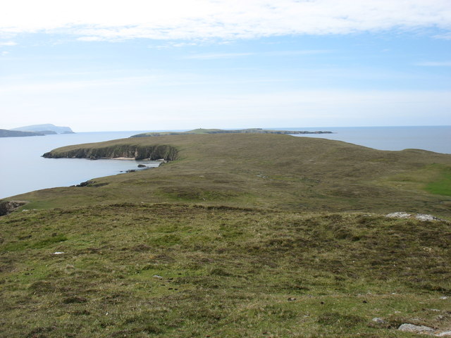
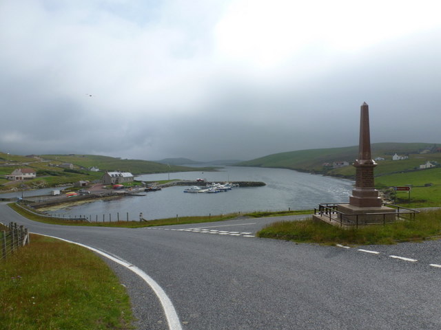
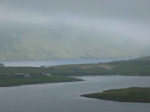
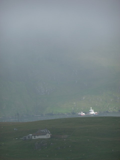
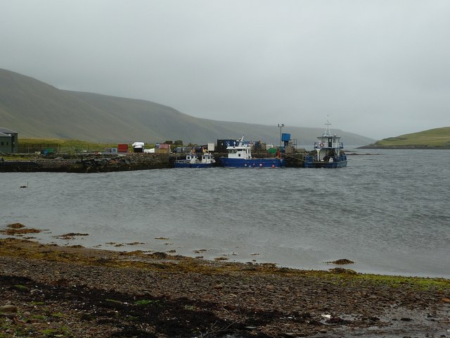
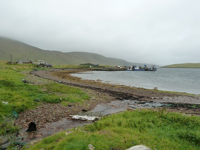
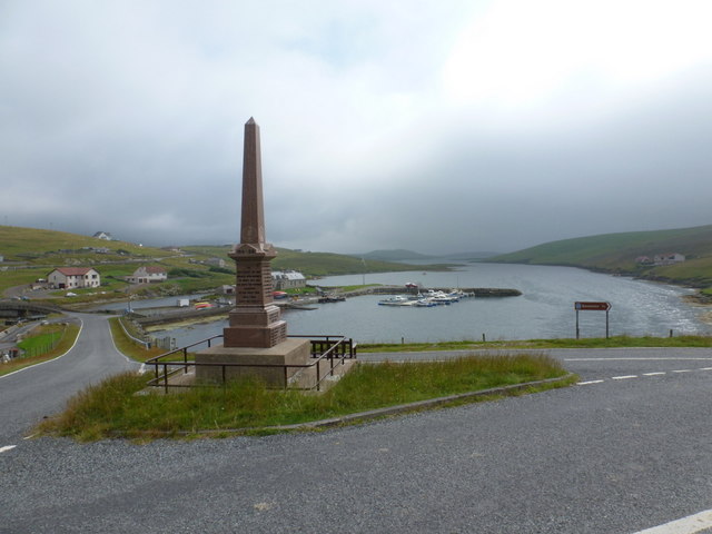
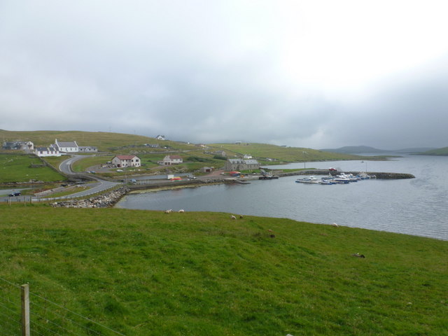
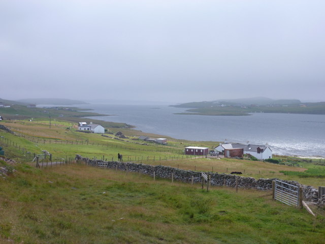
Lamar is a small coastal feature located in the Shetland Islands, which are part of Scotland. It is specifically classified as a headland or point, characterized by its prominent and elevated position jutting out into the sea. Lamar is situated on the eastern coast of Shetland, offering stunning views of the North Sea.

The headland is known for its rugged and rocky terrain, with towering cliffs that extend out into the ocean. The cliffs are composed of various types of sedimentary rock, including sandstone and shale, which have been shaped and eroded by the relentless force of the waves over time. This geological formation attracts many geology enthusiasts and provides a fascinating insight into the region's geological history.

Lamar is also home to a diverse range of marine life, making it a popular spot for wildlife enthusiasts and birdwatchers. The surrounding waters are teeming with various species of fish, seals, and seabirds, including puffins, gannets, and guillemots. Visitors can often observe these animals in their natural habitat, adding to the allure of the area.

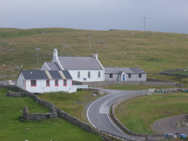
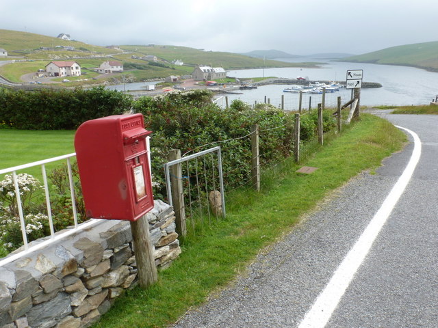
Access to Lamar is relatively easy, with a well-maintained path that leads visitors to the headland. However, caution is advised when exploring the cliffs, as they can be steep and unstable in certain areas. It is advisable to wear appropriate footwear and exercise caution when navigating the terrain.

Overall, Lamar is a captivating coastal feature in the Shetland Islands, offering visitors breathtaking views, rich geological history, and abundant wildlife. It is a must-visit destination for nature lovers and those seeking a unique and rugged coastal experience.

If you have any feedback on the listing, please let us know in the comments section below.

Lamar Images

Images are sourced within 2km of 60.066944/-1.3341571 or Grid Reference HU3731. Thanks to Geograph Open Source API. All images are credited.
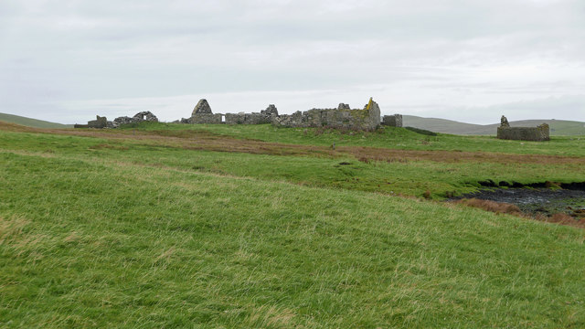
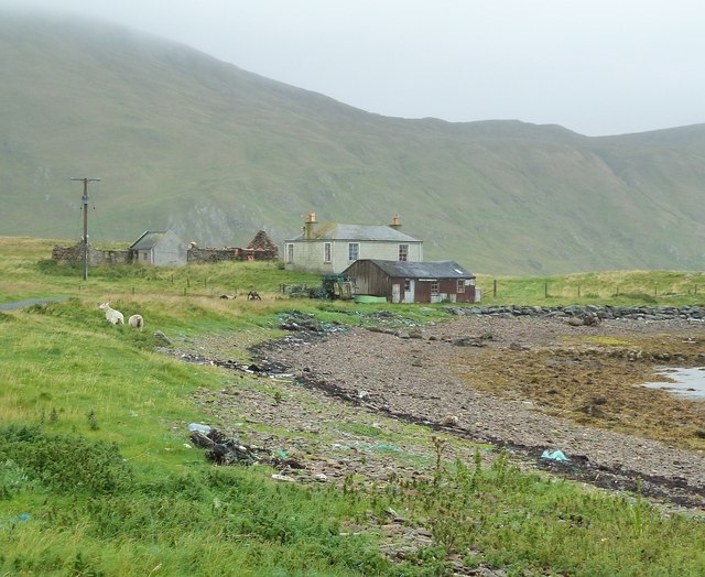
The southern part of Houss Ness Seen from just south of the summit of Ward of Symbister.
The southern part of Houss Ness
Seen from just south of the summit of Ward of Symbister.
At Gossigarth on Kettla Ness Looking towards Banna Minn and Duncansclett.
At Gossigarth on Kettla Ness
Looking towards Banna Minn and Duncansclett.
Symbister, East Burra An extensive set of ruined buildings.
Symbister, East Burra
An extensive set of ruined buildings.
Burnt Mound at Symbister One of three burnt mounds indicated on the 1:25,000 OS mapping.  This was a smaller mound.  Often features like this are marked on maps yet are hard to find. A Eureka moment followed after the  GPS location was checked. I understand the purpose of burnt mounds is a contentious issue.
Burnt Mound at Symbister
One of three burnt mounds indicated on the 1:25,000 OS mapping. This was a smaller mound. Often features like this are marked on maps yet are hard to find. A Eureka moment followed after the GPS location was checked. I understand the purpose of burnt mounds is a contentious issue.
Symbister This croft site was abandoned in the early 1950s largely because there was no road to it. [P. Guy, Walking the Coastline of Shetland, South Mainland, Shetland Times, Lerwick, 2000.]
Symbister
This croft site was abandoned in the early 1950s largely because there was no road to it. [P. Guy, Walking the Coastline of Shetland, South Mainland, Shetland Times, Lerwick, 2000.]
Derelict Croft The ruins of the croft at Gossigarth with Banna Minn showing behind
Derelict Croft
The ruins of the croft at Gossigarth with Banna Minn showing behind
West Burra: overlooking Bridge End A fine view past the war memorial and down South Voe, the marina nestling below.
West Burra: overlooking Bridge End
A fine view past the war memorial and down South Voe, the marina nestling below.
East Burra: the Baptist church Looking across the dip between the two Burras towards this small church on East Burra.
East Burra: the Baptist church
Looking across the dip between the two Burras towards this small church on East Burra.
East Burra: Houss from West Burra Looking across South Voe towards the scattered dwellings of Houss with the mighty slopes of Shetland's south mainland on the far side of Clift Sound beyond.
East Burra: Houss from West Burra
Looking across South Voe towards the scattered dwellings of Houss with the mighty slopes of Shetland's south mainland on the far side of Clift Sound beyond.
Houss: view from Papil Looking across the water separating West Burra (our side) from East Burra, on which we see a few of the buildings, one of them ruined, in the hamlet of Houss. Immediately to the south (right) of these is the narrow strip of land connecting Houss Ness to the 'main' part of East Burra. The Clift Hills, on the mainland, are the backdrop, shrouded in cloud.
Houss: view from Papil
Looking across the water separating West Burra (our side) from East Burra, on which we see a few of the buildings, one of them ruined, in the hamlet of Houss. Immediately to the south (right) of these is the narrow strip of land connecting Houss Ness to the 'main' part of East Burra. The Clift Hills, on the mainland, are the backdrop, shrouded in cloud.
Houss: a house with a dramatic backdrop Looking across to a Houss house, as it were, from West Burra. I haven't been able to exactly locate the house on the map but it's somewhere hereabouts. In the background, a couple of vessels, below the cliffs of the Clift Hills, are catching a very rare bit of sun today - the rarity of the fine weather hinted at by the low mist towards the top of the hills.
Houss: a house with a dramatic backdrop
Looking across to a Houss house, as it were, from West Burra. I haven't been able to exactly locate the house on the map but it's somewhere hereabouts. In the background, a couple of vessels, below the cliffs of the Clift Hills, are catching a very rare bit of sun today - the rarity of the fine weather hinted at by the low mist towards the top of the hills.
Boats at The Taing The boats seen here are moored at a yard on the east coast of the Voe of North House, on the small peninsula called The Taing on East Burra. East Burra is a very narrow island (as is West Burra) that is linked to Mainland Shetland via bridges to Trondra and West Burra. The bridge between West and East Burra is a simple stone arch bridge in Bridge End.
Boats at The Taing
The boats seen here are moored at a yard on the east coast of the Voe of North House, on the small peninsula called The Taing on East Burra. East Burra is a very narrow island (as is West Burra) that is linked to Mainland Shetland via bridges to Trondra and West Burra. The bridge between West and East Burra is a simple stone arch bridge in Bridge End.
The Taing and Voe of North House The Taing is a small promontory of East Burra island into Clift Sound, with the Voe of North House on the right. The little stream entering the Voe at this point is a drain from the small Loch of Houss a few hundred yards to the north.
A closer view of the end of the Taing can be seen here <a href="https://www.geograph.org.uk/photo/2586774">HU3831 : Boats at The Taing</a> and of the cottages on the left of the image, here <a href="https://www.geograph.org.uk/photo/2695373">HU3831 : Cottages on The Taing</a>
The Taing and Voe of North House
The Taing is a small promontory of East Burra island into Clift Sound, with the Voe of North House on the right. The little stream entering the Voe at this point is a drain from the small Loch of Houss a few hundred yards to the north. A closer view of the end of the Taing can be seen here HU3831 : Boats at The Taing and of the cottages on the left of the image, here HU3831 : Cottages on The Taing
Cottages on The Taing A cluster of current and former dwellings at the northern end of The Taing, a small promontory of East Burra island. The Clift Hills of Mainland Shetland rise up behind them as a quite dramatic backdrop.
Cottages on The Taing
A cluster of current and former dwellings at the northern end of The Taing, a small promontory of East Burra island. The Clift Hills of Mainland Shetland rise up behind them as a quite dramatic backdrop.
West Burra: war memorial The war memorial at Bridge End stands at a fantastic viewpoint as we look beyond it down South Voe, separating East Burra (left) from West Burra.
West Burra: war memorial
The war memorial at Bridge End stands at a fantastic viewpoint as we look beyond it down South Voe, separating East Burra (left) from West Burra.
West Burra: postbox № ZE2 14, Bridge End This small postbox serves the southern villages of West Burra, as well as East Burra, and is emptied each weekday and Saturday morning at half past seven.
West Burra: postbox № ZE2 14, Bridge End
This small postbox serves the southern villages of West Burra, as well as East Burra, and is emptied each weekday and Saturday morning at half past seven.
West Burra: the marina Looking down on the marina, which is at the head of South Voe which separates the island of West Burra from East Burra (background).
West Burra: the marina
Looking down on the marina, which is at the head of South Voe which separates the island of West Burra from East Burra (background).
East Burra: view down South Voe Looking down South Voe, the long inlet separating the islands of East Burra and West Burra.
East Burra: view down South Voe
Looking down South Voe, the long inlet separating the islands of East Burra and West Burra.
Show me another place!

Lamar is located at Grid Ref: HU3731 (Lat: 60.066944, Lng: -1.3341571)

Unitary Authority: Shetland Islands

Police Authority: Highlands and Islands

What 3 Words

///ports.apricot.dares. Near Scalloway, Shetland Islands

Related Wikis

West Burra

West Burra is one of the Scalloway Islands, a subgroup of the Shetland Islands in Scotland. It is connected by bridge to East Burra. With an area of 743...

Burra, Shetland

Burra (Old Norse: Barrey) is the collective name for two of the Shetland Islands, West (pop. 753) and East Burra (pop. 66), which are connected by bridge...

Scalloway Islands

The Scalloway Islands are in Shetland opposite Scalloway on south west of the Mainland. They form a mini-archipelago and include: Burra (two islands linked...

East Burra

East Burra (Old Norse: Barrey) is one of the Scalloway Islands, a subgroup of the Shetland Islands in Scotland. It is connected by a bridge to West Burra...

Nearby Amenities

Located within 500m of 60.066944,-1.3341571
Papil
Place: hamlet
Lat/Long: 60.0657494/-1.3377553
Power: pole
Lat/Long: 60.0644322/-1.3268137
Power: pole
Lat/Long: 60.0651617/-1.3272885
Power: pole
Lat/Long: 60.0655057/-1.3268727
Power: pole
Lat/Long: 60.0659715/-1.3263819
Power: pole
Lat/Long: 60.0664519/-1.3258535
Power: pole
Lat/Long: 60.070384/-1.3388997
Power: pole
Lat/Long: 60.0697991/-1.3388729
Power: pole
Lat/Long: 60.069233/-1.3388354
Power: pole
Lat/Long: 60.0685452/-1.3388193
Power: pole
Lat/Long: 60.0679442/-1.3387978
Power: pole
Lat/Long: 60.0674718/-1.3387951
Power: pole
Lat/Long: 60.0668816/-1.3387603
Power: pole
Lat/Long: 60.0656507/-1.3391055
Power: pole
Lat/Long: 60.0650708/-1.3394268
Power: pole
Lat/Long: 60.0637817/-1.3401979
Power: pole
Lat/Long: 60.0683579/-1.3401695
Power: pole
Lat/Long: 60.0680578/-1.3255483
Power: pole
Lat/Long: 60.0683441/-1.3268433
The data included in this document is from www.openstreetmap.org. The data is made available under ODbL.

Have you been to Lamar?

Leave your review of Lamar below (or comments, questions and feedback).