Brunt Head

Coastal Feature, Headland, Point in Shetland

Scotland

Brunt Head

The Nev, Fitful Head, from the air With a view to Ward of Scousburgh
The Nev, Fitful Head, from the air Credit: Mike Pennington

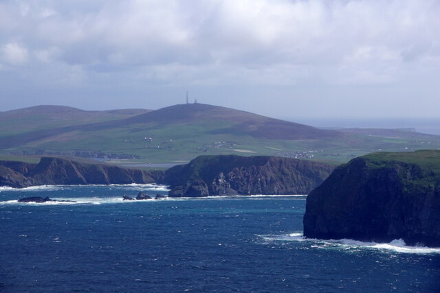
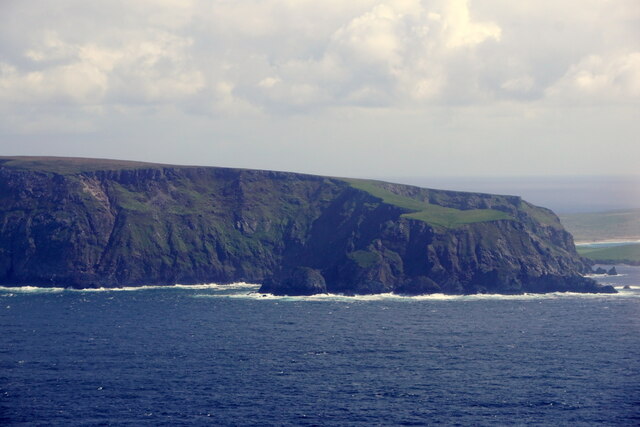
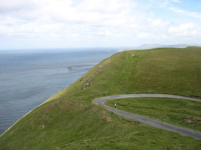
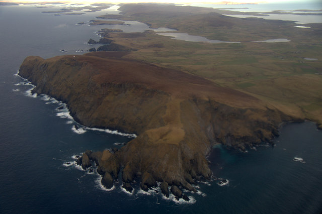
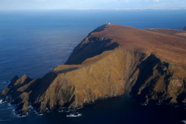
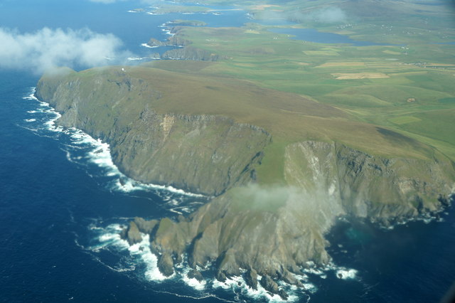
Brunt Head, located in the Shetland Islands, is a prominent coastal feature that stands as a majestic headland jutting out into the North Sea. This rocky point is situated on the eastern side of the Shetland mainland, near the small community of Sandwick.

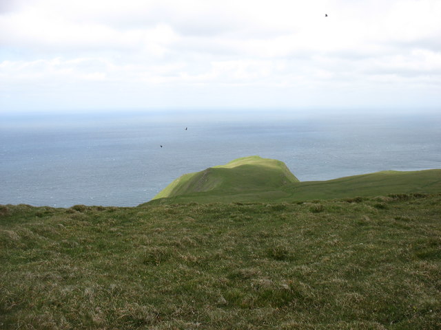
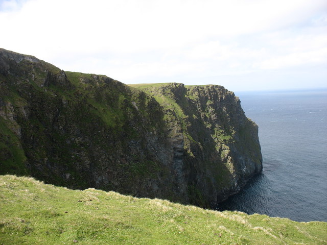
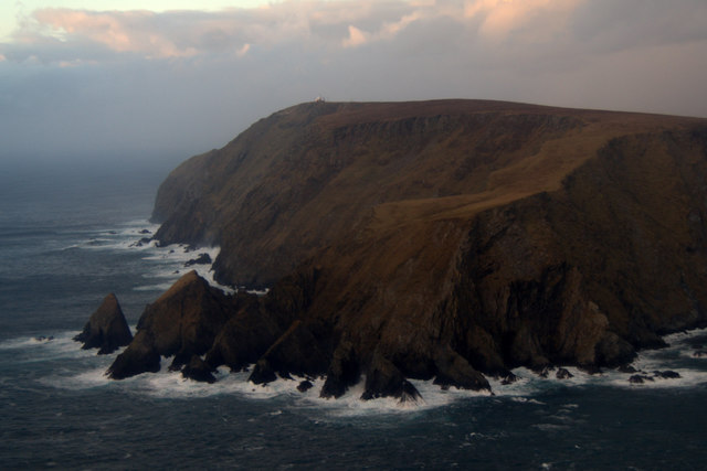
Rising to an impressive height of approximately 40 meters, Brunt Head commands breathtaking views of the surrounding rugged coastline and the vast expanse of the North Sea. Its sheer cliffs, composed of layered sedimentary rocks, are constantly being shaped by the relentless forces of wind and waves. Over the centuries, this powerful erosion has sculpted the headland into its current form, creating dramatic sea caves and arches that are a sight to behold.

The area surrounding Brunt Head is a haven for wildlife, with numerous seabird colonies nesting on the cliffs. Species such as puffins, guillemots, and razorbills can be spotted during the breeding season, adding to the natural beauty and charm of the headland. Additionally, the surrounding waters are frequented by seals, dolphins, and even occasional sightings of whales, making it a popular spot for wildlife enthusiasts and photographers.

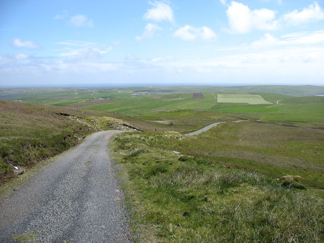
Access to Brunt Head is relatively easy, with a well-maintained coastal path leading to the headland. The path offers stunning views along the way, allowing visitors to fully appreciate the wild and untamed beauty of this coastal gem. Whether it's to admire the breathtaking scenery, observe the diverse wildlife, or simply enjoy a peaceful walk by the sea, Brunt Head is a must-visit destination for nature lovers and adventure seekers alike.

If you have any feedback on the listing, please let us know in the comments section below.
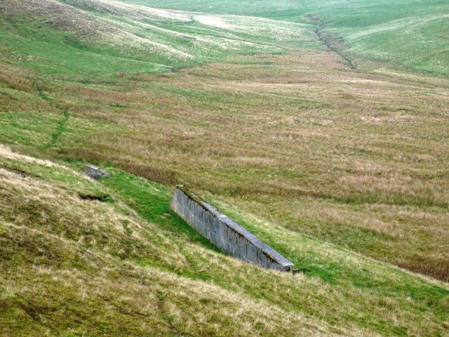
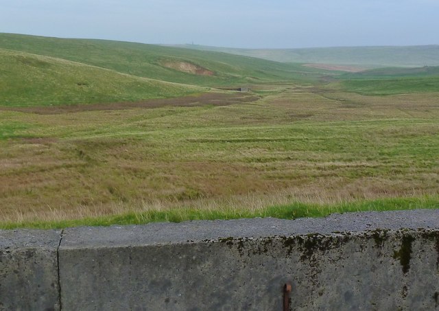
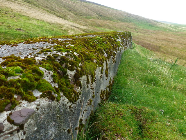
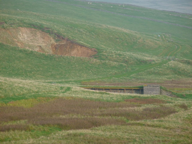
Brunt Head Images

Images are sourced within 2km of 59.90156/-1.3835693 or Grid Reference HU3413. Thanks to Geograph Open Source API. All images are credited.

The Nev, Fitful Head, from the air With a view to Ward of Scousburgh
The Nev, Fitful Head, from the air
With a view to Ward of Scousburgh
Fitful Head from the air
Whales Wick, Fitful Head, from the air
The Ords, Fitful Head
Cliffs at The Nev, north of Fitful Head
The bend in the track There is a well-graded track up to the communications masts on Fitful Head. Clearly, it is not open to the public to drive up, but it is an easy walk from Quendale. At this point, there is a sharp bend. Coming down, I certainly would not want to lose control here, or miss the turn in mist. The consequences are pretty clear!

I think that the rocks just left of centre must be Swarta Skerry, in <a href="https://www.geograph.org.uk/gridref/HU3415">HU3415</a>.
The bend in the track
There is a well-graded track up to the communications masts on Fitful Head. Clearly, it is not open to the public to drive up, but it is an easy walk from Quendale. At this point, there is a sharp bend. Coming down, I certainly would not want to lose control here, or miss the turn in mist. The consequences are pretty clear! I think that the rocks just left of centre must be Swarta Skerry, in HU3415.
The track from Fitful Head A well-graded track serves the communications station on Fitful Head. Clearly, it is not open to the public to drive, but it gives an easy walk. This is looking back downhill towards Quendale.
The track from Fitful Head
A well-graded track serves the communications station on Fitful Head. Clearly, it is not open to the public to drive, but it gives an easy walk. This is looking back downhill towards Quendale.
Garth Wick from the air Taken from a plane just after take-off from Sumburgh Airport. The Lochs of Spiggie and Brow are obvious in the distance.
Garth Wick from the air
Taken from a plane just after take-off from Sumburgh Airport. The Lochs of Spiggie and Brow are obvious in the distance.
Siggar Ness and Fitful Head from the air
Siggar Ness and Fitful Head from the air Taken from a plane coming in to land at Sumburgh Airport.
Siggar Ness and Fitful Head from the air
Taken from a plane coming in to land at Sumburgh Airport.
Siggar Ness and Fitful Head from the air Taken from a plane just after take-off from Sumburgh Airport. There is snow on the west Mainland of Shetland in the distance.
Siggar Ness and Fitful Head from the air
Taken from a plane just after take-off from Sumburgh Airport. There is snow on the west Mainland of Shetland in the distance.
Siggar Ness and Fitful Head from the air
At Garths Ness - Wreck of the oil tanker 'MV Braer' (1994) This what was left of the MV Braer by July 1994. the surrounding landscape had made a remarkable recovery due to the rough nature of the weather in this area. The following is from Wikipedia:
At 05.19 hrs on Tuesday 5 January 1993, Lerwick coastguard were advised that the tanker, Braer, en route from Bergen, Norway to Quebec, Canada, laden with 85,000 tonnes of Norwegian Gullfaks crude oil, had lost engine power but was in no immediate danger. Her estimated position then was 10 miles (19 km) south of Sumburgh Head and she was drifting in predominantly southwesterly winds of force 10–11. The coastguard alerted rescue helicopters from Sumburgh and RAF Lossiemouth, and made enquiries about the availability of local tugs. At the Coast Guard's suggestion, the master agreed that non-essential personnel should be removed from the vessel—14 of the 34 crew were taken off by the coastguard helicopter from Sumburgh at 08:25.

At 08:50 it was feared that the ship would run aground near Horse Island, and the experience of Aegean Sea which burst into flames shortly after grounding led the coastguard to persuade the Greek Captain Alexandros S. Gkelis to abandon ship. However, because of strong northwest local currents, Braer moved against the prevailing wind and missed Horse Island, drifting towards Quendale Bay.

With the arrival on scene of the anchor handling vessel Star Sirius, it was decided to attempt to establish a tow. The master and some personnel were taken out by helicopter and were put back on board the vessel. Efforts to attach a heaving line were unsuccessful, and at 11:19 the vessel was confirmed as being grounded at Garths Ness, with oil being seen to flow out into the sea from the moment of impact. At this time, the would-be rescue team were rescued by the helicopter.
At Garths Ness - Wreck of the oil tanker 'MV Braer' (1994)
This what was left of the MV Braer by July 1994. the surrounding landscape had made a remarkable recovery due to the rough nature of the weather in this area. The following is from Wikipedia: At 05.19 hrs on Tuesday 5 January 1993, Lerwick coastguard were advised that the tanker, Braer, en route from Bergen, Norway to Quebec, Canada, laden with 85,000 tonnes of Norwegian Gullfaks crude oil, had lost engine power but was in no immediate danger. Her estimated position then was 10 miles (19 km) south of Sumburgh Head and she was drifting in predominantly southwesterly winds of force 10–11. The coastguard alerted rescue helicopters from Sumburgh and RAF Lossiemouth, and made enquiries about the availability of local tugs. At the Coast Guard's suggestion, the master agreed that non-essential personnel should be removed from the vessel—14 of the 34 crew were taken off by the coastguard helicopter from Sumburgh at 08:25. At 08:50 it was feared that the ship would run aground near Horse Island, and the experience of Aegean Sea which burst into flames shortly after grounding led the coastguard to persuade the Greek Captain Alexandros S. Gkelis to abandon ship. However, because of strong northwest local currents, Braer moved against the prevailing wind and missed Horse Island, drifting towards Quendale Bay. With the arrival on scene of the anchor handling vessel Star Sirius, it was decided to attempt to establish a tow. The master and some personnel were taken out by helicopter and were put back on board the vessel. Efforts to attach a heaving line were unsuccessful, and at 11:19 the vessel was confirmed as being grounded at Garths Ness, with oil being seen to flow out into the sea from the moment of impact. At this time, the would-be rescue team were rescued by the helicopter.
Fitful Head: view from a few miles east Looking out from the Northlink ferry to Aberdeen as cloud covers Fitful Head on a beautiful sunny evening.
Fitful Head: view from a few miles east
Looking out from the Northlink ferry to Aberdeen as cloud covers Fitful Head on a beautiful sunny evening.
Mystery Feature An absolute mystery when first located, but close investigation revealed its identity.
It turns out to be a Protective Wall for a Target Zone on an old disused firing range (some evidence here <a href="https://www.geograph.org.uk/photo/2622204">HU3513 : Blitzed Target Zone</a>.
It faces another Target Zone (down-range) about 450 metres away; see - <a href="https://www.geograph.org.uk/photo/2622226">HU3613 : Unmarked Feature</a>.
The platform (maybe planks) on which the targets stood, is missing.
Mystery Feature
An absolute mystery when first located, but close investigation revealed its identity. It turns out to be a Protective Wall for a Target Zone on an old disused firing range (some evidence here HU3513 : Blitzed Target Zone. It faces another Target Zone (down-range) about 450 metres away; see - HU3613 : Unmarked Feature. The platform (maybe planks) on which the targets stood, is missing.
Fire Wall This is the protective wall at a Target Zone on an old disused firing range.
There are no names, nor designations, on the map, nor references (that I could find) on the Internet.
Looking from this protective wall, across the valley, one can see another obvious Target Zone <a href="https://www.geograph.org.uk/photo/2622226">HU3613 : Unmarked Feature</a> - centre and to the right of the quarry.
This Fire Wall but not the Target Zone is shown on the OS map.
Fire Wall
This is the protective wall at a Target Zone on an old disused firing range. There are no names, nor designations, on the map, nor references (that I could find) on the Internet. Looking from this protective wall, across the valley, one can see another obvious Target Zone HU3613 : Unmarked Feature - centre and to the right of the quarry. This Fire Wall but not the Target Zone is shown on the OS map.
Blitzed Target Zone The front edge of the protective wall, behind which, on a raised platform I assume, targets stood.
The 'blitzing' suggests that a lot of 'incoming fire' had raked the wall, as the rear edges and the protected front ones appear as sharp as new. The whole area must have been used for weapon training.
Blitzed Target Zone
The front edge of the protective wall, behind which, on a raised platform I assume, targets stood. The 'blitzing' suggests that a lot of 'incoming fire' had raked the wall, as the rear edges and the protected front ones appear as sharp as new. The whole area must have been used for weapon training.
Unmarked Feature In the field I could find no direct evidence on the OS maps for such an obvious feature (unlike the one mentioned below). A later desktop search found a small trace-mark on the larger-scale maps.
It is the sheltered Target Zone on a rifle range and linked to - <a href="https://www.geograph.org.uk/photo/2622169">HU3513 : Mystery Feature</a>.
Unmarked Feature
In the field I could find no direct evidence on the OS maps for such an obvious feature (unlike the one mentioned below). A later desktop search found a small trace-mark on the larger-scale maps. It is the sheltered Target Zone on a rifle range and linked to - HU3513 : Mystery Feature.
Show me another place!

Brunt Head is located at Grid Ref: HU3413 (Lat: 59.90156, Lng: -1.3835693)

Unitary Authority: Shetland Islands

Police Authority: Highlands and Islands

What 3 Words

///snooty.violinist.parkland. Near Sumburgh, Shetland Islands

Related Wikis

Fitful Head

Fitful Head is a 283-metre-high (928 ft) headland at the southwest corner of Mainland, Shetland, Scotland, some 6 kilometres (3.7 mi) northwest of the...

MV Braer

The MV Braer was an oil tanker which ran aground during a storm off Shetland, Scotland, in January 1993, and nearly a week later broke up during the most...

Lochs of Spiggie and Brow

The Lochs of Spiggie and Brow are located west of Boddam in the parish of Dunrossness, in the South Mainland of Shetland, Scotland, about 6 km north of...

Toab, Shetland

Toab is the southernmost village on Mainland, Shetland, Scotland. It is part of Virkie and overlooks Sumburgh Airport. Toab is within the parish of Dunrossness...

Nearby Amenities

Located within 500m of 59.90156,-1.3835693
Fitful Head
Corbett: no
Ele: 283
Graham: no
Marilyn: yes
Munro: no
Natural: peak
Prominence: 270
Lat/Long: 59.9058125/-1.3821974
Power: pole
Lat/Long: 59.9044332/-1.3771558
Power: pole
Lat/Long: 59.9052913/-1.3812837
Power: pole
Lat/Long: 59.9046591/-1.378167
Power: pole
Lat/Long: 59.9050721/-1.3801733
Power: pole
Lat/Long: 59.9048555/-1.3792184
Man Made: survey_point
Lat/Long: 59.9055535/-1.3826624
Power: pole
Lat/Long: 59.9054702/-1.3820884
The data included in this document is from www.openstreetmap.org. The data is made available under ODbL.

Have you been to Brunt Head?

Leave your review of Brunt Head below (or comments, questions and feedback).