Crag Point

Coastal Feature, Headland, Point in Northumberland

England

Crag Point

On the beach at Seaton Sluice The tidal part of the beach makes for much easier walking but is separated from the upper part of the beach by a more or less continuous channel which is a little tricky to cross. Furthermore this channel drains to the sea through a number of rivulets at right angles to the coast, thereby further impeding progress.
On the beach at Seaton Sluice Credit: Oliver Dixon

Crag Point is a prominent headland located on the Northumberland coast in northeastern England. Situated near the village of Boulmer, it is a notable feature along this stretch of rugged coastline.

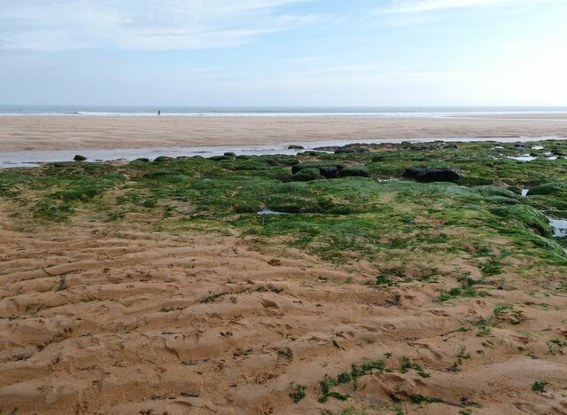
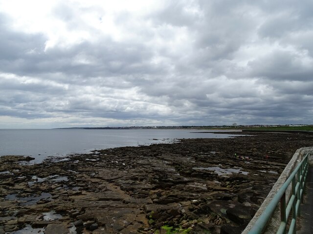
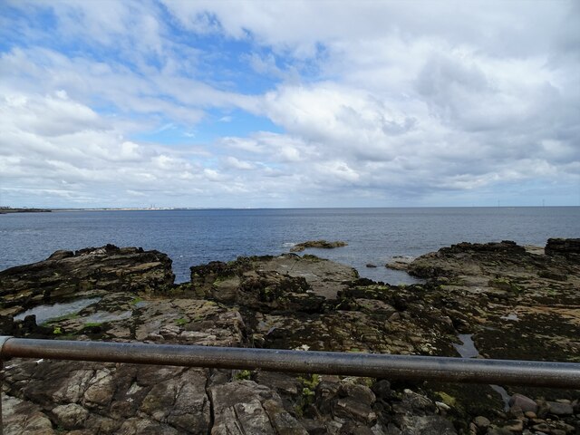
The headland is characterized by its towering cliffs that rise sharply from the sea, reaching heights of up to 30 meters (98 feet). These cliffs are composed primarily of sedimentary rocks, such as sandstone and limestone, which have been shaped and eroded by the relentless action of the North Sea over centuries.

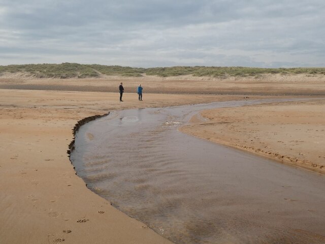
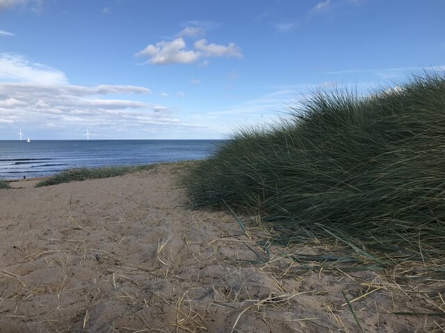
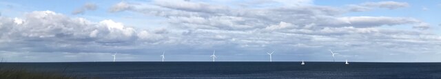
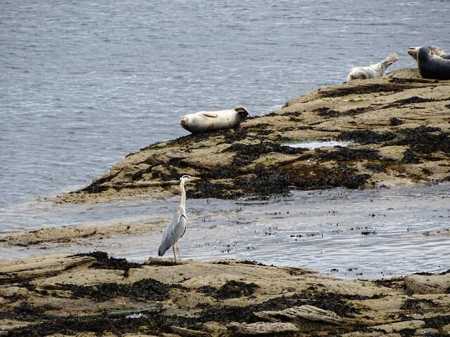
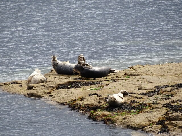
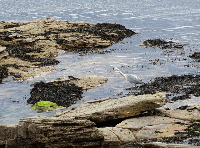
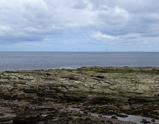
Crag Point offers breathtaking panoramic views of the surrounding coastline and the expansive North Sea. On a clear day, visitors can see as far as the Farne Islands, a group of small uninhabited islands that are home to a diverse range of bird species. The headland also provides a vantage point for observing marine wildlife, including seals and dolphins, which are often spotted swimming in the nearby waters.

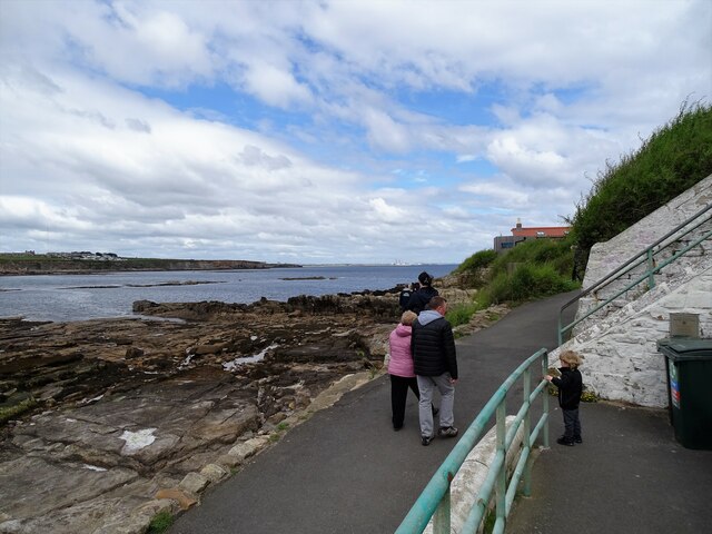
The area is a popular destination for nature enthusiasts, hikers, and photographers due to its dramatic cliffs, picturesque landscapes, and abundant wildlife. Crag Point is part of the Northumberland Coast Area of Outstanding Natural Beauty, ensuring its preservation and protection for future generations to enjoy.

Access to Crag Point is possible via a footpath that leads from Boulmer village, offering a pleasant coastal walk for visitors. However, caution is advised near the cliff edges, as they can be unstable and pose a danger.

If you have any feedback on the listing, please let us know in the comments section below.
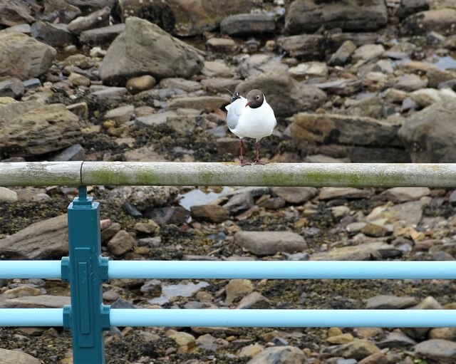
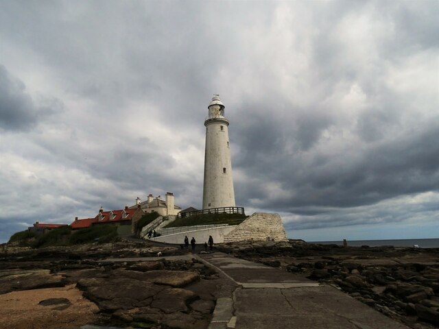
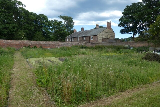
Crag Point Images

Images are sourced within 2km of 55.079546/-1.46369 or Grid Reference NZ3476. Thanks to Geograph Open Source API. All images are credited.

On the beach at Seaton Sluice The tidal part of the beach makes for much easier walking but is separated from the upper part of the beach by a more or less continuous channel which is a little tricky to cross. Furthermore this channel drains to the sea through a number of rivulets at right angles to the coast, thereby further impeding progress.
On the beach at Seaton Sluice
The tidal part of the beach makes for much easier walking but is separated from the upper part of the beach by a more or less continuous channel which is a little tricky to cross. Furthermore this channel drains to the sea through a number of rivulets at right angles to the coast, thereby further impeding progress.
Beach at Seaton Sluice
Sand dunes at Hartley Links
View of Blyth Offshore Wind Farm from Hartley Links
St Mary's Lighthouse Viewed at low tide when the lighthouse on St Mary's Island can be accessed on the concrete causeway to the right of the photo.
St Mary's Lighthouse
Viewed at low tide when the lighthouse on St Mary's Island can be accessed on the concrete causeway to the right of the photo.
View down the coast Looking south down the length of Whitley Bay from near St Mary's Island. The view is all the down to the Lighthouse on the end of South Shields pier.
View down the coast
Looking south down the length of Whitley Bay from near St Mary's Island. The view is all the down to the Lighthouse on the end of South Shields pier.
Looking along the promenade Looking north along the promenade at the north end of Whitley Bay. The promenade runs to the causeway to St Mary's Island.
Looking along the promenade
Looking north along the promenade at the north end of Whitley Bay. The promenade runs to the causeway to St Mary's Island.
Promenade to Curry's Point The promenade leads to the causeway to St Mary's Island, seen here with its lighthouse. This is the northern point of Whitley Bay.
Promenade to Curry's Point
The promenade leads to the causeway to St Mary's Island, seen here with its lighthouse. This is the northern point of Whitley Bay.
Gull on the railings A Black Headed Gull on the promenade railings near St Mary's Island at Whitley Bay. Note that this bird has been ringed.
Gull on the railings
A Black Headed Gull on the promenade railings near St Mary's Island at Whitley Bay. Note that this bird has been ringed.
View down the coast from St Mary's Island A view south down the coast past Whitley Bay, Tynemouth, South Shields and Marsden.
View down the coast from St Mary's Island
A view south down the coast past Whitley Bay, Tynemouth, South Shields and Marsden.
Across the causeway to the Lighthouse The lighthouse on St Mary's Island is accessible at low tide across the causeway.
Across the causeway to the Lighthouse
The lighthouse on St Mary's Island is accessible at low tide across the causeway.
Vegetable gardens at Seaton Delaval Located at one end of the car park away from the hall.
Vegetable gardens at Seaton Delaval
Located at one end of the car park away from the hall.
Looking up the coast from St Mary's Island A good view north past Blyth and Ellington.
Looking up the coast from St Mary's Island
A good view north past Blyth and Ellington.
Grey Seals at St Mary's Island The little island at the north end of Whitley Bay is an excellent place to see close views of Grey Seals. They haul out on the rocks here at low tide. A Heron doing a spot of fishing also.
Grey Seals at St Mary's Island
The little island at the north end of Whitley Bay is an excellent place to see close views of Grey Seals. They haul out on the rocks here at low tide. A Heron doing a spot of fishing also.
Path up to St Mary's Island Access path at the end of the causeway. Good view up the coast from here also.
Path up to St Mary's Island
Access path at the end of the causeway. Good view up the coast from here also.
Basking seals A group of Grey Seals on the rocks at St Mary's Island. This is a great place to see close up views of these animals. Disturbance by unthinking people and their dogs is a problem however. They were quite undisturbed on this occasion, which could be a hopeful sign.
Basking seals
A group of Grey Seals on the rocks at St Mary's Island. This is a great place to see close up views of these animals. Disturbance by unthinking people and their dogs is a problem however. They were quite undisturbed on this occasion, which could be a hopeful sign.
Grey Heron at St Mary's Island This little island is a great place to see birds and seals at close quarters.
Grey Heron at St Mary's Island
This little island is a great place to see birds and seals at close quarters.
View of wind turbines from St Mary's Island Sea view from the island showing some of the turbines of the Blyth Offshore Wind Farm.
View of wind turbines from St Mary's Island
Sea view from the island showing some of the turbines of the Blyth Offshore Wind Farm.
Show me another place!

Crag Point is located at Grid Ref: NZ3476 (Lat: 55.079546, Lng: -1.46369)

Unitary Authority: Northumberland

Police Authority: Northumbria

What 3 Words

///chop.layers.relax. Near Seaton Delaval, Northumberland

Nearby Locations

Crag Point Collywell Bay

Related Wikis

Collywell Bay railway station

Collywell Bay was a railway station constructed in 1913–14 to serve a planned branch line terminating at Seaton Sluice. Although the line was built, the...

Seaton Sluice

Seaton Sluice is a village in Northumberland. It lies on the coast at the mouth of the Seaton Burn (a small river), midway between Whitley Bay and Blyth...

Hartley, Northumberland

Hartley is a village and former civil parish, now in the parish of Seaton Valley in Northumberland, England. The village lies on the A193 road 4 miles...

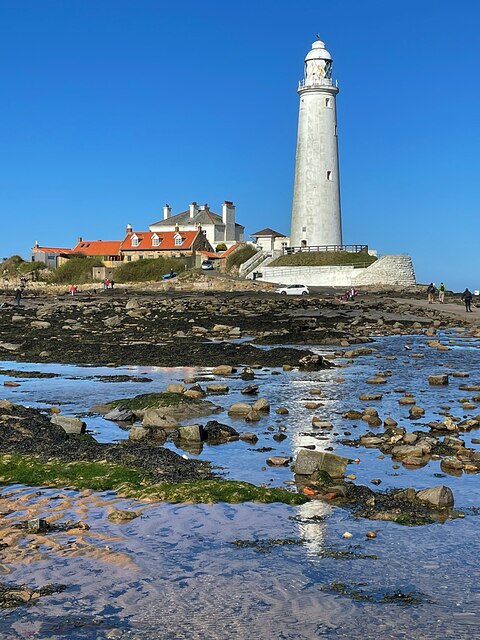
St Mary's Island (Tyne and Wear)

St Mary's Island, sometimes referred to as Bait Island is a small sandstone island near the seaside resort of Whitley Bay, Tyne and Wear, England. It is...

Nearby Amenities

Located within 500m of 55.079546,-1.46369
Old Hartley
Place: village
Wikidata: Q3783557
Lat/Long: 55.0771317/-1.4680176
Crag Point
Place: locality
Lat/Long: 55.078952/-1.4624627
Noexit: yes
Lat/Long: 55.0782387/-1.4710436
Noexit: yes
Lat/Long: 55.0770714/-1.4683101
Crossing
Crossing: unmarked
Crossing Island: yes
Lat/Long: 55.0798102/-1.4713631
Communication Mobile Phone: yes
Man Made: mast
Operator: O2
Ref: 75301
Tower Type: communication
Lat/Long: 55.0770236/-1.4685472
Bus: yes
Public Transport: stop_position
Lat/Long: 55.0775207/-1.4692044
Bus Stop
HARTLEY SQUARE
Bench: yes
Bin: yes
Bus: yes
Departures Board: timetable
Naptan AtcoCode: 3100Z339760
Naptan CommonName: Hartley Square
Naptan Indicator: northbound
Naptan Landmark: Old Hartley roundabout
Naptan NaptanCode: nldajwpj
Naptan Street: Beresford Road
Naptan Verified: no
Public Transport: platform
Shelter: yes
Lat/Long: 55.0774127/-1.4692244
Bus Stop
Old Hartley, Hartley Square
Bench: yes
Bin: yes
Bus: yes
Departures Board: timetable
Naptan AtcoCode: 3100Z340759
Naptan CommonName: Hartley Square
Naptan Indicator: sb
Naptan Landmark: Old Hartley roundabout
Naptan NaptanCode: nldgagtd
Naptan Street: Beresford Road
Naptan Verified: no
Public Transport: platform
Shelter: yes
Lat/Long: 55.0769378/-1.4684588
Waste Basket
Colour: black
Lat/Long: 55.0753812/-1.4648977
Bus: yes
Bus Bay: right
Public Transport: stop_position
Lat/Long: 55.0768434/-1.4685555
Waste Basket
Lat/Long: 55.0769717/-1.4684975
Defibrillator
Emergency: defibrillator
Indoor: no
Lat/Long: 55.0760343/-1.4672542
Crossing
Button Operated: yes
Crossing: traffic_signals
Tactile Paving: yes
Lat/Long: 55.0770905/-1.468783
Traffic Signals
Lat/Long: 55.0770567/-1.4687535
Traffic Signals
Lat/Long: 55.0771212/-1.4688139
Generator Method: photovoltaic
Generator Output Electricity: yes
Generator Source: solar
Generator Type: solar_photovoltaic_panel
Power: generator
Lat/Long: 55.0759772/-1.4682332
Generator Method: photovoltaic
Generator Output Electricity: yes
Generator Source: solar
Generator Type: solar_photovoltaic_panel
Power: generator
Lat/Long: 55.0770805/-1.4699967
The data included in this document is from www.openstreetmap.org. The data is made available under ODbL.

Have you been to Crag Point?

Leave your review of Crag Point below (or comments, questions and feedback).