Collywell Bay

Bay in Northumberland

England

Collywell Bay

Access Road and verge, south of Curry's Point
Access Road and verge, south of Curry's Point Credit: Philip Cornwall

Collywell Bay is a picturesque coastal bay located in Northumberland, England. Situated between the towns of Whitley Bay and Seaton Sluice, it is a popular destination for tourists and locals alike.

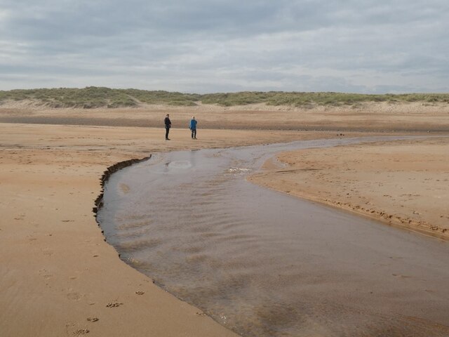
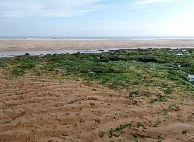
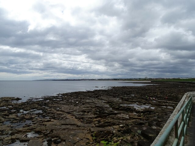
The bay is characterized by its stunning natural beauty, with golden sandy beaches and clear blue waters. The beach stretches for approximately half a mile, offering ample space for sunbathing, picnicking, and a variety of beach activities. The bay is also home to a range of rock pools, which are perfect for exploring and discovering marine life.

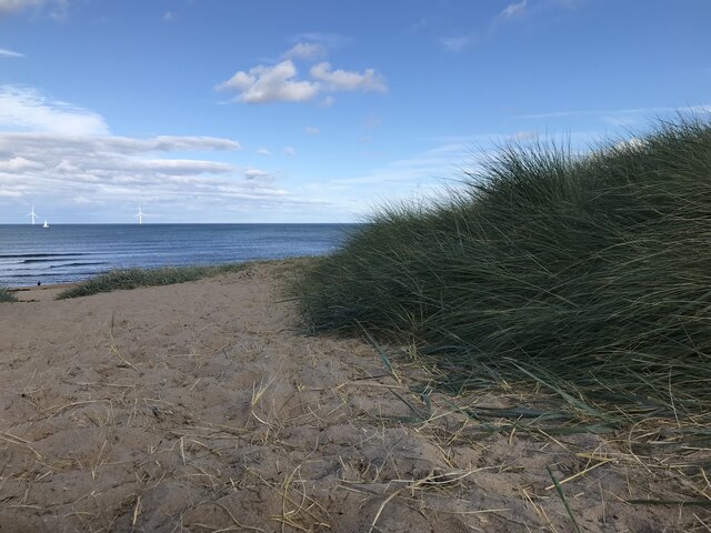
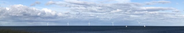
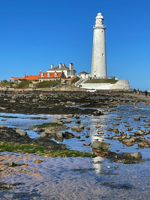
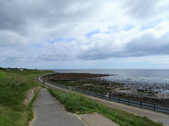
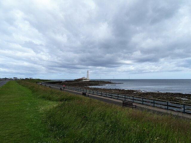
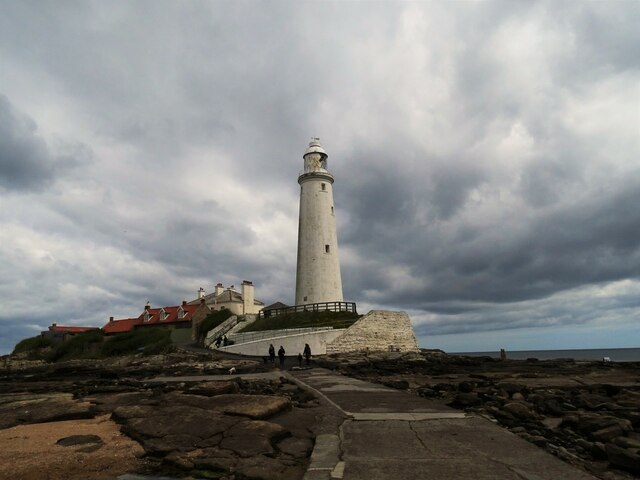
Collywell Bay is known for its peaceful and tranquil atmosphere, making it an ideal spot for relaxation and unwinding. The bay is surrounded by grassy dunes and rocky cliffs, providing a scenic backdrop for visitors. It also boasts fantastic views of St Mary's Island and its iconic lighthouse, which is accessible via a causeway during low tide.

The bay is well-equipped with amenities for visitors, including car parks, toilets, and a nearby cafe offering refreshments. Lifeguards are present during the summer months to ensure the safety of swimmers and beachgoers.

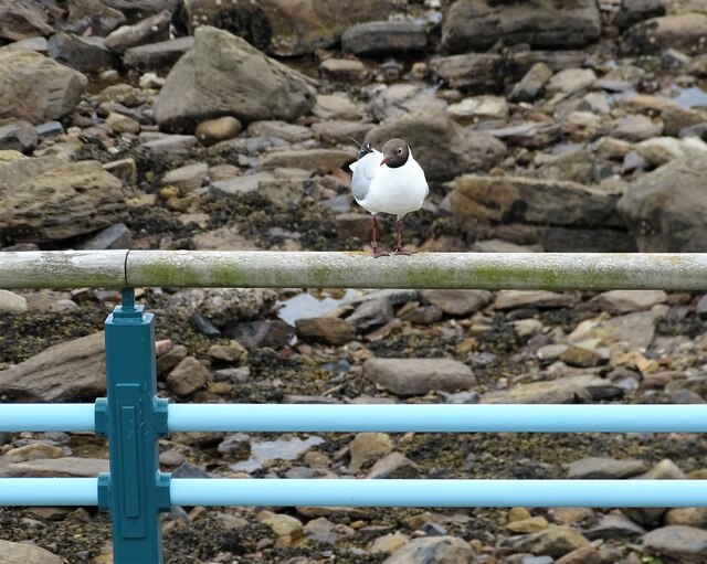
Collywell Bay is a haven for wildlife enthusiasts, with various seabirds and marine species inhabiting the area. It is also a popular spot for fishing, with anglers often seen casting their lines from the beach or nearby rocks.

In summary, Collywell Bay is a beautiful coastal bay in Northumberland, offering a serene and scenic environment for visitors to enjoy the beach, explore rock pools, and take in breathtaking views of St Mary's Island.

If you have any feedback on the listing, please let us know in the comments section below.

Collywell Bay Images

Images are sourced within 2km of 55.081579/-1.4680958 or Grid Reference NZ3476. Thanks to Geograph Open Source API. All images are credited.

Access Road and verge, south of Curry's Point
Curry's Point and St Mary's Island Taken shortly after high tide, the causeway connecting the island to the mainland is submerged.
Curry's Point and St Mary's Island
Taken shortly after high tide, the causeway connecting the island to the mainland is submerged.
St Mary's Lighthouse, North of Whitley Bay St Mary's Lighthouse is on the tiny St Mary's (or Bait) Island, just north of Whitley Bay on the coast of North East England. The small rocky tidal island is linked to the mainland by a short concrete causeway which is submerged at high tide. The lighthouse and adjacent keepers' cottages were built in 1898 by the John Miller company of Tynemouth, using 645 blocks of stone and 750,000 bricks. The lighthouse was decommissioned in 1984
St Mary's Lighthouse, North of Whitley Bay
St Mary's Lighthouse is on the tiny St Mary's (or Bait) Island, just north of Whitley Bay on the coast of North East England. The small rocky tidal island is linked to the mainland by a short concrete causeway which is submerged at high tide. The lighthouse and adjacent keepers' cottages were built in 1898 by the John Miller company of Tynemouth, using 645 blocks of stone and 750,000 bricks. The lighthouse was decommissioned in 1984
Seaton Delaval Hall Seaton Delaval Hall is a Grade I listed country house in Northumberland, England. It is near the coast just north of Newcastle upon Tyne. Located between Seaton Sluice and Seaton Delaval, it was designed by Sir John Vanbrugh in 1718 for Admiral George Delaval; it is now owned by the National Trust.

Since completion of the house in 1728, it has had an unfortunate history. Neither architect nor patron lived to see its completion; it then passed through a succession of heirs, being lived in only intermittently. Most damaging of all, in 1822 the central block was gutted by fire, and has remained an empty shell ever since.
Seaton Delaval Hall
Seaton Delaval Hall is a Grade I listed country house in Northumberland, England. It is near the coast just north of Newcastle upon Tyne. Located between Seaton Sluice and Seaton Delaval, it was designed by Sir John Vanbrugh in 1718 for Admiral George Delaval; it is now owned by the National Trust. Since completion of the house in 1728, it has had an unfortunate history. Neither architect nor patron lived to see its completion; it then passed through a succession of heirs, being lived in only intermittently. Most damaging of all, in 1822 the central block was gutted by fire, and has remained an empty shell ever since.
Church of Our Lady, Seaton Delaval Grade 1 listed <span class="nowrap"><a title="https://historicengland.org.uk/listing/the-list/list-entry/1041317" rel="nofollow ugc noopener" href="https://historicengland.org.uk/listing/the-list/list-entry/1041317">Link</a><img style="margin-left:2px;" alt="External link" title="External link - shift click to open in new window" src="https://s1.geograph.org.uk/img/external.png" width="10" height="10"/></span>
Church of Our Lady, Seaton Delaval
Grade 1 listed LinkExternal link
On the beach at Seaton Sluice The tidal part of the beach makes for much easier walking but is separated from the upper part of the beach by a more or less continuous channel which is a little tricky to cross. Furthermore this channel drains to the sea through a number of rivulets at right angles to the coast, thereby further impeding progress.
On the beach at Seaton Sluice
The tidal part of the beach makes for much easier walking but is separated from the upper part of the beach by a more or less continuous channel which is a little tricky to cross. Furthermore this channel drains to the sea through a number of rivulets at right angles to the coast, thereby further impeding progress.
Beach at Seaton Sluice
Seaton Delaval Hall
Seaton Delaval Hall
Sand dunes at Hartley Links
View of Blyth Offshore Wind Farm from Hartley Links
St Mary's Lighthouse Viewed at low tide when the lighthouse on St Mary's Island can be accessed on the concrete causeway to the right of the photo.
St Mary's Lighthouse
Viewed at low tide when the lighthouse on St Mary's Island can be accessed on the concrete causeway to the right of the photo.
Looking along the promenade Looking north along the promenade at the north end of Whitley Bay. The promenade runs to the causeway to St Mary's Island.
Looking along the promenade
Looking north along the promenade at the north end of Whitley Bay. The promenade runs to the causeway to St Mary's Island.
Promenade to Curry's Point The promenade leads to the causeway to St Mary's Island, seen here with its lighthouse. This is the northern point of Whitley Bay.
Promenade to Curry's Point
The promenade leads to the causeway to St Mary's Island, seen here with its lighthouse. This is the northern point of Whitley Bay.
Gull on the railings A Black Headed Gull on the promenade railings near St Mary's Island at Whitley Bay. Note that this bird has been ringed.
Gull on the railings
A Black Headed Gull on the promenade railings near St Mary's Island at Whitley Bay. Note that this bird has been ringed.
View down the coast from St Mary's Island A view south down the coast past Whitley Bay, Tynemouth, South Shields and Marsden.
View down the coast from St Mary's Island
A view south down the coast past Whitley Bay, Tynemouth, South Shields and Marsden.
Across the causeway to the Lighthouse The lighthouse on St Mary's Island is accessible at low tide across the causeway.
Across the causeway to the Lighthouse
The lighthouse on St Mary's Island is accessible at low tide across the causeway.
Vegetable gardens at Seaton Delaval Located at one end of the car park away from the hall.
Vegetable gardens at Seaton Delaval
Located at one end of the car park away from the hall.
Gardens west of the house Looking across some of the gardens at Seaton Delaval Hall.
Gardens west of the house
Looking across some of the gardens at Seaton Delaval Hall.
Show me another place!

Collywell Bay is located at Grid Ref: NZ3476 (Lat: 55.081579, Lng: -1.4680958)

Unitary Authority: Northumberland

Police Authority: Northumbria

What 3 Words

///laptop.complains.ocean. Near Seaton Delaval, Northumberland

Nearby Locations

Crag Point Collywell Bay

Related Wikis

Collywell Bay railway station

Collywell Bay was a railway station constructed in 1913–14 to serve a planned branch line terminating at Seaton Sluice. Although the line was built, the...

Seaton Sluice

Seaton Sluice is a village in Northumberland. It lies on the coast at the mouth of the Seaton Burn (a small river), midway between Whitley Bay and Blyth...

Hartley, Northumberland

Hartley is a village and former civil parish, now in the parish of Seaton Valley in Northumberland, England. The village lies on the A193 road 4 miles...

St Mary's Island (Tyne and Wear)

St Mary's Island, sometimes referred to as Bait Island is a small sandstone island near the seaside resort of Whitley Bay, Tyne and Wear, England. It is...

St Mary's Lighthouse

St Mary's Lighthouse is on the tiny St Mary's (or Bait) Island, just north of Whitley Bay on the coast of North East England. The small rocky tidal island...
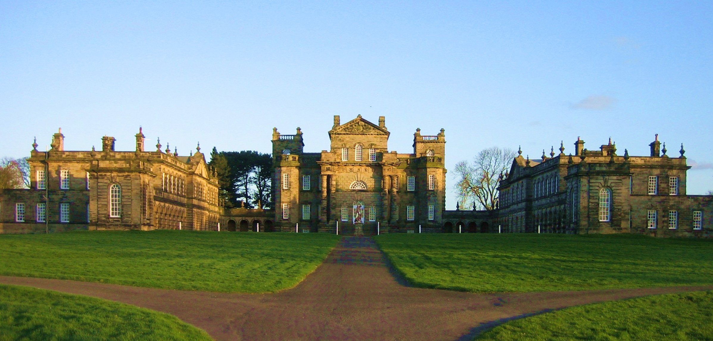
Seaton Delaval Hall

Seaton Delaval Hall is a Grade I listed country house in Northumberland, England, near the coast just north of Newcastle upon Tyne. Located between Seaton...

Brierdene railway station

Brierdene was to have been a railway station on the Collywell Bay Branch Line and construction began in 1913 and was abandoned in 1914. The station was...

Dairy House railway station

Dairy House was a railway station near Newcastle, England. It was opened in 1851 to serve the Seaton Suice Branch Line but was closed by 1862. The station...

Nearby Amenities

Located within 500m of 55.081579,-1.4680958
Old Hartley
Place: village
Wikidata: Q3783557
Lat/Long: 55.0771317/-1.4680176
Seaton Sluice
Place: village
Wikidata: Q2262418
Lat/Long: 55.0840248/-1.4731802
Crag Point
Place: locality
Lat/Long: 55.078952/-1.4624627
Board Type: history
Check Date: 2021-06-05
Information: board
Tourism: information
Lat/Long: 55.0843687/-1.4722102
Tourism: viewpoint
Lat/Long: 55.0850032/-1.4702734
Post Box
Brand: Royal Mail
Brand Wikidata: Q638098
Check Date: 2023-12-11
Collection Plate: CP7D
Collection Times: Mo-Fr 09:00; Sa 07:00; Su off
Operator: Royal Mail
Operator Wikidata: Q638098
Post Box Type: lamp
Postal Code: NE26 4BZ
Ref: NE26 423D
Royal Cypher: EIIR
Royal Cypher Wikidata: Q33102113
Source: survey
Lat/Long: 55.0792687/-1.4729276
Noexit: yes
Lat/Long: 55.078586/-1.4734767
Noexit: yes
Lat/Long: 55.0804175/-1.4730823
Noexit: yes
Lat/Long: 55.0805229/-1.4726979
Noexit: yes
Lat/Long: 55.0806797/-1.4723558
Noexit: yes
Lat/Long: 55.0800466/-1.4721953
Post Box
Operator: Royal Mail
Operator Wikidata: Q638098
Post Box Type: pillar
Postal Code: NE26 4DR
Ref: NE26 515
Royal Cypher: EIIR
Royal Cypher Wikidata: Q33102113
Lat/Long: 55.0824144/-1.4740154
Pharmacy
Boots Pharmacy
Brand: Boots
Brand Wikidata: Q6123139
Brand Wikipedia: en:Boots (company)
Dispensing: yes
Drive Through: no
Healthcare: pharmacy
Website: https://www.boots.com/stores/1514-seaton-sluice-ne26-4dr
Lat/Long: 55.0824199/-1.4741471
Noexit: yes
Lat/Long: 55.0829654/-1.4749573
Noexit: yes
Lat/Long: 55.0834424/-1.475149
Fast Food
Harbour Fish and Chips
Cuisine: fish_and_chips
Delivery: no
Drive Through: no
Opening Hours: Mo-Fr 11:30-14:00,16:15-21:00; Sa 11:30-21:00
Takeaway: only
Lat/Long: 55.0833423/-1.4749799
Noexit: yes
Lat/Long: 55.0831557/-1.4738231
Noexit: yes
Lat/Long: 55.0834333/-1.4733475
Noexit: yes
Lat/Long: 55.0782608/-1.471229
Noexit: yes
Lat/Long: 55.0782387/-1.4710436
Noexit: yes
Lat/Long: 55.0798144/-1.471993
Cafe
Harbour View Coffee Shop
Addr City: Whitley Bay
Addr County: Northumberland
Addr Postcode: NE26 4DR
Addr Street: Beresford Road
Addr Suburb: Seaton Sluice
Fhrs Id: 289218
Opening Hours: Mo-Fr 11:30-13:45, Th,Fr 16:15-19:00, Sa 11:30-17:30
Lat/Long: 55.0833599/-1.4751013
Seaton Sluice War Memorial
Historic: memorial
Lat/Long: 55.0832692/-1.4715349
Parking
Lat/Long: 55.0844481/-1.4718633
Leisure: slipway
Lat/Long: 55.0842699/-1.4740864
Crossing
Crossing: unmarked
Crossing Island: yes
Tactile Paving: yes
Lat/Long: 55.0836382/-1.4747941
Crossing
Crossing: unmarked
Crossing Island: yes
Lat/Long: 55.0798102/-1.4713631
Noexit: yes
Lat/Long: 55.0804465/-1.4721782
Cafe
Castaways
Addr City: Whitley Bay
Addr County: Northumberland
Addr Housenumber: 32
Addr Postcode: NE26 4QZ
Addr Street: Collywell Bay Road
Addr Suburb: Seaton Sluice
Fhrs Id: 289217
Lat/Long: 55.0828293/-1.4714339
Persona
Shop: hairdresser
Lat/Long: 55.0826855/-1.4736989
Bench
Backrest: yes
Lat/Long: 55.0843437/-1.4722954
Bench
Backrest: yes
Lat/Long: 55.0843109/-1.4739923
Atm
Lat/Long: 55.0805225/-1.4721899
Atm
Lat/Long: 55.0821474/-1.4731876
Crossing
Button Operated: yes
Crossing: traffic_signals
Crossing Ref: puffin
Tactile Paving: yes
Lat/Long: 55.0821236/-1.4735383
Bus: yes
Bus Bay: left
Public Transport: stop_position
Lat/Long: 55.0833977/-1.4747472
Bus: yes
Public Transport: stop_position
Lat/Long: 55.0775207/-1.4692044
Bus Stop
HARTLEY SQUARE
Bench: yes
Bin: yes
Bus: yes
Departures Board: timetable
Naptan AtcoCode: 3100Z339760
Naptan CommonName: Hartley Square
Naptan Indicator: northbound
Naptan Landmark: Old Hartley roundabout
Naptan NaptanCode: nldajwpj
Naptan Street: Beresford Road
Naptan Verified: no
Public Transport: platform
Shelter: yes
Lat/Long: 55.0774127/-1.4692244
Defibrillator
Access: yes
Defibrillator Location: West wall of Seaton Sluice Social Club
Emergency: defibrillator
Indoor: no
Opening Hours: 24/7
Operator: NEAS
Phone: +44 999
Ref GB The Circuit: 4CBD4BDC-7C54-4781-9E8E-ADB0008EBCC1
Wheelchair: yes
Lat/Long: 55.0834898/-1.4745442
Bus Stop
POST OFFICE
Bench: yes
Bin: yes
Bus: yes
Lit: no
Naptan AtcoCode: 3100Z336766
Naptan CommonName: Post Office
Naptan Indicator: N-Bound
Naptan Landmark: Harbour
Naptan NaptanCode: nldajtgj
Naptan Street: Beresford Road
Naptan Verified: no
Public Transport: platform
Shelter: yes
Tactile Paving: no
Lat/Long: 55.0832703/-1.474842
Bus Stop
MILLWAY
Bench: yes
Bus: yes
Naptan AtcoCode: 3100Z337763
Naptan CommonName: Millway
Naptan Indicator: near
Naptan Landmark: Millway Garage
Naptan NaptanCode: nldamgmw
Naptan Street: Beresford Road
Naptan Verified: no
Public Transport: platform
Shelter: yes
Lat/Long: 55.0808574/-1.472448
Bus Stop
Seaton Sluice, Post Office
Bus: yes
Departures Board: timetable
Naptan AtcoCode: 3100Z336765
Naptan CommonName: Post Office
Naptan Indicator: opp
Naptan Landmark: Harbour
Naptan NaptanCode: nldatjgd
Naptan Street: Beresford Road
Naptan Verified: no
Passenger Information Display: no
Public Transport: platform
Shelter: yes
Lat/Long: 55.0827574/-1.4739731
Bus Stop
Seaton Sluice, Millway
Bench: yes
Bin: yes
Bus: yes
Departures Board: timetable
Naptan AtcoCode: 3100Z338763
Naptan CommonName: Millway
Naptan Indicator: opp
Naptan Landmark: Police Station
Naptan NaptanCode: nldatjgj
Naptan Street: Beresford Road
Naptan Verified: no
Public Transport: platform
Shelter: yes
Lat/Long: 55.0802796/-1.4716276
Parking
Beresford Road East Car Park
Fee: no
Maxstay: 3 days
Operator: Northumberland County Council
Parking: surface
Lat/Long: 55.081112/-1.4721322
Crossing
Crossing: unmarked
Crossing Island: yes
Kerb: lowered
Tactile Paving: yes
Lat/Long: 55.0833786/-1.4747281
Noexit: yes
Lat/Long: 55.0801208/-1.47423
Traffic Signals
Lat/Long: 55.0771212/-1.4688139
Bus: yes
Public Transport: stop_position
Lat/Long: 55.0809114/-1.472396
Addr Housenumber: 68
Lat/Long: 55.0816686/-1.4727366
Addr Housenumber: 84
Lat/Long: 55.0812422/-1.4723426
Addr Housenumber: 70
Lat/Long: 55.0816211/-1.4727042
Addr Housenumber: 86
Lat/Long: 55.0812006/-1.4722853
Addr Housenumber: 82
Lat/Long: 55.0812881/-1.4723897
Bicycle Parking
Bicycle Parking: stands
Capacity: 6
Covered: no
Lat/Long: 55.0834619/-1.4749905
Seaton Sluice
Historic Railway: station
Railway: site
Wikidata: Q30694400
Wikipedia: en:Seaton Sluice railway station
Lat/Long: 55.0845635/-1.4710204
Collywell Bay
Historic Railway: station
Railway: site
Wikidata: Q30626901
Wikipedia: en:Collywell Bay railway station
Lat/Long: 55.080076/-1.4745069
Noexit: yes
Lat/Long: 55.0802031/-1.4738154
Give Way
Direction: forward
Lat/Long: 55.0820148/-1.473356
Give Way
Direction: forward
Lat/Long: 55.0836088/-1.4748713
Give Way
Direction: forward
Lat/Long: 55.0828152/-1.4742845
Give Way
Direction: forward
Lat/Long: 55.0826032/-1.4740739
Generator Method: photovoltaic
Generator Output Electricity: yes
Generator Source: solar
Generator Type: solar_photovoltaic_panel
Power: generator
Lat/Long: 55.0789906/-1.4738001
Generator Method: photovoltaic
Generator Output Electricity: yes
Generator Source: solar
Generator Type: solar_photovoltaic_panel
Power: generator
Lat/Long: 55.0794835/-1.4731416
Generator Method: photovoltaic
Generator Output Electricity: yes
Generator Source: solar
Generator Type: solar_photovoltaic_panel
Power: generator
Lat/Long: 55.0776056/-1.4714626
Generator Method: photovoltaic
Generator Output Electricity: yes
Generator Source: solar
Generator Type: solar_photovoltaic_panel
Power: generator
Lat/Long: 55.0779557/-1.4717817
The data included in this document is from www.openstreetmap.org. The data is made available under ODbL.

Have you been to Collywell Bay?

Leave your review of Collywell Bay below (or comments, questions and feedback).