Cleras Geo
Coastal Feature, Headland, Point in Shetland
Scotland
Cleras Geo
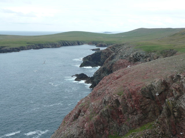
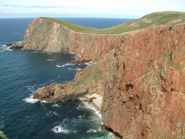
Cleras Geo, located in Shetland, is a prominent coastal feature known for its stunning headland and point. Situated on the eastern coast of the mainland, it offers breathtaking views of the North Sea and the surrounding rugged landscape.
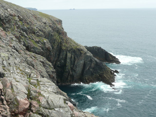
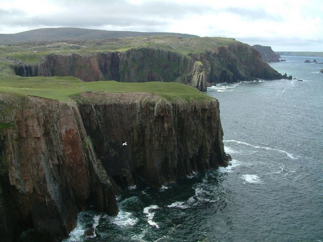
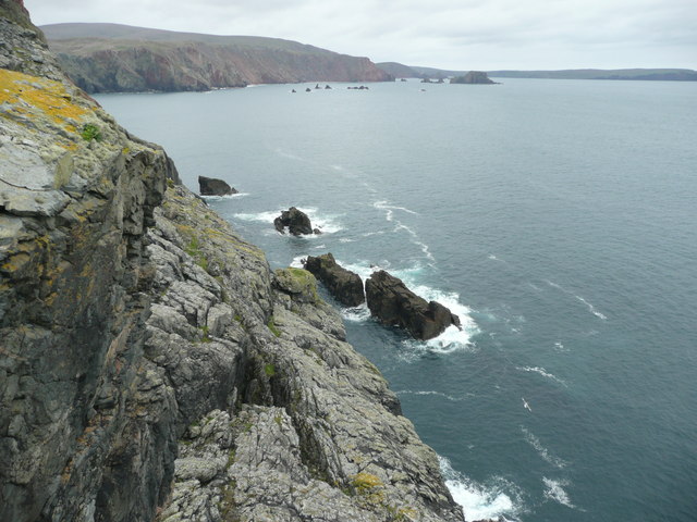
The headland at Cleras Geo is characterized by its steep cliffs, which rise dramatically from the sea below. These cliffs are composed of layers of sedimentary rock, showcasing the geological history of the area. The constant erosion by the crashing waves has shaped the cliffs over time, creating unique formations and caves that attract both locals and tourists.
At the tip of the headland, there is a striking point that juts out into the sea. This point offers an ideal vantage point to observe the powerful forces of nature at play, as waves crash against the rocks below. It is also a popular spot for birdwatching, as numerous seabirds can be seen soaring above the water or nesting on the cliffs.
Cleras Geo's coastal location makes it an excellent spot for outdoor activities such as hiking, photography, and fishing. The surrounding area is rich in wildlife, with seals often seen basking on nearby rocks, and occasional sightings of dolphins or whales further out to sea.
Access to Cleras Geo is relatively easy, with a well-maintained footpath leading to the headland. However, visitors are advised to take caution, as the cliffs can be dangerous due to their steepness and potential for landslides.
Overall, Cleras Geo is a captivating coastal feature that showcases the raw beauty and power of nature. Its headland and point offer an unforgettable experience for those seeking to immerse themselves in Shetland's stunning coastal scenery.
If you have any feedback on the listing, please let us know in the comments section below.
Cleras Geo Images
Images are sourced within 2km of 60.592247/-1.4409972 or Grid Reference HU3089. Thanks to Geograph Open Source API. All images are credited.
Cleras Geo is located at Grid Ref: HU3089 (Lat: 60.592247, Lng: -1.4409972)
Unitary Authority: Shetland Islands
Police Authority: Highlands and Islands
What 3 Words
///relished.craters.most. Near Ulsta, Shetland Islands
Nearby Locations
Related Wikis

Uyea, Northmavine
Uyea (Scots: Öya in Shetland dialect spelling) is an uninhabited tidal island located to the northwest of Mainland, Shetland. Uyea lies off the Northmavine...

Lang Ayre
The Lang Ayre is a beach on the west side of Ronas Hill, Northmavine, Shetland. At 1 kilometre (0.6 mi) in length it is the archipelago's longest. It is...

North Roe
North Roe is a village, and protected area at the northern tip in the large Northmavine peninsula of the Mainland of Shetland, Scotland. It is a small...

Ronas Hill
Ronas Hill (or Rönies Hill) is a hill in Shetland, Scotland. It is classed as a Marilyn, and is the highest point in the Shetland Islands at an elevation...

Fethaland
Fethaland or Fedeland (pronounced [ˈfeɪdələnd]) is an abandoned settlement at the extreme north end of Mainland, Shetland. It was the site of the largest...

Ronas Voe
Ronas Voe (pronounced [ˈrø̞nis ˌvo̞:] Shetland Dialect: Rønies Voe) is a voe in Northmavine, Shetland. It divides the land between Ronas Hill, Shetland...

Tingon
Tingon is a peninsula in the north-west of Northmavine, Shetland. It is delineated on the east by Ronas Voe, and on the west by Hamnavoe. It is designated...

Voe, Northmavine
Voe is a settlement on the Northmavine peninsula of Mainland, Shetland, Scotland. It is at the head of Ronas Voe and just off the A970 road. == Whaling... ==
Have you been to Cleras Geo?
Leave your review of Cleras Geo below (or comments, questions and feedback).