Hevdadale Head
Coastal Feature, Headland, Point in Shetland
Scotland
Hevdadale Head
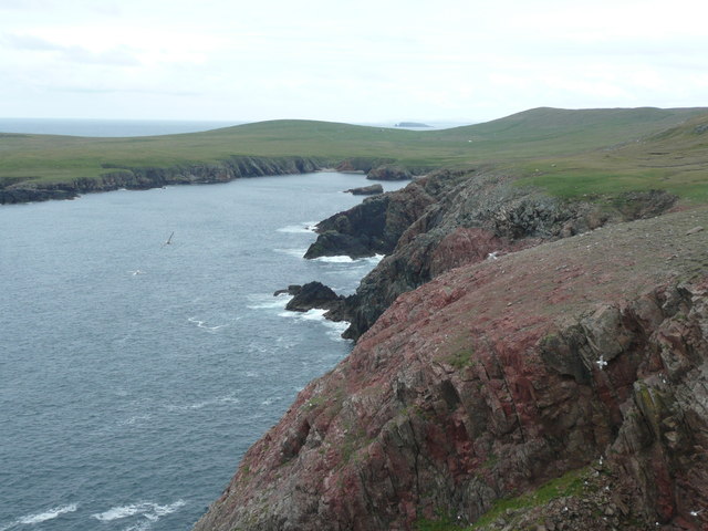
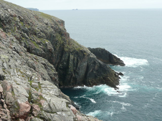
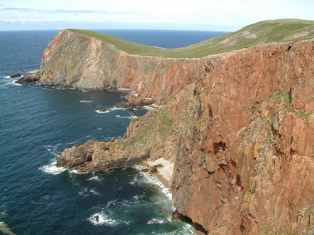
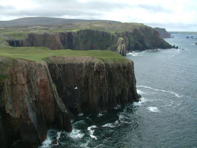
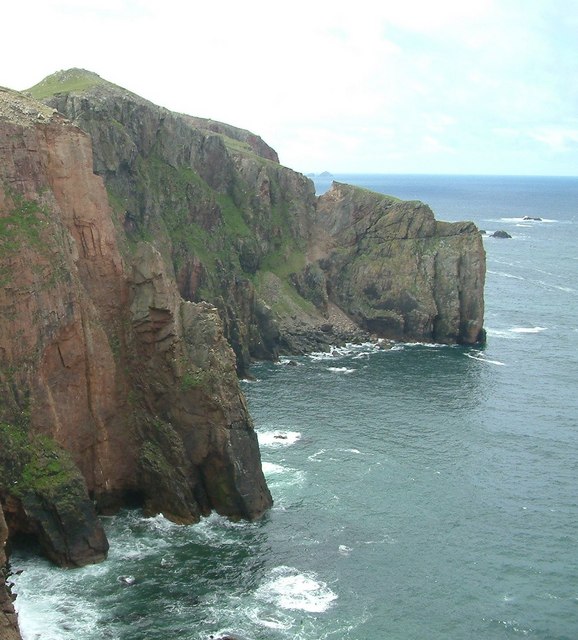
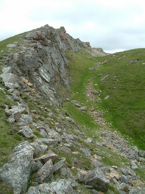
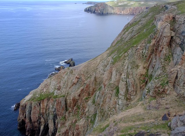
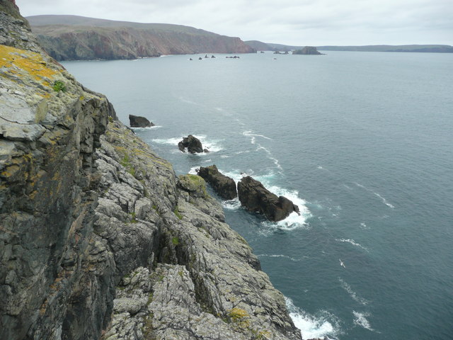
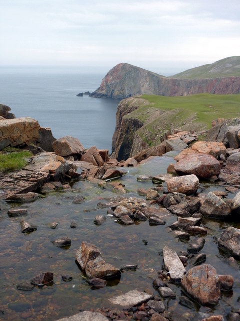
Hevdadale Head is a prominent coastal feature located on the island of Shetland, Scotland. Situated on the western side of the island, it is a headland that extends out into the North Atlantic Ocean, forming a distinct point. The headland is characterized by its rugged cliffs, which rise steeply from the sea to a height of approximately 150 meters (492 feet) at their highest point.
The geology of Hevdadale Head is primarily composed of sedimentary rocks, including sandstone and shale, which have been shaped and eroded by the relentless forces of the ocean over millions of years. This erosion has created striking features, such as sea caves and stacks, adding to the dramatic beauty of the headland.
The area surrounding Hevdadale Head is rich in biodiversity, providing habitat for various bird species, including fulmars, puffins, and guillemots. The cliffs also serve as nesting sites for these birds, making it a popular spot for birdwatching enthusiasts.
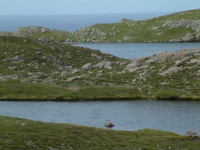
Access to Hevdadale Head is limited due to its remote location and rugged terrain, but it can be reached by foot via a coastal path from the nearby village of Walls. The headland offers breathtaking views of the surrounding coastline and the open sea, making it a popular destination for hikers and nature lovers.
Overall, Hevdadale Head is a stunning coastal feature in Shetland, boasting impressive cliffs, diverse wildlife, and breathtaking vistas. Its natural beauty and remote location make it a must-visit destination for those exploring the island.
If you have any feedback on the listing, please let us know in the comments section below.
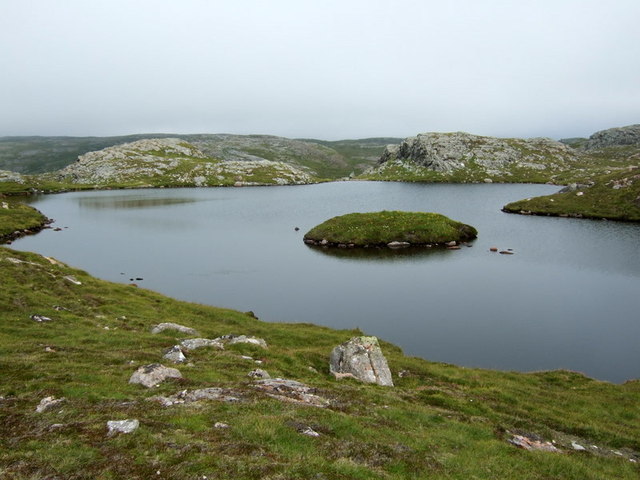
Hevdadale Head Images
Images are sourced within 2km of 60.586107/-1.4412857 or Grid Reference HU3089. Thanks to Geograph Open Source API. All images are credited.
Hevdadale Head is located at Grid Ref: HU3089 (Lat: 60.586107, Lng: -1.4412857)
Unitary Authority: Shetland Islands
Police Authority: Highlands and Islands
What 3 Words
///playoffs.roaming.shampoos. Near Ulsta, Shetland Islands
Nearby Locations
Related Wikis

Lang Ayre
The Lang Ayre is a beach on the west side of Ronas Hill, Northmavine, Shetland. At 1 kilometre (0.6 mi) in length it is the archipelago's longest. It is...

Uyea, Northmavine
Uyea (Scots: Öya in Shetland dialect spelling) is an uninhabited tidal island located to the northwest of Mainland, Shetland. Uyea lies off the Northmavine...

Ronas Hill
Ronas Hill (or Rönies Hill) is a hill in Shetland, Scotland. It is classed as a Marilyn, and is the highest point in the Shetland Islands at an elevation...

North Roe
North Roe is a village, and protected area at the northern tip in the large Northmavine peninsula of the Mainland of Shetland, Scotland. It is a small...

Ronas Voe
Ronas Voe (pronounced [ˈrø̞nis ˌvo̞:] Shetland Dialect: Rønies Voe) is a voe in Northmavine, Shetland. It divides the land between Ronas Hill, Shetland...

Fethaland
Fethaland or Fedeland (pronounced [ˈfeɪdələnd]) is an abandoned settlement at the extreme north end of Mainland, Shetland. It was the site of the largest...

Tingon
Tingon is a peninsula in the north-west of Northmavine, Shetland. It is delineated on the east by Ronas Voe, and on the west by Hamnavoe. It is designated...

Voe, Northmavine
Voe is a settlement on the Northmavine peninsula of Mainland, Shetland, Scotland. It is at the head of Ronas Voe and just off the A970 road. == Whaling... ==
Have you been to Hevdadale Head?
Leave your review of Hevdadale Head below (or comments, questions and feedback).