The Gaaba

Coastal Feature, Headland, Point in Shetland

Scotland

The Gaaba

Ness of Hillwick Taken from the B9078 between Burnside and Eshaness, Shetland, I am looking across Sand Wick to the Ness of Hillswick. The Isle of Westerhouse is visible just off the Pund of Grevasand to the west of the Ness.
Ness of Hillwick Credit: Carroll Pierce

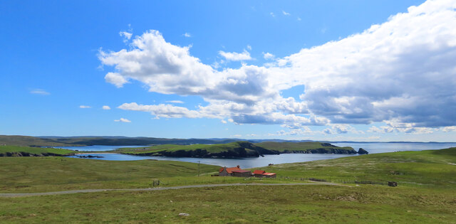
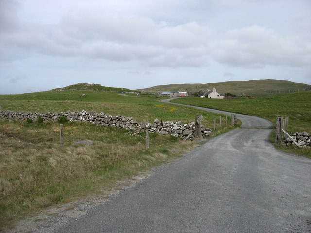
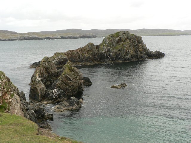
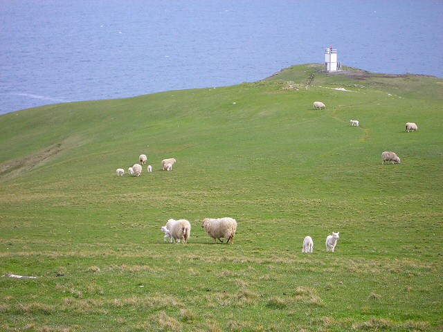
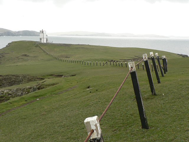
The Gaaba is a prominent coastal feature located in the Shetland Islands, an archipelago situated off the northeast coast of Scotland. It is specifically found on the island of Unst, which is the northernmost inhabited island in the British Isles. The Gaaba is classified as a headland, which is a narrow piece of land that juts out into the sea.

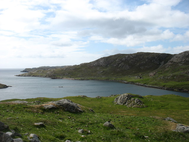
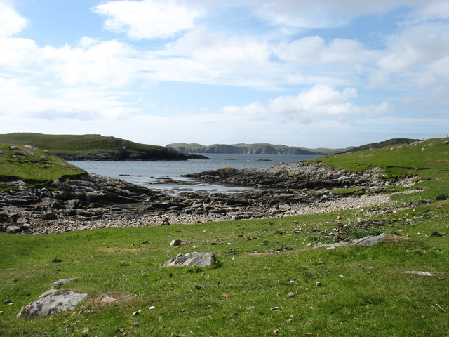
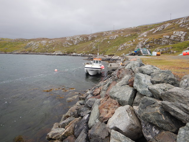
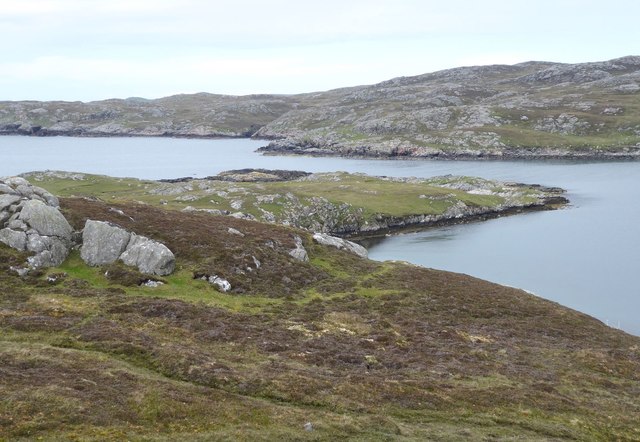
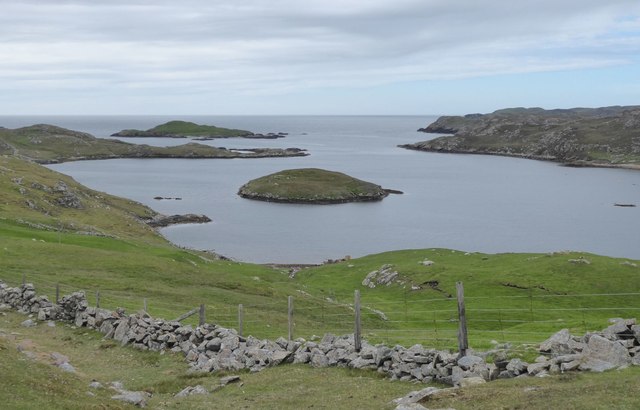
This coastal feature is known for its rugged and dramatic cliffs, which rise vertically from the Atlantic Ocean to a considerable height. The Gaaba offers breathtaking views of the surrounding coastline and the open sea, making it a popular spot for visitors and nature enthusiasts. The cliffs are composed of layered rocks, showcasing geological formations that provide valuable insights into the area's geological history.

In addition to its scenic beauty, The Gaaba is also home to a diverse range of bird species. The cliffs provide nesting sites for colonies of seabirds, including kittiwakes, guillemots, and fulmars. Birdwatchers flock to this area to observe these fascinating creatures in their natural habitat.

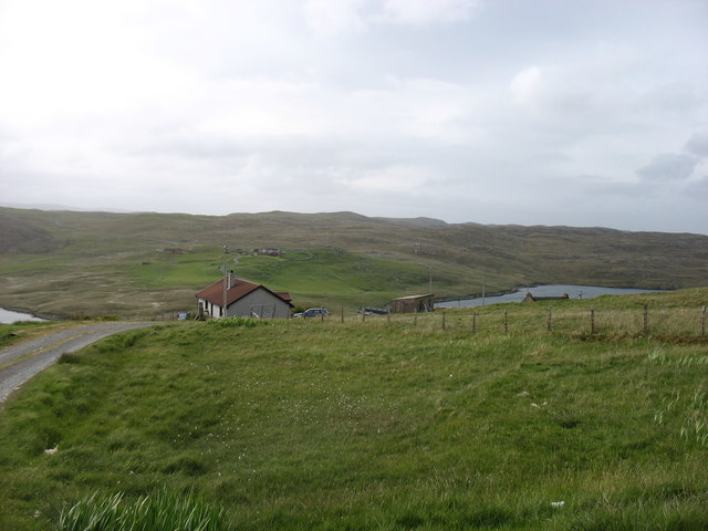
Access to The Gaaba is relatively easy, as there are footpaths and trails that lead visitors to the headland. However, caution is advised when exploring the area, as the cliffs can be steep and unstable. It is important to adhere to safety guidelines and stay within designated paths to avoid accidents.

Overall, The Gaaba is a remarkable coastal feature in the Shetland Islands, offering stunning views, geological wonders, and a haven for birdlife.

If you have any feedback on the listing, please let us know in the comments section below.

The Gaaba Images

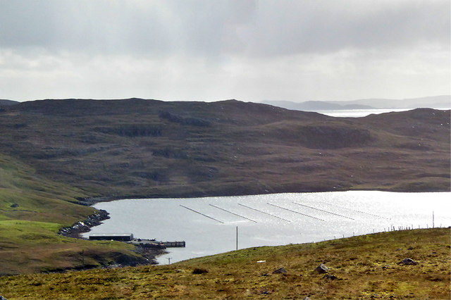
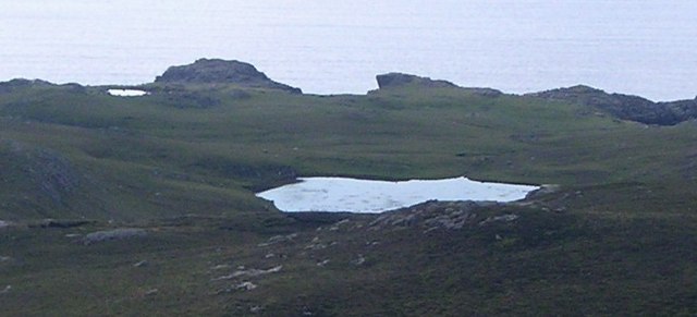
Images are sourced within 2km of 60.458709/-1.4648731 or Grid Reference HU2975. Thanks to Geograph Open Source API. All images are credited.

Ness of Hillwick Taken from the B9078 between Burnside and Eshaness, Shetland, I am looking across Sand Wick to the Ness of Hillswick. The Isle of Westerhouse is visible just off the Pund of Grevasand to the west of the Ness.
Ness of Hillwick
Taken from the B9078 between Burnside and Eshaness, Shetland, I am looking across Sand Wick to the Ness of Hillswick. The Isle of Westerhouse is visible just off the Pund of Grevasand to the west of the Ness.
Gunnister Voe
Gunnister Voe
North Sound, Nibon The northern end of the Isle of Nibon is on the left, with the Ness of Hillswick in the distance.
North Sound, Nibon
The northern end of the Isle of Nibon is on the left, with the Ness of Hillswick in the distance.
Olnesfirth and Hamar Voe
Hamar Farm I was at the end of the public road: the rather battered sign says Private Road, although I doubt that there would have been any objection had I walked closer. But there wasn't anywhere to park!
Hamar Farm
I was at the end of the public road: the rather battered sign says Private Road, although I doubt that there would have been any objection had I walked closer. But there wasn't anywhere to park!
Fish farm boat, Gunnista Voe A rather steep and rough track (I'd have attempted it in a Mini in my youth, but rather more circumspect in middle age, high clearance 4-wheel drive seemed a better idea) reaches this small quay on Gunnista Voe, which is occupied by fish farming installations. We were prospecting for a place to put on with sea kayaks, and this seemed a little too awkward, though it was the only place near the water with adequate parking in the vicinity.
Fish farm boat, Gunnista Voe
A rather steep and rough track (I'd have attempted it in a Mini in my youth, but rather more circumspect in middle age, high clearance 4-wheel drive seemed a better idea) reaches this small quay on Gunnista Voe, which is occupied by fish farming installations. We were prospecting for a place to put on with sea kayaks, and this seemed a little too awkward, though it was the only place near the water with adequate parking in the vicinity.
Valliers Ness In Gunnister Voe.
Valliers Ness
In Gunnister Voe.
Looking down Gunnister Voe Holm of Gunnister in the centre.
Looking down Gunnister Voe
Holm of Gunnister in the centre.
Hamar Voe Mussel Fishery Hamar Voe is an inlet on the east coast of the Northmavine on the northwest of mainland Shetland. It is the site for a common mussel (Mytilus edulis) fishery, comprised of a single long-line mussel farm located along the east shore of the main body of the voe.
Hamar Voe Mussel Fishery
Hamar Voe is an inlet on the east coast of the Northmavine on the northwest of mainland Shetland. It is the site for a common mussel (Mytilus edulis) fishery, comprised of a single long-line mussel farm located along the east shore of the main body of the voe.
Hillswick, Shetland Large traditionally built houses at Hillswick. In the background is Findlins House and Findlins Farm.
Hillswick, Shetland
Large traditionally built houses at Hillswick. In the background is Findlins House and Findlins Farm.
Snapa Water Shallow weedy lochan.
Snapa Water
Shallow weedy lochan.
Weathered Peat West Mill loch of Hamar, peculiar weathered peat formation.
Weathered Peat
West Mill loch of Hamar, peculiar weathered peat formation.
The Quilse
The Quilse
Gordi Stack This is the stack seen edge on. From other directions it looks much wider. In the distance to the right are the Drongs - another dramatic rock formation. See <a href="https://www.geograph.org.uk/photo/550985">HU2675 : The Drongs</a> for an telephoto view.
Gordi Stack
This is the stack seen edge on. From other directions it looks much wider. In the distance to the right are the Drongs - another dramatic rock formation. See HU2675 : The Drongs for an telephoto view.
Sheep near Baa Taing Looking down the sheep pasture towards the lighthouse.
Sheep near Baa Taing
Looking down the sheep pasture towards the lighthouse.
Baa Taing light A rope handrail provides safe access to the light in bad weather. The headland is wide and flat, so the conditions that might require the safety rail defy imagination.
Baa Taing light
A rope handrail provides safe access to the light in bad weather. The headland is wide and flat, so the conditions that might require the safety rail defy imagination.
Lochan and cliffs Looking across the lochan at the south end of Hillswick Ness, backed by the cliffs above Queen Geos.
Lochan and cliffs
Looking across the lochan at the south end of Hillswick Ness, backed by the cliffs above Queen Geos.
Eider ducks These large sea ducks are a common sight on northern coasts.
Eider ducks
These large sea ducks are a common sight on northern coasts.
Show me another place!

The Gaaba is located at Grid Ref: HU2975 (Lat: 60.458709, Lng: -1.4648731)

Unitary Authority: Shetland Islands

Police Authority: Highlands and Islands

What 3 Words

///relishing.pampered.tonic. Near Brae, Shetland Islands

Related Wikis

Hillswick

Hillswick is a small village in Northmavine, on the shore of the Atlantic Ocean and lies to the north-north west of Mainland, Shetland, the most northerly...

Gunnister

Gunnister is a small 'abandoned' village at the North-West Mainland in Shetland, Scotland. It is most commonly known for the Gunnister Man - the remains...

Punds Water

Punds Water is a freshwater loch near Mangaster in Northmavine, Shetland. It also gives its name to a nearby Neolithic heel-shaped cairn. == Heel-shaped... ==

The Drongs

The Drongs are a group of sea stacks off the coast of Hillswick Ness, Northmavine, Shetland, Scotland. They lie to the west of the Isle of Westerhouse...

Have you been to The Gaaba?

Leave your review of The Gaaba below (or comments, questions and feedback).