Hamar

Coastal Feature, Headland, Point in Shetland

Scotland

Hamar

The Kame of Foula Britain's highest cliff (unless, like some, you think that the 'ledge' halfway down disqualifies it). It is, of course, impossible to take a meaningful photograph wholly within the square. In fact, it is probably impossible to stand up on two feet within the square!
The Kame of Foula Credit: Mike Pennington

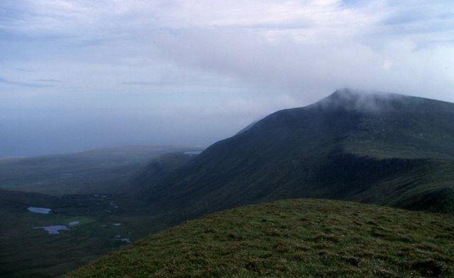
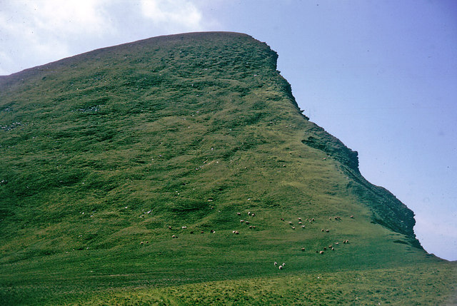
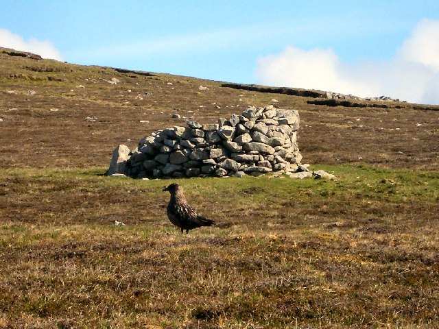
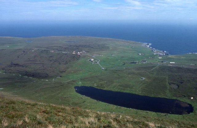
Hamar is a small coastal feature located on the island of Shetland, which is a part of Scotland. It is specifically situated on the west coast of the island, near the village of Walls. Hamar is primarily known for its distinctive headland and point.

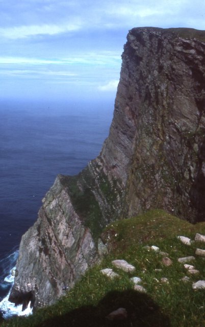
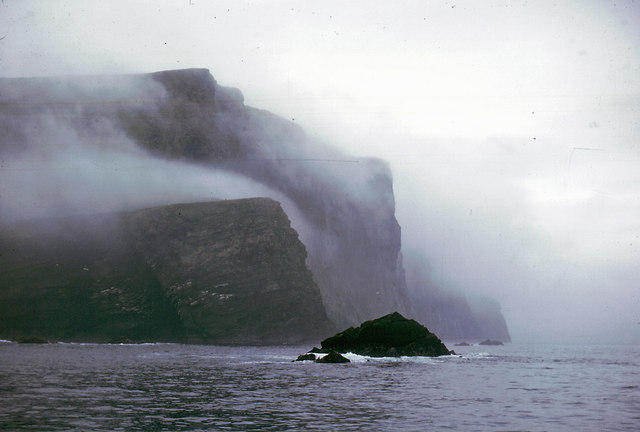
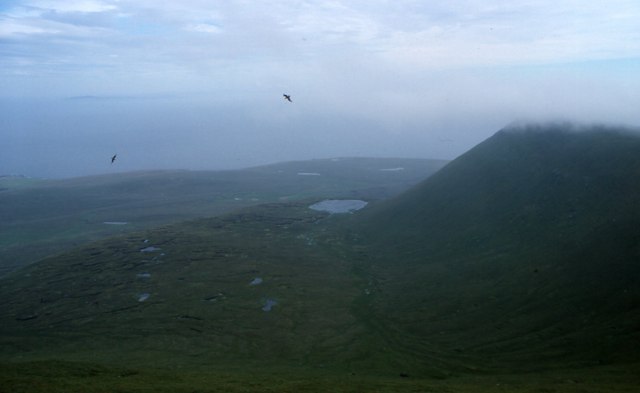
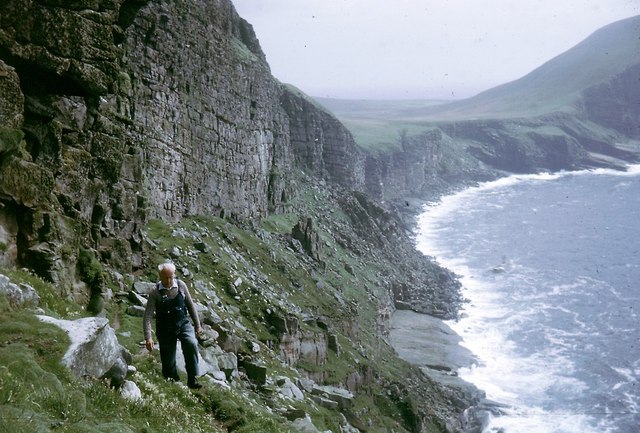
The headland at Hamar is characterized by its rugged and dramatic cliffs that stretch out into the North Atlantic Ocean. These cliffs are composed of sedimentary rocks, including sandstone and shale, which have been eroded over thousands of years by the powerful waves and winds of the Atlantic. The result is a stunning landscape of towering cliffs, caves, and rocky outcrops.

At the end of the headland, there is a prominent point that offers breathtaking panoramic views of the surrounding coastline. This point serves as a popular vantage point for locals and visitors alike, who come to admire the stunning beauty of the area and watch the crashing waves below.

Hamar is also known for its rich biodiversity. The area is home to a variety of seabirds, including puffins, fulmars, and guillemots, which nest in the cliffs during the breeding season. The surrounding waters are teeming with marine life, making it a popular spot for fishing and wildlife enthusiasts.

In summary, Hamar is a picturesque coastal feature on the island of Shetland, characterized by its rugged cliffs, dramatic headland, and stunning views. It is a haven for nature lovers, offering a unique opportunity to witness the raw beauty of Scotland's coastline.

If you have any feedback on the listing, please let us know in the comments section below.

Hamar Images

Images are sourced within 2km of 60.133178/-2.0952613 or Grid Reference HT9438. Thanks to Geograph Open Source API. All images are credited.

The Kame of Foula Britain's highest cliff (unless, like some, you think that the 'ledge' halfway down disqualifies it). It is, of course, impossible to take a meaningful photograph wholly within the square. In fact, it is probably impossible to stand up on two feet within the square!
The Kame of Foula
Britain's highest cliff (unless, like some, you think that the 'ledge' halfway down disqualifies it). It is, of course, impossible to take a meaningful photograph wholly within the square. In fact, it is probably impossible to stand up on two feet within the square!
View from Da Kame to Da Sneug, Foula The highest hill on Foula and the second highest in Shetland. Taken from near da Kame. On the left are the Lochs o' da Fleck and the Loch o' Ouvrafandel is in the distance.
View from Da Kame to Da Sneug, Foula
The highest hill on Foula and the second highest in Shetland. Taken from near da Kame. On the left are the Lochs o' da Fleck and the Loch o' Ouvrafandel is in the distance.
Da Nort Bank On this slope the skuas attacked and the sheep tried to chase me over the cliff. It was the nesting season but both skuas and sheep meant business.
Da Nort Bank
On this slope the skuas attacked and the sheep tried to chase me over the cliff. It was the nesting season but both skuas and sheep meant business.
The cliffs of Foula The highest point, the Kame, is in the mist.
The cliffs of Foula
The highest point, the Kame, is in the mist.
The croft of Harrier 1964 The skuas did not attack if you were on the island road, but it was always useful to carry a long bonxie stick, and wave it in the air above your head when they sized you up.
The croft of Harrier 1964
The skuas did not attack if you were on the island road, but it was always useful to carry a long bonxie stick, and wave it in the air above your head when they sized you up.
Plantiecrub on Foula Plantiecrubs were used by crofters to keep their kale and cabbage seedlings safe from grazing by livestock. The bird in the foreground is a bonxie (great skua).
Plantiecrub on Foula
Plantiecrubs were used by crofters to keep their kale and cabbage seedlings safe from grazing by livestock. The bird in the foreground is a bonxie (great skua).
Cliffs north-west of Da Smaalie, Foula These cliffs are on the west coast of Foula where the land rises steeply to the main ridge of hills that crosses the island.
Cliffs north-west of Da Smaalie, Foula
These cliffs are on the west coast of Foula where the land rises steeply to the main ridge of hills that crosses the island.
Hamnafield, Foula Hamnafield from the Sneug.
Hamnafield, Foula
Hamnafield from the Sneug.
Mill Loch, Foula With Ham beyond.
Mill Loch, Foula
With Ham beyond.
The Noup, Foula Taken from the cliffs at the end of the valley of Da Smaalie.
The Noup, Foula
Taken from the cliffs at the end of the valley of Da Smaalie.
Sneck o' da Smaalie, Foula A crack in the rocks in the cliffs at the end of the valley of Da Smaalie. Slithering down and over the rocks down to the wave-cut beach at the bottom is a popular Sunday afternoon day out on Foula - or it was the day we descended.
Sneck o' da Smaalie, Foula
A crack in the rocks in the cliffs at the end of the valley of Da Smaalie. Slithering down and over the rocks down to the wave-cut beach at the bottom is a popular Sunday afternoon day out on Foula - or it was the day we descended.
Sneck  o' da Smaalie, Foula The view looking back up the crack in the cliffs after the descent. The upper and lower entrances to the Sneck are in different gridsquares.
Sneck o' da Smaalie, Foula
The view looking back up the crack in the cliffs after the descent. The upper and lower entrances to the Sneck are in different gridsquares.
Mucklebrik's Wick, Foula Taken after a descent of the Sneck o' da Smaalie, looking towards the headland of Wester Hoevda.
Mucklebrik's Wick, Foula
Taken after a descent of the Sneck o' da Smaalie, looking towards the headland of Wester Hoevda.
On a traverse of Ufshins There is a terrace beneath the major cliffs that can be accessed through the Sneck of Smallie.  You feel really remote down here.
On a traverse of Ufshins
There is a terrace beneath the major cliffs that can be accessed through the Sneck of Smallie. You feel really remote down here.
Puffins on the Ufshins Fabulous birds!
Puffins on the Ufshins
Fabulous birds!
View to The Noup over Mucklebrik from above Ufshins The vertical cleft of da Sneck o da Smallie is visible.  This cleft provides access to Ufshins and an exciting sheeptrack/footpath that eventually brings you out at the top of the cliffs.
View to The Noup over Mucklebrik from above Ufshins
The vertical cleft of da Sneck o da Smallie is visible. This cleft provides access to Ufshins and an exciting sheeptrack/footpath that eventually brings you out at the top of the cliffs.
Ufshins Looking back along the terrace towards the Sneck of the Smallie.  This is an exhilarating walk.
Ufshins
Looking back along the terrace towards the Sneck of the Smallie. This is an exhilarating walk.
The 1000 ft cliff of Nebbifield The near vertical face of Nebbifield viewed from below the top of the Kame
The 1000 ft cliff of Nebbifield
The near vertical face of Nebbifield viewed from below the top of the Kame
Show me another place!

Hamar is located at Grid Ref: HT9438 (Lat: 60.133178, Lng: -2.0952613)

Unitary Authority: Shetland Islands

Police Authority: Highlands and Islands

What 3 Words

///dawn.soonest.moved. Near Walls, Shetland Islands

Related Wikis

Foula

Foula (), located in the Shetland archipelago of Scotland, is one of the United Kingdom's most remote permanently inhabited islands. Owned since the turn...

Foula Airfield

Foula Airfield (IATA: FOA) is an airfield located on the remote island of Foula, part of the Shetland Islands in the north of Scotland. == History == The...

RMS Oceanic (1899)

RMS Oceanic was a transatlantic ocean liner built for the White Star Line. She sailed on her maiden voyage on 6 September 1899 and was the largest ship...

Related Videos

A Trip to Foula

Ref: SFA20180043.4 Synopsis: This film documents a trip by council officials to Foula in 1984. They are taken on a tour of the ...

Shetland Core Paths / Episode 6 - Fantastic Foula!

This month we're going way out west, to Foula! A location as remote as you'll get on Shetland.

Athene talks to Lyn Robertson - Foula Tales

On a recent visit to Foula, an island in the Shetland Isles, Athene English, owner of The Great English Outdoors, spoke to Lyn ...

Nearby Amenities

Located within 500m of 60.133178,-2.0952613
Sneck o' da Smallie
Place: locality
Lat/Long: 60.1293035/-2.0917824
The data included in this document is from www.openstreetmap.org. The data is made available under ODbL.

Have you been to Hamar?

Leave your review of Hamar below (or comments, questions and feedback).