Sandastack

Coastal Feature, Headland, Point in Shetland

Scotland

Sandastack

The Kame of Foula Britain's highest cliff (unless, like some, you think that the 'ledge' halfway down disqualifies it). It is, of course, impossible to take a meaningful photograph wholly within the square. In fact, it is probably impossible to stand up on two feet within the square!
The Kame of Foula Credit: Mike Pennington

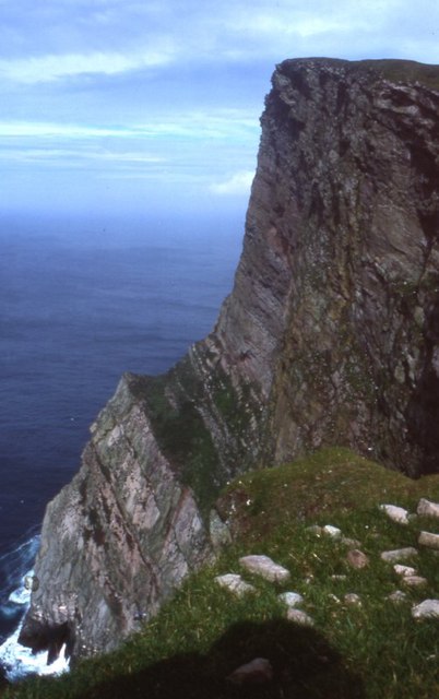
Sandstack is a prominent coastal feature located on the Shetland Islands, off the northern coast of Scotland. Specifically, it is situated on the eastern side of the main island, on the coastline that faces the North Sea. Sandstack is classified as a headland or point, jutting out into the sea.

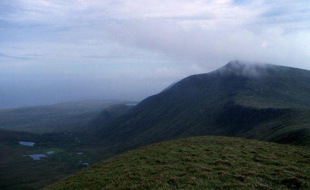
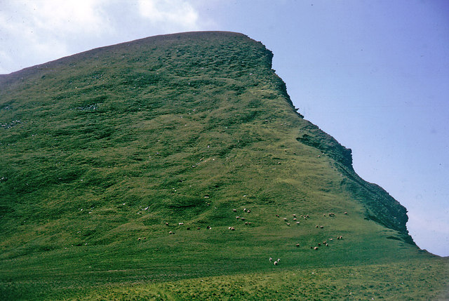
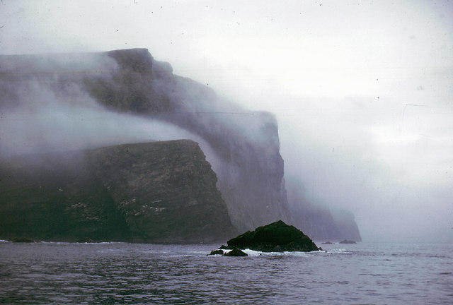
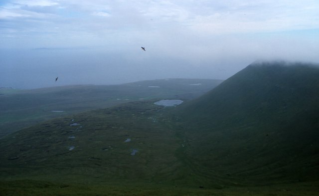
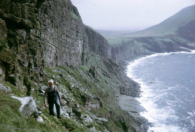
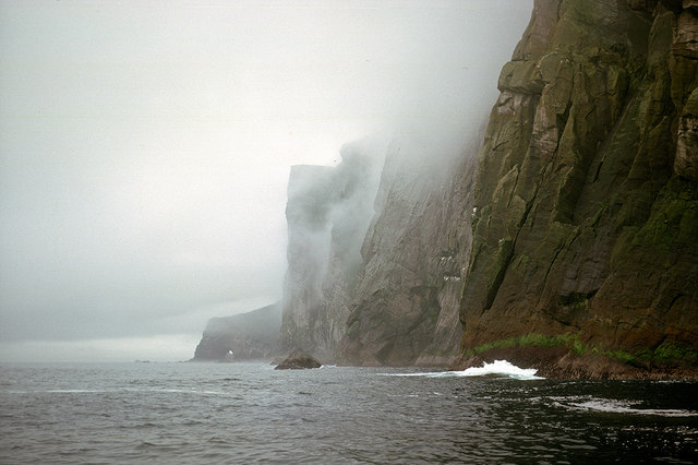
This coastal feature is characterized by its rugged and rocky terrain, with cliffs rising steeply from the sea. The rocks that make up Sandstack are primarily composed of sedimentary materials, such as sandstone and shale. Erosion by the relentless waves and weathering have shaped the headland over time, resulting in its distinctive appearance.

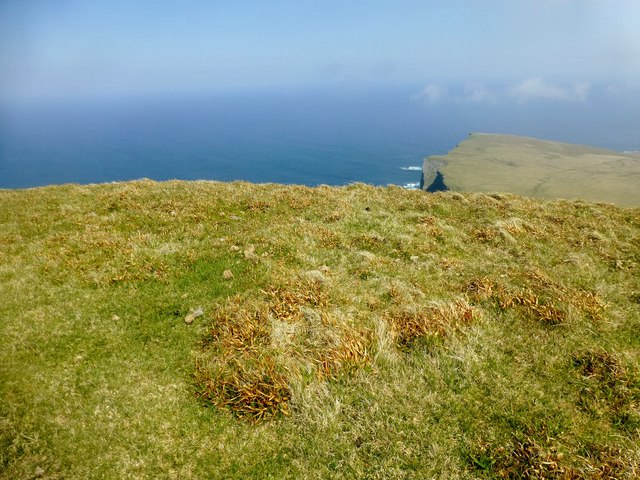
Sandstack offers breathtaking views of the surrounding coastline, with its elevated position providing an excellent vantage point. From here, visitors can observe the power of the ocean as it crashes against the cliffs, creating dramatic displays of spray and foam.

The headland is also home to a diverse range of flora and fauna. Sea birds, such as puffins and gannets, can often be spotted nesting on the cliffs, while seals can be seen basking on nearby rocks. The surrounding waters are teeming with marine life, including fish, dolphins, and even occasional sightings of whales.

Due to its remote location and exposed nature, Sandstack is not easily accessible to the general public. However, for those adventurous enough to make the journey, the headland offers a unique and awe-inspiring experience of the untamed beauty of the Shetland coastline.

If you have any feedback on the listing, please let us know in the comments section below.

Sandastack Images

Images are sourced within 2km of 60.131823/-2.1055171 or Grid Reference HT9438. Thanks to Geograph Open Source API. All images are credited.

The Kame of Foula Britain's highest cliff (unless, like some, you think that the 'ledge' halfway down disqualifies it). It is, of course, impossible to take a meaningful photograph wholly within the square. In fact, it is probably impossible to stand up on two feet within the square!
The Kame of Foula
Britain's highest cliff (unless, like some, you think that the 'ledge' halfway down disqualifies it). It is, of course, impossible to take a meaningful photograph wholly within the square. In fact, it is probably impossible to stand up on two feet within the square!
View from Da Kame to Da Sneug, Foula The highest hill on Foula and the second highest in Shetland. Taken from near da Kame. On the left are the Lochs o' da Fleck and the Loch o' Ouvrafandel is in the distance.
View from Da Kame to Da Sneug, Foula
The highest hill on Foula and the second highest in Shetland. Taken from near da Kame. On the left are the Lochs o' da Fleck and the Loch o' Ouvrafandel is in the distance.
Da Nort Bank On this slope the skuas attacked and the sheep tried to chase me over the cliff. It was the nesting season but both skuas and sheep meant business.
Da Nort Bank
On this slope the skuas attacked and the sheep tried to chase me over the cliff. It was the nesting season but both skuas and sheep meant business.
The cliffs of Foula The highest point, the Kame, is in the mist.
The cliffs of Foula
The highest point, the Kame, is in the mist.
Cliffs north-west of Da Smaalie, Foula These cliffs are on the west coast of Foula where the land rises steeply to the main ridge of hills that crosses the island.
Cliffs north-west of Da Smaalie, Foula
These cliffs are on the west coast of Foula where the land rises steeply to the main ridge of hills that crosses the island.
Hamnafield, Foula Hamnafield from the Sneug.
Hamnafield, Foula
Hamnafield from the Sneug.
The Noup, Foula Taken from the cliffs at the end of the valley of Da Smaalie.
The Noup, Foula
Taken from the cliffs at the end of the valley of Da Smaalie.
Sneck o' da Smaalie, Foula A crack in the rocks in the cliffs at the end of the valley of Da Smaalie. Slithering down and over the rocks down to the wave-cut beach at the bottom is a popular Sunday afternoon day out on Foula - or it was the day we descended.
Sneck o' da Smaalie, Foula
A crack in the rocks in the cliffs at the end of the valley of Da Smaalie. Slithering down and over the rocks down to the wave-cut beach at the bottom is a popular Sunday afternoon day out on Foula - or it was the day we descended.
Sneck  o' da Smaalie, Foula The view looking back up the crack in the cliffs after the descent. The upper and lower entrances to the Sneck are in different gridsquares.
Sneck o' da Smaalie, Foula
The view looking back up the crack in the cliffs after the descent. The upper and lower entrances to the Sneck are in different gridsquares.
Mucklebrik's Wick, Foula Taken after a descent of the Sneck o' da Smaalie, looking towards the headland of Wester Hoevda.
Mucklebrik's Wick, Foula
Taken after a descent of the Sneck o' da Smaalie, looking towards the headland of Wester Hoevda.
On a traverse of Ufshins There is a terrace beneath the major cliffs that can be accessed through the Sneck of Smallie.  You feel really remote down here.
On a traverse of Ufshins
There is a terrace beneath the major cliffs that can be accessed through the Sneck of Smallie. You feel really remote down here.
Puffins on the Ufshins Fabulous birds!
Puffins on the Ufshins
Fabulous birds!
View to The Noup over Mucklebrik from above Ufshins The vertical cleft of da Sneck o da Smallie is visible.  This cleft provides access to Ufshins and an exciting sheeptrack/footpath that eventually brings you out at the top of the cliffs.
View to The Noup over Mucklebrik from above Ufshins
The vertical cleft of da Sneck o da Smallie is visible. This cleft provides access to Ufshins and an exciting sheeptrack/footpath that eventually brings you out at the top of the cliffs.
Ufshins Looking back along the terrace towards the Sneck of the Smallie.  This is an exhilarating walk.
Ufshins
Looking back along the terrace towards the Sneck of the Smallie. This is an exhilarating walk.
The 1000 ft cliff of Nebbifield The near vertical face of Nebbifield viewed from below the top of the Kame
The 1000 ft cliff of Nebbifield
The near vertical face of Nebbifield viewed from below the top of the Kame
The base of the Nebbifield sea cliffs The lower section of the 1000 ft sea cliff
The base of the Nebbifield sea cliffs
The lower section of the 1000 ft sea cliff
Da Kame A super scenic spot today with Tricky Speirs.
Name: Da Kame
Hill number: 103797
Height: 376m / 1234ft
Area: 22: Shetland Islands
Class: 3
Grid ref: HT940400 (est)
Drop: 60m
Col: 316m  HT944397
Da Kame
A super scenic spot today with Tricky Speirs. Name: Da Kame Hill number: 103797 Height: 376m / 1234ft Area: 22: Shetland Islands Class: 3 Grid ref: HT940400 (est) Drop: 60m Col: 316m HT944397
Below Da Nort Bank Beneath the steep straight coastline of Da Nort Bank.  No GPS in 1964 so this is my best estimate.
Below Da Nort Bank
Beneath the steep straight coastline of Da Nort Bank. No GPS in 1964 so this is my best estimate.
Show me another place!

Sandastack is located at Grid Ref: HT9438 (Lat: 60.131823, Lng: -2.1055171)

Unitary Authority: Shetland Islands

Police Authority: Highlands and Islands

What 3 Words

///essays.friction.extremely. Near Walls, Shetland Islands

Related Wikis

Foula

Foula (), located in the Shetland archipelago of Scotland, is one of the United Kingdom's most remote permanently inhabited islands. Owned since the turn...

Foula Airfield

Foula Airfield (IATA: FOA) is an airfield located on the remote island of Foula, part of the Shetland Islands in the north of Scotland. == History == The...

RMS Oceanic (1899)

Oceanic was a transatlantic ocean liner built for the White Star Line. She sailed on her maiden voyage on 6 September 1899 and was the largest ship in...

Nearby Amenities

Located within 500m of 60.131823,-2.1055171
Mucklabrek's Wick
Place: locality
Lat/Long: 60.1298176/-2.1034554
The data included in this document is from www.openstreetmap.org. The data is made available under ODbL.

Have you been to Sandastack?

Leave your review of Sandastack below (or comments, questions and feedback).