Little Kipp

Coastal Feature, Headland, Point in Aberdeenshire

Scotland

Little Kipp

Caves at Aberdour beach From the top of the cliff looking down towards the beach and caves
Caves at Aberdour beach Credit: Ralph Greig

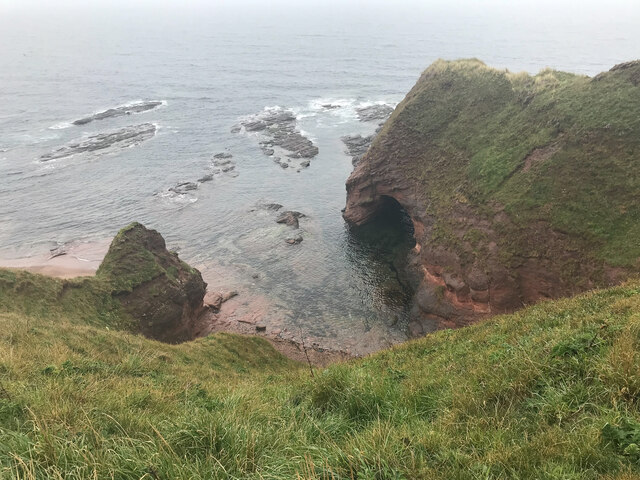
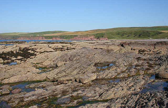
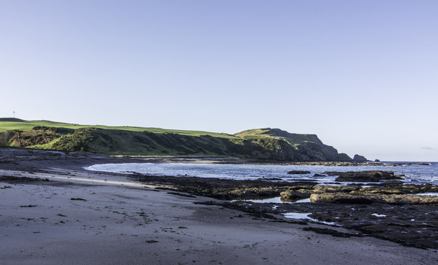
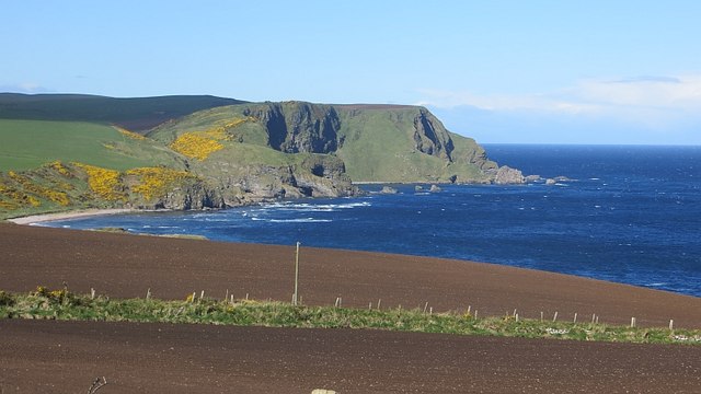
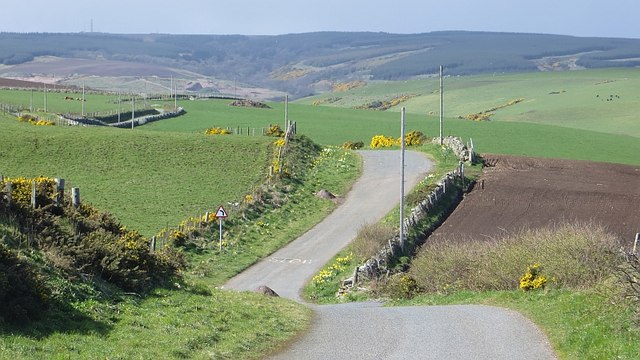
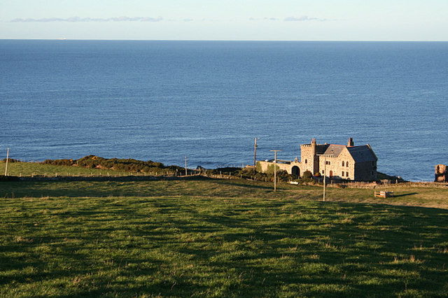
Little Kipp is a prominent coastal feature located in Aberdeenshire, Scotland. It is a headland that stretches out into the North Sea, forming a distinctive point along the coastline. Situated about 10 miles south of Fraserburgh, Little Kipp stands as a natural landmark in the region.

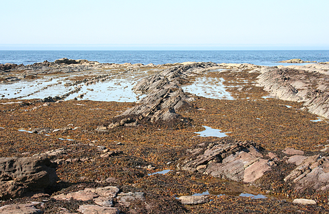
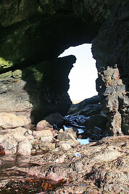
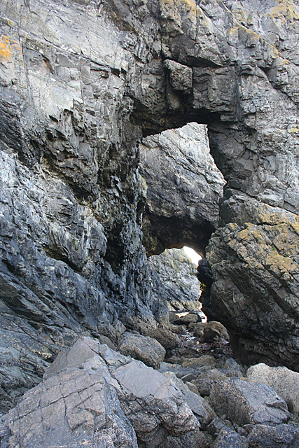
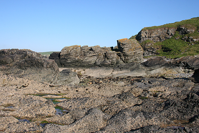
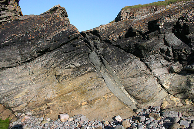
The headland is characterized by its rugged cliffs and rocky terrain, providing a dramatic backdrop against the crashing waves of the North Sea. The cliffs of Little Kipp reach heights of approximately 30 meters, offering breathtaking panoramic views of the surrounding area.

The area surrounding Little Kipp is rich in biodiversity, with a variety of plant and animal species inhabiting the rocky shores and nearby waters. Seabirds such as gannets, guillemots, and puffins can often be spotted nesting on the cliffs, while seals and dolphins are occasionally seen swimming offshore.

Little Kipp is also a popular destination for outdoor enthusiasts and nature lovers. The headland offers opportunities for hiking, birdwatching, and photography, attracting visitors from near and far. Its secluded location and unspoiled natural beauty make it an ideal spot for those seeking tranquility and a connection with nature.

Access to Little Kipp is relatively easy, with a well-maintained footpath leading to the point. However, caution is advised when navigating the cliffs, as they can be steep and slippery. It is also advisable to check the tide times, as the headland can be cut off from the mainland during high tide.

Overall, Little Kipp is a picturesque coastal feature that showcases the stunning beauty of Aberdeenshire's rugged coastline. Its unique geology, diverse wildlife, and recreational opportunities make it a must-visit destination for nature enthusiasts and adventurers alike.

If you have any feedback on the listing, please let us know in the comments section below.
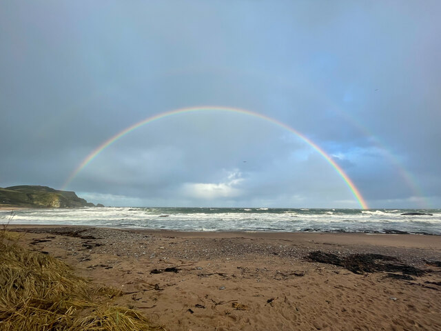
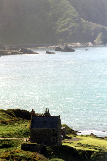
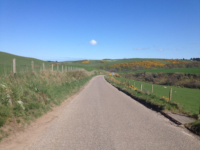
Little Kipp Images

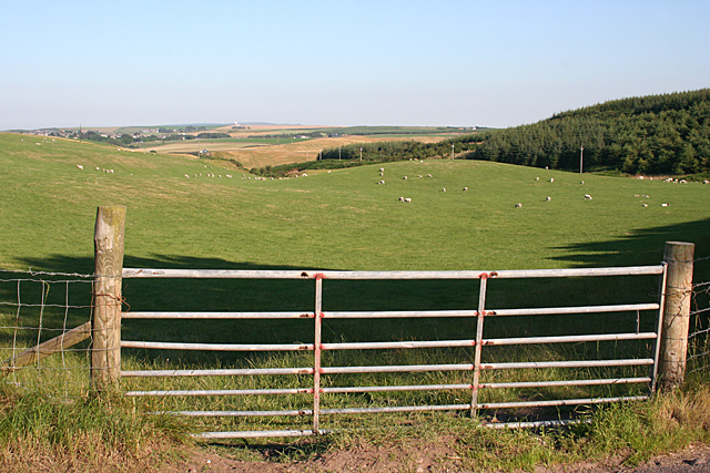
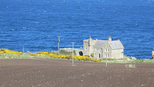
Images are sourced within 2km of 57.673659/-2.1989546 or Grid Reference NJ8864. Thanks to Geograph Open Source API. All images are credited.

Caves at Aberdour beach From the top of the cliff looking down towards the beach and caves
Caves at Aberdour beach
From the top of the cliff looking down towards the beach and caves
Beach Rainbow
Beach Rainbow
Dundarg Castle House A Category B Listed castellated house built by Air Vice Marshall Carnegie in 1937-8 mostly from the Aberdour Free Church. The house is sited within a Scheduled Ancient Monument. Constructed on the site of a prehistoric promontory fort, Dundarg was a late 13th/early 14th century Castle first mentioned in 1334 when it was besieged by and fell to the Warden of Scotland, Sir Andrew de Moray in December that year. The castle was then abandoned although there is some evidence it was briefly re-fortified, perhaps in the period 1550-60.
Dundarg Castle House
A Category B Listed castellated house built by Air Vice Marshall Carnegie in 1937-8 mostly from the Aberdour Free Church. The house is sited within a Scheduled Ancient Monument. Constructed on the site of a prehistoric promontory fort, Dundarg was a late 13th/early 14th century Castle first mentioned in 1334 when it was besieged by and fell to the Warden of Scotland, Sir Andrew de Moray in December that year. The castle was then abandoned although there is some evidence it was briefly re-fortified, perhaps in the period 1550-60.
B9031 near Towie
B9031 near Towie
Black Dog The rocks on the shore here are sandstones, and they are dipping at about 30º to the west.
Black Dog
The rocks on the shore here are sandstones, and they are dipping at about 30º to the west.
Natural Arch at Pitjossie This is one of two natural arches, quite close together. It was not easy to get through both of them, and I could not have got any further without getting very wet. I don't mind that for me, but I don't like getting the camera wet! For the reciprocal view see <a href="https://www.geograph.org.uk/photo/4095801">NJ8765 : Natural Arch</a>.
Natural Arch at Pitjossie
This is one of two natural arches, quite close together. It was not easy to get through both of them, and I could not have got any further without getting very wet. I don't mind that for me, but I don't like getting the camera wet! For the reciprocal view see NJ8765 : Natural Arch.
Natural Arch This is the reciprocal view of <a href="https://www.geograph.org.uk/photo/4095796">NJ8765 : Natural Arch at Pitjossie</a>.
Natural Arch
This is the reciprocal view of NJ8765 : Natural Arch at Pitjossie.
Natural Arches Looking through both natural arches from Ceard's Cove to Pitjossie.
Natural Arches
Looking through both natural arches from Ceard's Cove to Pitjossie.
Ceard's Cove The rocks here are metamorphic, and they are overlain by sandstone just a few tens of metres beyond here.
Ceard's Cove
The rocks here are metamorphic, and they are overlain by sandstone just a few tens of metres beyond here.
Metamorphic Rocks This is one of the easternmost of the metamorphic rock outcrops on this coast.
Metamorphic Rocks
This is one of the easternmost of the metamorphic rock outcrops on this coast.
Sandstone Strata These rocks are dipping at about 30º to the north, which is curious because just a short distance away the rocks dip to the west. Another visit, with more time and less tide, is called for!
Sandstone Strata
These rocks are dipping at about 30º to the north, which is curious because just a short distance away the rocks dip to the west. Another visit, with more time and less tide, is called for!
St Drostan's Kirk and Beach House The ruins are those of St Drostan's Kirk, dating from the early 16th century. Beach House is the former manse. It was built by Alexander Laing with William Robertson in Regency style, with a semicircular stair at the rear.
St Drostan's Kirk and Beach House
The ruins are those of St Drostan's Kirk, dating from the early 16th century. Beach House is the former manse. It was built by Alexander Laing with William Robertson in Regency style, with a semicircular stair at the rear.
Pitnacalder Pitnacalder stands above the Dour Water where it emerges from Drostan Den.
Pitnacalder
Pitnacalder stands above the Dour Water where it emerges from Drostan Den.
Looking towards Drostan Den The actual den, through which the headwaters of the Dour flow, is hidden by the lie of the land. It is to the right, between the field and the wood.
Looking towards Drostan Den
The actual den, through which the headwaters of the Dour flow, is hidden by the lie of the land. It is to the right, between the field and the wood.
New Aberdour Beach
New Aberdour Beach
View towards Strahangles Point Arable foreground and a wild coast between Rosehearty and Pennan.
View towards Strahangles Point
Arable foreground and a wild coast between Rosehearty and Pennan.
Dundarg Castle House Farmland and a house beside the site of Dundarg Castle.
Dundarg Castle House
Farmland and a house beside the site of Dundarg Castle.
Winding road The coast road passes Dundarg Castle.
Winding road
The coast road passes Dundarg Castle.
Show me another place!

Little Kipp is located at Grid Ref: NJ8864 (Lat: 57.673659, Lng: -2.1989546)

Unitary Authority: Aberdeenshire

Police Authority: North East

What 3 Words

///triangle.energy.landscape. Near Rosehearty, Aberdeenshire

Related Wikis

Rescue from SS William Hope

In the 1884 rescue from SS William Hope in Aberdour Bay off the north coast of Aberdeenshire in Scotland Jane Whyte rescued fifteen sailors from their...

Dundarg Castle

Dundarg Castle is a ruined castle about 2 kilometres (1.2 mi) north-northeast of New Aberdour, Aberdeenshire, Scotland, built within the ramparts of an...

New Aberdour

New Aberdour is a small planned village in the Aberdour parish of Aberdeenshire, Scotland, situated south of Aberdour Bay on the Moray Firth. It lies 7...

Aberdour House (Aberdeenshire)

Aberdour House is Category A listed country house in New Aberdour, Aberdeenshire, Scotland. Dating to around 1740, it was built by John Forbes, of Knappernay...

Nearby Amenities

Located within 500m of 57.673659,-2.1989546
Source: Old Landsat image trace
Lat/Long: 57.6729179/-2.1968905
Source: Old Landsat image trace
Lat/Long: 57.6720642/-2.1939111
Source: Old Landsat image trace
Lat/Long: 57.6717787/-2.1921279
Source: Old Landsat image trace
Lat/Long: 57.6717839/-2.1926993
Source: Old Landsat image trace
Lat/Long: 57.6732188/-2.1978143
Source: Old Landsat image trace
Lat/Long: 57.6719924/-2.1913968
Toilets
Access: yes
Fee: no
Operator: Aberdeenshire Council
Unisex: yes
Lat/Long: 57.6710405/-2.1934389
Power: pole
Lat/Long: 57.6693722/-2.2011844
Power: pole
Lat/Long: 57.6694264/-2.1997971
Power: pole
Lat/Long: 57.6694775/-2.1984889
Power: pole
Lat/Long: 57.669431/-2.1976211
Power: pole
Lat/Long: 57.6693856/-2.1967664
The data included in this document is from www.openstreetmap.org. The data is made available under ODbL.

Have you been to Little Kipp?

Leave your review of Little Kipp below (or comments, questions and feedback).