Guide About

Coastal Feature, Headland, Point in Kincardineshire

Scotland

Guide About

Looking down into Trollochy Trollochy is a short, cliff girt inlet below Crawton.
Looking down into Trollochy Credit: Gordon Hatton

Guide About is a prominent coastal feature located in Kincardineshire, Scotland. It is a headland that juts out into the North Sea, forming a distinct point along the coastline. The headland is situated approximately 10 kilometers south of Stonehaven and 40 kilometers south of Aberdeen.

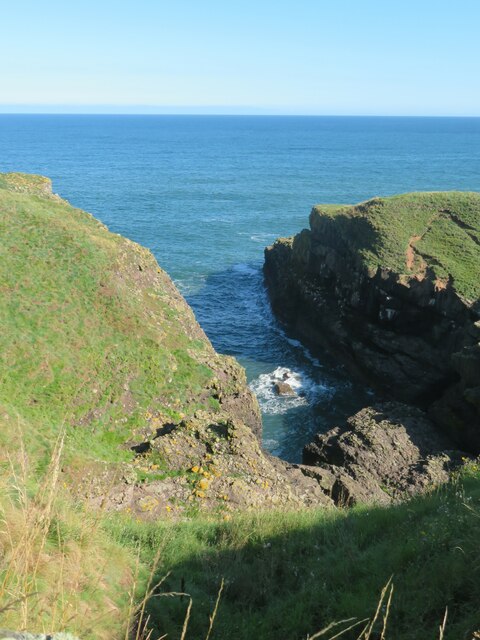
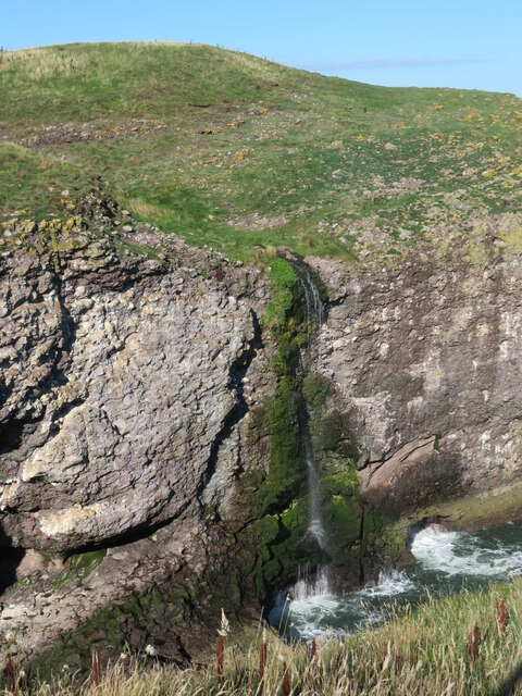
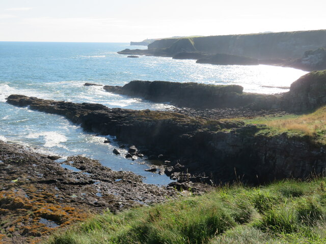
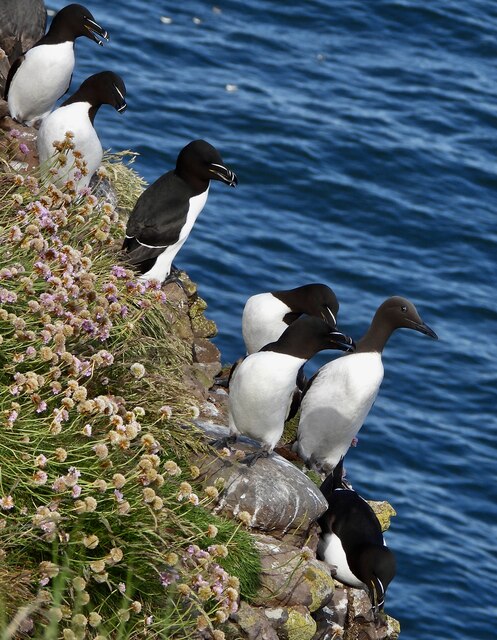
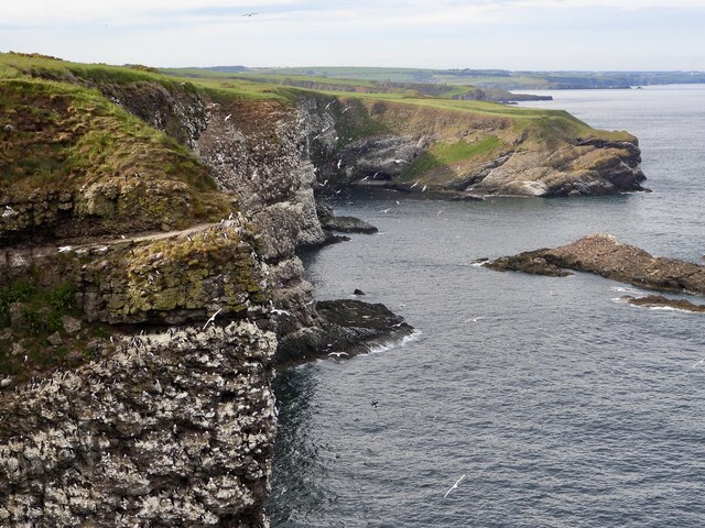
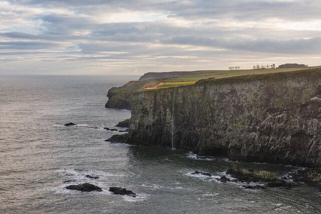
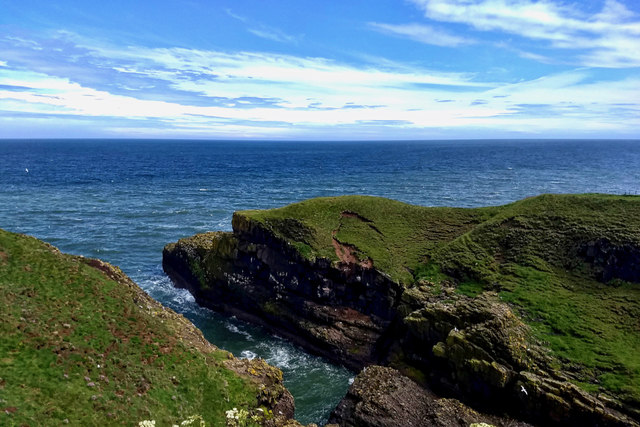
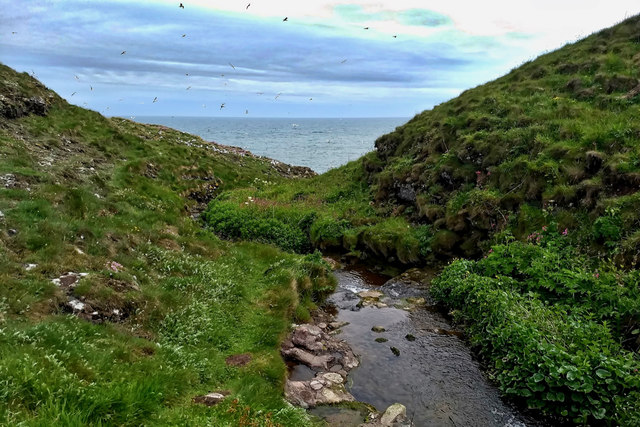
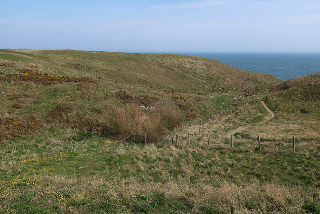
Guide About offers stunning panoramic views of the surrounding area, including the rugged coastline, the North Sea, and the nearby Dunnottar Castle. The headland is known for its dramatic cliffs, which provide a habitat for various seabirds such as fulmars, guillemots, and kittiwakes. The crashing waves against the cliffs create a picturesque and awe-inspiring sight.

The area around Guide About is also rich in marine life. It is a popular spot for fishing enthusiasts, with the possibility of catching species such as cod, mackerel, and haddock. The headland is also frequented by seals, dolphins, and occasionally even whales, making it a great location for wildlife spotting.

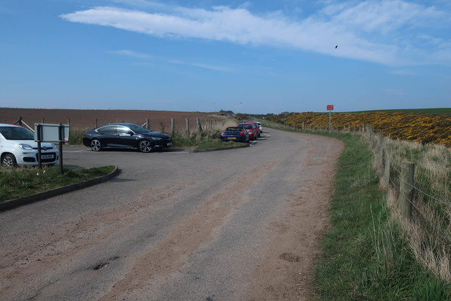
Access to Guide About is relatively easy, with a well-maintained footpath leading to the headland. The path offers a pleasant walk through the coastal landscape, and there are designated viewpoints along the way for visitors to pause and take in the breathtaking scenery.

Overall, Guide About is a must-visit destination for nature lovers and outdoor enthusiasts. Its rugged cliffs, diverse wildlife, and stunning views make it a truly remarkable coastal feature in Kincardineshire.

If you have any feedback on the listing, please let us know in the comments section below.

Guide About Images

Images are sourced within 2km of 56.920025/-2.2003924 or Grid Reference NO8780. Thanks to Geograph Open Source API. All images are credited.

Looking down into Trollochy Trollochy is a short, cliff girt inlet below Crawton.
Looking down into Trollochy
Trollochy is a short, cliff girt inlet below Crawton.
Waterfall into the sea at Crawton A wee burn makes a dramatic plunge into the cliff bound inlet of Trollochy at Crawton.
Waterfall into the sea at Crawton
A wee burn makes a dramatic plunge into the cliff bound inlet of Trollochy at Crawton.
Rock ribs extending out into the sea at Crawton The view south from the small headland at Crawton where rocky reefs defy the waves. The view extends along Crawton Bay.
Rock ribs extending out into the sea at Crawton
The view south from the small headland at Crawton where rocky reefs defy the waves. The view extends along Crawton Bay.
Baler at work Tractor with baler working a harvested field near Cowieswells Farm.
Baler at work
Tractor with baler working a harvested field near Cowieswells Farm.
Razorbills and Guillemots Lives most of the year at sea, coming to land to breed. Both birds depends on the health of the marine environment. Fishing nets, pollution at sea and declining fish stocks all threaten these birds.
Razorbills and Guillemots
Lives most of the year at sea, coming to land to breed. Both birds depends on the health of the marine environment. Fishing nets, pollution at sea and declining fish stocks all threaten these birds.
Cliffs at Crawley Bird Sanctuary Not so many birds to be seen on the cliff face due to the devastation of Bird flu on the bird population.
Cliffs at Crawley Bird Sanctuary
Not so many birds to be seen on the cliff face due to the devastation of Bird flu on the bird population.
Waterfall in Tremuda Bay The water from small burn draining the fields above forms the small but prominent waterfall.
Waterfall in Tremuda Bay
The water from small burn draining the fields above forms the small but prominent waterfall.
A minor road near Catterline You can just see the foglights through the haar. There is a conifer shelter belt on the left, and the trees have thinned the fog enough to get a shot off.
A minor road near Catterline
You can just see the foglights through the haar. There is a conifer shelter belt on the left, and the trees have thinned the fog enough to get a shot off.
Farmland near Mill of Uras
Cotbank of Hilton
Cotbank of Hilton
New house, Cotbank of Hilton
National Cycle Route 1  Heading south near Cotbank of Hilton.
National Cycle Route 1
Heading south near Cotbank of Hilton.
National Cycle Route 1 Heading south.
National Cycle Route 1
Heading south.
Trollochy
Trollochy
Stream into Trollochy
Parking for Fowlsheugh A large seabird colony and RSPB reserve.
Parking for Fowlsheugh
A large seabird colony and RSPB reserve.
Path to the cliffs, Fowlsheugh
New house in Crawton
Show me another place!

Guide About is located at Grid Ref: NO8780 (Lat: 56.920025, Lng: -2.2003924)

Unitary Authority: Aberdeenshire

Police Authority: North East

What 3 Words

///mankind.caressed.prayers. Near Stonehaven, Aberdeenshire

Related Wikis

Craiglethy

Craiglethy (Scottish Gaelic: Creag Liathach - meaning grey rock) is a small island/skerry off Fowlsheugh on the east coast of Aberdeenshire, Scotland in...

Fowlsheugh

Fowlsheugh is a coastal nature reserve in Kincardineshire, northeast Scotland, known for its 70-metre-high (230 ft) cliff formations and habitat supporting...

Crawton

Crawton is a former fishing community on the southeast Aberdeenshire coast in Scotland, deserted since 1927. Approximately three miles south of Stonehaven...

Thornyhive Bay

Thornyhive Bay is an embayment along the North Sea coast in Aberdeenshire, Scotland. This bay is situated approximately 2.5 miles south of the town of...

Catterline

Catterline is a coastal village on the North Sea in Aberdeenshire, Scotland. It is situated about 5 miles (8.0 km) south of Stonehaven; nearby to the...

Dunnottar Castle

Dunnottar Castle (Scottish Gaelic: Dùn Fhoithear, "fort on the shelving slope") is a ruined medieval fortress located upon a rocky headland on the north...

Bowdun Head

Bowdun Head is a headland landform on the North Sea coast approximately one kilometre south of Stonehaven, Scotland.(Ordnance Survey, 2004) Slightly to...

Dunnicaer

Dunnicaer, or Dun-na-caer, is a precipitous sea stack just off the coast of Aberdeenshire, Scotland, between Dunnottar Castle and Stonehaven. Despite the...

Nearby Amenities

Located within 500m of 56.920025,-2.2003924
Created By: almien_coastlines
Source: PGS
Lat/Long: 56.921602/-2.198185
Created By: almien_coastlines
Source: PGS
Lat/Long: 56.921733/-2.19865
Created By: almien_coastlines
Source: PGS
Lat/Long: 56.921863/-2.198882
Created By: almien_coastlines
Source: PGS
Lat/Long: 56.922376/-2.199105
Created By: almien_coastlines
Source: PGS
Lat/Long: 56.922379/-2.199573
Created By: almien_coastlines
Source: PGS
Lat/Long: 56.922635/-2.199567
Created By: almien_coastlines
Source: PGS
Lat/Long: 56.92276/-2.199096
Created By: almien_coastlines
Source: PGS
Lat/Long: 56.922885/-2.198626
Created By: almien_coastlines
Source: PGS
Lat/Long: 56.922372/-2.198403
Source: PGS
Lat/Long: 56.9165863/-2.1985334
Source: PGS
Lat/Long: 56.9168773/-2.198731
Source: PGS
Lat/Long: 56.9169993/-2.1988134
Source: PGS
Lat/Long: 56.9173195/-2.1988099
Source: PGS
Lat/Long: 56.9175592/-2.1989966
Source: PGS
Lat/Long: 56.9186519/-2.1998452
Source: PGS
Lat/Long: 56.9199427/-2.200158
Source: PGS
Lat/Long: 56.9209985/-2.2005072
Source: PGS
Lat/Long: 56.9213604/-2.2000472
Source: PGS
Lat/Long: 56.9225159/-2.2008765
Source: PGS
Lat/Long: 56.9227616/-2.2012829
Source: PGS
Lat/Long: 56.9231736/-2.1999257
Source: PGS
Lat/Long: 56.924341/-2.2002904
Source: PGS
Lat/Long: 56.9244164/-2.2008001
Source: PGS
Lat/Long: 56.9160347/-2.1980586
Uras Knaps
Place: locality
Lat/Long: 56.9192203/-2.2043937
Valehead
Place: isolated_dwelling
Lat/Long: 56.9158558/-2.2029614
Power: pole
Lat/Long: 56.9159504/-2.2035149
Power: pole
Lat/Long: 56.9226164/-2.206878
Material: wood
Power: pole
Lat/Long: 56.9220163/-2.2068338
Material: wood
Power: pole
Lat/Long: 56.9214931/-2.2067695
Material: wood
Power: pole
Lat/Long: 56.9208435/-2.2070707
Material: wood
Power: pole
Lat/Long: 56.920164/-2.2073846
Power: pole
Lat/Long: 56.9194672/-2.2077217
Power: pole
Lat/Long: 56.9190027/-2.2079239
Material: wood
Power: pole
Lat/Long: 56.9192166/-2.2083073
The data included in this document is from www.openstreetmap.org. The data is made available under ODbL.

Have you been to Guide About?

Leave your review of Guide About below (or comments, questions and feedback).