Scarffie Geo

Coastal Feature, Headland, Point in Orkney

Scotland

Scarffie Geo

Holland House from Nouster, North Ronaldsay
Holland House from Nouster, North Ronaldsay Credit: Mike Pennington

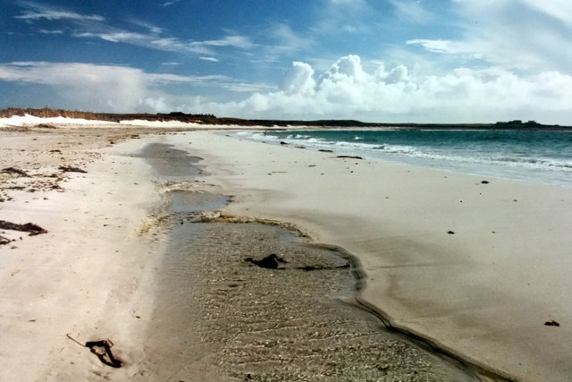
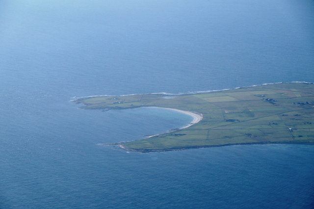
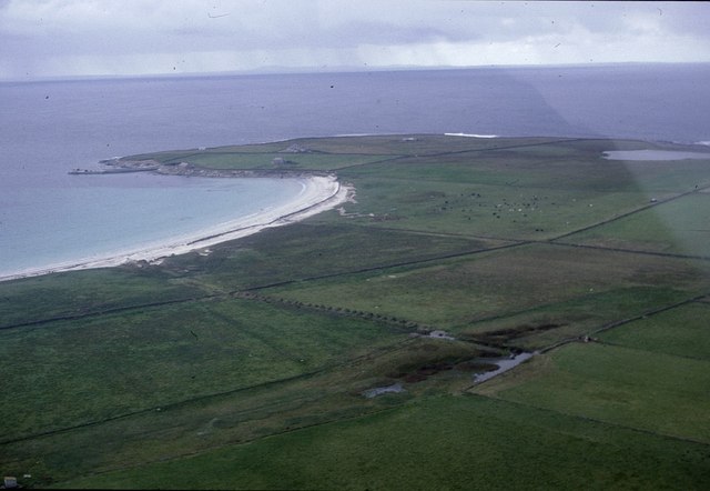
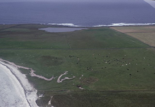
Scarffie Geo is a prominent coastal feature located on the mainland of Orkney, a group of islands in the northern part of Scotland. It is a picturesque headland that juts out into the North Sea, forming a distinct point along the stunning coastline.

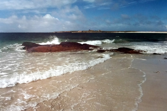
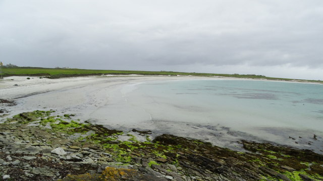
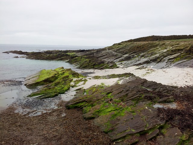
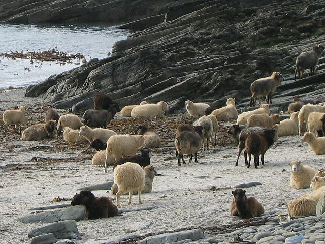
The geo, a term used locally to describe a narrow inlet or cove, is characterized by steep cliffs that rise dramatically from the sea. These cliffs are composed of rugged sandstone, creating a striking contrast with the deep blue waters below. The exposed rock formations showcase the area's geological history and provide a habitat for various seabirds and marine life.

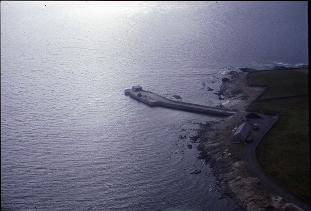
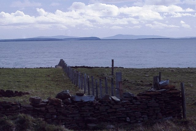
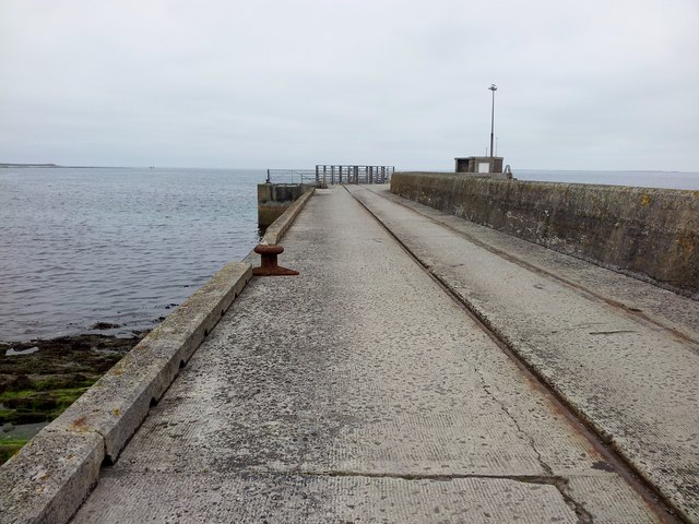
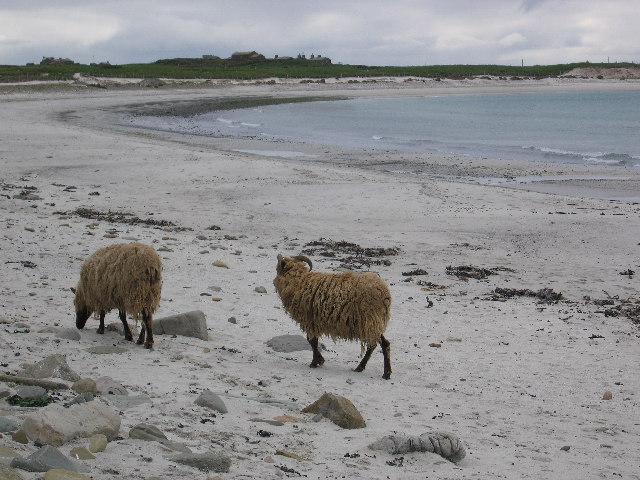
Scarffie Geo offers breathtaking panoramic views of the surrounding seascape, with the neighboring islands of Hoy and Rousay visible in the distance. The headland is a popular spot for outdoor enthusiasts, attracting hikers, birdwatchers, and photographers alike. Its remote location and unspoiled natural beauty make it an ideal destination for those seeking tranquility and solitude.

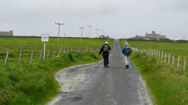
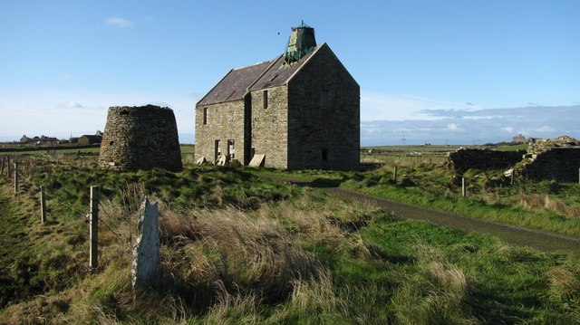
Visitors to Scarffie Geo can enjoy leisurely walks along the coastal path, exploring the diverse flora and fauna that inhabit the area. The headland also serves as a historical site, with remnants of ancient settlements and archaeological sites scattered throughout the surrounding landscape.

Overall, Scarffie Geo is a captivating coastal feature in Orkney, offering a unique combination of striking geological formations, breathtaking vistas, and a rich cultural and natural heritage.

If you have any feedback on the listing, please let us know in the comments section below.

Scarffie Geo Images

Images are sourced within 2km of 59.347352/-2.420313 or Grid Reference HY7651. Thanks to Geograph Open Source API. All images are credited.

Holland House from Nouster, North Ronaldsay
Nouster Bay, North Ronaldsay Although named South Bay on OS maps, this is known as Nouster Bay locally.
Nouster Bay, North Ronaldsay
Although named South Bay on OS maps, this is known as Nouster Bay locally.
Nouster Bay, North Ronaldsay Looking across towards the pier; although named South Bay on OS maps, the bay is known as Nouster Bay locally.
Nouster Bay, North Ronaldsay
Looking across towards the pier; although named South Bay on OS maps, the bay is known as Nouster Bay locally.
South Bay, North Ronaldsay, from the air
Off loading cars from MV Earl Sigard at North Ronaldsay North Ronaldsay is the only inhabited island in the Orkney Islands where vehicles need to be craned off and on.
Off loading cars from MV Earl Sigard at North Ronaldsay
North Ronaldsay is the only inhabited island in the Orkney Islands where vehicles need to be craned off and on.
On North Ronaldsay - South Bay
On North Ronaldsay - walking from the jetty towards Holland
Old mills at Nesstoun, North Ronaldsay The large building is a watermill, built in 1907 to replace another nearby. The conical stump is the base of Peckhouse Windmill which had a wooden upper structure.
Old mills at Nesstoun, North Ronaldsay
The large building is a watermill, built in 1907 to replace another nearby. The conical stump is the base of Peckhouse Windmill which had a wooden upper structure.
Nouster Bay, North Ronaldsay, from the air Named South Bay on the maps but known as Nouster Bay on the island. Twingness and Loch Gretchen are in the background.
Nouster Bay, North Ronaldsay, from the air
Named South Bay on the maps but known as Nouster Bay on the island. Twingness and Loch Gretchen are in the background.
Dunes behind Nouster Bay, North Ronaldsay, from the air Loch Gretchen is in the background.
Dunes behind Nouster Bay, North Ronaldsay, from the air
Loch Gretchen is in the background.
North Ronaldsay pier from the air
View to the rest of Orkney from North Ronaldsay From near the Bird Observatory, looking towards, if I remember correctly, Sanday, Eday and Rousay.
View to the rest of Orkney from North Ronaldsay
From near the Bird Observatory, looking towards, if I remember correctly, Sanday, Eday and Rousay.
Midsummer sunset at the North Ronaldsay standing stone There appears to be no significance to the alignment of the stone according to the solstice, although the stone does appear to aligned with the setting sun at the equinox.
Midsummer sunset at the North Ronaldsay standing stone
There appears to be no significance to the alignment of the stone according to the solstice, although the stone does appear to aligned with the setting sun at the equinox.
Coastal View Near North Ronaldsay Pier
Pier at North Ronaldsay
North Ronaldsay sheep The sheep are a special breed which has evolved to eat seaweed. All access to the shore is fenced to stop them getting onto pastures as their digestive systems cannot cope with grass.
North Ronaldsay sheep
The sheep are a special breed which has evolved to eat seaweed. All access to the shore is fenced to stop them getting onto pastures as their digestive systems cannot cope with grass.
Burrian Broch, North Ronaldsay
South Bay beach on North Ronaldsay Sheep on the South Bay beach near Nouster at the southern end of North Ronaldsay, the most Northerly Orkney Island. The Sheep famously spend most of the year grazing only on the beach and seaweed, kept there by a 13 mile drystone dyke, maintained by the community, that circles the entire island.
South Bay beach on North Ronaldsay
Sheep on the South Bay beach near Nouster at the southern end of North Ronaldsay, the most Northerly Orkney Island. The Sheep famously spend most of the year grazing only on the beach and seaweed, kept there by a 13 mile drystone dyke, maintained by the community, that circles the entire island.
Show me another place!

Scarffie Geo is located at Grid Ref: HY7651 (Lat: 59.347352, Lng: -2.420313)

Unitary Authority: Orkney Islands

Police Authority: Highlands and Islands

What 3 Words

///continued.jeep.banks. Near Hollandstoun, Orkney Islands

Related Wikis

Broch of Burrian

The Broch of Burrian is an Iron Age broch located on North Ronaldsay in the Orkney Islands, in Scotland (grid reference HY76275138). == Location == The...

Bustatoun

Bustatoun is a village on the island of North Ronaldsay, in Orkney, Scotland. The settlement is within the parish of Cross and Burness. == References... ==

North Ronaldsay Airport

North Ronaldsay Airport (IATA: NRL, ICAO: EGEN) is located on North Ronaldsay island, 28 NM (52 km; 32 mi) northeast by north of Kirkwall, Orkney Islands...

Ancumtoun

Ancumtoun is a small settlement in the north of the island of North Ronaldsay, Orkney, Scotland. The settlement is within the parish of Cross and Burness...

Nearby Amenities

Located within 500m of 59.347352,-2.420313
Broch of Burrian
Historic: archaeological_site
Wikidata: Q15108049
Wikipedia: en:Broch of Burrian
Lat/Long: 59.3480729/-2.4189244
Point of Burrian
Place: locality
Lat/Long: 59.3476855/-2.4183048
The data included in this document is from www.openstreetmap.org. The data is made available under ODbL.

Have you been to Scarffie Geo?

Leave your review of Scarffie Geo below (or comments, questions and feedback).