Long Labor

Coastal Feature, Headland, Point in Orkney

Scotland

Long Labor

Holland House from Nouster, North Ronaldsay
Holland House from Nouster, North Ronaldsay Credit: Mike Pennington

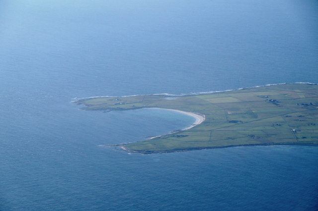
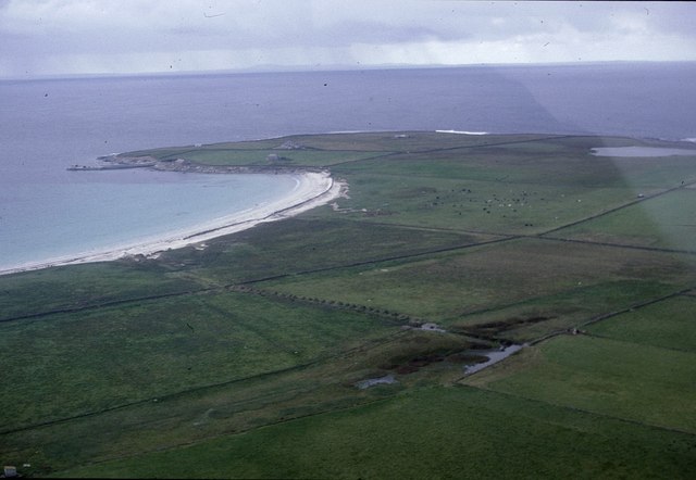
Long Labor is a prominent coastal feature located in Orkney, an archipelago in northeastern Scotland. It is a headland that extends into the North Sea, forming a distinct point on the coastline. The name "Long Labor" is derived from the Old Norse language, where "Long" refers to the length of the headland and "Labor" means "a promontory."

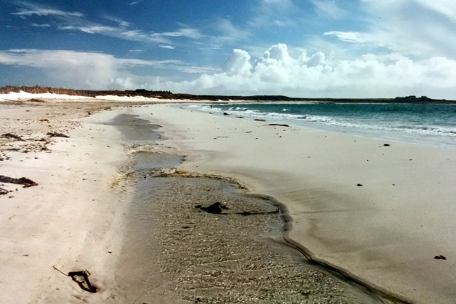
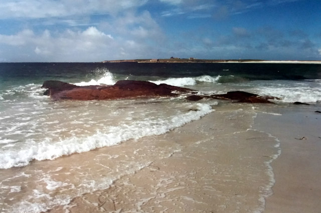
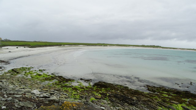
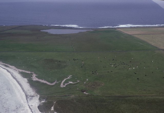
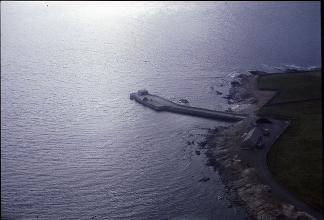
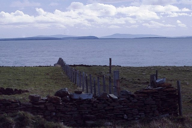
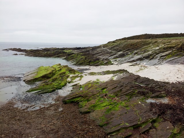
This coastal feature is characterized by its rugged and rocky terrain, with steep cliffs that drop dramatically into the sea. These cliffs are composed of layered sedimentary rocks, showcasing the geological history of the area. Long Labor is known for its striking beauty, with its sheer cliffs providing breathtaking views of the surrounding coastline and the vast expanse of the North Sea.

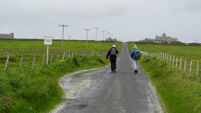
The headland is a popular destination for nature enthusiasts and hikers, offering various walking trails that allow visitors to explore its unique landscape. These trails provide opportunities to observe diverse flora and fauna, including seabirds such as fulmars, guillemots, and puffins, which nest on the cliffs during the breeding season.

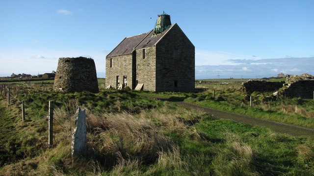
Long Labor also has historical significance, as it is home to the remains of an ancient broch, a round stone tower built during the Iron Age. This archaeological site provides insight into the early human settlement of the area and is of interest to historians and archaeologists alike.

Overall, Long Labor is a captivating coastal feature in Orkney, attracting visitors with its natural beauty, diverse wildlife, and historical significance.

If you have any feedback on the listing, please let us know in the comments section below.

Long Labor Images

Images are sourced within 2km of 59.347284/-2.4220353 or Grid Reference HY7651. Thanks to Geograph Open Source API. All images are credited.

Holland House from Nouster, North Ronaldsay
Nouster Bay, North Ronaldsay Although named South Bay on OS maps, this is known as Nouster Bay locally.
Nouster Bay, North Ronaldsay
Although named South Bay on OS maps, this is known as Nouster Bay locally.
Nouster Bay, North Ronaldsay Looking across towards the pier; although named South Bay on OS maps, the bay is known as Nouster Bay locally.
Nouster Bay, North Ronaldsay
Looking across towards the pier; although named South Bay on OS maps, the bay is known as Nouster Bay locally.
South Bay, North Ronaldsay, from the air
Off loading cars from MV Earl Sigard at North Ronaldsay North Ronaldsay is the only inhabited island in the Orkney Islands where vehicles need to be craned off and on.
Off loading cars from MV Earl Sigard at North Ronaldsay
North Ronaldsay is the only inhabited island in the Orkney Islands where vehicles need to be craned off and on.
On North Ronaldsay - South Bay
On North Ronaldsay - walking from the jetty towards Holland
Old mills at Nesstoun, North Ronaldsay The large building is a watermill, built in 1907 to replace another nearby. The conical stump is the base of Peckhouse Windmill which had a wooden upper structure.
Old mills at Nesstoun, North Ronaldsay
The large building is a watermill, built in 1907 to replace another nearby. The conical stump is the base of Peckhouse Windmill which had a wooden upper structure.
Nouster Bay, North Ronaldsay, from the air Named South Bay on the maps but known as Nouster Bay on the island. Twingness and Loch Gretchen are in the background.
Nouster Bay, North Ronaldsay, from the air
Named South Bay on the maps but known as Nouster Bay on the island. Twingness and Loch Gretchen are in the background.
Dunes behind Nouster Bay, North Ronaldsay, from the air Loch Gretchen is in the background.
Dunes behind Nouster Bay, North Ronaldsay, from the air
Loch Gretchen is in the background.
North Ronaldsay pier from the air
View to the rest of Orkney from North Ronaldsay From near the Bird Observatory, looking towards, if I remember correctly, Sanday, Eday and Rousay.
View to the rest of Orkney from North Ronaldsay
From near the Bird Observatory, looking towards, if I remember correctly, Sanday, Eday and Rousay.
Midsummer sunset at the North Ronaldsay standing stone There appears to be no significance to the alignment of the stone according to the solstice, although the stone does appear to aligned with the setting sun at the equinox.
Midsummer sunset at the North Ronaldsay standing stone
There appears to be no significance to the alignment of the stone according to the solstice, although the stone does appear to aligned with the setting sun at the equinox.
Coastal View Near North Ronaldsay Pier
Pier at North Ronaldsay
North Ronaldsay sheep The sheep are a special breed which has evolved to eat seaweed. All access to the shore is fenced to stop them getting onto pastures as their digestive systems cannot cope with grass.
North Ronaldsay sheep
The sheep are a special breed which has evolved to eat seaweed. All access to the shore is fenced to stop them getting onto pastures as their digestive systems cannot cope with grass.
Burrian Broch, North Ronaldsay
South Bay beach on North Ronaldsay Sheep on the South Bay beach near Nouster at the southern end of North Ronaldsay, the most Northerly Orkney Island. The Sheep famously spend most of the year grazing only on the beach and seaweed, kept there by a 13 mile drystone dyke, maintained by the community, that circles the entire island.
South Bay beach on North Ronaldsay
Sheep on the South Bay beach near Nouster at the southern end of North Ronaldsay, the most Northerly Orkney Island. The Sheep famously spend most of the year grazing only on the beach and seaweed, kept there by a 13 mile drystone dyke, maintained by the community, that circles the entire island.
Show me another place!

Long Labor is located at Grid Ref: HY7651 (Lat: 59.347284, Lng: -2.4220353)

Unitary Authority: Orkney Islands

Police Authority: Highlands and Islands

What 3 Words

///soft.portfolio.woof. Near Hollandstoun, Orkney Islands

Related Wikis

Broch of Burrian

The Broch of Burrian is an Iron Age broch located on North Ronaldsay in the Orkney Islands, in Scotland (grid reference HY76275138). == Location == The...

Bustatoun

Bustatoun is a village on the island of North Ronaldsay, in Orkney, Scotland. The settlement is within the parish of Cross and Burness. == References... ==

North Ronaldsay Airport

North Ronaldsay Airport (IATA: NRL, ICAO: EGEN) is located on North Ronaldsay island, 28 NM (52 km; 32 mi) northeast by north of Kirkwall, Orkney Islands...

Ancumtoun

Ancumtoun is a small settlement in the north of the island of North Ronaldsay, Orkney, Scotland. The settlement is within the parish of Cross and Burness...

Scar boat burial

The Scar boat burial is a Viking boat burial near the village of Scar, on Sanday, in Orkney, Scotland. The burial, which dates to between 875 and 950 AD...

Nearby Amenities

Located within 500m of 59.347284,-2.4220353
Broch of Burrian
Historic: archaeological_site
Wikidata: Q15108049
Wikipedia: en:Broch of Burrian
Lat/Long: 59.3480729/-2.4189244
Point of Burrian
Place: locality
Lat/Long: 59.3476855/-2.4183048
The data included in this document is from www.openstreetmap.org. The data is made available under ODbL.

Have you been to Long Labor?

Leave your review of Long Labor below (or comments, questions and feedback).