Noust of Tofts

Coastal Feature, Headland, Point in Orkney

Scotland

Noust of Tofts

Wreck of B-98, Bay of Lopness, Sanday Remains of a World War 1 German Torpedo Ship-Destroyer stranded at Bay of Lopness in 1920 when being towed to Rosyth to be broken up.
Wreck of B-98, Bay of Lopness, Sanday Credit: Alpin Stewart

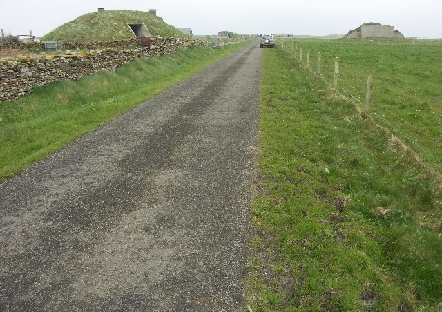
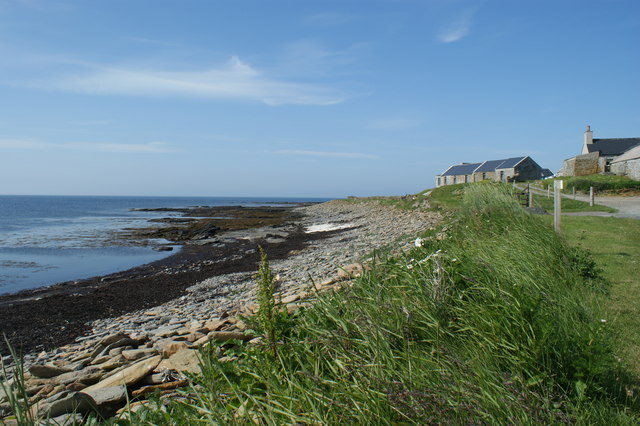
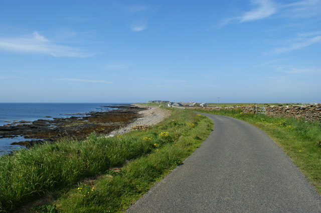
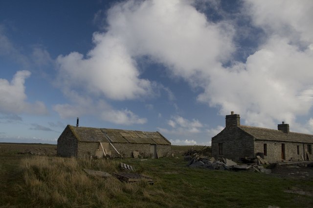
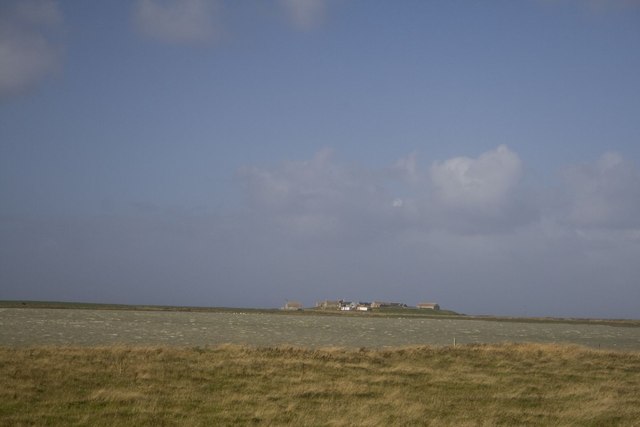
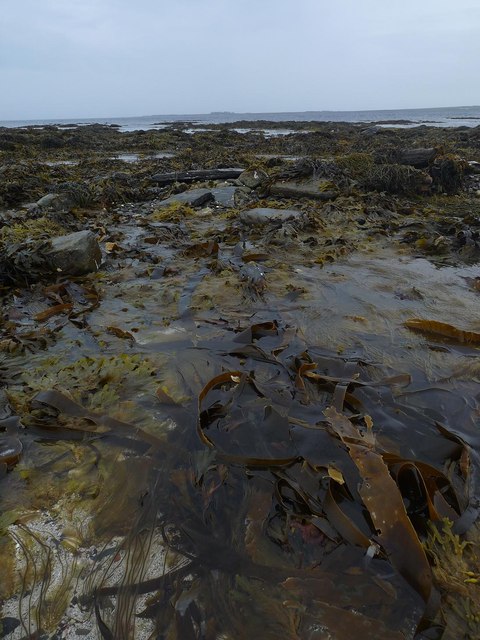
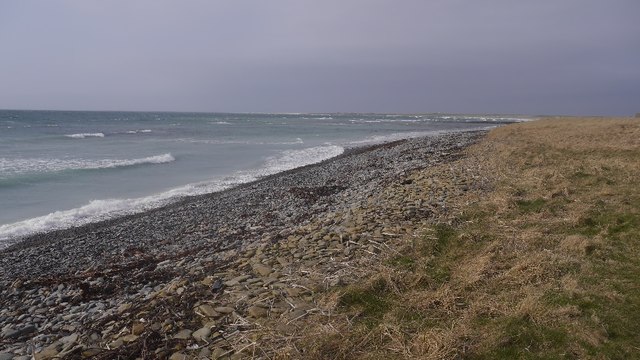
Noust of Tofts is a prominent coastal feature located on the island of Orkney, situated off the northeastern coast of Scotland. It is specifically found on the southern coastline of the island, near the town of Stromness. Noust of Tofts is classified as a headland, also sometimes referred to as a point, due to its projecting and elevated position along the shoreline.

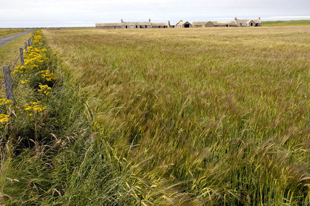
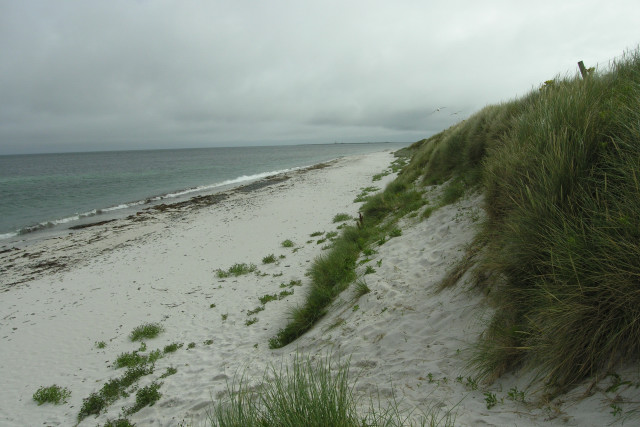
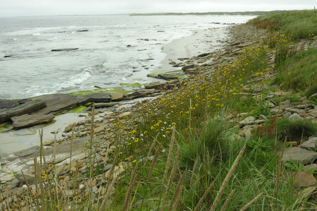
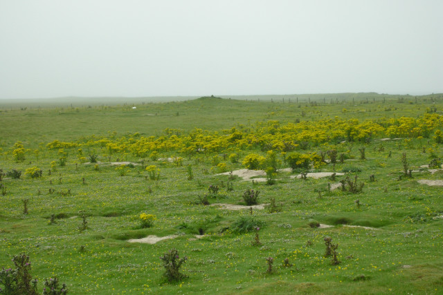
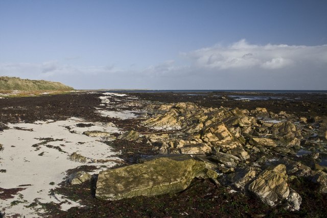
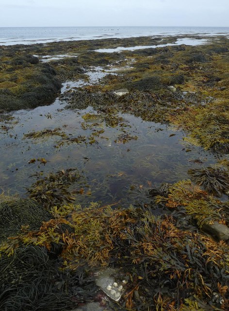
This coastal feature showcases stunning natural beauty, with its rocky cliffs and rugged terrain. It offers breathtaking panoramic views of the surrounding area, including the vast expanse of the North Sea. The headland is known for its unique geological formations, including sea stacks and caves, which have been formed over centuries by the erosive power of the sea.

The Noust of Tofts is also notable for its rich biodiversity. The headland provides a habitat for a variety of bird species, including seagulls, puffins, and fulmars, making it a popular spot for birdwatching enthusiasts. The surrounding waters are home to a diverse range of marine life, with seals often spotted basking on the rocks and dolphins occasionally seen swimming offshore.

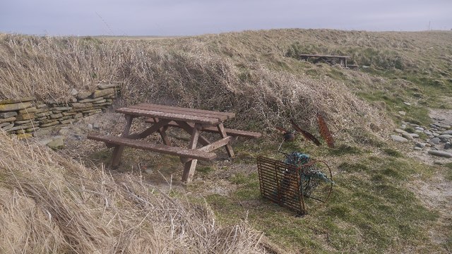
In addition to its natural attractions, Noust of Tofts holds historical significance. It has been used as a navigational landmark for centuries, guiding sailors and fishermen along the coast. The headland is also believed to have archaeological remains, with evidence of ancient settlements and burial sites in the vicinity.

Overall, Noust of Tofts is a captivating coastal feature that offers visitors a chance to appreciate the beauty of Orkney's rugged coastline, observe diverse wildlife, and experience the rich history of the area.

If you have any feedback on the listing, please let us know in the comments section below.

Noust of Tofts Images

Images are sourced within 2km of 59.300118/-2.4471388 or Grid Reference HY7446. Thanks to Geograph Open Source API. All images are credited.

Wreck of B-98, Bay of Lopness, Sanday Remains of a World War 1 German Torpedo Ship-Destroyer stranded at Bay of Lopness in 1920 when being towed to Rosyth to be broken up.
Wreck of B-98, Bay of Lopness, Sanday
Remains of a World War 1 German Torpedo Ship-Destroyer stranded at Bay of Lopness in 1920 when being towed to Rosyth to be broken up.
Whalehead WWII Chain Home radar station (Reserve site) Isle of Sanday, Orkney
Whalehead WWII Chain Home radar station (Reserve site)
Isle of Sanday, Orkney
WW2 Mortuary on Sanday Only remaining building of the camp associated with the RAF Whalehead Chain Home radar station on Isle of Sanday in the Orkney Islands.
WW2 Mortuary on Sanday
Only remaining building of the camp associated with the RAF Whalehead Chain Home radar station on Isle of Sanday in the Orkney Islands.
Galilee Deserted houses in the north-east of Sanday
Galilee
Deserted houses in the north-east of Sanday
Field roller at gateside, in the northwest of Sanday Sandy field in background shows why the Vikings named the island Sanday (= sand island)
Field roller at gateside, in the northwest of Sanday
Sandy field in background shows why the Vikings named the island Sanday (= sand island)
Rocky foreshore and croft on Northwall peninsula Coastal scenery on north eastern peninsula of the island of Sanday
Rocky foreshore and croft on Northwall peninsula
Coastal scenery on north eastern peninsula of the island of Sanday
Road alongside Bay of Sandquoy Road runs alongside the eastern shore of the Bay of Sandquoy , only just above the high tide level on the island of Sanday.
Road alongside Bay of Sandquoy
Road runs alongside the eastern shore of the Bay of Sandquoy , only just above the high tide level on the island of Sanday.
South end of Bay of Sowerdie Looking along a shell sand bay with Start Point lighthouse in the far distance.
South end of Bay of Sowerdie
Looking along a shell sand bay with Start Point lighthouse in the far distance.
Looking South to the Bay of Sowerdie The Bay of Sowerdie is flanked to the North and South by sandstone bedrock outcrops.
Looking South to the Bay of Sowerdie
The Bay of Sowerdie is flanked to the North and South by sandstone bedrock outcrops.
Cairns on Tofts Ness, Sanday Looking South West, through fine drizzle, towards one of many cairns on this sandy headland of Sanday.
Cairns on Tofts Ness, Sanday
Looking South West, through fine drizzle, towards one of many cairns on this sandy headland of Sanday.
Galilee, Sanday, Orkney This cottage was being reconstructed at the time of our visit, complete with its own wind turbine.
Galilee, Sanday, Orkney
This cottage was being reconstructed at the time of our visit, complete with its own wind turbine.
Pund of Hindgreenie, Sanday, Orkney
North Loch, Sanday, Orkney With Tofts farm in the distance.
North Loch, Sanday, Orkney
With Tofts farm in the distance.
Taing of Tor Sker, Sanday, Orkney The dots in the sea in the middle of the photo are hauled out seals.
Taing of Tor Sker, Sanday, Orkney
The dots in the sea in the middle of the photo are hauled out seals.
Taing of Tor Sker, Sanday, Orkney Tofts farm on the Tofts Ness peninsula can just be seen on the horizon.
Taing of Tor Sker, Sanday, Orkney
Tofts farm on the Tofts Ness peninsula can just be seen on the horizon.
Picnic tables, Bay of Lopness Helpfully dug into the dunes - not so useful today with a strong southeasterly wind.
Picnic tables, Bay of Lopness
Helpfully dug into the dunes - not so useful today with a strong southeasterly wind.
Bay of Lopness, Sanday The tide has yet to reveal the sandy part of the beach.
Bay of Lopness, Sanday
The tide has yet to reveal the sandy part of the beach.
Langamay Partly flooded links at the eastern end of Sanday
Langamay
Partly flooded links at the eastern end of Sanday
Show me another place!

Noust of Tofts is located at Grid Ref: HY7446 (Lat: 59.300118, Lng: -2.4471388)

Unitary Authority: Orkney Islands

Police Authority: Highlands and Islands

What 3 Words

///otters.divorcing.match. Near Hollandstoun, Orkney Islands

Related Wikis

East Sanday Coast

The East Sanday Coast is a protected wetland area on and around the island of Sanday, the third-largest of the Orkney islands off the north coast of Scotland...

Broch of Burrian

The Broch of Burrian is an Iron Age broch located on North Ronaldsay in the Orkney Islands, in Scotland (grid reference HY76275138). == Location == The...

Bustatoun

Bustatoun is a village on the island of North Ronaldsay, in Orkney, Scotland. The settlement is within the parish of Cross and Burness. == References... ==

Scar boat burial

The Scar boat burial is a Viking boat burial near the village of Scar, on Sanday, in Orkney, Scotland. The burial, which dates to between 875 and 950 AD...

North Ronaldsay Airport

North Ronaldsay Airport (IATA: NRL, ICAO: EGEN) is located on North Ronaldsay island, 28 NM (52 km; 32 mi) northeast by north of Kirkwall, Orkney Islands...

Scar, Orkney

Scar is a village and farm complex on the island of Sanday in Orkney, Scotland. The B9068 road runs from Scar to Kettletoft. The Scar boat burial was found...

Sanday, Orkney

Sanday (, Scots: Sandee) is one of the inhabited islands of Orkney that lies off the north coast of mainland Scotland. With an area of 50.43 km2 (19.5...

Sanday Airport

Sanday Airport (IATA: NDY, ICAO: EGES) is located 20 NM (37 km; 23 mi) north northeast of Kirkwall Airport on Sanday, Orkney Islands, Scotland. Sanday...

Nearby Amenities

Located within 500m of 59.300118,-2.4471388
Meur Burnt Mound (original location)
Archaeological Site: megalith
Historic: archaeological_site
Historic Civilization: neolithic
Megalith Type: cairn
Note: Removed to Sanday Heritage Centre in Lady Village
Ref Megalithic.co.uk: 49400
Website: https://www.megalithic.co.uk/article.php?sid=49400
Lat/Long: 59.2972175/-2.4458846
Material: wood
Power: pole
Lat/Long: 59.2958891/-2.4451608
Material: wood
Power: pole
Lat/Long: 59.2992999/-2.4451966
Material: wood
Power: pole
Lat/Long: 59.2980101/-2.4451682
Material: wood
Power: pole
Lat/Long: 59.29705/-2.4450689
Material: wood
Power: pole
Lat/Long: 59.3005173/-2.4452392
Material: wood
Power: pole
Lat/Long: 59.3007698/-2.4438784
Material: wood
Power: pole
Lat/Long: 59.3012078/-2.4415091
Material: wood
Power: pole
Lat/Long: 59.3016627/-2.4395443
The data included in this document is from www.openstreetmap.org. The data is made available under ODbL.

Have you been to Noust of Tofts?

Leave your review of Noust of Tofts below (or comments, questions and feedback).