Baki Ber
Coastal Feature, Headland, Point in Orkney
Scotland
Baki Ber
Baki Ber is a prominent coastal feature located in Orkney, an archipelago in Scotland. It is primarily known as a headland or point, jutting out into the North Sea. The name "Baki Ber" is derived from the Old Norse language, with "Baki" meaning "back" and "Ber" meaning "rock."
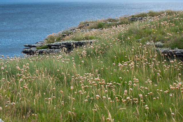
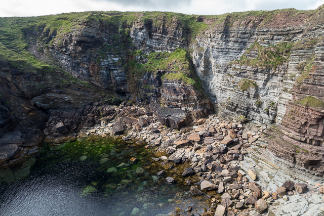
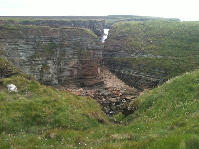
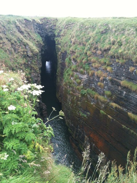
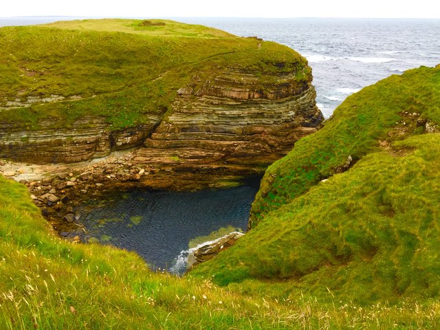
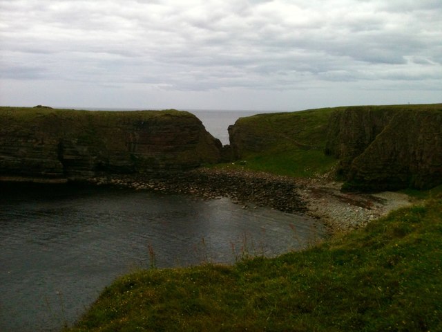
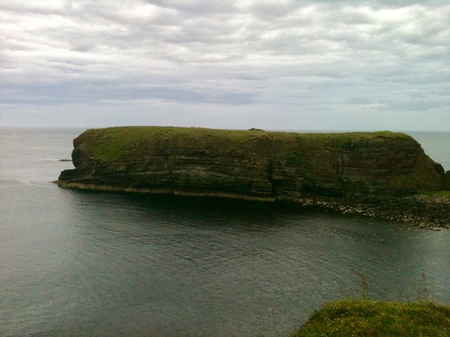
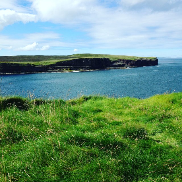
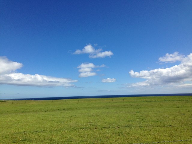
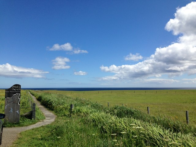
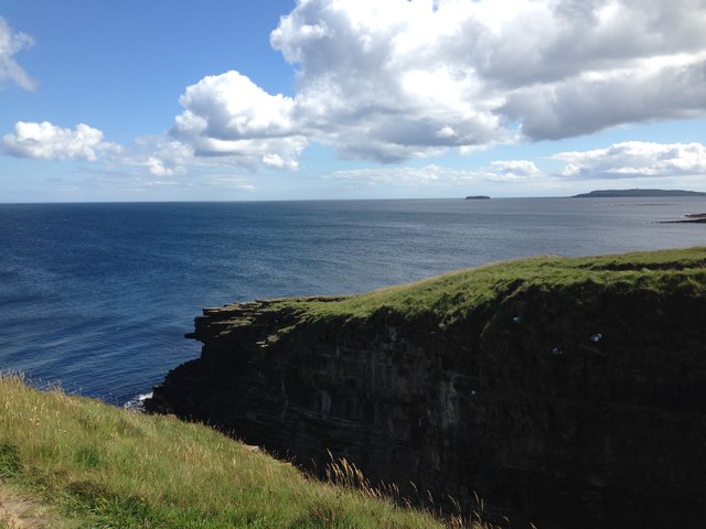
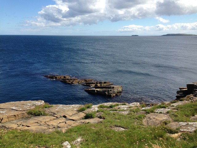
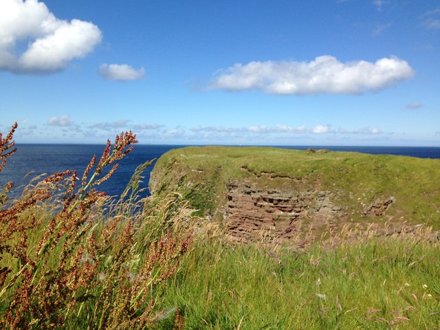
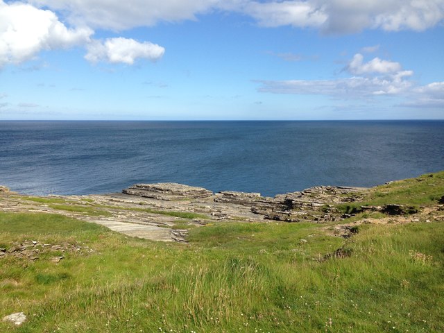
Situated on the west coast of Orkney's Mainland, Baki Ber offers breathtaking views of the surrounding landscape. This headland is characterized by rugged cliffs, rocky shores, and panoramic vistas of the sea. The cliffs are composed of sandstone and are adorned with various seabird colonies, including puffins, guillemots, and fulmars.
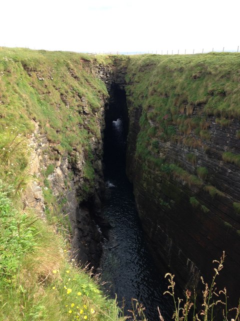
The geological formation of Baki Ber is of great interest to both locals and visitors. It is believed to have been shaped by glacial activity during the last Ice Age and subsequently eroded by the relentless force of the sea. This erosion has resulted in the formation of sea caves, natural arches, and stacks along the coastline.
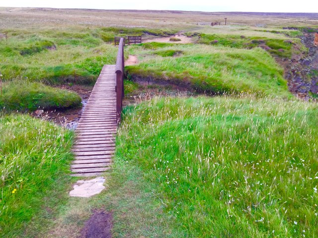
Baki Ber is a popular spot for outdoor enthusiasts, offering opportunities for walking, hiking, and birdwatching. The headland is accessible via a coastal path that winds its way along the clifftops, providing stunning views and a chance to observe the diverse flora and fauna that thrive in this unique ecosystem.
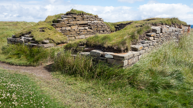
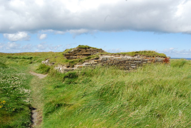
In addition to its natural beauty, Baki Ber holds historical significance. Archaeological sites nearby suggest that the area has been inhabited since Neolithic times, with evidence of ancient settlements and burial mounds. These remnants of the past add to the allure and intrigue of Baki Ber, making it a must-visit destination for those exploring the wonders of Orkney.
If you have any feedback on the listing, please let us know in the comments section below.
Baki Ber Images
Images are sourced within 2km of 58.950766/-2.7065873 or Grid Reference HY5907. Thanks to Geograph Open Source API. All images are credited.
Baki Ber is located at Grid Ref: HY5907 (Lat: 58.950766, Lng: -2.7065873)
Unitary Authority: Orkney Islands
Police Authority: Highlands and Islands
What 3 Words
///stun.slot.toolbar. Near Deerness, Orkney Islands
Nearby Locations
Related Wikis

The Gloup
The Gloup () is a collapsed sea cave in the Mull Head Nature Reserve in the islands of Orkney, Scotland. The name derives from the Old Norse "gluppa",...

Deerness
Deerness (, locally , Old Norse: Dyrnes) is a quoad sacra parish (i.e. one created and functioning for ecclesiastical purposes only) and peninsula in Mainland...

Point of Ayre, Orkney
There are also two similarly named points in the British Isles: Point of Ayre, Isle of Man and Point of Ayr, Wales.Point of Ayre is a headland in the parish...

Horse of Copinsay
The Horse of Copinsay, also known as the Horse, is a rectangular uninhabited sea stack to the north east of Copinsay in the Orkney Islands, Scotland....
Nearby Amenities
Located within 500m of 58.950766,-2.7065873Have you been to Baki Ber?
Leave your review of Baki Ber below (or comments, questions and feedback).