South Gearsan

Cliff, Slope in Orkney

Scotland

South Gearsan

Sunset beyond Mull Head, Deerness Taken from the Aberdeen-Orkney-Shetland ferry several km to the SE.
Sunset beyond Mull Head, Deerness Credit: Mike Pennington

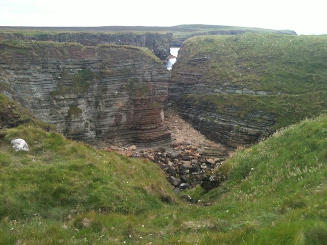
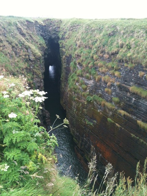
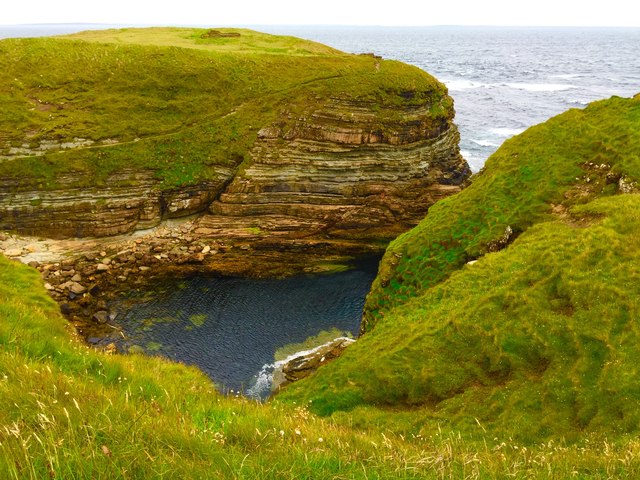
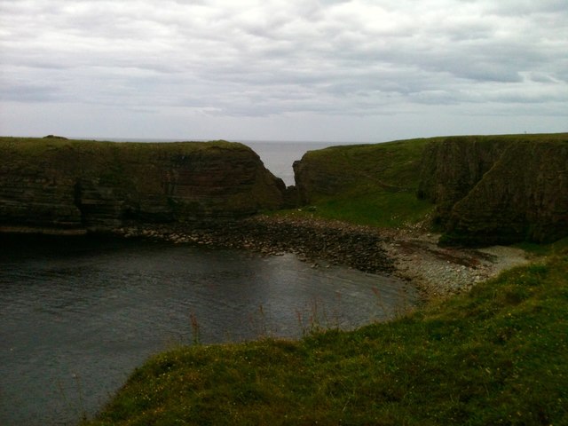
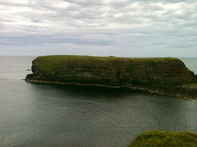
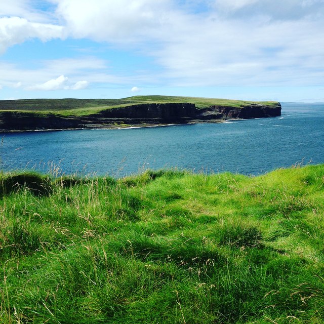
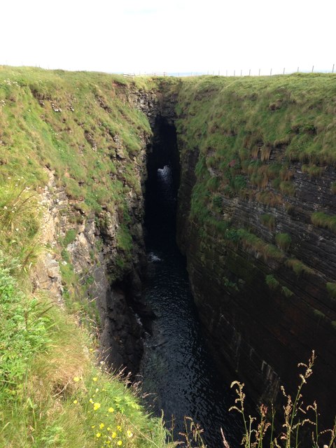
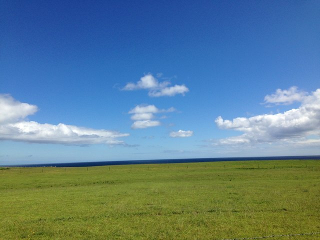
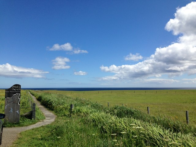
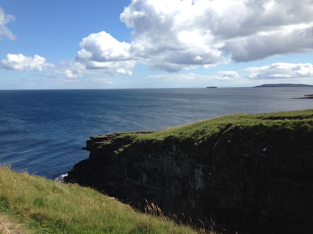
South Gearsan is a prominent cliff and slope located in the Orkney Islands, off the northeastern coast of Scotland. Situated on the southern coast of the main island, this natural feature is known for its breathtaking views and geological significance.

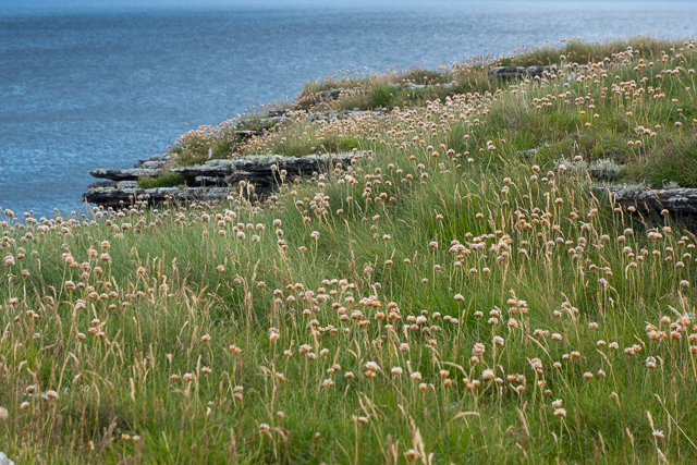
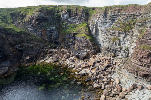
Rising to a height of approximately 100 meters (328 feet), South Gearsan offers a commanding vista of the surrounding landscape. The cliff face exhibits layers of sedimentary rock, showcasing millions of years of geological history. The lower portion of the cliff is characterized by rugged and jagged rock formations, while the upper part is covered in lush vegetation, creating a striking contrast.

The slope leading up to South Gearsan is a mix of grassland and heather, providing a diverse habitat for a range of plant and animal species. The area is known for its rich biodiversity, with several rare and protected species calling it home.

Visitors to South Gearsan can enjoy various activities, including hiking, birdwatching, and photography. The cliff offers an ideal vantage point for observing seabirds such as puffins, guillemots, and fulmars, which nest in the crevices and ledges along the cliff face.

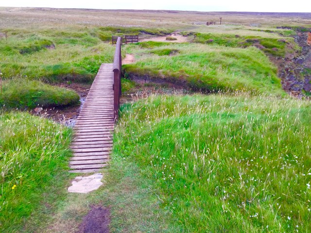
Accessible by foot or by boat, South Gearsan attracts both nature enthusiasts and geology enthusiasts alike. Its stunning beauty and scientific significance make it a must-visit destination for those exploring the Orkney Islands.

If you have any feedback on the listing, please let us know in the comments section below.

South Gearsan Images

Images are sourced within 2km of 58.956949/-2.7075831 or Grid Reference HY5907. Thanks to Geograph Open Source API. All images are credited.

Sunset beyond Mull Head, Deerness Taken from the Aberdeen-Orkney-Shetland ferry several km to the SE.
Sunset beyond Mull Head, Deerness
Taken from the Aberdeen-Orkney-Shetland ferry several km to the SE.
Mull Head, Deerness, from the north-east Taken from the Aberdeen-Orkney-Shetland several km to the north-east.
Mull Head, Deerness, from the north-east
Taken from the Aberdeen-Orkney-Shetland several km to the north-east.
Mull Head from the north Taken from the Aberdeen-Orkney-Shetland ferry. Beyond Mull Head is the Brough of Deerness and the island of Copinsay.
Mull Head from the north
Taken from the Aberdeen-Orkney-Shetland ferry. Beyond Mull Head is the Brough of Deerness and the island of Copinsay.
Sea Pink on the clifftop Sea Pink (Armeria maritima) is common on these clifftops although unfortunately the flowers were well past their best when we visited in mid-July.
Sea Pink on the clifftop
Sea Pink (Armeria maritima) is common on these clifftops although unfortunately the flowers were well past their best when we visited in mid-July.
Cliffs and shore in Little Burra Geo
Ruined chapel at the Brough of Deerness This is the remains of the tenth century chapel.
Ruined chapel at the Brough of Deerness
This is the remains of the tenth century chapel.
Brough of Deerness - Church ruins The remains on Brough of Deerness.
Brough of Deerness - Church ruins
The remains on Brough of Deerness.
Deerness, Orkney Islands
The Gloup in Deerness
Deerness, Orkney Mainland
The Gloup in Deerness
Deerness, Orkney Mainland
Show me another place!

South Gearsan is located at Grid Ref: HY5907 (Lat: 58.956949, Lng: -2.7075831)

Unitary Authority: Orkney Islands

Police Authority: Highlands and Islands

What 3 Words

///slanting.meaty.acute. Near Deerness, Orkney Islands

Related Wikis

The Gloup

The Gloup () is a collapsed sea cave in the Mull Head Nature Reserve in the islands of Orkney, Scotland. The name derives from the Old Norse "gluppa",...

Deerness

Deerness (, locally , Old Norse: Dyrnes) is a quoad sacra parish (i.e. one created and functioning for ecclesiastical purposes only) and peninsula in Mainland...

Point of Ayre, Orkney

There are also two similarly named points in the British Isles: Point of Ayre, Isle of Man and Point of Ayr, Wales. Point of Ayre is a headland in the...

Horse of Copinsay

The Horse of Copinsay, also known as the Horse, is a rectangular uninhabited sea stack to the north east of Copinsay in the Orkney Islands, Scotland....

Nearby Amenities

Located within 500m of 58.956949,-2.7075831
Created By: almien_coastlines mod
Lat/Long: 58.960758/-2.705107
Created By: almien_coastlines mod
Lat/Long: 58.953344/-2.709134
Created By: almien_coastlines mod
Lat/Long: 58.9582/-2.705625
Toilets
Fee: no
Toilets Disposal: flush
Unisex: yes
Lat/Long: 58.9569216/-2.7161302
Leisure: picnic_table
Lat/Long: 58.9568823/-2.7161396
The Gloup
Tourism: attraction
Wikidata: Q7736847
Wikipedia: en:The Gloup
Lat/Long: 58.9558095/-2.7110459
Generator Method: wind_turbine
Generator Source: wind
Generator Type: horizontal_axis
Power: generator
Lat/Long: 58.9579538/-2.7115926
Generator Method: wind_turbine
Generator Source: wind
Generator Type: horizontal_axis
Power: generator
Lat/Long: 58.958413/-2.7118877
Generator Method: wind_turbine
Generator Source: wind
Generator Type: horizontal_axis
Power: generator
Lat/Long: 58.9588694/-2.7121559
Power: pole
Lat/Long: 58.9579386/-2.7145511
Power: pole
Lat/Long: 58.95746/-2.7157205
The data included in this document is from www.openstreetmap.org. The data is made available under ODbL.

Have you been to South Gearsan?

Leave your review of South Gearsan below (or comments, questions and feedback).