Kirk Ness

Coastal Feature, Headland, Point in Orkney

Scotland

Kirk Ness

Newark Bay A northward view of this grand bay, note the two people on the beach.  
The nearest water is labelled Newark Bay, beyond that is the rocky beach (with lively rock pools) named Langa Tang, and then comes Pool of Cletts.
Newark Bay Credit: Peter Church

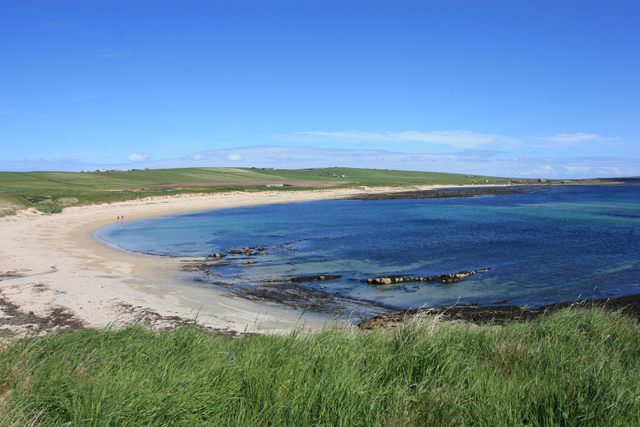
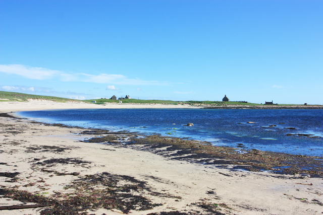
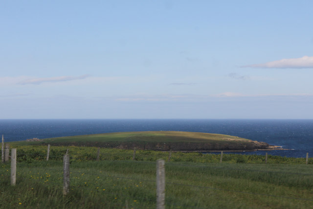
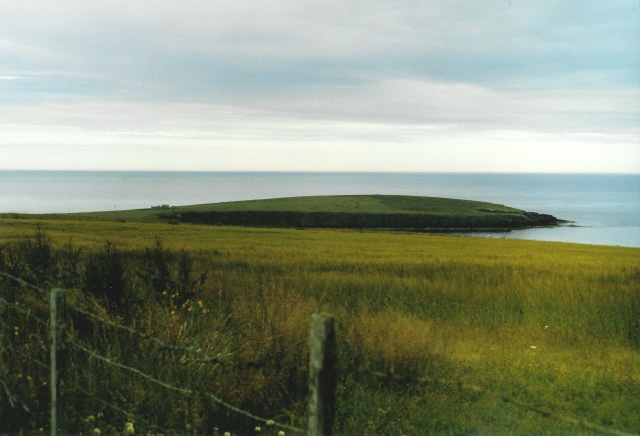
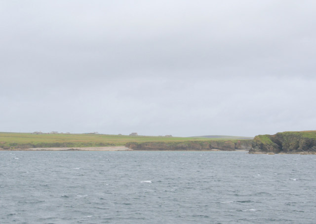
Kirk Ness is a prominent coastal feature located on the mainland of Orkney, an archipelago in northern Scotland. Known for its stunning natural beauty, Kirk Ness is a headland that juts out into the North Sea, forming a distinctive point on the eastern coast of Orkney.

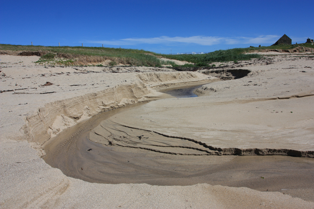
This rugged headland is characterized by steep cliffs that rise dramatically from the sea, providing breathtaking views of the surrounding coastline. The cliffs are composed of Old Red Sandstone, a sedimentary rock formation that dates back millions of years. Over time, the relentless waves and winds have carved unique formations into the cliffs, creating a visually striking landscape.

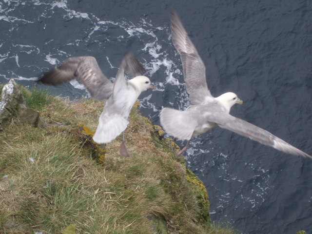
The area surrounding Kirk Ness is rich in biodiversity, attracting a variety of bird species and marine life. The cliffs provide nesting sites for seabirds such as puffins, guillemots, and razorbills, while seals can often be spotted basking on the rocky shores. The coastal waters around Kirk Ness are also home to a diverse range of marine species, including dolphins, porpoises, and even occasional sightings of whales.

Kirk Ness is a popular destination for nature enthusiasts and outdoor adventurers. Visitors can explore the rugged coastline on foot, following scenic coastal paths that offer panoramic views of the surrounding seascape. The headland is also a great spot for birdwatching, photography, and simply enjoying the tranquility of the natural environment.

In conclusion, Kirk Ness is a stunning headland on the coast of Orkney, offering breathtaking views, diverse wildlife, and opportunities for outdoor activities. Its natural beauty and unique geological features make it a must-visit destination for those exploring the region.

If you have any feedback on the listing, please let us know in the comments section below.
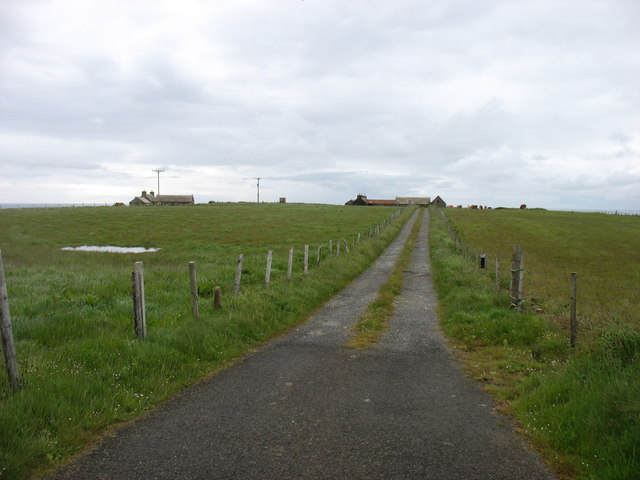
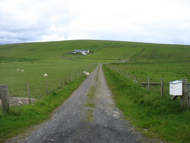
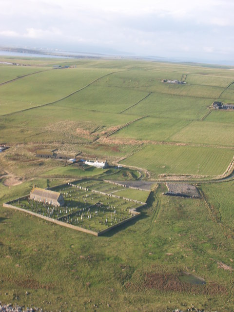
Kirk Ness Images

Images are sourced within 2km of 58.805222/-2.9089195 or Grid Reference ND4791. Thanks to Geograph Open Source API. All images are credited.

Newark Bay A northward view of this grand bay, note the two people on the beach.  
The nearest water is labelled Newark Bay, beyond that is the rocky beach (with lively rock pools) named Langa Tang, and then comes Pool of Cletts.
Newark Bay
A northward view of this grand bay, note the two people on the beach. The nearest water is labelled Newark Bay, beyond that is the rocky beach (with lively rock pools) named Langa Tang, and then comes Pool of Cletts.
The Irene Part of the Engine Block from Irene.
She was the 'subject' of the gallant rescue attempt by the Longhope Lifeboat Crew, who lost their lives in 1969.
See here <span class="nowrap"><a title="http://news.stv.tv/scotland/82797-orkney-remembers-longhope-disaster/" rel="nofollow ugc noopener" href="http://news.stv.tv/scotland/82797-orkney-remembers-longhope-disaster/">Link</a><img style="margin-left:2px;" alt="External link" title="External link - shift click to open in new window" src="https://s1.geograph.org.uk/img/external.png" width="10" height="10"/></span>

More here <span class="nowrap"><a title="http://theramblinggardener.com/2014/11/28/the-longhope-lifeboat-disaster/comment-page-1/" rel="nofollow ugc noopener" href="http://theramblinggardener.com/2014/11/28/the-longhope-lifeboat-disaster/comment-page-1/">Link</a><img style="margin-left:2px;" alt="External link" title="External link - shift click to open in new window" src="https://s1.geograph.org.uk/img/external.png" width="10" height="10"/></span>
and this <a href="https://www.geograph.org.uk/photo/1066362">ND3389 : Longhope Lifeboat Memorial</a>
The Irene
Part of the Engine Block from Irene. She was the 'subject' of the gallant rescue attempt by the Longhope Lifeboat Crew, who lost their lives in 1969. See here LinkExternal link More here LinkExternal link and this ND3389 : Longhope Lifeboat Memorial
The cemetery at Kirkhouse Point This is a peaceful "final resting place" with a mile of unspoiled beach beyond the wall.
The cemetery at Kirkhouse Point
This is a peaceful "final resting place" with a mile of unspoiled beach beyond the wall.
Natural beach art, Kirkhouse These superb curves are caused by water from springs about 500 metres north.
Natural beach art, Kirkhouse
These superb curves are caused by water from springs about 500 metres north.
Pool of Cletts "Pool of Cletts" is the name shown on OS maps for the area on the north side of this bay.
Pool of Cletts
"Pool of Cletts" is the name shown on OS maps for the area on the north side of this bay.
Fields near Lime Banks
Cauldhame Hill Appears to be in the Scottish Water compound accessed from the track with Jim Bloomer and Tricky Speirs .
Name: Cauldhame Hill
Hill number: 12222
Height: 87m / 285ft
Parent (Ma/M):none
Area:23: Orkney Islands
Class:0
Grid ref: ND467922 (est)
Drop: 53m
Col: 34m  ND452900
Cauldhame Hill
Appears to be in the Scottish Water compound accessed from the track with Jim Bloomer and Tricky Speirs . Name: Cauldhame Hill Hill number: 12222 Height: 87m / 285ft Parent (Ma/M):none Area:23: Orkney Islands Class:0 Grid ref: ND467922 (est) Drop: 53m Col: 34m ND452900
Minor road at South Cara Near the easternmost point of South Ronaldsay.
Minor road at South Cara
Near the easternmost point of South Ronaldsay.
The drive to Howatoft Farm
Vensilly Farm and Hill
Cemetery, Kirkhouse Taken from a glider, looking West over South Ronaldsay.
Cemetery, Kirkhouse
Taken from a glider, looking West over South Ronaldsay.
Wheems bothy camp site, South Ronaldsay
Grimness View ENE from near the road to Dyke-end farm, in the Grimness area of South Ronaldsay, showing grassland running down to Grim Ness itself.
Grimness
View ENE from near the road to Dyke-end farm, in the Grimness area of South Ronaldsay, showing grassland running down to Grim Ness itself.
Fulmarus glacialis A couple of Fulmars taking off from the Stack of Kame. The Stack of Kame isn't a proper stack but a narrow - as in a couple of feet wide at the top - headland sticking out into the sea. I was lucky enough to be above them without them realising and snapped them just as they sensed my presence a few feet above.
Fulmarus glacialis
A couple of Fulmars taking off from the Stack of Kame. The Stack of Kame isn't a proper stack but a narrow - as in a couple of feet wide at the top - headland sticking out into the sea. I was lucky enough to be above them without them realising and snapped them just as they sensed my presence a few feet above.
Lime Banks to the west of Grim Ness.
Kirkhouse Point. The cemetery at Kirkhouse can be seen mid frame.
Kirkhouse Point.
The cemetery at Kirkhouse can be seen mid frame.
Biggings and Moss Edge The lochan isn't named on the map. In the centre is Biggings and beyond the bend in the road lies Moss Edge.Vensilly in the far distance.
Biggings and Moss Edge
The lochan isn't named on the map. In the centre is Biggings and beyond the bend in the road lies Moss Edge.Vensilly in the far distance.
Vensilly Hill Both the hill and house are named Vensilly. I hope that the occupiers like sheep!
Vensilly Hill
Both the hill and house are named Vensilly. I hope that the occupiers like sheep!
Show me another place!

Kirk Ness is located at Grid Ref: ND4791 (Lat: 58.805222, Lng: -2.9089195)

Unitary Authority: Orkney Islands

Police Authority: Highlands and Islands

What 3 Words

///bulbs.developed.unveils. Near St Margaret's Hope, Orkney Islands

Related Wikis

Grim Ness

Grimness is a cliff-girt headland on the island of South Ronaldsay, in the Orkney archipelago of Scotland. It is located between Honeysgeo and Skipi Geo...

South Ronaldsay

South Ronaldsay (, also , Scots: Sooth Ronalshee) is one of the Orkney Islands off the north coast of Scotland. It is linked to the Orkney Mainland by...

St Margaret's Hope

St Margaret's Hope is a village in the Orkney Islands, off the north coast of Scotland. It is known locally as The Hope or The Hup. With a population...
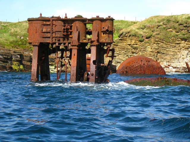
HMS Opal (1915)

HMS Opal was an Admiralty M-class destroyer of the Royal Navy. She served in the First World War following her construction at Sunderland in 1915. Attached...

Burray

Burray () is one of the Orkney Islands in Scotland. It lies to the east of Scapa Flow and is one of a chain of islands linked by the Churchill Barriers...

Herston, Orkney

Herston is a village on South Ronaldsay, Orkney, Scotland, United Kingdom. Herston is historically a fishing village but its only industry to speak of...

Hoxa, Orkney

Hoxa is a small settlement on the island of South Ronaldsay in the Orkney Islands north of mainland Scotland. Hoxa is located 1+1⁄4 miles (2.0 km) west...

Liddle Burnt Mound

Liddle Burnt Mound is a Bronze Age site on the island of South Ronaldsay, Orkney. The site consists of the remains of a building and a mound that surrounds...

Nearby Amenities

Located within 500m of 58.805222,-2.9089195
The Grud
Place: locality
Lat/Long: 58.8035095/-2.9137964
West Quoy
Place: locality
Lat/Long: 58.8063331/-2.9099955
Manse Bay
Natural: bay
Lat/Long: 58.8090688/-2.9094337
Power: pole
Lat/Long: 58.8083635/-2.9140203
The data included in this document is from www.openstreetmap.org. The data is made available under ODbL.

Have you been to Kirk Ness?

Leave your review of Kirk Ness below (or comments, questions and feedback).