Murka Hole

Coastal Feature, Headland, Point in Orkney

Scotland

Murka Hole

Nev Hill Incipient hay or, more likely, silage on the slopes of Nev Hill, with a view towards the mountains of Hoy.
Nev Hill Credit: Anne Burgess

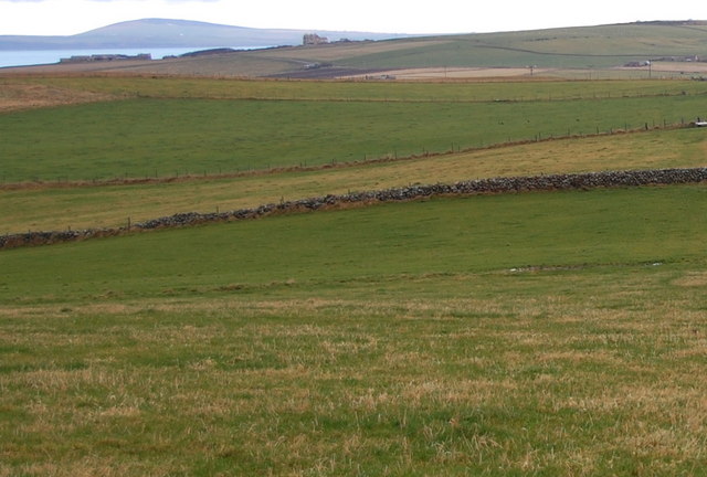
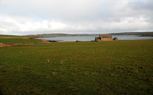
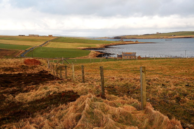
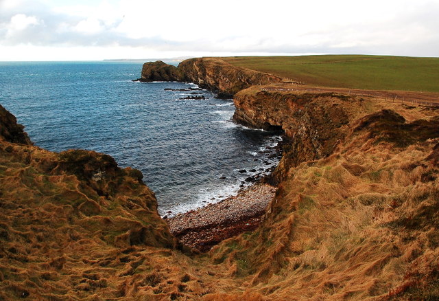
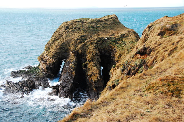
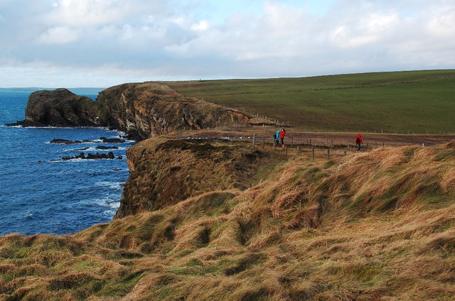
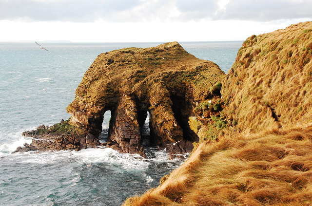
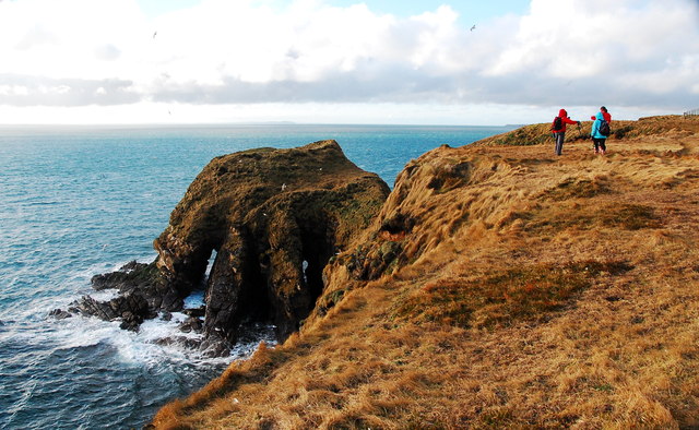
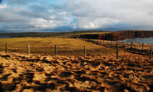
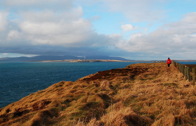
Murka Hole is a prominent coastal feature located in Orkney, an archipelago situated off the northeastern coast of Scotland. It is specifically found on the west side of Rousay, one of the Orkney islands. Murka Hole is characterized as a headland or point, jutting out into the sea with its distinctive shape and geological composition.

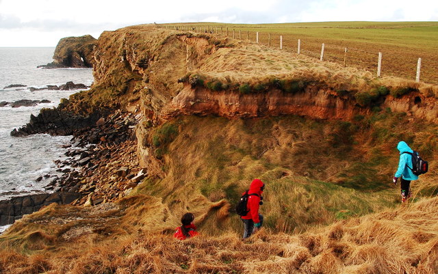
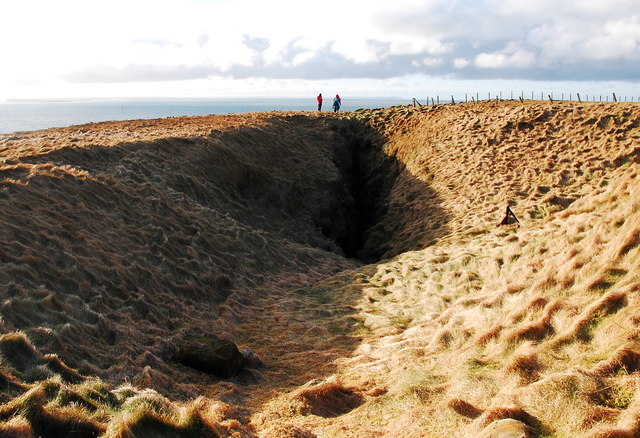
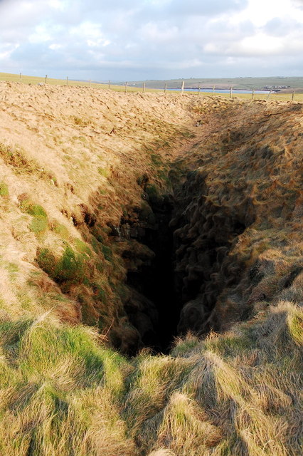
This coastal feature is renowned for its rugged and imposing cliffs, which are composed of sandstone and conglomerate rock formations. These cliffs rise to an impressive height, offering breathtaking views of the surrounding sea and coastline. The dramatic landscape and the interplay of light and shadows make it a popular destination for photographers and nature enthusiasts.

Murka Hole is also notable for its unique geological formations. Within its cliffs, there are several natural caves and sea stacks that have been formed over thousands of years through erosion by wind, water, and ice. These caves and stacks provide habitats for a variety of seabirds, including guillemots, puffins, and fulmars, making it a significant site for birdwatchers.

In addition to its natural beauty, Murka Hole is steeped in history. It is believed that the area was inhabited by humans as far back as the Neolithic period, and evidence of ancient settlements and burial sites have been discovered nearby. The site also holds cultural significance, with folklore and legends passed down through generations.

Overall, Murka Hole is a captivating coastal feature, showcasing the rugged beauty and rich history of the Orkney Islands. Its impressive cliffs, geological formations, and diverse wildlife make it a must-visit destination for those exploring the region.

If you have any feedback on the listing, please let us know in the comments section below.

Murka Hole Images

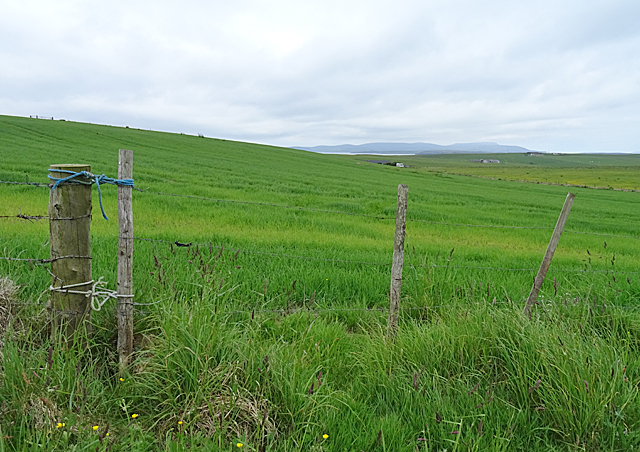
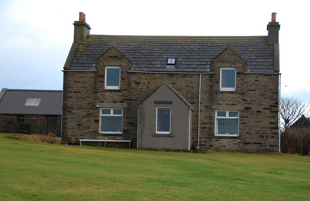
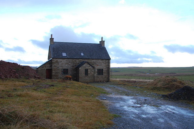
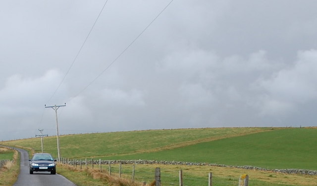
Images are sourced within 2km of 58.797646/-3.0121875 or Grid Reference ND4190. Thanks to Geograph Open Source API. All images are credited.

Nev Hill Incipient hay or, more likely, silage on the slopes of Nev Hill, with a view towards the mountains of Hoy.
Nev Hill
Incipient hay or, more likely, silage on the slopes of Nev Hill, with a view towards the mountains of Hoy.
West Shaird Typical Orkney features include the one-and-a-half stories, and the cemented strips on the gable ends below the chimneys. The style of the original skylight is a common feature too.
West Shaird
Typical Orkney features include the one-and-a-half stories, and the cemented strips on the gable ends below the chimneys. The style of the original skylight is a common feature too.
New house built by West Shaird Similar to West Shaird in style, but missing the lovely upper windows. It lies right by West Shaird.
New house built by West Shaird
Similar to West Shaird in style, but missing the lovely upper windows. It lies right by West Shaird.
Nev Hill The low, undulating land leading to Nev Hill. Note the one remaining stone field boundary, (known locally as dykes).
Nev Hill
The low, undulating land leading to Nev Hill. Note the one remaining stone field boundary, (known locally as dykes).
Stone dyke on Nev Hill Looking northwards from Nev Hill. One remaining traditional stone dyke undulates across the fields, amid the wire fences.
Stone dyke on Nev Hill
Looking northwards from Nev Hill. One remaining traditional stone dyke undulates across the fields, amid the wire fences.
Chapel and the Oyce of Herston I think that the old chapel has been renovated within the last few years.
Chapel and the Oyce of Herston
I think that the old chapel has been renovated within the last few years.
Farmland and the Oyce of Herston Looking northwards toward the old chapel.
Farmland and the Oyce of Herston
Looking northwards toward the old chapel.
Clifftops and pebble beach Looking westwards toward The Altar, Harrabrough Head.
Clifftops and pebble beach
Looking westwards toward The Altar, Harrabrough Head.
The Altar, Cavernous Triptych Unusual geomorphology at Harra Brough with three, almost parallel tunnels, running through the headland.
The Altar, Cavernous Triptych
Unusual geomorphology at Harra Brough with three, almost parallel tunnels, running through the headland.
Looking westwards towards The Altar Coastal scenery en-route to Harrabrough Head.
Looking westwards towards The Altar
Coastal scenery en-route to Harrabrough Head.
Coastal Erosion The cliffs are being undercut and mass-wasting is taking place.
Coastal Erosion
The cliffs are being undercut and mass-wasting is taking place.
The Altar, Harra Brough Two of the three tunnels are clearly visible here. As the third one opens the second one closes making it hard to get a view through all three tunnels simultaneously.
The Altar, Harra Brough
Two of the three tunnels are clearly visible here. As the third one opens the second one closes making it hard to get a view through all three tunnels simultaneously.
The Altar, Harra Brough Once more, two of the three tunnels showing clear through.
The Altar, Harra Brough
Once more, two of the three tunnels showing clear through.
Looking eastwards from Murka Hole Winter landscape, but the days are at last beginning to lengthen.
Looking eastwards from Murka Hole
Winter landscape, but the days are at last beginning to lengthen.
Murka Hole Looking southwest toward the blowhole. This will be a geo in a few centuries, maybe even decades.
Murka Hole
Looking southwest toward the blowhole. This will be a geo in a few centuries, maybe even decades.
Murka Hole Looking northeastwards over the blowhole.
Murka Hole
Looking northeastwards over the blowhole.
Coastal path, Harrabrough Head Looking northwest along the coast, with Flotta (and wind turbine) in the sunshine and the high hills of Hoy beyond.
Coastal path, Harrabrough Head
Looking northwest along the coast, with Flotta (and wind turbine) in the sunshine and the high hills of Hoy beyond.
Fence Post Covered in lichen.
Fence Post
Covered in lichen.
Show me another place!

Murka Hole is located at Grid Ref: ND4190 (Lat: 58.797646, Lng: -3.0121875)

Unitary Authority: Orkney Islands

Police Authority: Highlands and Islands

What 3 Words

///fear.seating.premature. Near St Margaret's Hope, Orkney Islands

Related Wikis

Herston, Orkney

Herston is a village on South Ronaldsay, Orkney, Scotland, United Kingdom. Herston is historically a fishing village but its only industry to speak of...

Hoxa, Orkney

Hoxa is a small settlement on the island of South Ronaldsay in the Orkney Islands north of mainland Scotland. Hoxa is located 1+1⁄4 miles (2.0 km) west...

South Ronaldsay

South Ronaldsay (, also , Scots: Sooth Ronalshee) is one of the Orkney Islands off the north coast of Scotland. It is linked to the Orkney Mainland by...

St Margaret's Hope

St Margaret's Hope is a village in the Orkney Islands, off the north coast of Scotland. It is known locally as The Hope or The Hup. With a population...

Nearby Amenities

Located within 500m of 58.797646,-3.0121875
The Altar
Natural: cliff
Lat/Long: 58.796945/-3.0125909
Power: pole
Lat/Long: 58.8007252/-3.0106455
Power: pole
Lat/Long: 58.8007516/-3.0095458
Power: pole
Lat/Long: 58.8007989/-3.0083361
Power: pole
Lat/Long: 58.8008656/-3.007054
Generator Method: wind_turbine
Generator Source: wind
Generator Type: horizontal_axis
Power: generator
Lat/Long: 58.8008636/-3.0121225
The data included in this document is from www.openstreetmap.org. The data is made available under ODbL.

Have you been to Murka Hole?

Leave your review of Murka Hole below (or comments, questions and feedback).