Double Taing

Coastal Feature, Headland, Point in Orkney

Scotland

Double Taing

Cloddyhall Standing Stone A standing stone on South Ronaldsay measuring 8'6" in height.
Cloddyhall Standing Stone Credit: David Bremner

Double Taing is a prominent coastal feature located in Orkney, a group of islands located off the northeastern coast of Scotland. This coastal feature is classified as a headland or point due to its unique geographical characteristics.

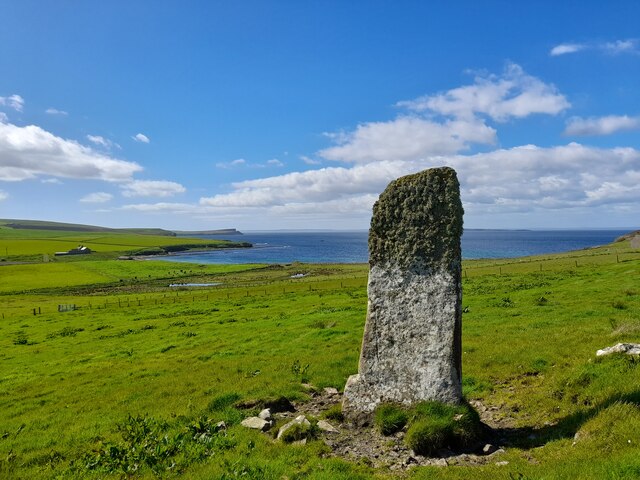
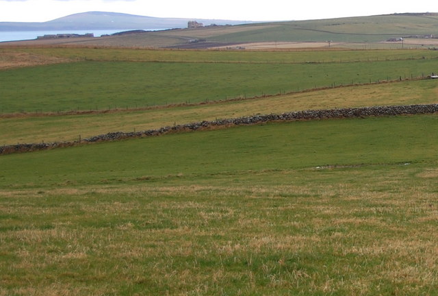
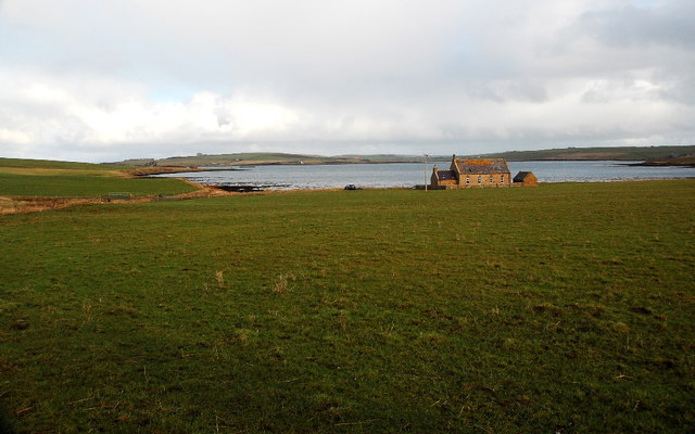
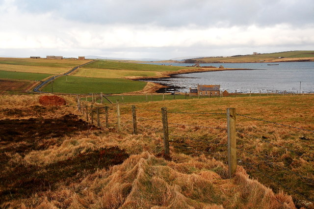
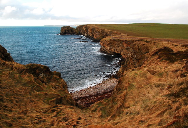
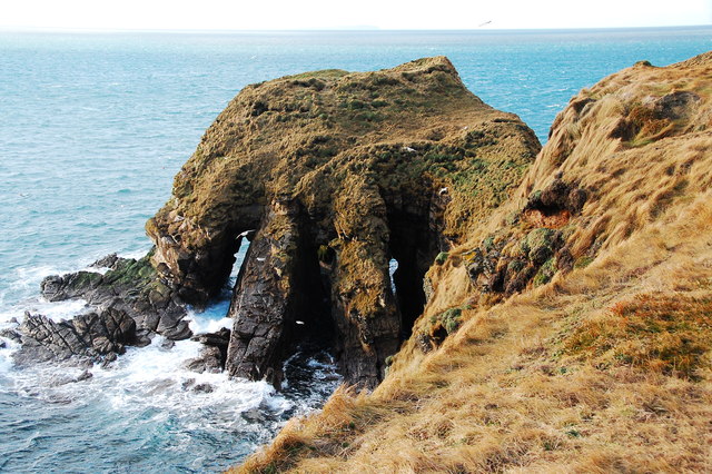
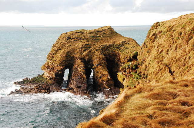
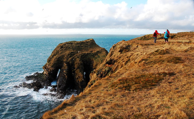
Situated on the northern coast of the island of Westray, Double Taing offers spectacular views of the North Atlantic Ocean. It is positioned between two beautiful sandy beaches, Sand Ayre to the east and Grobust Bay to the west. The headland stretches out into the sea, forming a distinctive double-pointed shape that gives it its name.

The headland is composed of rugged sandstone cliffs that rise approximately 30 meters above sea level. These cliffs are home to various seabird colonies, including puffins, guillemots, and fulmars, making Double Taing a popular spot for birdwatching enthusiasts. The area is also abundant in marine life, with seals often seen basking on the rocks or swimming in the surrounding waters.

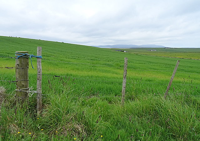
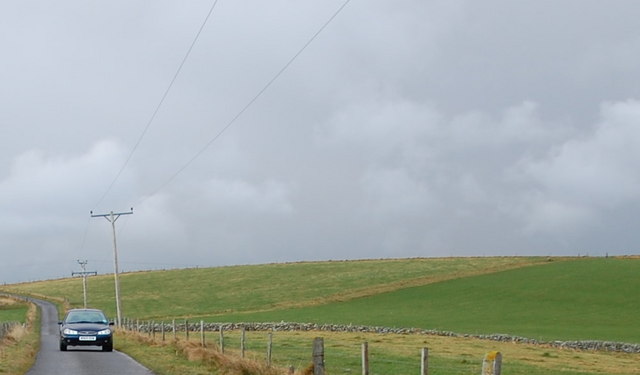
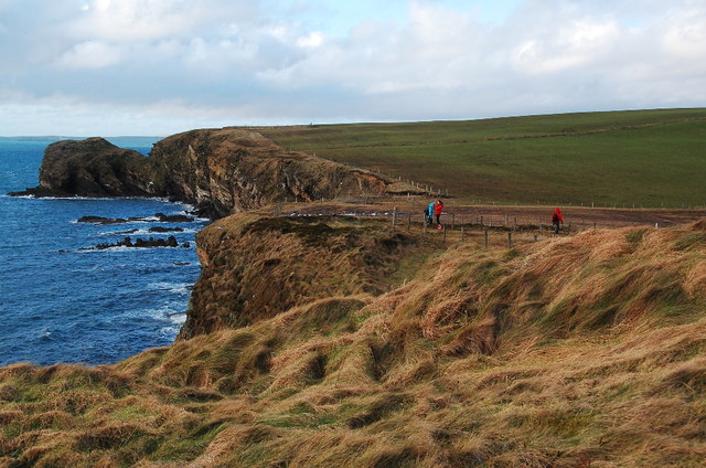
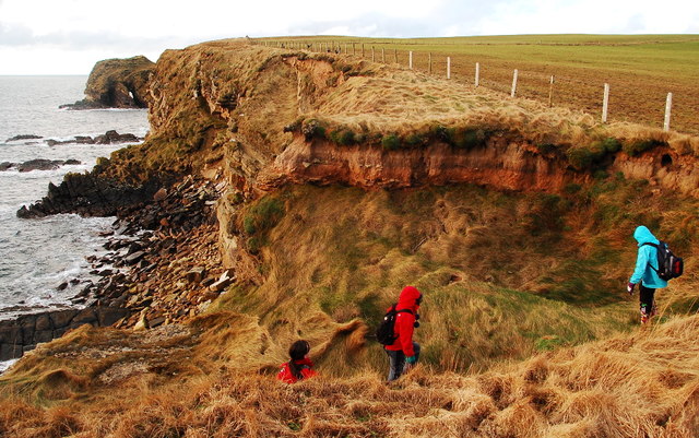
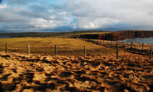
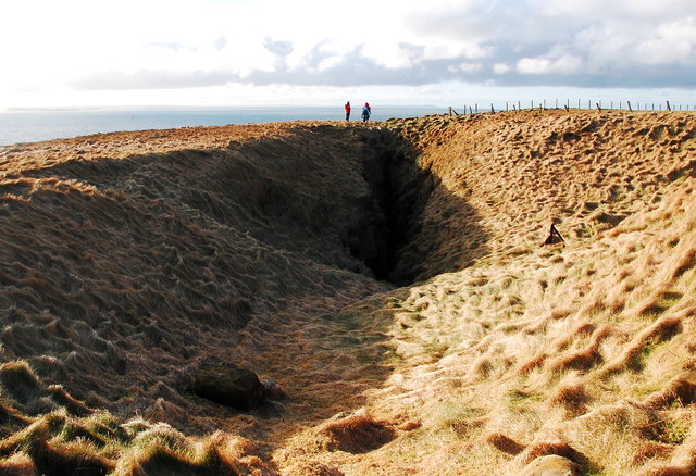
Access to Double Taing is relatively easy, with a nearby car park and a well-maintained footpath leading to the headland. The footpath offers stunning coastal views and takes visitors through vibrant grassy meadows and wildflower-filled fields.

The unique geological features, diverse wildlife, and scenic beauty make Double Taing a must-visit destination for nature lovers and photographers alike. Whether it's exploring the rugged cliffs, observing the abundant birdlife, or simply enjoying the breathtaking views, Double Taing offers a memorable experience for visitors to Orkney.

If you have any feedback on the listing, please let us know in the comments section below.

Double Taing Images

Images are sourced within 2km of 58.797312/-3.0100147 or Grid Reference ND4190. Thanks to Geograph Open Source API. All images are credited.

Cloddyhall Standing Stone A standing stone on South Ronaldsay measuring 8'6" in height.
Cloddyhall Standing Stone
A standing stone on South Ronaldsay measuring 8'6" in height.
Nev Hill Incipient hay or, more likely, silage on the slopes of Nev Hill, with a view towards the mountains of Hoy.
Nev Hill
Incipient hay or, more likely, silage on the slopes of Nev Hill, with a view towards the mountains of Hoy.
Standing Stone Neolithic foreground, with an oil tanker emerging from behind the island (Swona) in the background.
Standing Stone
Neolithic foreground, with an oil tanker emerging from behind the island (Swona) in the background.
Cloudiehall Farm buildings overlooking Sandwick Bay. Same red as at Sandwick House!
Cloudiehall
Farm buildings overlooking Sandwick Bay. Same red as at Sandwick House!
West Shaird Typical Orkney features include the one-and-a-half stories, and the cemented strips on the gable ends below the chimneys. The style of the original skylight is a common feature too.
West Shaird
Typical Orkney features include the one-and-a-half stories, and the cemented strips on the gable ends below the chimneys. The style of the original skylight is a common feature too.
New house built by West Shaird Similar to West Shaird in style, but missing the lovely upper windows. It lies right by West Shaird.
New house built by West Shaird
Similar to West Shaird in style, but missing the lovely upper windows. It lies right by West Shaird.
Nev Hill The low, undulating land leading to Nev Hill. Note the one remaining stone field boundary, (known locally as dykes).
Nev Hill
The low, undulating land leading to Nev Hill. Note the one remaining stone field boundary, (known locally as dykes).
Stone dyke on Nev Hill Looking northwards from Nev Hill. One remaining traditional stone dyke undulates across the fields, amid the wire fences.
Stone dyke on Nev Hill
Looking northwards from Nev Hill. One remaining traditional stone dyke undulates across the fields, amid the wire fences.
Chapel and the Oyce of Herston I think that the old chapel has been renovated within the last few years.
Chapel and the Oyce of Herston
I think that the old chapel has been renovated within the last few years.
Farmland and the Oyce of Herston Looking northwards toward the old chapel.
Farmland and the Oyce of Herston
Looking northwards toward the old chapel.
Clifftops and pebble beach Looking westwards toward The Altar, Harrabrough Head.
Clifftops and pebble beach
Looking westwards toward The Altar, Harrabrough Head.
The Altar, Cavernous Triptych Unusual geomorphology at Harra Brough with three, almost parallel tunnels, running through the headland.
The Altar, Cavernous Triptych
Unusual geomorphology at Harra Brough with three, almost parallel tunnels, running through the headland.
Looking westwards towards The Altar Coastal scenery en-route to Harrabrough Head.
Looking westwards towards The Altar
Coastal scenery en-route to Harrabrough Head.
Coastal Erosion The cliffs are being undercut and mass-wasting is taking place.
Coastal Erosion
The cliffs are being undercut and mass-wasting is taking place.
The Altar, Harra Brough Two of the three tunnels are clearly visible here. As the third one opens the second one closes making it hard to get a view through all three tunnels simultaneously.
The Altar, Harra Brough
Two of the three tunnels are clearly visible here. As the third one opens the second one closes making it hard to get a view through all three tunnels simultaneously.
The Altar, Harra Brough Once more, two of the three tunnels showing clear through.
The Altar, Harra Brough
Once more, two of the three tunnels showing clear through.
Looking eastwards from Murka Hole Winter landscape, but the days are at last beginning to lengthen.
Looking eastwards from Murka Hole
Winter landscape, but the days are at last beginning to lengthen.
Murka Hole Looking southwest toward the blowhole. This will be a geo in a few centuries, maybe even decades.
Murka Hole
Looking southwest toward the blowhole. This will be a geo in a few centuries, maybe even decades.
Show me another place!

Double Taing is located at Grid Ref: ND4190 (Lat: 58.797312, Lng: -3.0100147)

Unitary Authority: Orkney Islands

Police Authority: Highlands and Islands

What 3 Words

///audible.breached.loyal. Near St Margaret's Hope, Orkney Islands

Related Wikis

Herston, Orkney

Herston is a village on South Ronaldsay, Orkney, Scotland, United Kingdom. Herston is historically a fishing village but its only industry to speak of...

Hoxa, Orkney

Hoxa is a small settlement on the island of South Ronaldsay in the Orkney Islands north of mainland Scotland. Hoxa is located 1+1⁄4 miles (2.0 km) west...

South Ronaldsay

South Ronaldsay (, also , Scots: Sooth Ronalshee) is one of the Orkney Islands off the north coast of Scotland. It is linked to the Orkney Mainland by...

St Margaret's Hope

St Margaret's Hope is a village in the Orkney Islands, off the north coast of Scotland. It is known locally as The Hope or The Hup. With a population...

Switha

Switha is a small uninhabited island towards the south of Orkney, Scotland, approximately 41 hectares in area. == Geography and geology == Switha lies...

HMS Opal (1915)

HMS Opal was an Admiralty M-class destroyer of the Royal Navy. She served in the First World War following her construction at Sunderland in 1915. Attached...

Nevi Skerry

Nevi Skerry is a skerry situated in Scapa Flow in the Orkney Islands. The skerry is situated approximately 1 km (0.62 mi) east of Flotta and approximately...

Whome

Whome is the largest settlement on the Orkney island of Flotta, Scotland. The village is situated on the B9046, the main road across Flotta. Views from...

Nearby Amenities

Located within 500m of 58.797312,-3.0100147
The Altar
Natural: cliff
Lat/Long: 58.796945/-3.0125909
Power: pole
Lat/Long: 58.8007252/-3.0106455
Power: pole
Lat/Long: 58.8007516/-3.0095458
Power: pole
Lat/Long: 58.8007989/-3.0083361
Power: pole
Lat/Long: 58.8008656/-3.007054
Power: pole
Lat/Long: 58.8009225/-3.0057934
Power: pole
Lat/Long: 58.7997554/-3.0033392
Power: pole
Lat/Long: 58.7999527/-3.0046266
Power: pole
Lat/Long: 58.8003251/-3.0045891
Burnt Mound
Historic: ruins
Lat/Long: 58.8001632/-3.0047218
Generator Method: wind_turbine
Generator Source: wind
Generator Type: horizontal_axis
Power: generator
Lat/Long: 58.8008636/-3.0121225
The data included in this document is from www.openstreetmap.org. The data is made available under ODbL.

Have you been to Double Taing?

Leave your review of Double Taing below (or comments, questions and feedback).