Harrabrough Head

Coastal Feature, Headland, Point in Orkney

Scotland

Harrabrough Head

Nev Hill Incipient hay or, more likely, silage on the slopes of Nev Hill, with a view towards the mountains of Hoy.
Nev Hill Credit: Anne Burgess

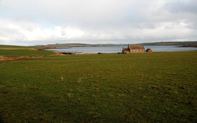
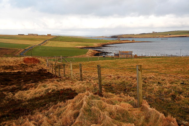
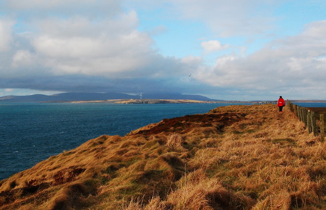
Harrabrough Head is a prominent coastal feature located in Orkney, a group of islands in Scotland's northernmost region. Situated on the eastern coast of the main Orkney Island, this headland extends into the North Sea, offering breathtaking views and a rich historical significance.

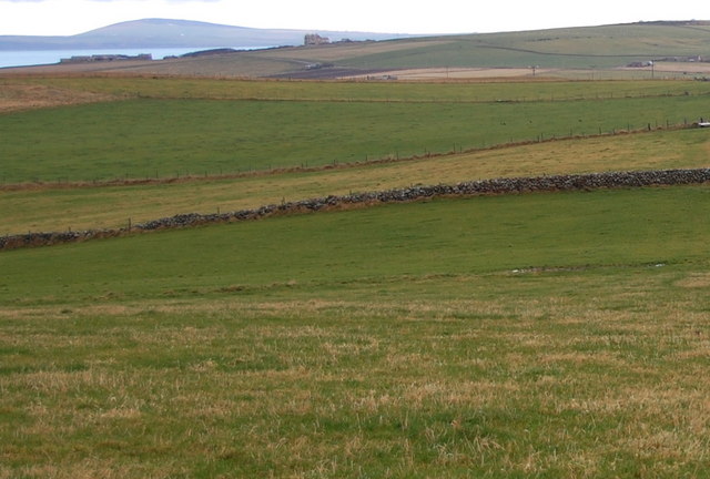
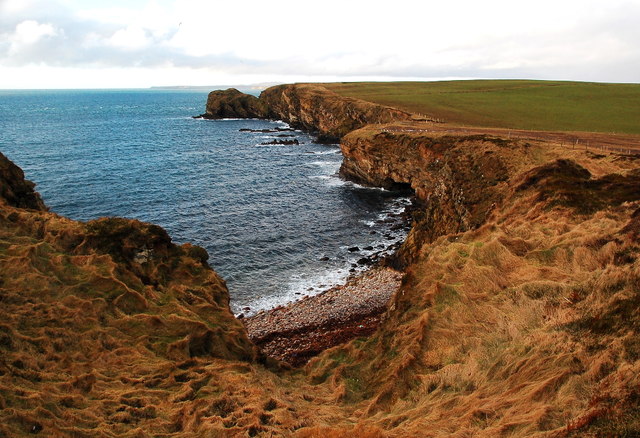
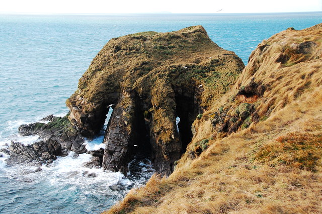
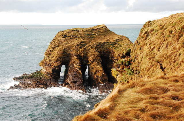
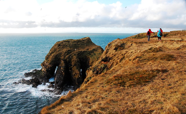
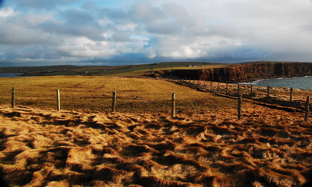
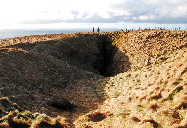
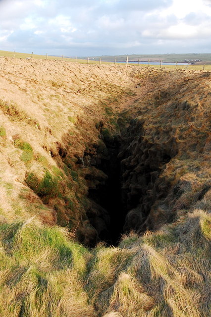
The headland is characterized by its steep cliffs that rise dramatically from the sea, reaching heights of up to 100 meters. These cliffs are composed of sedimentary rocks, providing a glimpse into the geological history of the area. The rugged coastline is further accentuated by the presence of sea stacks and caves, which are home to a variety of seabirds, including puffins, guillemots, and razorbills.

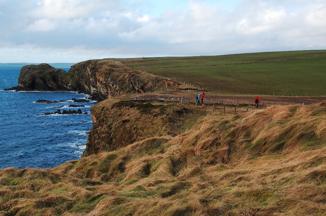
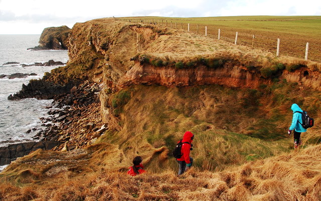
Harrabrough Head has long been a popular destination for nature enthusiasts and hikers, with several walking trails that allow visitors to explore the area's natural beauty. The headland also offers opportunities for fishing and birdwatching, attracting both locals and tourists alike.

In addition to its natural wonders, Harrabrough Head holds historical significance. The headland is home to ancient archaeological sites, including the remains of Iron Age settlements and a Viking burial ground. These remnants serve as a testament to the area's rich cultural heritage and offer a glimpse into the lives of the people who once called this place home.

Overall, Harrabrough Head is a captivating coastal feature that combines stunning natural scenery with a rich historical past. Its towering cliffs, diverse wildlife, and archaeological sites make it a must-visit destination for those exploring the Orkney Islands.

If you have any feedback on the listing, please let us know in the comments section below.

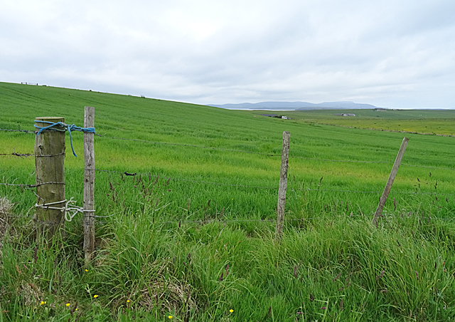
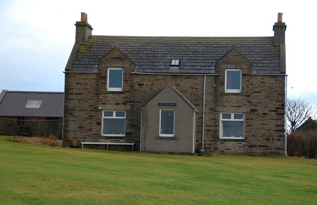
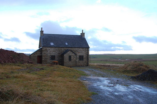
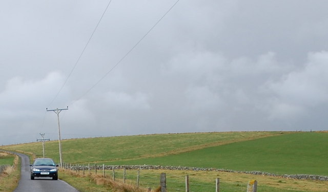
Harrabrough Head Images

Images are sourced within 2km of 58.797086/-3.0125865 or Grid Reference ND4190. Thanks to Geograph Open Source API. All images are credited.

Nev Hill Incipient hay or, more likely, silage on the slopes of Nev Hill, with a view towards the mountains of Hoy.
Nev Hill
Incipient hay or, more likely, silage on the slopes of Nev Hill, with a view towards the mountains of Hoy.
West Shaird Typical Orkney features include the one-and-a-half stories, and the cemented strips on the gable ends below the chimneys. The style of the original skylight is a common feature too.
West Shaird
Typical Orkney features include the one-and-a-half stories, and the cemented strips on the gable ends below the chimneys. The style of the original skylight is a common feature too.
New house built by West Shaird Similar to West Shaird in style, but missing the lovely upper windows. It lies right by West Shaird.
New house built by West Shaird
Similar to West Shaird in style, but missing the lovely upper windows. It lies right by West Shaird.
Nev Hill The low, undulating land leading to Nev Hill. Note the one remaining stone field boundary, (known locally as dykes).
Nev Hill
The low, undulating land leading to Nev Hill. Note the one remaining stone field boundary, (known locally as dykes).
Stone dyke on Nev Hill Looking northwards from Nev Hill. One remaining traditional stone dyke undulates across the fields, amid the wire fences.
Stone dyke on Nev Hill
Looking northwards from Nev Hill. One remaining traditional stone dyke undulates across the fields, amid the wire fences.
Chapel and the Oyce of Herston I think that the old chapel has been renovated within the last few years.
Chapel and the Oyce of Herston
I think that the old chapel has been renovated within the last few years.
Farmland and the Oyce of Herston Looking northwards toward the old chapel.
Farmland and the Oyce of Herston
Looking northwards toward the old chapel.
Clifftops and pebble beach Looking westwards toward The Altar, Harrabrough Head.
Clifftops and pebble beach
Looking westwards toward The Altar, Harrabrough Head.
The Altar, Cavernous Triptych Unusual geomorphology at Harra Brough with three, almost parallel tunnels, running through the headland.
The Altar, Cavernous Triptych
Unusual geomorphology at Harra Brough with three, almost parallel tunnels, running through the headland.
Looking westwards towards The Altar Coastal scenery en-route to Harrabrough Head.
Looking westwards towards The Altar
Coastal scenery en-route to Harrabrough Head.
Coastal Erosion The cliffs are being undercut and mass-wasting is taking place.
Coastal Erosion
The cliffs are being undercut and mass-wasting is taking place.
The Altar, Harra Brough Two of the three tunnels are clearly visible here. As the third one opens the second one closes making it hard to get a view through all three tunnels simultaneously.
The Altar, Harra Brough
Two of the three tunnels are clearly visible here. As the third one opens the second one closes making it hard to get a view through all three tunnels simultaneously.
The Altar, Harra Brough Once more, two of the three tunnels showing clear through.
The Altar, Harra Brough
Once more, two of the three tunnels showing clear through.
Looking eastwards from Murka Hole Winter landscape, but the days are at last beginning to lengthen.
Looking eastwards from Murka Hole
Winter landscape, but the days are at last beginning to lengthen.
Murka Hole Looking southwest toward the blowhole. This will be a geo in a few centuries, maybe even decades.
Murka Hole
Looking southwest toward the blowhole. This will be a geo in a few centuries, maybe even decades.
Murka Hole Looking northeastwards over the blowhole.
Murka Hole
Looking northeastwards over the blowhole.
Coastal path, Harrabrough Head Looking northwest along the coast, with Flotta (and wind turbine) in the sunshine and the high hills of Hoy beyond.
Coastal path, Harrabrough Head
Looking northwest along the coast, with Flotta (and wind turbine) in the sunshine and the high hills of Hoy beyond.
Fence Post Covered in lichen.
Fence Post
Covered in lichen.
Show me another place!

Harrabrough Head is located at Grid Ref: ND4190 (Lat: 58.797086, Lng: -3.0125865)

Unitary Authority: Orkney Islands

Police Authority: Highlands and Islands

What 3 Words

///submits.proof.blatantly. Near St Margaret's Hope, Orkney Islands

Related Wikis

Herston, Orkney

Herston is a village on South Ronaldsay, Orkney, Scotland, United Kingdom. Herston is historically a fishing village but its only industry to speak of...

Hoxa, Orkney

Hoxa is a small settlement on the island of South Ronaldsay in the Orkney Islands north of mainland Scotland. Hoxa is located 1+1⁄4 miles (2.0 km) west...

South Ronaldsay

South Ronaldsay (, also , Scots: Sooth Ronalshee) is one of the Orkney Islands off the north coast of Scotland. It is linked to the Orkney Mainland by...

St Margaret's Hope

St Margaret's Hope is a village in the Orkney Islands, off the north coast of Scotland. It is known locally as The Hope or The Hup. With a population...

Nearby Amenities

Located within 500m of 58.797086,-3.0125865
The Altar
Natural: cliff
Lat/Long: 58.796945/-3.0125909
Power: pole
Lat/Long: 58.8007252/-3.0106455
Power: pole
Lat/Long: 58.8007516/-3.0095458
Power: pole
Lat/Long: 58.8007989/-3.0083361
Generator Method: wind_turbine
Generator Source: wind
Generator Type: horizontal_axis
Power: generator
Lat/Long: 58.8008636/-3.0121225
The data included in this document is from www.openstreetmap.org. The data is made available under ODbL.

Have you been to Harrabrough Head?

Leave your review of Harrabrough Head below (or comments, questions and feedback).