Kelda Ber
Coastal Feature, Headland, Point in Orkney
Scotland
Kelda Ber
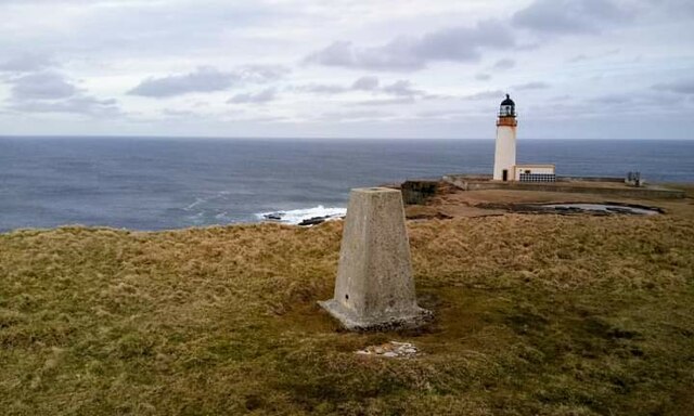
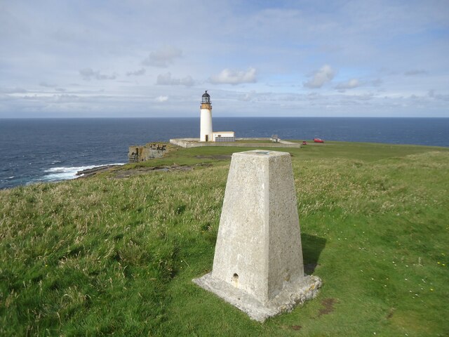
Kelda Ber is a prominent coastal feature located on the northernmost tip of the Orkney Islands, Scotland. It is a headland that extends into the North Sea, forming a distinctive point along the island's coastline. Kelda Ber is situated near the village of Birsay, approximately 15 miles northwest of Kirkwall, the capital city of Orkney.
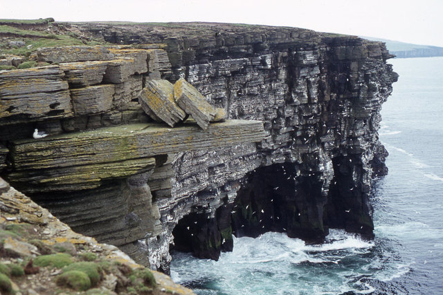
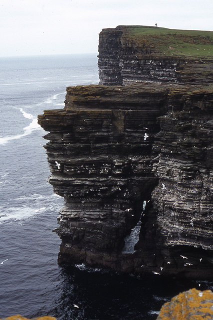
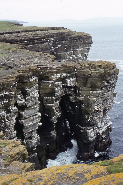
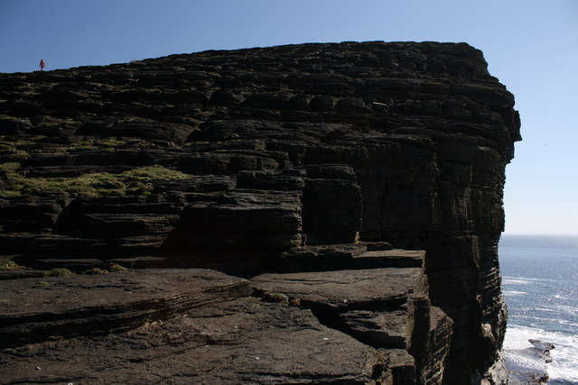
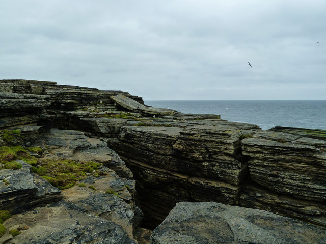
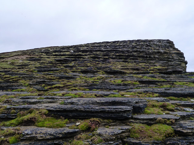
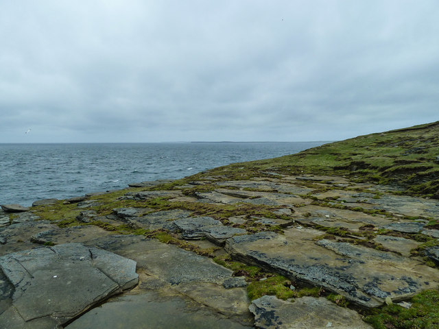
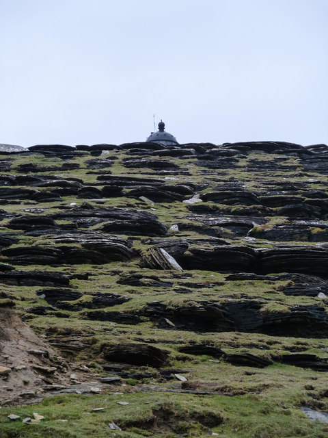
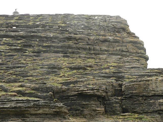
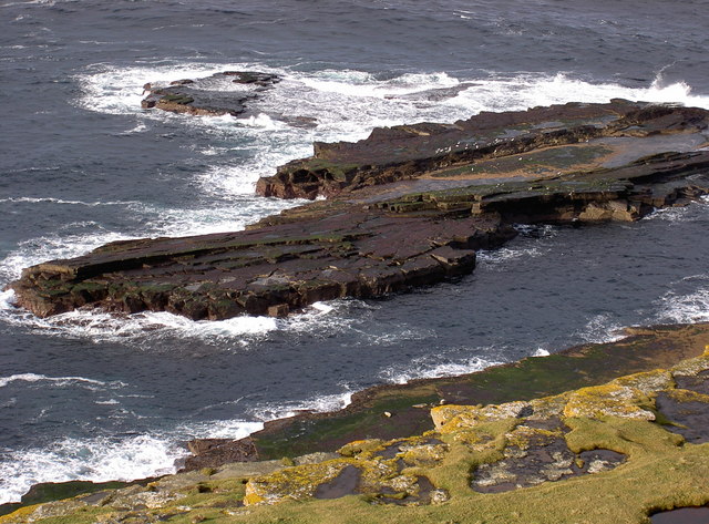
The headland is composed of rugged cliffs that rise steeply from the sea, reaching heights of around 50 meters. These cliffs are predominantly made up of sandstone, with layers of sedimentary rocks visible along their faces. The exposed rock formations provide a glimpse into the geological history of the area, showcasing the effects of erosion and the passage of time.
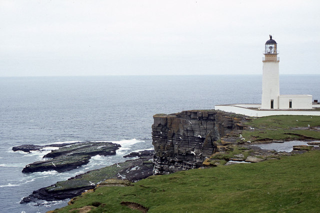
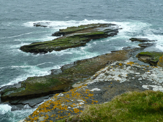
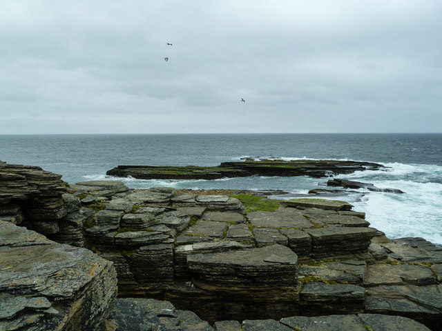
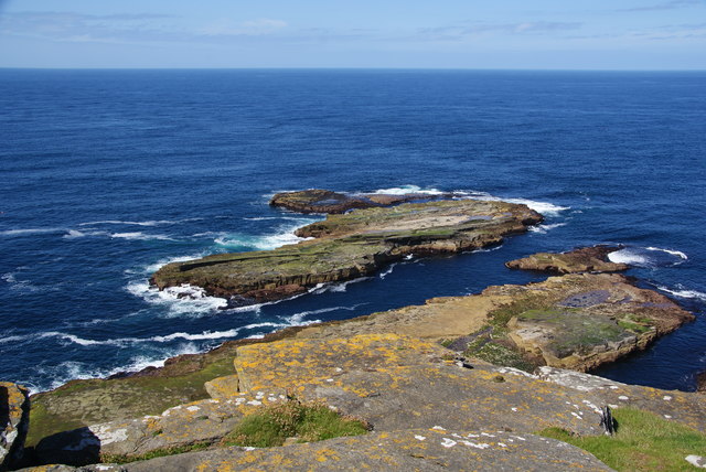
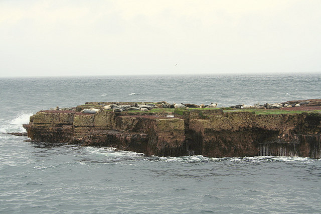
Kelda Ber is renowned for its breathtaking views of the surrounding ocean and the neighboring islands. From its vantage point, visitors can witness the powerful waves crashing against the cliffs and observe various seabirds soaring above the water. The headland also offers panoramic vistas of the nearby Brough of Birsay, a tidal island that can be accessed during low tide.
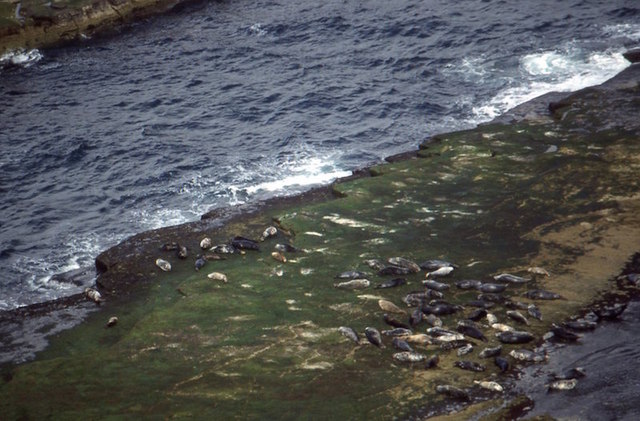
The area surrounding Kelda Ber is rich in wildlife, with seals often seen lounging on the rocks and seabird colonies nesting along the cliffs. The headland is a popular destination for nature enthusiasts, hikers, and photographers, who come to explore its rugged beauty and capture the dramatic coastal scenery.
Access to Kelda Ber is relatively easy, with a well-maintained footpath leading from Birsay village to the headland. Visitors are advised to take caution while walking along the cliffs, as they can be unstable in some areas. Nonetheless, Kelda Ber remains a must-visit destination for those seeking an immersive coastal experience in the stunning Orkney Islands.
If you have any feedback on the listing, please let us know in the comments section below.
Kelda Ber Images
Images are sourced within 2km of 59.325296/-3.0671294 or Grid Reference HY3949. Thanks to Geograph Open Source API. All images are credited.
Kelda Ber is located at Grid Ref: HY3949 (Lat: 59.325296, Lng: -3.0671294)
Unitary Authority: Orkney Islands
Police Authority: Highlands and Islands
What 3 Words
///incurring.shunning.afford. Near Pierowall, Orkney Islands
Nearby Locations
Related Wikis

Noup Head Lighthouse
Noup Head Lighthouse lies on the north west headland of the isle of Westray, in Orkney, Scotland. It was constructed by David A Stevenson in 1898 for...

Noltland Castle
Noltland Castle is located near Pierowall on the island of Westray in the Orkney Islands of Scotland. It dates mainly to the later 16th century, although...

Links of Noltland
Links of Noltland is a large prehistoric settlement located on the north coast of the island of Westray in Orkney, Scotland. The extensive ruins includes...

Pierowall
Pierowall is a village of Westray in the Orkney Islands, off the coast of the northern Scottish mainland. The village is the island's largest settlement...

Lady Kirk
The Lady Kirk (or St Mary's Kirk) at Pierowall is a ruined 17th-century church on the island of Westray, in Orkney, Scotland. The church was built in 1674...

Westray
Westray (, Scots: Westree) is one of the Orkney Islands in Scotland, with a usual resident population of just under 600 people. Its main village is Pierowall...

Quoygrew settlement, Westray
Quoygrew, Westray is the site of a medieval Norse settlement on the island of Westray in Orkney, Scotland. Established as a small farmstead most likely...
Westray Airport
Westray Airport (IATA: WRY, ICAO: EGEW) is an airport at Aikerness, on Westray in the Orkney Islands, Scotland. It is best known for being one of the two...
Have you been to Kelda Ber?
Leave your review of Kelda Ber below (or comments, questions and feedback).